Tropical Weather Developments Raise Concerns Across the Caribbean
Tropical Weather Developments Raise Concerns Across the Caribbean The National Hurricane Center continues to track developments in the Atlantic basin as the 2026 season gets underway with early activity. Tropical Activity Prompts Vigilance Across the Caribbean as Hurricane Season Unfolds Port of Spain, Trinidad and Tobago — The National Hurricane Center is monitoring Invest 90L
The National Hurricane Center continues to track developments in the Atlantic basin as the 2026 season gets underway with early activity.
Tropical Activity Prompts Vigilance Across the Caribbean as Hurricane Season Unfolds
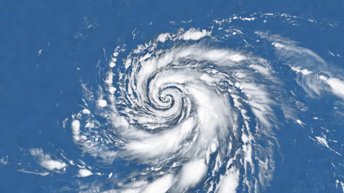
Port of Spain, Trinidad and Tobago — The National Hurricane Center is monitoring Invest 90L near the Gulf of Mexico, which carries a 60 percent chance of developing into Tropical Storm Arthur, the first named storm of the 2026 Atlantic hurricane season. This early system has drawn attention from forecasters across the region because of its potential path and the unusually warm sea surface temperatures that could support further strengthening in the coming days. Communities from the southern Caribbean to the Gulf coast are already reviewing their plans as the disturbance moves westward.
Current tropical weather situation
Invest 90L has formed in an area of favourable conditions just north of the Yucatan Peninsula, where sea surface temperatures remain well above the seasonal average. Forecasters note that the system is drifting slowly westward and could organise further over the next forty eight hours if wind shear stays low. The National Hurricane Center has outlined several possible tracks that bring the disturbance closer to the western Caribbean before any potential turn northward.
Current observations show the disturbance already producing widespread showers and thunderstorms, with satellite imagery indicating a gradual consolidation of the low level circulation. Warm ocean waters in the Gulf of Mexico are providing ample energy, raising the likelihood that the system reaches tropical storm strength within the next few days. Residents along the projected path are advised to monitor updates closely because even a weak tropical storm can bring heavy rainfall to coastal areas.
Forecast models continue to show divergence beyond seventy two hours, with some solutions keeping the system over land while others allow it to remain over water longer. This uncertainty means that impacts could extend into the central Caribbean depending on how the steering currents evolve. The Trinidad and Tobago Meteorological Service has already begun issuing special bulletins to keep the public informed of any changes in the track.
2026 season outlook
NOAA has released its seasonal forecast indicating an above average number of named storms for 2026, driven in part by the transition from neutral conditions toward a developing La Niña pattern. The outlook suggests between fourteen and eighteen named storms could form, with several of those potentially reaching hurricane strength before the season ends in November. This projection sits noticeably higher than the long term average of twelve named storms per season.
El Niño influences that suppressed activity in previous years have now faded, allowing for more conducive atmospheric conditions across the main development region. Sea surface temperatures remain elevated, which forecasters say will support rapid intensification if systems move into the central Atlantic. Caribbean nations are therefore preparing for the possibility of multiple landfalls or near misses throughout the summer and autumn months.
Regional meteorologists emphasise that early season activity does not necessarily dictate the overall pace of the season, yet it serves as a reminder that preparedness must begin well before peak months. Comparisons with quieter years highlight how quickly conditions can shift when ocean heat content stays high. Continued monitoring by international agencies will be essential to refine these numbers as the season progresses.
Impacts on Trinidad and Tobago and the Lesser Antilles
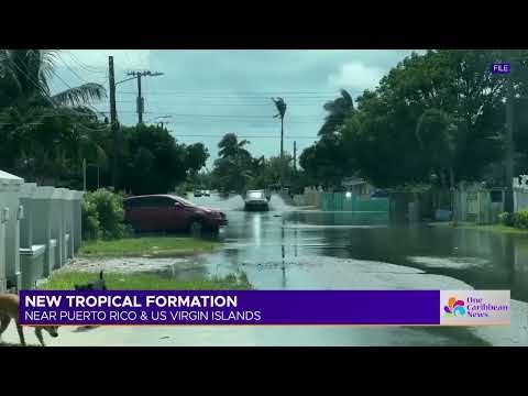
Although Invest 90L is currently positioned farther west, the broader pattern of increased moisture could still affect the southern Caribbean through enhanced rainfall and gusty winds over the coming weekend. Flood prone areas such as parts of central and south Trinidad remain particularly vulnerable because drainage systems often struggle during prolonged downpours. Agricultural communities in both Trinidad and Tobago are watching soil moisture levels closely, as excessive rain at this stage of the crop cycle can damage young plantings.
Tourism operators in the Lesser Antilles have begun communicating with visitors about flexible cancellation policies in case the disturbance strengthens and alters flight schedules. Hotels in Tobago have activated their standard inclement weather protocols, including securing outdoor furniture and reviewing generator readiness. Even indirect effects such as rough seas can disrupt ferry services between the islands and reduce visitor arrivals at short notice.
Local authorities stress that southern Caribbean nations often experience the outer bands of western systems, bringing localised flooding rather than direct hurricane force winds. This pattern has been observed in several recent seasons and requires residents to remain alert even when the centre stays distant. Agricultural losses from waterlogged fields can take months to recover, affecting both food security and export earnings.
Preparedness guidance
The Trinidad and Tobago Meteorological Service recommends that households review their emergency plans now rather than waiting for a direct threat to materialise. Families are advised to stock at least three days of non perishable food, clean water, and essential medicines while ensuring that battery powered radios remain functional. Checking the condition of roof fastenings and clearing gutters can reduce damage from even moderate rainfall events.
Shelter locations have been published on official government websites, with updates provided through community centres in each municipal corporation. Residents are encouraged to identify their nearest shelter in advance and to make arrangements for pets and elderly family members who may require additional assistance. Communication plans should include designated out of area contacts so that family members can relay messages if local networks become congested.
Authorities continue to stress the importance of relying on official sources rather than unverified social media reports during any tropical weather event. Regular drills conducted by the Office of Disaster Preparedness have helped communities understand evacuation routes and assembly points. Early action remains the most effective way to limit disruption when systems approach the islands.
Role of regional agencies
The Caribbean Institute for Meteorology and Hydrology provides critical forecasting support that feeds into national meteorological services across the region. Its regional models help refine track and intensity predictions for systems such as Invest 90L, allowing countries with limited resources to access high quality guidance. Coordination with national offices ensures consistent messaging reaches the public in a timely manner.
The Caribbean Disaster Emergency Management Agency plays a central role in mobilising resources when multiple islands face simultaneous threats. CDEMA maintains pre positioned supplies and facilitates rapid needs assessments following any significant weather impact. Its established relationships with international partners help channel assistance quickly when local capacity is stretched.
Joint training exercises organised by these agencies have improved interoperability between national response teams in recent years. Regular information sharing through established protocols reduces duplication of effort and ensures that warnings reach even the smallest communities. Continued investment in these collaborative mechanisms strengthens the overall resilience of the Caribbean basin.
Climate change and SIDS
Warming ocean temperatures are widely recognised as a factor that can increase the intensity of tropical cyclones, even if the total number of storms does not rise dramatically. Small island developing states such as those in CARICOM face heightened exposure because their economies and infrastructure are concentrated along coastlines. Adaptation funding remains a priority topic in regional discussions, with calls for more predictable support from international climate finance mechanisms.
CARICOM leaders have consistently advocated for greater recognition of loss and damage caused by extreme weather events linked to climate change. Infrastructure resilience projects, including upgraded drainage and reinforced public buildings, are underway in several member states but require sustained financing to reach completion. These efforts aim to reduce the economic setbacks that follow each significant storm.
Regional scientists continue to study how shifting climate patterns may alter traditional storm tracks and seasons. Their findings inform policy decisions at both national and CARICOM levels. Long term planning must balance immediate preparedness needs with the broader goal of building communities that can withstand stronger and potentially wetter systems in future decades.
Lessons from past hurricanes
Hurricane Ivan in 2004 demonstrated the widespread destruction that can occur even when a system passes at some distance, prompting many Caribbean nations to strengthen building codes and early warning systems. The experience led to improved coordination between meteorological offices and disaster management agencies that continues to this day. Communities learned the value of timely evacuations and clear public communication during that event.
Hurricane Maria in 2017 brought renewed focus on the vulnerability of power grids and communication networks, resulting in targeted investments to harden critical infrastructure across the region. Lessons from that storm have been incorporated into current shelter management plans and supply chain strategies. Recent storms have further reinforced the need for flexible response frameworks that can adapt to rapidly changing forecasts.
Collectively these events have shaped a culture of proactive preparedness rather than reactive recovery in Trinidad and Tobago and neighbouring islands. Annual reviews of response protocols help identify remaining gaps before the next season begins. The memory of past impacts serves as a constant reminder that vigilance must be maintained throughout every hurricane season.
By Sharon Sahatoo, Staff Writer
What's Your Reaction?
 Like
0
Like
0
 Dislike
0
Dislike
0
 Love
0
Love
0
 Funny
0
Funny
0
 Wow
0
Wow
0
 Sad
0
Sad
0
 Angry
0
Angry
0
Caribbean Correspondent at Global1.News. Based in Port of Spain, Trinidad, covering Caribbean politics, economy, energy, climate, and culture. Amplifying the voices and stories of the Caribbean region.


Comments (0)