
B.C. Wildfires: 66,871-Hectare Blaze Merges Near Clinton
In a recent CBC News report, the B.C. Wildfire Service faces severe strain with more than 140 wildfires burning across British Columbia as of Sunday, July 27, leaving crews at full capacity amid drought conditions that heighten ignition risks and aggressive fire behaviour throughout the southern half of the province. B.C. Wildfires: 66,871-Hectare Blaze Merges Near Clinton Clinton, B.C. – July 27, 2026 — Article continues with...
B.C. Wildfires: 66,871-Hectare Blaze Merges Near Clinton
Clinton, B.C. – July 27, 2026 — Article continues with...
The Overnight Merger Near Clinton
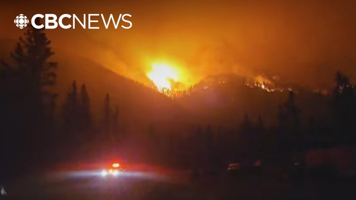
The Pear Lake and Fiftynine Creek wildfires merged overnight on July 25/26, 2026, forming a single blaze now estimated at 66,871 hectares, roughly 670 square kilometres in size.
This merger occurred north of Clinton, B.C., where the fire crossed Highway 97 and jumped previously established containment lines, demonstrating how quickly separate incidents can combine under extreme conditions.
The combined fire exhibited Rank 4 and 5 behaviour, featuring highly to extremely vigorous surface fire with active crown fire and moderate to long-range spotting that complicates direct attack efforts by ground crews.
The Pear Lake fire ignited on June 12 from a lightning strike amid an early-season thunderstorm that swept through the Cariboo region, quickly establishing itself in dense stands of lodgepole pine and Douglas fir already stressed by prolonged dry weather. Within days, the blaze grew to several hundred hectares as crews struggled with limited access roads and shifting winds that pushed flames upslope. By mid-July, it had expanded to more than 20,000 hectares, forcing initial containment lines to be redrawn repeatedly while ground teams focused on protecting remote cabins and recreational sites.
Drought conditions across British Columbia's interior have intensified over the past decade, with the Cariboo experiencing below-average precipitation for 18 consecutive months leading into this season. Soil moisture levels remain critically low, allowing surface fuels to cure rapidly and enabling fires to transition from creeping to crowning behaviour within hours. These patterns reflect broader climate trends, including warmer spring temperatures that advance snowmelt and extend the fire season by several weeks compared with historical norms.
When measured against past seasons, the current merger near Clinton echoes the scale seen in 2017 when the Elephant Hill fire consumed more than 150,000 hectares, yet it surpasses the early-July activity recorded in 2018 and 2021. The 2023 season saw fewer large-scale mergers but still required inter-regional resource shifts; this year's rapid coalescence into a 66,871-hectare complex underscores how overlapping drought years have left fuel loads more continuous and receptive to extreme fire behaviour.
Formation of the Big Bar Complex
The Big Bar complex now encompasses four fires including Pear Lake, Fiftynine Creek, French Bar Creek and Bonanza Creek, reaching a combined area of 88,812 hectares.
Fire information officer Jean Strong provided updates noting that the Fiftynine Creek fire continues burning close to Highway 97 at Chasm, north of Clinton, and is progressing northward into new terrain.
Where the fire crossed Highway 97, it burned into an old burn scar from the 2017 Elephant Hill wildfire, where sparse fuels helped moderate fire activity in that specific zone.
Provincial Scale of the Crisis
Most of the more than 140 wildfires burn in the southern half of British Columbia, with the Cariboo Fire Centre experiencing particularly intense activity that draws resources away from other regions.
The fire column from the Pear Lake wildfire created its own weather system, generating lightning over the area and raising the potential for additional ignitions during an already critical period.
Drought conditions across the region continue to raise the risk of new ignitions and aggressive fire behaviour, a pattern that has become familiar in British Columbia's interior over recent seasons.
At this point in the season, the tally of more than 140 active wildfires exceeds the five-year average for late July by roughly 40 incidents, with the majority concentrated south of Prince George. In comparison, 2023 recorded approximately 95 fires burning simultaneously by the same date, while 2021 saw a spike to 110 during its peak week. The current distribution places exceptional pressure on southern fire centres, where multiple complexes demand simultaneous air support and ground personnel.
Smoke from these fires has degraded air quality across much of British Columbia and into Alberta, with fine particulate readings in Kamloops and Williams Lake reaching levels classified as very high risk for sensitive populations. Plumes have carried eastward, prompting Alberta health officials to issue advisories for communities near the border and reducing visibility on major highways. These transboundary effects highlight how interior fires influence regional atmospheric conditions far beyond their ignition points.
The Cariboo Fire Centre faces particular challenges due to its vast jurisdiction and limited road network, which delays crew rotations and equipment repositioning. With multiple large fires drawing from the same pool of helicopters and dozers, incident commanders must prioritise daily, often shifting resources between the Big Bar complex and smaller ignitions that threaten communities. This strain is compounded by the need to maintain reserves for potential new starts triggered by lightning from pyrocumulus clouds.
Highway 97 Closure and Access Impacts
Highway 97 remains closed between the junction with Highway 99 and 70 Mile House after the fire crossed the route north of Clinton, disrupting travel and supply lines for communities in the Cariboo.
This closure affects residents and commercial traffic alike, forcing detours that lengthen response times for emergency services already operating under stretched conditions.
Evacuation Orders and Property Losses
The Thompson-Nicola Regional District issued an evacuation order for 70 Mile House as of Monday, July 27 at 10 a.m., adding to the roughly 1,200 properties now under evacuation orders province-wide and another 6,400 under alert status.
Clinton resident Steve Larabie told media that he and his family lost everything when the fire destroyed their property, while structure loss has been confirmed in and around Clinton though the full number of affected properties is still being assessed.
Clinton CAO Brian Doddridge stated that the village had been preserved from major loss, a narrow outcome that highlights the uneven impact of the blaze on different parts of the community.
Clinton, a community of roughly 650 residents, has seen its social fabric tested as families navigate sudden displacement and the loss of generational properties. Many residents rely on tourism and small-scale ranching, sectors now disrupted by road closures and uncertainty over the coming months. Local businesses have shuttered temporarily, while schools and community centres have been repurposed as information hubs, illustrating how even modest population centres absorb disproportionate impacts during interface fires.
Steve Larabie and his family represent one of several households that watched flames overtake their home despite last-minute efforts to wet roofs and clear vegetation. Their account of fleeing with minutes to spare underscores the narrow evacuation windows that characterise fast-moving crown fires in the region. Neighbours have organised informal support networks to share clothing and temporary lodging, filling gaps until formal assistance fully activates.
The roughly 1,200 properties currently under evacuation orders surpass figures from the comparable period in 2023, when approximately 800 properties faced similar measures, though they remain below the 2017 peak when more than 2,500 orders were issued province-wide. Emergency Support Services has expanded pre-registration options through an online portal, allowing residents to upload identification and banking details in advance so that financial aid and hotel vouchers can be issued within hours of an order rather than days.
Resource Strain and Incoming Support
B.C. Wildfire Service resources are stretched thin and operating at capacity, prompting the arrival of firefighters from Yukon, Alberta and Mexico to bolster local crews facing simultaneous demands across multiple complexes.
Water shortages and other logistical challenges further complicate the wildfire response, limiting options for direct suppression in remote sections of the Big Bar complex.
Mutual aid agreements enable the rapid deployment of firefighters from Yukon and Alberta, coordinated through the Canadian Interagency Forest Fire Centre, which maintains standing arrangements for resource sharing across provinces and territories. Mexican crews, arriving under a federal partnership renewed in 2024, bring specialised experience in steep-terrain operations and have been integrated into night-shift mop-up teams near Clinton. These international contributions supplement British Columbia's own roster, which has already mobilised more than 2,000 personnel this season.
Water shortages in the Cariboo region have forced reliance on distant sources, requiring additional pump relays and helicopter bucket operations that consume valuable flight hours. Several natural water bodies near the Big Bar complex have dropped below usable levels due to drought, compelling crews to construct temporary reservoirs or truck water from the Fraser River, adding logistical complexity to an already stretched supply chain.
Canada's overall firefighting capacity depends on these layered agreements, yet repeated high-demand seasons have revealed gaps in heavy equipment availability and trained personnel retention. Provinces routinely exchange air tankers and incident management teams, but sustained multi-year drought has increased the frequency of simultaneous large fires, testing the limits of the national pool and prompting calls for expanded federal investment in seasonal hiring and equipment modernisation.
Defence Operations and Future Assessments
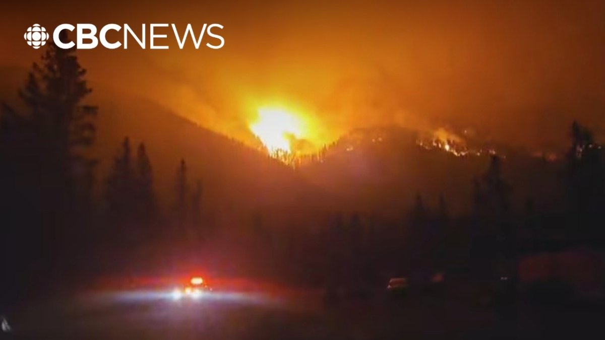
Structure protection personnel focus on defence and mop-up around the southeast flank near Clinton, working to prevent further losses while crews monitor the fire's northern progression.
A rapid assessment team will evaluate property damage once conditions allow safe access, providing the data needed for recovery planning in affected areas.
Provincial Preparedness and Long-Term Context
The province has urged British Columbians to pre-register with Emergency Support Services in advance of potential evacuations, recognising that early preparation reduces pressure on response systems during peak fire periods.
These events underscore the recurring pressure on British Columbia's wildfire management infrastructure, where overlapping incidents in the Cariboo and southern regions test the limits of available personnel and equipment year after year.
By Alex Thompson, Staff WriterThis article was produced with AI-assisted research and editorial support. Reporting is based on sources cited in the article.
What's Your Reaction?
 Like
0
Like
0
 Dislike
0
Dislike
0
 Love
0
Love
0
 Funny
0
Funny
0
 Wow
0
Wow
0
 Sad
0
Sad
0
 Angry
0
Angry
0

Canada Correspondent at Global1.News. Based in Toronto, covering Canadian politics, energy, trade, and US-Canada relations. Provides the Canadian perspective on North American and global affairs.














Comments (0)