
Dr. Roxy Mathew Koll: IITM's View on India's Monsoon Crisis
India recorded extreme weather events on all 122 monsoon days in 2025, while extreme rain events in central India have risen 75 percent since 1950 according to IITM research. This pattern of prolonged dry spells followed by intense downpours now defines the southwest monsoon, directly threatening lives across Kerala, Odisha, and Assam. Dr. Roxy Mathew Koll of IITM Pune links th
India recorded extreme weather events on all 122 monsoon days in 2025, while extreme rain events in central India have risen 75 percent since 1950 according to IITM research. This pattern of prolonged dry spells followed by intense downpours now defines the southwest monsoon, directly threatening lives across Kerala, Odisha, and Assam. Dr. Roxy Mathew Koll of IITM Pune links the local destruction to human decisions rather than climate alone.
Local Development Choices Intensify Monsoon Disasters as Extreme Rainfall Triples Across Central India
Pune, Maharashtra – July 7, 2026 — Dr. Roxy Mathew Koll, climate scientist at the Indian Institute of Tropical Meteorology, warned that floods and landslides killing dozens this season stem from land-use decisions made without environmental assessment. His team documented that widespread extreme rain events over central India have tripled since 1950, with nearly half of seasonal rainfall now concentrated in just 20-30 hours.
Monsoon Rainfall Trends and IMD 2026 Forecast Data
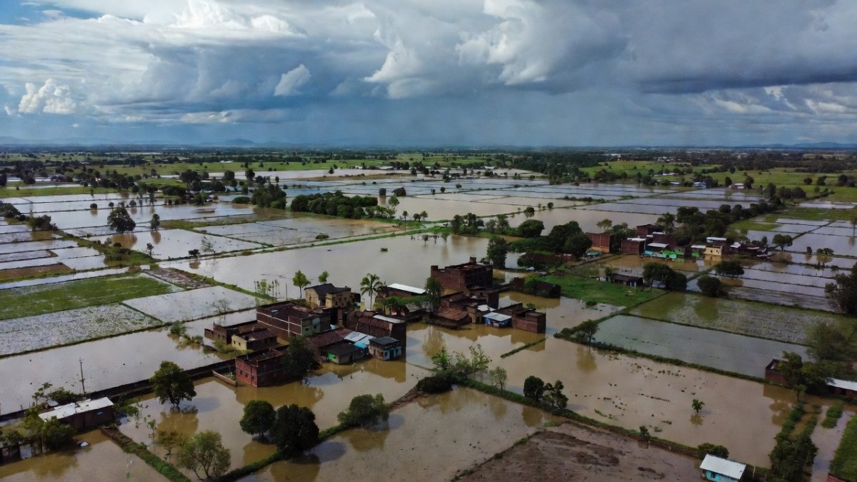
The India Meteorological Department forecasts the 2026 southwest monsoon at 90 percent of the Long Period Average, placing it in the below-normal category. July rainfall is projected below 94 percent of the 280.4 mm average. Dry spells have lengthened 27 percent over recent decades while extreme events delivering 150 mm or more in a day increased roughly 75 percent in central India between 1950 and 2015. Warmer air now holds approximately 7 percent more moisture for every additional degree Celsius, amplifying short bursts of heavy rain. These verified IITM statistics show that nearly half of India’s seasonal rain falls within 20-30 hours, leaving states such as Madhya Pradesh and Maharashtra with sudden runoff that overwhelms drainage. Indian students preparing for civil services examinations must now incorporate these updated monsoon metrics into disaster-management case studies, while taxpayers in rain-fed districts face repeated crop losses that strain state budgets already committed to irrigation projects.
Global Warming, Weak El Niño, and Indian Ocean Dipole Influence
Global warming supplies the additional atmospheric moisture that turns normal monsoon depressions into extreme events, yet Dr. Koll states the volume of rain is amplified by a weak El Niño that may strengthen through the season. The Indian Ocean Dipole remains neutral, removing any offsetting cooling effect. IITM data confirm that these large-scale drivers interact with local topography in the Western Ghats and Himalayas to produce flash floods. For patients in flood-prone districts of Kerala and Assam, the health consequences include water-borne diseases that overload primary health centres already short of staff during peak monsoon months. Policy makers in New Delhi must therefore align National Disaster Management Authority guidelines with the latest IITM projections rather than relying on outdated rainfall norms that no longer match observed 75 percent increases in extreme events.
Human-Caused Land Use Changes Behind Wayanad and Northeast Tragedies
Dr. Koll’s central message remains unequivocal: floods, landslides, and destruction visible locally result from land-use changes and development without environmental or climate assessment. In Wayanad, Kerala, a landslide on July 7, 2026 killed at least three workers and left seven missing at a tunnel construction site near Kalladi and Meenakshi Bridge. State authorities termed it a man-made tragedy after illegal mud dumping continued despite warnings, repeating the pattern seen at Mundakai in 2024 that claimed more than 300 lives. Roughly half of Kerala’s terrain consists of hills with slopes exceeding 20 degrees, rendering it acutely landslide-prone. In Assam and Arunachal Pradesh, more than 22,000 people across six districts suffered inundation after riverbank erosion collapsed a railway bridge over the Simen river, submerging 100 villages and 1,600 hectares of farmland. These incidents illustrate how construction practices in ecologically sensitive zones convert climatic extremes into human disasters for Indian citizens living downstream.
Western Ghats and Himalayan Vulnerability Under Unchecked Development
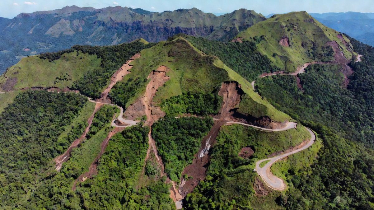
The Western Ghats and Himalayas face heightened risk because soil stability has been compromised by road widening, hydropower projects, and tourism infrastructure built without adequate slope-stability studies. Dr. Koll, recipient of the Vigyan Yuva Shanti Swarup Bhatnagar award, emphasises that multi-agency coordination for early warning systems must incorporate real-time soil moisture and rainfall data from IITM networks. For Indian engineering students at institutions such as IIT Madras and NIT Calicut, curriculum updates now include mandatory climate-risk modules that reference these exact vulnerabilities. Taxpayers funding the Char Dham highway and other Himalayan projects bear the long-term cost when landslides sever connectivity and require repeated reconstruction, diverting resources from primary healthcare and education in hill districts.
Health System Strain and Agricultural Losses Across Affected States
Floodwaters in Balangir district of Odisha forced the rescue of 120 livestock alongside six herders, highlighting direct threats to rural livelihoods and food security. In Assam, submerged farmland reduces kharif output and increases dependence on the public distribution system, raising fiscal pressure on the state exchequer. Health centres in Dhemaji and Lakhimpur report rising cases of diarrhoeal diseases and snake bites following inundation, stretching already limited stocks of medicines procured under the National Health Mission. Indian patients in these districts experience delayed treatment when roads remain cut for days, underscoring the need for climate-resilient primary health infrastructure. The Ministry of Health must integrate IITM monsoon forecasts into district-level preparedness plans to protect citizens whose access to care is seasonally disrupted.
Policy Recommendations and Early Warning Imperatives for India
Dr. Koll advocates expanded early warning systems and multi-agency coordination that link IMD, state disaster management authorities, and local panchayats. He stresses that development projects in landslide-prone districts require mandatory climate-impact assessments before clearance. For Indian policymakers drafting the next National Action Plan on Climate Change, these recommendations translate into concrete requirements: slope-stability audits for all new roads in the Western Ghats, real-time rainfall thresholds for school and hospital closures, and dedicated funding lines for nature-based solutions such as riparian buffers. Students entering the Indian Administrative Service will be evaluated on their grasp of these integrated approaches that connect monsoon science directly to citizen welfare. The evidence from 2026 already demonstrates that ignoring local land-use decisions converts manageable rainfall variability into preventable loss of life and property.
— By Dr. Raj Patel, Staff WriterThis article was produced with AI-assisted research and editorial support. Reporting is based on sources cited in the article.
What's Your Reaction?
 Like
0
Like
0
 Dislike
0
Dislike
0
 Love
0
Love
0
 Funny
0
Funny
0
 Wow
0
Wow
0
 Sad
0
Sad
0
 Angry
0
Angry
0

India/South Asia Correspondent at Global1.News. Analytical voice with a background in science and health journalism. Based in New Delhi, covering Indian politics, education, healthcare, technology, and policy. Breaks down complex data into clear, actionable reporting.












Comments (0)