
Super Typhoon Bavi Enters PAR - Communities Brace for Storm Inday
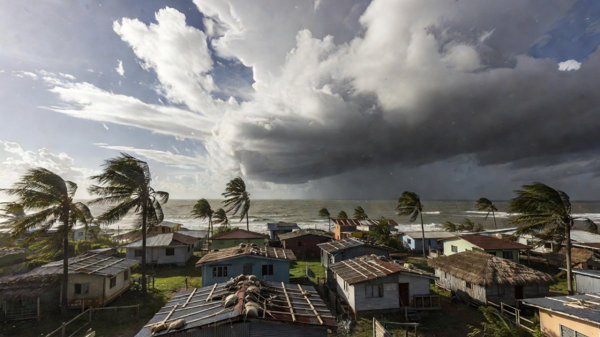
The Philippines is once again bracing for the impact of a powerful weather system as Super Typhoon Bavi, locally named Inday, moves steadily closer to our shores. According to the Philippine Atmospheric, Geophysical and Astronomical Services Administration, or PAGASA, its 5pm advisory on July 7 placed the storm 1,705 kilometers east of Central Luzon. It was tracking west-northw
Bavi’s Track and Strength
PAGASA’s latest data shows Bavi maintaining its strength as it travels across the open Pacific. At the time of the July 7 advisory, the super typhoon carried maximum sustained winds of 185 kilometers per hour, with gusts up to 230 kilometers per hour. It was located 1,705 kilometers east of Central Luzon and moving west-northwest at 25 kilometers per hour. These figures indicate a formidable system, even if its path keeps it from directly striking the archipelago.
Weather Specialist Benison Estareja of PAGASA emphasized that the probability of landfall stays low. “Kung pagbabasehan natin itong latest track at yung mga nagdaang track, maliit pa rin po ang tyansa na ito ay tatama sa ating kalupaan or magla-landfall,” he stated. Estareja noted that both the current forecast and historical tracks support this assessment. Still, he reminded the public that the storm’s outer bands can still affect weather patterns across a wide area.
The 800-kilometer radius of Bavi means its influence extends far beyond its center. Even without landfall, strong winds and heavy rainfall can reach several provinces. PAGASA continues to issue regular bulletins so that residents can adjust their plans accordingly. This steady flow of information helps families decide whether to move to safer ground or simply secure their homes more thoroughly.
Wind Signals and Affected Areas
PAGASA has raised Wind Signal No. 2 and No. 3 over Batanes and Cagayan because of the strong winds expected within Bavi’s broad circulation. These signals indicate that winds of 62 to 88 kilometers per hour, or higher in some areas, may be felt within 24 hours. Residents in these provinces are advised to secure loose materials and stay away from coastal areas where storm surges could occur.
Signal No. 1 is also possible over Ilocos Norte, Apayao, Kalinga, Isabela, and northern Aurora. In these areas, winds between 39 and 61 kilometers per hour may bring occasional gusts that can damage light structures. Local governments are already reminding farmers to harvest what they can and to move livestock to higher ground where possible.
The rest of Luzon, along with the Visayas and western Mindanao, can expect moderately strong winds and occasional rains brought by the enhanced habagat. These conditions may not require the highest wind signals, yet they can still disrupt daily routines. Fisherfolk are being urged to avoid going out to sea until the weather improves.
Enhanced Habagat and Mindanao Concerns
The southwest monsoon enhanced by Bavi is already affecting western Mindanao. PAGASA warns of heavy rainfall over the Zamboanga Peninsula, the Bangsamoro Autonomous Region in Muslim Mindanao, or BARMM, SOCCSKSARGEN, Misamis Occidental, and Lanao del Norte. These rains increase the risk of flash floods and landslides, especially in mountainous and riverine communities.
Even areas far from Bavi’s center can experience prolonged downpours because the monsoon draws moisture from the typhoon’s outer bands. Local disaster offices in these regions are monitoring river levels and readying equipment for possible evacuations. Residents living near slopes have been advised to watch for cracks in the soil or unusual water flow that could signal an impending landslide.
Community leaders in BARMM and the Zamboanga Peninsula are coordinating with barangay officials to ensure that early warning systems are functioning. They are also checking evacuation centers to confirm they have adequate space and supplies. This proactive approach helps reduce the chance that families will be caught unprepared when the rains intensify.
DSWD Preparations Across the Country
The Department of Social Welfare and Development has prepositioned 4.775 million family food packs valued at P3.009 billion. In addition, the agency has 364,283 ready-to-eat food boxes and 271,446 non-food items such as blankets, mats, and hygiene kits ready for distribution. These stocks are strategically placed in regional warehouses so they can reach affected communities quickly.
Assistant Secretary Irene Dumlao stressed that the department does not wait for disaster to strike before acting. “Hindi na po tayo nag-hihintay na dumating muna ang sakuna, bago tayo umaksyon,” she said. Dumlao explained that prepositioning allows immediate response once local governments request assistance. This preparation is especially important for far-flung barangays that may become isolated during heavy rains.
DSWD teams are also coordinating with local government units to identify families who may need special assistance, including persons with disabilities and elderly residents. Mobile kitchens and relief distribution points are being set up in high-risk areas. The goal is to ensure that no community is left waiting when the enhanced habagat brings stronger rains in the coming days.
LTFRB and Transport Coordination
The Land Transportation Franchising and Regulatory Board, under Chairman Vigor Mendoza II, has directed all regional franchising and regulatory offices to use social media for timely travel suspension warnings. This step ensures that commuters and drivers receive updates quickly, even in remote areas where traditional media may not reach.
Mendoza’s office is coordinating closely with the Department of Public Works and Highways for possible road closures and with the Philippine Ports Authority for sea travel suspensions. These measures aim to prevent accidents on flooded highways or rough seas. Bus companies and shipping lines have been asked to monitor PAGASA bulletins and adjust schedules accordingly.
Travelers are encouraged to check official LTFRB channels before heading out, especially those planning trips to northern Luzon or western Mindanao. The agency continues to remind the public that safety comes first and that temporary suspensions are meant to protect lives. Coordination between national agencies and local transport groups helps keep everyone informed as conditions change.
What This Means for Communities
With classes possibly suspended and outdoor work disrupted, families are finding ways to stay safe while protecting their livelihoods. Fisherfolk in coastal towns are securing their boats, while farmers in upland areas are harvesting crops early to avoid losses. Barangay officials are conducting house-to-house visits to remind residents of evacuation routes and designated safe zones.
Community pantries and local volunteer groups are also stepping up to share extra food and supplies with neighbors who may run short. These grassroots efforts complement the larger preparations by DSWD and local governments. In many places, the spirit of bayanihan remains strong, with neighbors helping one another board up windows and move furniture to higher ground.
Parents are especially mindful of children’s safety, making sure school bags contain emergency contact numbers and that kids know where to go if classes are canceled. Livelihood activities such as sari-sari store operations and tricycle services may slow down, yet communities are finding creative ways to support one another during the period of heightened alert.
Outlook and Timeline
PAGASA forecasts that Bavi will exit the Philippine Area of Responsibility on Saturday morning. After leaving our waters, the system is expected to move toward northern Taiwan, where it may still influence weather patterns in the region. Although the direct threat to the Philippines is decreasing, the enhanced habagat will continue to bring rain to western sections of the country for several more days.
This marks the ninth tropical cyclone to enter the PAR in 2026 and the second in July alone. The early activity serves as a reminder that the cyclone season can bring multiple systems in quick succession. Residents are encouraged to stay updated through official PAGASA channels and local government announcements rather than relying on unverified social media posts.
As Bavi moves farther away, the focus shifts to recovery and continued vigilance. Communities that experienced flooding or landslides will need support in clearing debris and restoring daily routines. At the same time, everyone is reminded that the next weather disturbance could arrive sooner than expected, making ongoing preparedness a year-round habit rather than a one-time effort.
By Bella Reyes, Staff Writer
This article was produced with AI-assisted research and editorial support. Reporting is based on sources cited in the article.
What's Your Reaction?
 Like
0
Like
0
 Dislike
0
Dislike
0
 Love
0
Love
0
 Funny
0
Funny
0
 Wow
0
Wow
0
 Sad
0
Sad
0
 Angry
0
Angry
0

Philippines/Southeast Asia Correspondent at Global1.News. Manila-based journalist covering Philippine politics, environment, maritime security, and social issues. Passionate about marine conservation and the communities protecting the Philippines' natural heritage.













Comments (0)