
South Korea's 2026 Monsoon Disaster and Heat Wave Transition
Monsoon Deluge Submerges Central Korea Between July 8 and 10, 2026, the Korea Meteorological Administration recorded intense monsoon rainfall across central and southern provinces. Cheonan in South Chungcheong Province measured 267.1 mm over the three-day period, while Gyeryong recorded 259 mm. Several locations experienced hourly intensities of 30–50 mm, with wind gusts reachi
Monsoon Deluge Submerges Central Korea
Between July 8 and 10, 2026, the Korea Meteorological Administration recorded intense monsoon rainfall across central and southern provinces. Cheonan in South Chungcheong Province measured 267.1 mm over the three-day period, while Gyeryong recorded 259 mm. Several locations experienced hourly intensities of 30–50 mm, with wind gusts reaching 90 km/h in Gangwon Province. The Seoul metropolitan area received 50–100 mm, with isolated pockets up to 150 mm.
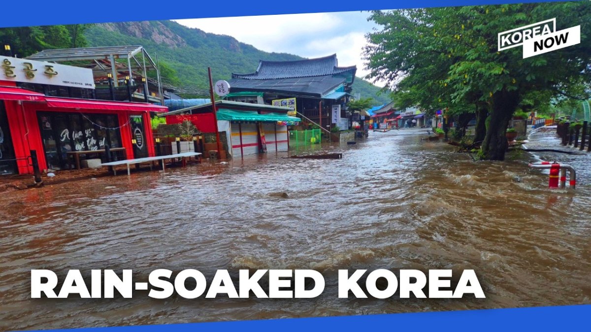
These figures align with forecasts issued by the Korea Meteorological Administration prior to the event. The pattern reflected typical East Asian monsoon dynamics intensified by warmer sea surface temperatures in the Yellow Sea and East China Sea, a trend documented in regional climate assessments.
Human and Infrastructure Toll
One person, a man in his seventies, remained missing in Yeongju, North Gyeongsang Province, after being swept away by floodwaters. Nationwide, 758 people were evacuated and more than 450 facilities sustained damage. Five landslides occurred in North Chungcheong and Gangwon provinces. Schools in Cheongju were inundated, and railway services faced disruptions on multiple lines serving the worst-affected provinces of North Gyeongsang, South Chungcheong, and North Chungcheong.
The concentration of impacts in the Chungcheong region and adjacent areas underscores the exposure of mid-sized cities and agricultural zones to short-duration, high-intensity rainfall events. Historical records from the Korea Meteorological Administration show that such localized extremes have increased in frequency since the early 2000s.
Shared River Risks on the Inter-Korean Border
The Korea Meteorological Administration issued specific advisories for residents in northern Gyeonggi and Gangwon provinces regarding potential rises in the Imjin, Hantan, and North Han rivers. These waterways originate in or traverse North Korean territory, creating a transboundary hazard that requires coordinated monitoring. Past flooding episodes along the Imjin River have demonstrated how upstream precipitation in North Korea can rapidly affect downstream South Korean communities without advance notification mechanisms.
This structural vulnerability remains a persistent feature of inter-Korean environmental relations. No formal bilateral flood-warning protocol currently operates at the scale required for real-time data exchange during monsoon peaks.
From Flood to Heat Wave — A Climate Whiplash Scenario
Following the subsidence of rainfall on the morning of July 10, the Korea Meteorological Administration warned of an immediate transition to extreme heat. Daytime temperatures were projected to exceed 30 °C across inland areas, with perceived temperatures reaching 31–33 °C or higher. The first-ever heat wave emergency warning was activated for Gyeongsan and Pohang, where readings approached 39 °C. Additional heat advisories covered southeastern Gyeonggi, southern Gangwon, Sejong, Chungcheong, Jeolla, Yeongnam, and Jeju provinces.
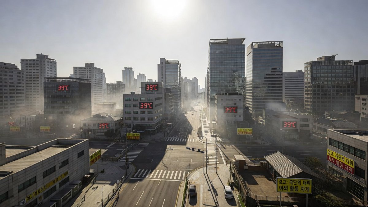
The rapid shift from flooding to heat stress illustrates compounding climate risks. Infrastructure and populations already stressed by inundation face secondary threats from power demand spikes, agricultural losses, and heat-related illness. Such sequences are consistent with projections in the Intergovernmental Panel on Climate Change Sixth Assessment Report for East Asia under continued warming trajectories.
Government Response and Disaster Management Infrastructure
The Central Disaster and Safety Countermeasures Headquarters coordinated national response operations. The Korea Meteorological Administration maintained continuous warning dissemination, while local governments managed evacuations and search efforts for the missing individual in Yeongju. Authorities anticipated that rainfall would largely cease by the morning of July 10, allowing a pivot toward heat-mitigation measures.
South Korea’s disaster management architecture, centered on the Framework Act on Disaster and Safety Management, provides a centralized coordination mechanism. However, the 2026 event exposed limits in addressing sequential hazards within short timeframes and in managing transboundary river risks without reciprocal data-sharing arrangements with North Korea.
Looking Ahead — Korea's Climate Adaptation Imperative
The July 2026 sequence carries direct implications for Korea’s national adaptation planning. Strengthening early-warning integration between flood and heat advisories, upgrading drainage in mid-sized cities such as Cheonan and Cheongju, and establishing reliable cross-border hydrological data exchange would address identified gaps. The Korea Meteorological Administration’s role in issuing the first heat wave emergency warning also signals an evolution in operational thresholds that may serve as a model for other provinces.
Without accelerated investment in resilient infrastructure and institutionalized inter-Korean environmental cooperation, the frequency of such compound events is expected to rise. South Korea’s experience in 2026 therefore functions as a concrete case study for refining disaster governance under accelerating climate variability in Northeast Asia.
By Prof. David Park, Staff Writer
This article was produced with AI-assisted research and editorial support. Reporting is based on sources cited in the article.
What's Your Reaction?
 Like
0
Like
0
 Dislike
0
Dislike
0
 Love
0
Love
0
 Funny
0
Funny
0
 Wow
0
Wow
0
 Sad
0
Sad
0
 Angry
0
Angry
0

East Asia/Technology Correspondent at Global1.News. Seoul-based voice covering Korean politics, technology, business, and culture. Analyzes how technology and geopolitics intersect across East Asia.














Comments (0)