
Floods Devastate Mindanao Farmlands After Typhoon Inday, 17 Dead
The Wrath of Typhoon Inday Hits Mindanao Typhoon Inday, known internationally as Bavi, entered the Philippine area of responsibility on July 8 as a super typhoon and quickly brought monsoon rains that soaked large parts of Mindanao. At least 17 people have died due to landslides induced by the cyclone. Communities in low-lying barangays now face the aftermath as floodwaters lin
The Wrath of Typhoon Inday Hits Mindanao
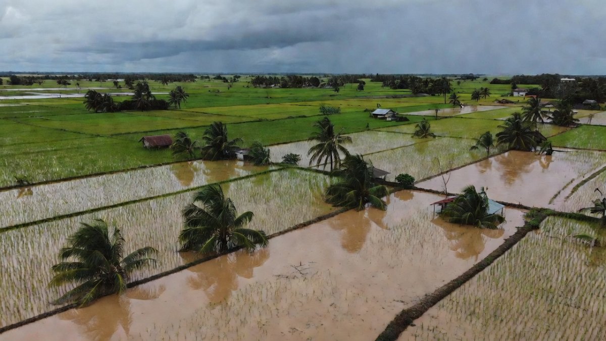
Typhoon Inday, known internationally as Bavi, entered the Philippine area of responsibility on July 8 as a super typhoon and quickly brought monsoon rains that soaked large parts of Mindanao. At least 17 people have died due to landslides induced by the cyclone. Communities in low-lying barangays now face the aftermath as floodwaters linger across farmlands and homes.
Farmers and their kapitbahay in affected areas are working together in quiet bayanihan to clear debris and check on one another. The rains fell heavily on rice fields that families have tended for generations. Many households rely on these harvests to keep sari-sari stores stocked and children in school.
Local government units are already coordinating initial assessments while residents share what little they have left. The scale of the flooding has left entire stretches of cropland underwater. This event follows a pattern that Mindanao communities know too well after successive weather disturbances.
PhilSA Satellite Maps Reveal Flood Extent
The Philippine Space Agency released satellite extent maps that show heavy flooding in parts of Cotabato and nearby Bangsamoro areas. These maps were produced using imagery captured on July 10 at around 5:31 a.m. Red markings indicate flooded areas, pink shows flood-affected physical rice areas, and brown marks flooded other crop areas.
PhilSA cautioned that the maps may underestimate flooding in urban and densely vegetated areas because of the complexity of radar backscatter from those surfaces. The maps remain subject to ground validation. The agency used the data to support the National Disaster Risk Reduction and Management Council in monitoring the situation.
Officials note that the imagery helps prioritize response efforts across multiple provinces. Residents in remote barangays appreciate any tool that brings attention to their situation. The maps provide a clearer picture than ground reports alone could offer in the first days after the storm.
Heavy Flooding in the Cotabato-Bangsamoro Corridor
The densest and most extensive visible flooding appears in the Cotabato-Bangsamoro corridor, particularly parts of Cotabato, the Bangsamoro's Special Geographic Area and nearby areas of Maguindanao del Sur. The strongest concentration of red flooded areas appears in central and eastern portions of this belt. Widespread red and pink markings stretch across low-lying communities around the Special Geographic Area and nearby towns.
Another map covering Maguindanao del Sur and Sultan Kudarat shows a heavy flood footprint, especially in eastern sections of Maguindanao del Sur. Families in these barangays woke to fields that had turned into lakes overnight. Rice seedlings that were just beginning to grow now sit under murky water.
Local leaders in Cotabato and Maguindanao del Sur are reaching out to neighboring LGUs for additional support. The corridor has long been a key agricultural zone for the region. The current flooding threatens both immediate food supplies and next season's planting cycle.
Devastation in Lanao del Sur and Lanao del Norte
Large flood clusters are visible in southwestern Lanao del Sur, especially near Balabagan and Malabang. A separate map of Lanao del Sur shows intense red clusters in the Balabagan-Malabang area. Residents there report that floodwaters reached higher than in previous storms.
In Lanao del Norte, the maps show extensive pink areas across the Lala-Kapatagan corridor and nearby towns. These pink zones represent flood-affected physical rice areas that stretch for kilometers. Farmers in Lala and Kapatagan are already calculating losses that will affect their entire harvest season.
Barangay officials in these corridors are organizing small teams to check on isolated households. The combination of landslides and flooding has cut some access roads. Kapitbahay networks remain the first line of help while larger aid arrives.
Affected Areas in Zamboanga and Sultan Kudarat
Maps of the Zamboanga Peninsula and Misamis areas show more scattered red flooding, although several areas still indicate wide stretches of flood-affected rice land. In Zamboanga del Sur, large pink patches are visible in the Mahayag-Tambulig area and adjoining localities. Zamboanga Sibugay also shows broad affected rice areas around the Diplahan-Imelda-Siay corridor.
The patterns suggest that even in areas where floodwaters appear less concentrated, agricultural communities may still have sustained widespread inundation. Sultan Kudarat appears on multiple maps with notable pink and brown markings. Rice farmers across these provinces share similar stories of fields that will need months to recover.
Tricycle drivers and small traders in these corridors are feeling the ripple effects as markets slow down. The broad pink zones in Zamboanga del Sur and Zamboanga Sibugay point to losses that go beyond single barangays. Communities are already discussing how they will replant once waters recede.
Rice Farmers Bear the Brunt of the Floods
The broadest pink zones appear in parts of Lanao del Norte, Zamboanga del Sur and Zamboanga Sibugay, as well as sections of Sultan Kudarat and Cotabato. These markings identify flood-affected physical rice areas that represent the backbone of local food production. Many farmers had invested their savings in this cropping season.
Losses in these rice lands will affect not only the growers but also the wider community that depends on steady harvests. Sari-sari store owners worry about rising prices once current stocks run low. The flooding has turned months of careful work into uncertain recovery.
Younger family members who usually help during planting are now focused on clearing mud from homes. Older farmers speak of past seasons when bayanihan helped them bounce back. This time the scale of damage across multiple provinces makes the task heavier.
Understanding SAR Satellite Data
PhilSA said the flood extent analysis used Sentinel-1 Synthetic Aperture Radar data and artificial intelligence to detect inundated areas. Sentinel-1 is a European Space Agency satellite. SAR is useful during storms because it can capture images through cloud cover and regardless of daylight conditions.
In simple terms, SAR works like a radar that bounces signals off the ground and reads the return to map water. This technology allows mapping even when skies remain overcast after a typhoon. The resulting images give disaster managers a faster overview than waiting for clear weather.
Artificial intelligence helps process the large volume of data into clear color-coded maps. PhilSA stressed that these maps still need ground validation from local teams. The combination of satellite views and community reports gives the most accurate picture for response planning.
Community Spirit and NDRRMC Response
The mapping supports the National Disaster Risk Reduction and Management Council in monitoring the situation and helping prioritize response. NDRRMC teams are using the PhilSA data alongside reports from LGUs in Cotabato, Maguindanao del Sur, and other affected provinces. This coordination aims to direct resources where flooding remains most extensive.
Across barangays, residents continue the tradition of bayanihan by sharing food and labor. Kapitbahay groups check on elderly neighbors and those with young children first. These small acts keep hope alive while larger aid slowly reaches remote areas.
Recovery will take time, yet Mindanao communities have shown resilience after every storm. Farmers are already planning how to clear fields once waters drop. The combination of satellite guidance and local knowledge offers the best path forward for these hard-hit agricultural zones.
By Bella Reyes, Staff WriterThis article was produced with AI-assisted research and editorial support. Reporting is based on sources cited in the article.
What's Your Reaction?
 Like
0
Like
0
 Dislike
0
Dislike
0
 Love
0
Love
0
 Funny
0
Funny
0
 Wow
0
Wow
0
 Sad
0
Sad
0
 Angry
0
Angry
0

Philippines/Southeast Asia Correspondent at Global1.News. Manila-based journalist covering Philippine politics, environment, maritime security, and social issues. Passionate about marine conservation and the communities protecting the Philippines' natural heritage.















Comments (0)