Greece's Thermal Satellites Offer Blueprint for Latin America Wildfire Crisis
Greece has just deployed the world's first national satellite constellation designed exclusively to spot wildfires — and the technology could reshape how Latin America fights its escalating fire crisis. The Hellenic Fire System's four thermal nanosatellites can detect a blaze the size of a parking space within 30 minutes, a capability that dwarfs conventional monitoring across
Greece has just deployed the world's first national satellite constellation designed exclusively to spot wildfires — and the technology could reshape how Latin America fights its escalating fire crisis. The Hellenic Fire System's four thermal nanosatellites can detect a blaze the size of a parking space within 30 minutes, a capability that dwarfs conventional monitoring across the Amazon, Pantanal, and Andean forests. With 19,462 fire foci already recorded in Brazil's first semester of 2026 alone and Bolivia losing 434,000 hectares to flames last year, the question is not whether Latin America needs this technology — but how quickly it can get it.
Greece's Thermal Satellites Could Transform How Latin America Fights Wildfires
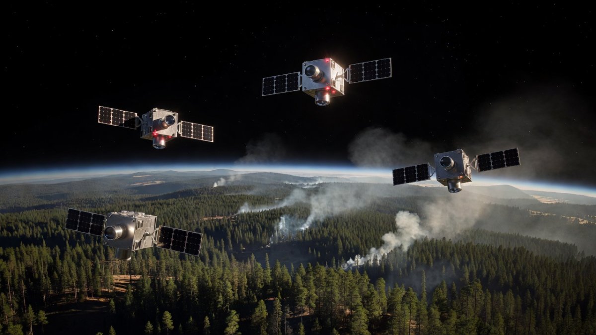
Athens, Greece — July 1, 2026 — The Hellenic Fire System marks a paradigm shift: four suitcase-sized nanosatellites in low Earth orbit carrying infrared sensors that identify fires as small as four meters across, with AI-powered alerts reaching fire crews in roughly half an hour. By contrast, conventional systems such as NASA's MODIS and VIIRS instruments require much larger heat signatures and can take hours to confirm an ignition. Greece's model, developed with OroraTech and the European Space Agency, offers Latin American nations a concrete blueprint for closing the detection gap that has allowed countless small fires to explode into megafires.
Greece's Thermal Satellite Revolution
In May 2026 Greece deployed four suitcase-sized OroraTech nanosatellites into low Earth orbit, creating the Hellenic Fire System. This constellation represents the world's first national effort fully dedicated to thermal wildfire detection and is now integrated directly into firefighting command structures. The satellites carry thermal infrared sensors capable of spotting fires as small as four meters across, equivalent to a single parking space. Conventional systems like MODIS and VIIRS require much larger heat signatures before registering an event. Artificial intelligence filters out false positives from solar panels, factory roofs, and industrial heat sources, ensuring alerts reach ground teams within approximately 30 minutes of ignition. The platform also generates real-time predictions of flame spread patterns. Greece complements the satellites with more than 100 drone surveillance bases equipped with thermal cameras, all supported by the EU Recovery and Resilience Facility, the Greek Ministry of Digital Governance, OroraTech, and the European Space Agency. This integrated approach demonstrates how small, specialized satellites can transform national preparedness.
Latin America's Devastating Fire Seasons
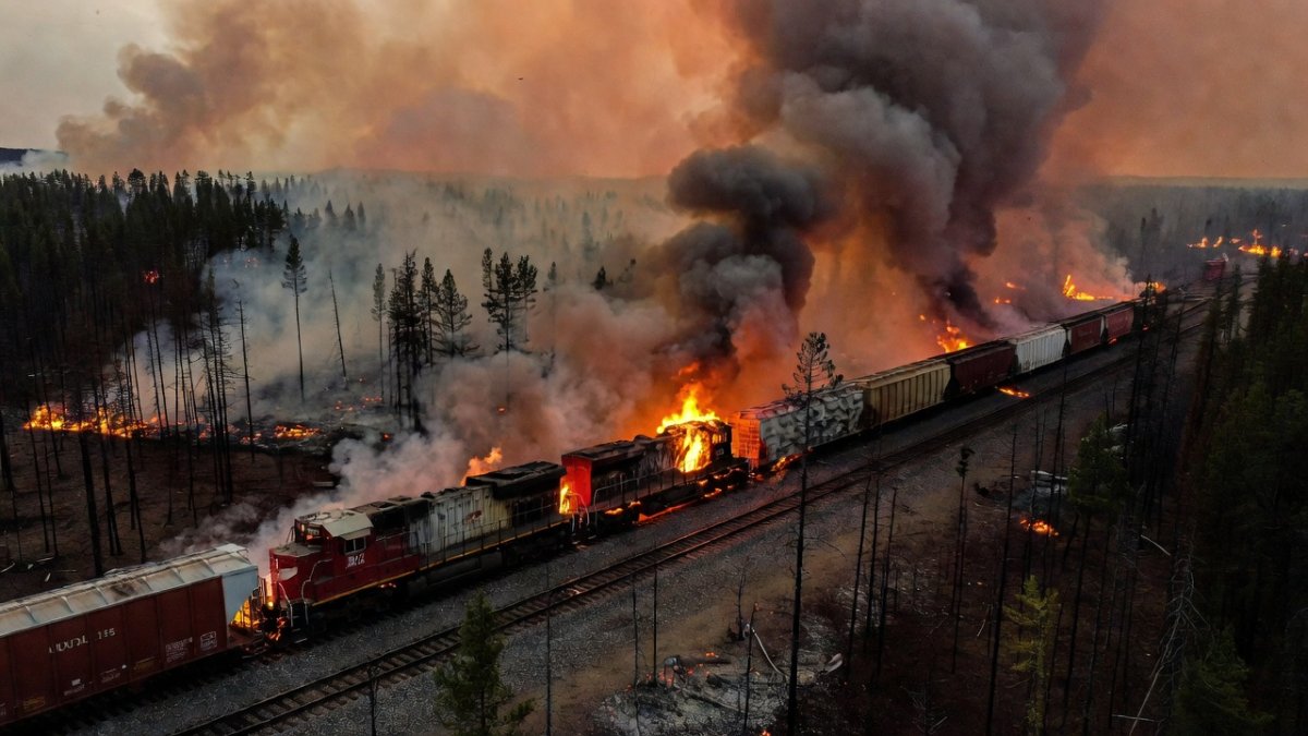
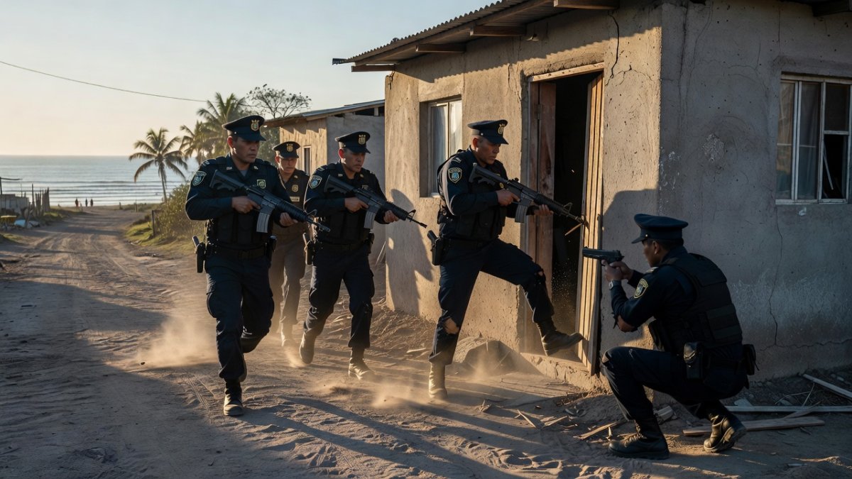
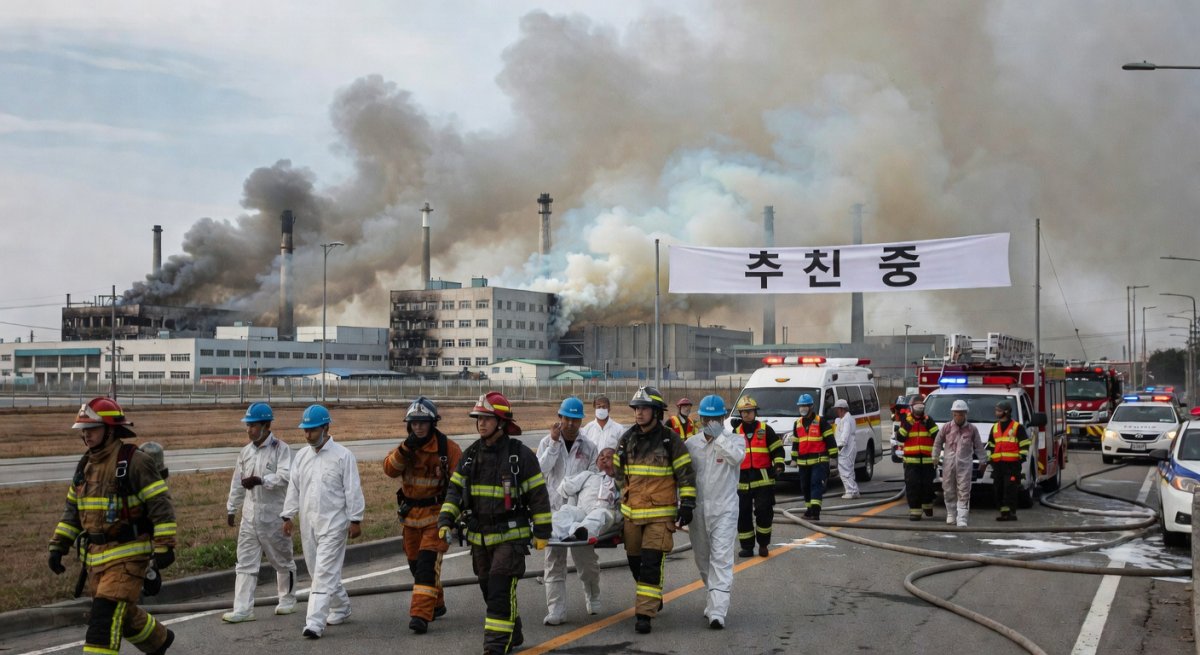
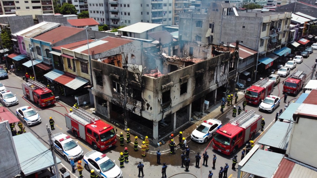
Latin America continues to endure punishing fire seasons that destroy ecosystems and displace communities. Brazil's INPE documented 19,462 fire foci during the first semester of 2026, marking a 0.96 percent year-over-year increase even as Amazon deforestation fell 61.4 percent in May to its lowest recorded level for that month. Chile suffered between 64,000 and 65,000 hectares burned in the 2025-2026 season, resulting in 15 to 21 deaths and more than 50,000 evacuations. Bolivia lost over 700,000 hectares of primary forest in 2025, with fires responsible for 62 percent or 434,000 hectares of that destruction; the Santa Cruz department alone recorded 146,361 hectares burned. In Colombia, 91 fires affected 13,463 hectares in Casanare by March 2026, while active fires persisted in Brazil's Pantanal region around Corumbá in late June. Despite Brazil hiring a record 4,385 brigadistas, a 26 percent increase, and deploying additional water-dropping helicopters, the scale of ignition points overwhelms current capacities. These numbers reveal a continent under sustained assault from both human and climatic drivers.
How Latin America Currently Monitors Fires
Institutions across Latin America rely on a patchwork of international and regional satellite assets. Brazil's INPE operates the Queimadas program, drawing data from MODIS, VIIRS, Sentinel-2, and GOES-16/18 satellites to track hotspots. Chile's CONAF coordinates aerial and ground surveillance, while Bolivia's ABT-Bolivia and Colombia's IDEAM monitor protected areas and agricultural frontiers. IBAMA and ICMBio enforce prevention in Brazilian reserves. An Argentine startup called Satellites on Fire claims its AI processes detections roughly 35 minutes faster than NASA FIRMS alerts. NASA’s PACE satellite adds value by tracking pre-fire vegetation stress through chlorophyll fluorescence measurements. In remote Amazon zones, Starlink and Swarm connectivity now transmit real-time readings from ground sensors. Brazil reduced burned area by 32 percent in 2025 compared with the ten-year average through integrated fire management. Yet these systems still depend on broad-coverage instruments with revisit times measured in hours or days, leaving critical gaps during the July-to-October Amazon dry season when risk peaks.
The Detection Gap
Conventional satellites frequently miss the earliest stages of wildfires because their sensors require larger heat sources and struggle with cloud cover common in tropical regions. Revisit intervals of several hours or more allow small ignitions to grow beyond control before authorities receive notification. In Bolivia and Colombia, fires that begin in remote forest patches often expand for an entire day before satellite passes confirm their presence. The four-meter detection threshold achieved by Greece’s OroraTech nanosatellites exposes how current Latin American monitoring underestimates ignition density. Cloud-obscured areas in the Amazon basin further delay confirmation, while industrial heat signatures generate false alarms that waste response resources. Without AI-driven filtering and rapid downlink capabilities, valuable minutes slip away. The upcoming FireSat constellation backed by the Bezos Earth Fund and Google promises global minutes-level detection, yet Latin American nations lack dedicated national systems comparable to Greece’s Hellenic Fire System. This technological shortfall leaves millions of hectares and countless communities exposed during peak fire months.
What Latin America Can Learn from Greece
Greece’s model shows that a small constellation of thermal nanosatellites, paired with AI and drone networks, can deliver actionable intelligence within 30 minutes. Latin American countries could adapt the OroraTech approach by launching regional nanosatellite clusters focused on the Amazon, Pantanal, and Chaco biomes. Argentina’s Satellites on Fire startup already demonstrates local capacity for faster processing than NASA FIRMS. Brazil and Chile might integrate similar thermal sensors with existing INPE and CONAF infrastructure while expanding Starlink-enabled ground networks. The European Space Agency’s collaboration with Greece offers a template for partnerships with ESA or new Latin American space agencies. FireSat’s planned global coverage will eventually help, yet dedicated national or regional constellations would provide sovereignty over data and faster customization for local vegetation types. By combining satellite alerts with the 4,385 brigadistas now active in Brazil and enhanced drone fleets, governments could shift from reactive firefighting to proactive containment, protecting both primary forest and rural livelihoods.
Voices from the Ground
Brazilian brigadistas describe racing against time as small fires detected too late explode into crown fires that consume thousands of hectares overnight. In Chile’s 2025-2026 season, evacuees from scorched communities recounted losing homes within hours of ignition because satellite warnings arrived after flames had already jumped containment lines. Bolivian indigenous communities in Santa Cruz report watching primary forest vanish at rates tied directly to the 434,000 hectares lost to fire in 2025, disrupting traditional hunting grounds and water sources. Colombian farmers in Casanare note that 13,463 hectares burned by March left soils degraded and livestock without pasture. These testimonies underscore how detection delays translate into irreversible ecological and human costs. Greece’s 30-minute alert window and four-meter sensitivity could empower these same communities with early warnings delivered via mobile networks, allowing preemptive action rather than desperate evacuation. The contrast between Europe’s technological edge and Latin America’s lived experience highlights an urgent equity gap in climate adaptation tools.
The Bottom Line
Climate change is lengthening dry seasons and stressing vegetation across Latin America, intensifying wildfire behavior beyond historical norms. Satellite technology now offers a critical adaptation pathway, as Greece’s Hellenic Fire System proves. With 19,462 fire foci already logged in Brazil this year and hundreds of thousands of hectares lost in Bolivia and Chile, the continent requires detection capabilities that match the speed of ignition. Integrating thermal nanosatellites, AI filtering, and drone networks would complement the record numbers of brigadistas and existing INPE monitoring. The July-to-October Amazon dry season brings elevated risk that current MODIS and VIIRS revisit times cannot fully address. By studying Greece’s partnership model with OroraTech and ESA, Latin American governments can build sovereign systems that protect primary forest, reduce evacuations, and save lives. The data are clear: faster, finer-scale detection is no longer optional but essential for regional resilience.
Keywords: Greece wildfire satellites, OroraTech, Latin America fires, INPE Queimadas, Amazon deforestation, thermal detection, FireSat, Brazil brigadistas, Bolivia forest loss, Chile wildfires, nanosatellites, wildfire alerts, ESA, CONAF, climate adaptation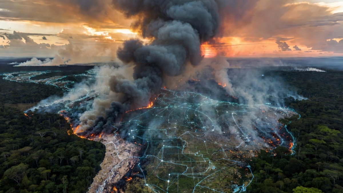
By Elena Vasquez, Staff Writer
What's Your Reaction?
 Like
0
Like
0
 Dislike
0
Dislike
0
 Love
0
Love
0
 Funny
0
Funny
0
 Wow
0
Wow
0
 Sad
0
Sad
0
 Angry
0
Angry
0
Latin America Correspondent at Global1.News. Based in Mexico City, covering politics, economics, energy, and culture across the region. Brings an on-the-ground perspective to stories spanning from the Rio Grande to Patagonia.


Comments (0)