America Under Siege: Deadly Tornadoes, Record-Breaking Hail, and Tropical Flooding Strike the Nation
America Under Siege: Deadly Tornadoes, Record-Breaking Hail, and Tropical Flooding Strike the Nation Midwest Tornado Outbreak CNN slammed the airwaves on June 17, 2026, with footage of a full-blown tornado outbreak ripping through Illinois, Indiana, Iowa, Wisconsin, and Ohio. The National Weather Service dropped Particularly Dangerous Situation warnings like they were handing o
America Under Siege: Deadly Tornadoes, Record-Breaking Hail, and Tropical Flooding Strike the Nation
Midwest Tornado Outbreak
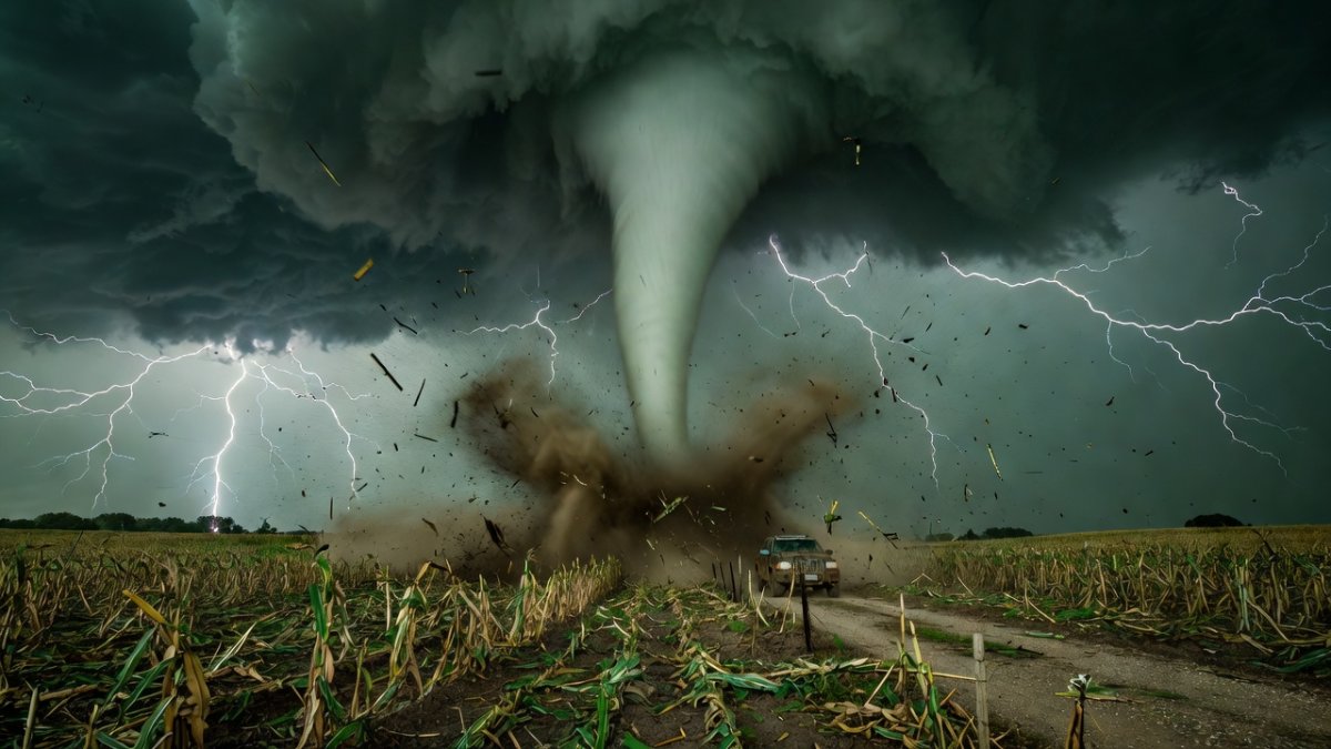
CNN slammed the airwaves on June 17, 2026, with footage of a full-blown tornado outbreak ripping through Illinois, Indiana, Iowa, Wisconsin, and Ohio. The National Weather Service dropped Particularly Dangerous Situation warnings like they were handing out parking tickets, and Fox Weather radar lit up with winds screaming past 90 mph and baseball-sized hail hammering everything in sight. This was not your average spring chase season. This was June turning into a war zone.
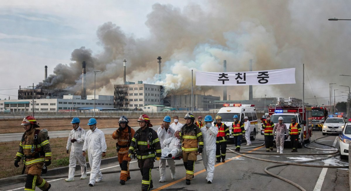
An EF3 tornado touched down near Kankakee, Illinois, carving a path of destruction that flattened homes, snapped power poles like toothpicks, and left entire neighborhoods looking like they had been hit by artillery. Charleston, Illinois, took a direct shot too, with roofs peeled off blocks at a time and debris fields stretching for miles. Residents described the roar as a freight train that refused to leave the tracks, shaking foundations and sending families scrambling into basements with seconds to spare.
Tens of thousands lost power across the region as the storms marched east. Trees came down on lines, transformers exploded in showers of sparks, and emergency crews worked through the night under floodlights. The scenes on the ground were raw: families picking through splintered lumber for photo albums, kids crying in the back of pickup trucks, and first responders calling for more chainsaws because the damage simply would not quit.
What residents experienced was pure chaos wrapped in darkness. One moment the sky turned that sick green color everyone dreads, the next the wind was trying to rip doors off hinges. Sirens wailed, phones screamed warnings, and then the world went sideways. This outbreak did not ask permission. It just arrived and started tearing.
Illinois Breaking Records
Illinois is now leading the entire nation with 95 tornadoes confirmed in 2026, and the NWS Chicago office is not sugarcoating what that means. The June 11 outbreak alone dropped multiple strong tornadoes across northern Illinois and northwest Indiana, part of a larger derecho event that also spawned two dozen twisters from June 10 through the 11th across Iowa, Illinois, Indiana, and Wisconsin. These are not isolated spins. This is a pattern that refuses to break.
One measurement stands out like a warning flare: 4.75-inch hail fell in Illinois, a mark that could rewrite the state record books if verified. Wisconsin is not far behind with 31 tornadoes already this year. Compare that to historical averages and the numbers jump off the page. Most years see far fewer early-season events of this intensity, yet 2026 is rewriting the script before summer even hits its stride.
The significance hits hard when you stack the data. Previous record years built slowly. This one is stacking violent weather on violent weather with almost no breathing room. NWS meteorologists are tracking the same atmospheric setup that keeps feeding these supercells, and the trend line is not pointing toward calmer days. Illinois and its neighbors are living through a season that feels less like weather and more like a sustained assault.
Power companies are still counting the cost in outages and overtime. Insurance adjusters are already flying in. The record books are flipping pages faster than forecasters can update them, and every new report adds another line to a story that keeps getting longer.
Tropical Storm Arthur Deadly Flooding
Reuters and CBS News confirmed the first named storm of the 2026 Atlantic hurricane season, Tropical Storm Arthur, formed on June 18 and was already gone by the 19th after just 12 hours at tropical storm strength. Short does not mean harmless. The system dumped 5 to 10 inches of rain across the Gulf Coast, with isolated pockets hitting 20 inches, and the National Weather Service immediately warned of widespread, potentially life-threatening flash flooding.
A road crew member was killed in Mississippi when floodwaters swept through a work zone. In Carriere, a dam failed and sent water racing toward homes, forcing rapid evacuations. Over in Kenner, Louisiana, a canal overtopped and turned streets into rivers within minutes. MEMA has been fielding continuous reports of roads vanishing, vehicles stranded, and families climbing onto roofs as the water kept rising.
The storm’s brevity masked its punch. Warm, saturated air met already soaked ground and the result was runoff that moved faster than anyone expected. Emergency managers watched gauges climb in real time and issued fresh warnings even as the center of circulation fell apart over land. The damage is measured in lives disrupted and infrastructure stressed, not in wind speed at landfall.
Rescue teams are still pulling vehicles from ditches and checking every flooded neighborhood for people who waited too long to leave. The numbers coming out of Mississippi and Louisiana keep climbing, and the message from MEMA is blunt: this system may be history, but the water is staying.
Climate Context — Why This June Feels Different
Warm Gulf waters are pumping moisture and vapor into the atmosphere like an open spigot, and Yale Climate Connections has been tracking how that extra fuel turns ordinary storms into record-breakers. Hotter oceans mean more energy available for both the supercells ripping across the Midwest and the tropical systems that form just offshore. The two events are not separate chapters. They are pages in the same atmospheric river pattern.
That pattern is showing up earlier and packing more punch. June used to be a shoulder month. Now it is delivering outbreaks that used to wait until peak season. The science is straightforward: warmer sea surface temperatures load the dice, and the dice keep coming up extreme. Forecasters are seeing the same moisture plume feed both the tornado-producing storms and the Gulf Coast deluge.
Residents on the ground do not need the charts to feel the shift. They are living through back-to-back days of warnings that used to be rare. The connection is visible in the radar loops and the rainfall totals, and it is forcing emergency planners to rethink what “normal” even means for the rest of the summer.
On the Ground — Voices From the Disaster Zones
In Kankakee, survivors are still describing the EF3 as a freight train that never stopped. Windows exploded inward, walls flexed, and then the roof was gone. Families huddled in hallways counting seconds while the wind tried to pull them into the sky. The quiet afterward was almost worse than the roar.
Charleston looks like a war zone in daylight. Entire blocks stand with roofs torn clean off, insulation hanging from trees like Spanish moss, and debris fields stretching for miles. Neighbors are walking the streets with chainsaws and tarps, sharing what little power they have left from generators that are running low on fuel.
Down in Carriere, Mississippi, the dam failure triggered evacuations that felt like a drill until the water actually arrived. People grabbed what they could and ran. In Kenner, Louisiana, water rose past doorsteps in minutes, sending residents wading through streets that had been dry an hour earlier. The stories all carry the same edge: it happened faster than anyone expected.
What Comes Next
Emergency managers are urging every county still under watches to stay on high alert. Saturated ground means even moderate rain can trigger new flooding, and power restoration timelines are stretching into next week across the hardest-hit Midwest counties. Shelters are open and stocked, but supplies of water, tarps, and non-perishable food are moving fast.
Officials are asking residents to check on neighbors, especially the elderly and those without vehicles. Donations of bottled water and batteries are being routed through local Red Cross chapters. The window for preparation is narrow, and the ground is already full.
Communities that just dug out from one round of storms are being told to expect more. The pattern has not broken. The only variable left is how ready people choose to be when the next cell fires up.
Check your local alerts right now, top off your gas tanks, and make sure your go-bag is by the door. If you can spare water, tarps, or cash for the shelters, send it today. The storms are not waiting for anyone to catch their breath. Stay ready, stay loud, and do not let the next warning catch you flat-footed. This is Jessica Ali, Lead Anchor — Global 1 News.
By Jessica Ali, Lead Anchor — Global 1 NewsWhat's Your Reaction?
 Like
0
Like
0
 Dislike
0
Dislike
0
 Love
0
Love
0
 Funny
0
Funny
0
 Wow
0
Wow
0
 Sad
0
Sad
0
 Angry
0
Angry
0
Editor-in-Chief at Global1.News. Atlanta-based journalist who cuts through the BS and tells it like it is. Lead anchor, host, and the voice you hear when the spin stops and the truth starts.


Comments (0)