
Super Typhoon Dolphin Threatens Millions Across East Asia
Super Typhoon Dolphin at 240 km/h Category 4 strength is tracking northwest toward the Philippines, Taiwan, and Japan. Rapid intensification has already occurred and further strengthening is possible before landfall. Stay alert, follow evacuation orders, and monitor official sources. This storm will bring dangerous winds, flooding, and surge to populated areas in the coming days. Preparation today can save lives tomorrow.
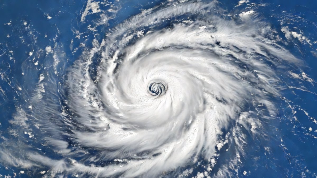
Super Typhoon Dolphin Roars Across the Western Pacific
Super Typhoon Dolphin is carving a dangerous path over the Western Pacific with sustained winds of 240 km/h, threatening millions across the Philippines, Taiwan, and Japan with life-threatening winds, torrential rain, and dangerous storm surge as it barrels northwest at Category 4 strength.
Super Typhoon Dolphin Threatens Millions Across East Asia
Western Pacific - Article continues...
I'm Jessica Ali reporting live from Global 1 News headquarters. Right now, Super Typhoon Dolphin is carving a dangerous path over the Western Pacific with sustained winds of 240 km/h. That puts it at Category 4 strength, and the storm is not finished strengthening. We are tracking this system in real time as it moves northwestward toward the Philippines, Taiwan, and eventually Japan.
At 0600 UTC on July 29, 2026, the Joint Typhoon Warning Center placed the center of Super Typhoon Dolphin at 15.4 degrees north latitude and 130.8 degrees east longitude. Central pressure stood at 925 millibars, with the system moving northwest at 18 kilometers per hour. The radius of 34-knot winds extended 280 kilometers from the center, giving the storm a broad wind field capable of affecting multiple island chains simultaneously.
Comparisons to recent Pacific super typhoons place Dolphin in elite company. Its current intensity matches the peak reached by Super Typhoon Surigae in 2021 and exceeds the maximum strength of Typhoon Nanmadol in 2022. Forecasters note that Dolphin has maintained a more symmetric structure than either of those systems at the equivalent stage of development.
Why This Storm Demands Immediate Attention
Today the Joint Typhoon Warning Center upgraded Dolphin to super typhoon status after explosive intensification. Weather Underground data shows the core has tightened dramatically this week, feeding off warm ocean waters. Zoom Earth imagery confirms the classic eye structure and expansive cloud shield that signal a major threat to land areas in the coming days. This is not a drill.
The storm strengthened from a 120 km/h typhoon to its present 240 km/h intensity in just 42 hours. Sea-surface temperatures along its path have remained near 30 degrees Celsius, while vertical wind shear has stayed below 10 knots, allowing the vortex to contract without disruption.
No competing tropical cyclones are present in the basin, eliminating any Fujiwara interaction that could deflect the track. July marks the traditional start of peak typhoon season in the Western Pacific, when climatological conditions most favor rapid intensification events such as the one now underway.
Tracking the Northwestward Threat
The storm's current northwestward track is locked in. Models from the New York Times live tracking map show the center passing near or over the northern Philippines within the next several days before continuing toward Taiwan and the southern islands of Japan. Coastal communities need to prepare now for life-threatening winds, torrential rain, and dangerous storm surge.
Manila, with a metropolitan population exceeding 14 million, sits near the left edge of the forecast cone. Taipei and its surrounding urban areas house another 7 million residents who could experience fringe effects. Okinawa and the southern Ryukyu Islands lie directly in the projected path, while longer-range guidance keeps Tokyo within the broader threat envelope.
Evacuation planning in the Philippines has already referenced the 2013 landfall of Typhoon Haiyan, which devastated similar coastal zones. Officials are prioritizing the movement of residents from barangays below three meters elevation, mirroring protocols used during that historic event.
Regional Impacts Already Unfolding
Evacuation orders are being drafted across vulnerable islands. In the Philippines, officials are moving residents from low-lying coastal zones. Taiwan's central weather bureau has begun issuing advisories, and Japanese meteorological agencies are monitoring the long-range track closely. The rapid intensification we have seen this week leaves little margin for error.
Manila's Ninoy Aquino International Airport has begun contingency planning for possible flight cancellations within 48 hours. Schools in northern Luzon provinces have announced early closures, and ferry operators across the Luzon Strait have suspended services between the Philippines and Taiwan.
Japanese authorities in Okinawa Prefecture have activated emergency operations centers and pre-positioned fuel and water supplies. Historical precedent from Typhoon Trami in 2018 shows that even glancing blows can produce widespread power outages lasting more than a week across the island chain.
What the Data Tells Us
Zoom Earth last modified its Super Typhoon Dolphin 2026 product on July 29, 2026 UTC, showing the system at peak organization. The New York Times map highlights the tight pressure gradient and the potential for further strengthening before land interaction. Weather Underground forecasters emphasize that any wobble in the track could shift the worst impacts by hundreds of kilometers, but the general northwestward motion remains the dominant signal.
The official forecast cone issued by the Joint Typhoon Warning Center shows a 200-kilometer uncertainty radius at 72 hours. A direct landfall scenario would bring the center across northern Luzon, while a rightward shift could produce only a glancing blow to the same region before the storm accelerates toward Taiwan.
The Japan Meteorological Agency forecast maintains a similar northwest trajectory but delays land interaction with the Ryukyu Islands by roughly 12 hours compared with JTWC guidance. Both agencies agree that any significant track deviation will depend on subtle changes in the subtropical ridge to the north.
Western Pacific sea-surface temperatures this season have averaged 1.2 degrees Celsius above the 1991-2020 baseline. Climate models indicate that such anomalies can increase the proportion of storms reaching Category 4 or 5 intensity by 5 to 10 percent. Current seasonal outlooks from the Tokyo Climate Center call for an above-average number of super typhoons through October.
The exceptionally warm Pacific waters near 30 degrees Celsius have supercharged Dolphin's core, allowing explosive intensification by supplying vast amounts of heat energy to the atmosphere. Climate science increasingly links these elevated sea surface temperatures to human-driven warming, which expands the window for storms to reach super typhoon strength before encountering land or cooler waters.
Preparedness Steps for Affected Populations
Residents in the projected path should secure property, stock emergency supplies, and follow local evacuation guidance without delay. Power outages and flooding are expected to be widespread. International aid organizations are already positioning resources in case the storm delivers the catastrophic rainfall totals some models are suggesting.
Key variables to monitor include any increase in upper-level easterly winds that could begin eroding the storm's outflow, as well as the exact timing of landfall relative to high tide. Storm-surge heights along Manila Bay could exceed three meters if the center passes within 50 kilometers of the capital.
Model rainfall totals range from 250 to 500 millimeters across northern Luzon, raising flash-flood and landslide risks in mountainous terrain. Residents should identify evacuation routes now and ensure battery-powered radios remain accessible once power is lost.
Global 1 News Commitment to Live Updates
We will continue broadcasting the latest positions, intensity changes, and official warnings from the Joint Typhoon Warning Center and national meteorological agencies. Our team is monitoring every satellite pass and model run so you receive accurate, timely information as the situation evolves.
The Bottom Line
Super Typhoon Dolphin at 240 km/h Category 4 strength is tracking northwest toward the Philippines, Taiwan, and Japan. Rapid intensification has already occurred and further strengthening is possible before landfall. Stay alert, follow evacuation orders, and monitor official sources. This storm will bring dangerous winds, flooding, and surge to populated areas in the coming days. Preparation today can save lives tomorrow.
With warm ocean waters continuing to fuel the system, residents must act immediately as the window for safe evacuation narrows. Global 1 News will remain on air with round-the-clock updates from the Joint Typhoon Warning Center and regional agencies.
By Jessica Ali, Staff Writer
This article was produced with AI-assisted research and editorial support. Reporting is based on sources cited in the article.
What's Your Reaction?
 Like
0
Like
0
 Dislike
0
Dislike
0
 Love
0
Love
0
 Funny
0
Funny
0
 Wow
0
Wow
0
 Sad
0
Sad
0
 Angry
0
Angry
0

Editor-in-Chief at Global1.News. Atlanta-based journalist who cuts through the BS and tells it like it is. Lead anchor, host, and the voice you hear when the spin stops and the truth starts.















Comments (0)