
Super Typhoon Inday Intensifies: Signal No. 1 Hoisted Over 12 Areas as PAGASA Monitors Path
Manila residents and communities across northern Luzon woke up to another day of vigilance on Wednesday as Super Typhoon Inday, known internationally as Bavi according to PAGASA and PhilStar reports, continued its steady approach over the Philippine Sea. The state weather bureau issued its 11 a.m. bulletin confirming the storm's position 1,270 kilometers east of Northern Luzon,

Manila residents and communities across northern Luzon woke up to another day of vigilance on Wednesday as Super Typhoon Inday, known internationally as Bavi according to PAGASA and PhilStar reports, continued its steady approach over the Philippine Sea. The state weather bureau issued its 11 a.m. bulletin confirming the storm's position 1,270 kilometers east of Northern Luzon, where it packs maximum sustained winds of 195 kilometers per hour near the center and gusts reaching 240 kph. This powerful system moves west-northwestward at 20 kph, keeping many families on edge about potential disruptions to daily routines. Ordinary Filipinos in affected regions understand that even distant super typhoons like this one can alter plans for work, school, and market visits through indirect weather changes. The situation reminds everyone that preparation remains key to staying safe amid the country's frequent stormy seasons.
Storm Strength and Direction
Super Typhoon Inday maintains its formidable strength with sustained winds of 195 kph near the center and gusts up to 240 kph, a combination that classifies it firmly as a super typhoon capable of generating dangerous conditions far from its core. PAGASA's 11 a.m. bulletin on Wednesday, July 8, tracks the storm moving west-northwestward at a consistent 20 kph pace across the Philippine Sea. These precise measurements matter greatly for safety planning because they help local officials decide when to issue alerts and when residents should begin securing their homes against flying debris or sudden power outages. Families use such data to stock up on essentials before gusts intensify and affect transportation networks. Understanding the numbers allows communities to coordinate with neighbors and avoid unnecessary risks during the coming days.
The storm's projected path shows it continuing generally west-northwestward over the next 24 hours before shifting northwestward over the open waters of the Philippine Sea. Its closest approach to extreme northern Luzon is anticipated on Friday, July 10, though the center is expected to remain offshore throughout this period. Even so, the outer rainbands will continue to influence weather patterns across wide areas by enhancing moisture and wind activity. This trajectory means residents in northern provinces can anticipate prolonged periods of unsettled conditions without direct landfall. Communities stay informed through regular updates to adjust their schedules accordingly and protect vulnerable members like children and the elderly.
Signal No. 1 Across 12 Provinces
Tropical Cyclone Wind Signal No. 1 currently covers twelve specific areas including Batanes, Cagayan including the Babuyan Islands, Isabela, Quirino, Nueva Vizcaya, Apayao, Kalinga, Mountain Province, Ifugao, Abra, Ilocos Norte, and Aurora. Under this signal, residents may experience strong winds between 39 and 61 kph within the next 36 hours, which PAGASA describes as posing only minimal to minor threats to life and property when proper precautions are taken. The signal serves as an early warning tool that allows local governments to activate basic response measures without causing widespread alarm. People in these provinces receive clear guidance on monitoring updates and avoiding unnecessary travel during the advisory period. This coverage reflects PAGASA's careful assessment of the storm's reach and helps coordinate resources across provincial boundaries.
Families living under Signal No. 1 find themselves balancing routine chores with extra vigilance as they prepare for possible gusty conditions over the coming day and a half. Farmers check their fields to ensure crops are not left exposed to strong winds that could damage young plants or harvest-ready produce. Parents adjust school commutes for children by arranging earlier pickups or alternative routes to avoid areas prone to falling branches. Sari-sari store owners tie down signage and secure lightweight goods that might scatter during sudden wind bursts. The 36-hour preparation window gives everyone time to complete these tasks calmly and support one another through simple acts of neighborly assistance.
Habagat Enhanced Across the Archipelago
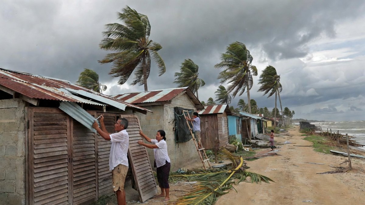
PAGASA forecasts that the enhanced southwest monsoon combined with Super Typhoon Inday's outer rainbands will generate strong to gale-force gusts across most parts of the country in the days ahead. The affected regions include Pangasinan, Zambales, Bataan, CALABARZON, most of MIMAROPA, the Bicol Region, most of the Visayas, and most of Mindanao, with these conditions expected to persist from Wednesday through Friday. This widespread influence demonstrates how a single distant storm can reshape weather patterns far beyond its immediate path. Local authorities encourage residents to secure outdoor items and limit exposure during peak gust periods. The extended timeline allows communities to plan work and travel with greater awareness of changing wind patterns.
Daily life in areas outside the Signal No. 1 zones feels the monsoon's reach through delayed commutes in Metro Manila and rougher waters that keep fishermen in the Visayas ashore for safety. Tricycle drivers in provincial towns slow their routes to avoid sudden gusts that could unbalance passengers or vehicles. Market vendors tie down tarps and arrange goods more securely to prevent losses from unexpected wind gusts. Students in distant regions may face canceled outdoor activities or adjusted class schedules as schools prioritize safety. These effects highlight how the habagat acts as a connecting thread that links distant communities in shared preparation efforts.
Gale Warning: Danger at Sea
A gale warning stays active over the eastern seaboards of Northern and Central Luzon as well as the Visayas, where very rough seas with waves up to 4.5 meters are forecast along the coasts of Isabela, northern Aurora, northern and eastern Catanduanes, and eastern Northern Samar. PAGASA specifically advises all mariners and operators of small seacraft to avoid sailing in these waters because of the dangerous conditions created by the combined monsoon and storm influences. The warning covers an extended period that requires careful coordination among coastal barangays to ensure everyone receives timely information. Fisherfolk rely on these alerts to make informed decisions about when to head out or stay in port. Such measures protect lives while acknowledging the economic pressures faced by those dependent on marine resources.
Fishing communities along these eastern coasts weigh their daily income needs against the clear risks posed by high waves and strong gusts that could capsize small boats. Families gather at the shore to discuss the latest PAGASA advisories and decide collectively whether to delay trips until conditions improve. Barangay officials coordinate with local radio stations and text alerts to reach every household before dawn, ensuring no one ventures out unaware of the dangers. This shared vigilance strengthens bonds within the community as neighbors offer support to those who must temporarily forgo their livelihood. The focus remains on returning home safely each evening rather than taking unnecessary chances.
Weekend Outlook and What to Expect
Super Typhoon Inday is set to pass closest to extreme northern Luzon on Friday, July 10, before continuing toward southern Japan and the waters north of Taiwan, with an expected exit from the Philippine Area of Responsibility on Saturday, July 11. The storm may then make landfall over the eastern coast of mainland China on Sunday, July 12, according to PAGASA's extended forecast. While the system could maintain super typhoon intensity until Thursday, it is projected to weaken into a typhoon by Thursday evening yet remain at typhoon strength through the rest of the period. This timeline gives Philippine communities a clear picture of when direct influences will taper off. Residents use the information to finalize any remaining preparations before the weekend.
Even after Inday leaves the PAR, the enhanced southwest monsoon will continue to bring gusty conditions to many areas through the weekend and into the following days. Communities in northern and central regions should anticipate ongoing strong winds that may affect outdoor plans and transportation. The extended period of unsettled weather underscores the importance of staying updated with official bulletins rather than assuming quick relief. Families plan indoor activities and check on relatives in coastal zones where seas may stay rough longer. This outlook encourages a measured approach to recovery and daily routines.
Preparing Your Family and Barangay
Families can begin practical preparations today by securing loose roofing materials and tin sheets that might become projectiles in gusty conditions, while also trimming any overhanging tree branches near homes. Preparing go-bags stocked with flashlights, extra batteries, and essential documents helps ensure quick response if power outages occur. Charging mobile phones and power banks in advance keeps communication lines open during potential disruptions. Stocking drinking water and canned goods provides a buffer against temporary supply chain delays. Checking on elderly neighbors and solo parents in the barangay builds a network of mutual support that strengthens overall community resilience.
Official resources remain available through PAGASA's website and social media channels, which provide hourly updates on the storm's progress and any changes to signals or warnings. Coordinating with barangay captains and local disaster risk reduction offices ensures that evacuation plans are clear and accessible to all residents. Knowing the locations of nearby evacuation centers allows families to move quickly if conditions worsen unexpectedly. The bayanihan spirit comes alive as neighbors share tools, information, and encouragement to complete preparations together. These steps foster a sense of collective responsibility that helps everyone navigate the situation with greater confidence.
The Bigger Picture
The Philippines encounters roughly twenty typhoons each year, making systems like Super Typhoon Inday a recurring part of life that communities have learned to manage through consistent vigilance and cooperation. Inday's arrival in early July coincides with the active southwest monsoon season, which often amplifies the effects of passing storms across the archipelago. PAGASA's continuous monitoring and clear bulletins play a vital role in helping families and local leaders stay ahead of developments. This ongoing work supports informed decision-making at every level of society. By remaining attentive to official guidance, residents contribute to safer outcomes for their families and neighbors.
By Bella Reyes, Staff WriterThis article was produced with AI-assisted research and editorial support. Reporting is based on sources cited in the article.
What's Your Reaction?
 Like
0
Like
0
 Dislike
0
Dislike
0
 Love
0
Love
0
 Funny
0
Funny
0
 Wow
0
Wow
0
 Sad
0
Sad
0
 Angry
0
Angry
0

Africa Correspondent at Global1.News. Based in Lagos, covering politics, business, technology, and culture across the continent. Focused on telling African stories beyond the headlines — the innovation, entrepreneurs, and communities shaping the region's future.















Comments (0)