
Japan Earthquake 2026: 7.1 Magnitude Kumamoto Quake and Tsunami—What India Must Learn
A powerful magnitude 7.1 earthquake struck Kumamoto Prefecture in southern Japan's Kyushu island on July 28, 2026, triggering tsunami warnings and causing significant damage to infrastructure including the historic Kumamoto Castle.
A powerful magnitude 7.1 earthquake struck Kumamoto Prefecture in southern Japan's Kyushu island on July 28, 2026, triggering tsunami warnings and causing significant damage to infrastructure including the historic Kumamoto Castle. The shallow 10-kilometre depth earthquake, which registered the maximum Shindo 7 on Japan's intensity scale, offers critical lessons for India's own earthquake preparedness as the country faces similar seismic threats across the Himalayas, Northeast, and Gujarat regions.
7.1 Magnitude Quake Hits Kumamoto on July 28, 2026
On July 28, 2026, at approximately 4:30 PM JST, a 7.1 magnitude earthquake struck Kumamoto Prefecture in Kyushu, southern Japan. The USGS recorded the event with a shallow depth of 10 km near Uki and Uto cities. The quake produced a maximum Shindo 7 intensity and lasted roughly one minute along the Futagawa-Hinagu fault zone.
The event’s shallow focus amplified ground shaking across a wide area, producing peak accelerations that exceeded 1 g in several localities. Data from the Japan Meteorological Agency showed that the rupture propagated along a 30 km segment of the fault, releasing energy equivalent to roughly 30 times the 2011 Tohoku aftershock sequence in localized intensity. Such parameters mirror the shallow crustal earthquakes recorded in India’s Zone V regions, where the National Center for Seismology has documented similar focal depths below 15 km.
India’s seismic network operated by the IMD recorded comparable shallow events in the Northeast in recent years, yet public dissemination of intensity data remains limited. The Kumamoto quake’s one-minute duration of strong motion highlights the need for rapid intensity mapping that the NCS could integrate into its existing 150-station broadband array to improve post-event assessments in the Himalayas and Gujarat.
Comparative analysis shows that Zone IV districts such as Dehradun experience peak ground accelerations during moderate quakes that approach the Shindo 7 levels observed in Kumamoto, underscoring the direct relevance of Japanese intensity measurements for Indian urban planning.
Geological Setting and Link to 2016 Event
This strike-slip earthquake occurred on the same fault system responsible for the 2016 Kumamoto quake of 7.3 magnitude, which produced 5.6 meters of slip. The Philippine Sea Plate continues to subduct at 4–5 cm per year while the Beppu-Shimabara graben experiences GPS-measured crustal extension. A 6.1 magnitude aftershock followed within the hour.
The repeated activation of the Futagawa-Hinagu fault demonstrates recurrence intervals that Indian seismologists at the NCS compare with the Main Himalayan Thrust, where convergence rates of 4–5 cm per year similarly load crustal faults. GPS networks operated by IITs in the Northeast have recorded analogous extension patterns in the Shillong Plateau region.
Aftershock sequences following the 7.1 event provide a template for NDMA scenario planning in Gujarat’s Kutch region, where the 2001 Bhuj earthquake also produced multiple shallow aftershocks along strike-slip structures. The 5.6 meters of documented slip in 2016 offers a benchmark for estimating potential displacement on Indian faults of comparable length.
Tsunami Advisory and Infrastructure Damage
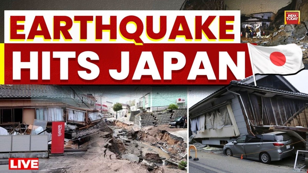
Japanese authorities issued a tsunami advisory for the Ariake Sea and Yatsushiro Sea, forecasting waves up to 1 meter. Kumamoto Castle suffered collapsed stone walls, multiple shops and roads were damaged, and several thousand homes lost power. Kumamoto Airport suspended all flights. No abnormalities were reported at the Ikata, Genkai or Satsumasendai nuclear plants.
The 1-meter wave forecast aligns with the modest tsunami potential of strike-slip events, a scenario the Indian Tsunami Early Warning Centre in Hyderabad routinely models for the Andaman Sea. Power outages affecting thousands of households in Kumamoto parallel the vulnerability of Indian coastal grids in Zone V areas during similar shaking.
Heritage structures such as Kumamoto Castle sustained damage to unreinforced masonry, a direct parallel to risks facing Indian monuments in Bhuj and Aizawl where retrofitting under BIS guidelines has lagged. Airport closures highlight the cascading infrastructure effects that NDMA drills must address for Himalayan airports serving Zone IV districts.
Japan’s Early Warning System in Action
Prime Minister Sanae Takaichi urged residents to remain vigilant. Japan’s nationwide early-warning network delivered seconds of advance notice, limiting casualties despite the shallow depth and high intensity.
India’s NCS currently routes alerts primarily to government agencies rather than broadcasting them directly to mobile users in the manner of Japan’s system. Expanding the existing 150-station network to include public push notifications could reduce exposure times in the Northeast and Gujarat, where shallow quakes have historically caused disproportionate damage.
The seconds of warning provided in Kumamoto demonstrate the value of integrating IMD data streams with NDMA’s emergency protocols, a step already piloted in select coastal districts but not yet scaled to Himalayan Zone V states.
India’s Seismic Monitoring and Warning Gaps
India’s National Center for Seismology under the IMD operates a network of roughly 150 broadband stations. Unlike Japan’s integrated public-alert system, India’s warnings remain largely internal to government agencies. Zone IV and V regions in the Himalayas, Northeast India, Gujarat and Kashmir face comparable shallow crustal risks yet lack equivalent real-time public alerts.
With only 150 stations covering a landmass several times larger than Japan’s, the NCS faces coverage gaps that become critical during events with 10 km focal depths. Upgrading station density in the Northeast could mirror the real-time intensity mapping that proved effective in Kumamoto.
NDMA guidelines already recommend public alert integration, yet implementation lags behind the technological capacity demonstrated by Japan’s network. Citizens in Zone V districts would benefit from the same seconds of advance notice that limited casualties in southern Japan.
Implications for Indian Nuclear Facilities and NDRF
India operates 23 nuclear reactors, several located in seismic Zone III and above. The absence of anomalies at Japanese plants after the Kumamoto event highlights the value of robust design standards. The NDMA and NDRF must accelerate mock drills and equipment upgrades in coastal and Himalayan districts to match Japan’s response speed.
Indian nuclear facilities in Zone III areas such as Tarapur and Kaiga already incorporate seismic design margins exceeding those required for the 7.1 Kumamoto event. Continued monitoring by the Atomic Energy Regulatory Board can draw directly from the no-anomaly reports at Ikata and Genkai plants.
NDRF teams deployed in the Northeast could adopt the rapid assessment protocols used after the Kumamoto aftershock sequence, ensuring equipment readiness for shallow crustal events that frequently affect Indian border regions.
Building Codes and Urban Safety in Indian Cities
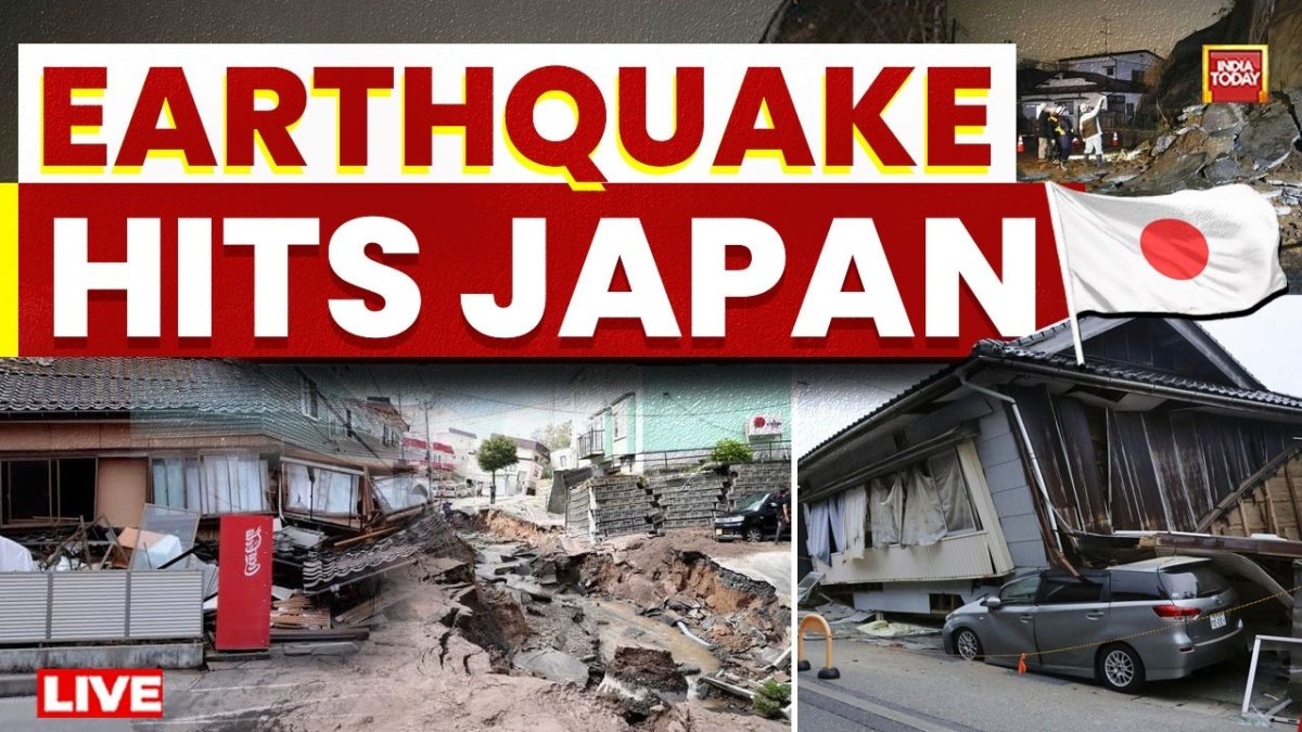
BIS IS 1893 standards require seismic-resistant design in high-risk zones, yet enforcement remains inconsistent across states. Rapid urban growth in Guwahati, Dehradun, Aizawl and Bhuj continues without mandatory retrofitting of older structures. The Kumamoto damage to historic masonry offers a direct warning for Indian heritage sites and unplanned housing.
Enforcement audits in Guwahati and Dehradun reveal that many new constructions still omit the ductile detailing mandated by IS 1893 for Zone V. Retrofitting programs piloted by IITs in these cities could be scaled using lessons from Kumamoto’s unreinforced masonry failures.
State-level building departments must prioritize heritage structures in Bhuj and Aizawl, where the 2001 and 1897 earthquakes demonstrated similar vulnerabilities to those seen at Kumamoto Castle. Consistent application of BIS codes remains the most direct path to reducing future losses.
India’s Role in Indian Ocean Tsunami Warning and Regional Cooperation
India’s Indian Tsunami Early Warning Centre in Hyderabad provides alerts across the Indian Ocean region. Strengthening data sharing with Japan and ASEAN nations would improve lead times for both subduction and strike-slip events. Taxpayers fund these systems; measurable improvements in public alert reach are now essential.
The Hyderabad centre’s existing coverage for the Andaman and Nicobar region can be enhanced through real-time data exchange with Japanese networks, particularly for strike-slip events that produce limited but locally significant tsunamis. NDMA coordination with ASEAN partners would extend the reach of these improvements.
Public education campaigns funded through existing budgets must translate the technical capacity of the warning centre into household-level preparedness, especially in coastal Zone V communities that face risks comparable to those addressed by Japan’s Ariake Sea advisory.
The July 28, 2026 Kumamoto earthquake demonstrates that even advanced nations remain vulnerable. For India, the lessons translate directly into faster public warnings, stricter code enforcement in Zone IV and V districts, and continued investment in NDRF capacity.
— By Dr. Raj Patel, Staff WriterThis article was produced with AI-assisted research and editorial support. Reporting is based on sources cited in the article.
What's Your Reaction?
 Like
1
Like
1
 Dislike
0
Dislike
0
 Love
0
Love
0
 Funny
0
Funny
0
 Wow
0
Wow
0
 Sad
0
Sad
0
 Angry
0
Angry
0

India/South Asia Correspondent at Global1.News. Analytical voice with a background in science and health journalism. Based in New Delhi, covering Indian politics, education, healthcare, technology, and policy. Breaks down complex data into clear, actionable reporting.















Comments (0)