Japan's Volcanic Prediction Technology Advances with 3D Geofluid Mapping
Introduction — Japan's volcanic reality Japan faces persistent volcanic hazards due to its position on the Pacific Ring of Fire. The country hosts 11
Introduction — Japan's volcanic reality
Japan faces persistent volcanic hazards due to its position on the Pacific Ring of Fire. The country hosts 111 active volcanoes that produce approximately 15 significant events each year. These figures underscore the need for continuous observation and improved forecasting capabilities to protect densely populated regions and critical infrastructure.
The stakes extend beyond immediate eruption impacts. Volcanic ash and pyroclastic flows can disrupt transportation networks, power grids, and communications over wide areas. Government agencies and research institutions have therefore prioritized the development of technologies that can provide earlier and more precise warnings.
NHK WORLD-JAPAN's BOSAI Episode 63, aired February 14, 2026, examined how Japanese scientists are refining prediction methods. The program highlighted work at the Earthquake Research Institute of the University of Tokyo, Tokyo Tech, and Kyushu University, showing how these efforts align with broader national resilience strategies such as Society 5.0.
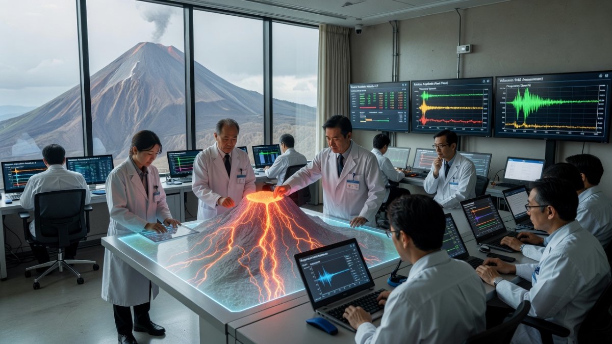
Geofluid Mapping — 3D magma tracking
Professor Hikaru Iwamori of the Earthquake Research Institute at the University of Tokyo and Tokyo Tech has pioneered geofluid mapping techniques that create the world's first three-dimensional visualizations of underground magma and water distributions. His method depicts both the location and volume of these fluids beneath volcanic systems, revealing previously hidden connections between magma movement, groundwater, earthquakes, and eruptions.
This approach integrates seismic data with geochemical analysis to trace how fluids migrate through crustal rock. By mapping these pathways, researchers can identify zones where pressure buildup may precede eruptive activity. The technique has already demonstrated its value in clarifying relationships between distant volcanic centers and regional seismic events.
Continued refinement of geofluid mapping supports Japan's long-term disaster preparedness goals. Integration with existing monitoring networks allows for more nuanced risk assessments that account for subsurface dynamics rather than surface observations alone. Such advances contribute directly to the data-driven society envisioned under Society 5.0 initiatives coordinated by METI.
Phreatic Eruption Prediction — warning systems
Associate Professor Koki Aizawa at the Institute of Seismology and Volcanology, Kyushu University, focuses on improving forecasts for phreatic eruptions, which remain among the most difficult to anticipate. His research on the Kirishima volcanic complex, particularly around Iwo-Yama, has documented changes in shallow groundwater flow prior to eruptive episodes.
Aizawa combines multi-parametric satellite observations with chemical sampling of springs and fumaroles. This integrated dataset captures subtle shifts in water chemistry and ground deformation that often precede steam-driven explosions. The methodology provides a template for monitoring other volcanoes where magma does not reach the surface.
These techniques are being tested at active sites across Kyushu. Results suggest that sustained observation of groundwater systems can extend warning times from minutes to hours in favorable conditions. Collaboration between Kyushu University and JMA aims to operationalize these findings within national alert protocols.
The Mount Ontake Lesson — why prediction matters
The 2014 phreatic eruption of Mount Ontake killed more than 60 people and left several others missing. The sudden onset of the event, with little precursory seismicity detectable by conventional instruments, exposed critical gaps in existing prediction capabilities. Hikers on the volcano's slopes had minimal time to evacuate.
Post-event analysis revealed that steam-driven explosions can occur without clear deep magmatic signals. This realization prompted increased investment in shallow subsurface monitoring and rapid communication systems. Researchers now emphasize the importance of real-time data integration across multiple parameters.
The Ontake disaster continues to shape research priorities. Both Iwamori's geofluid mapping and Aizawa's groundwater studies directly address the monitoring shortfalls identified after 2014. These efforts seek to prevent similar tragedies by detecting fluid-pressure changes at depths previously considered inaccessible to routine observation.
Mount Fuji and Tokyo Risk — economic implications
A major eruption of Mount Fuji could generate economic losses estimated at 2.5 trillion yen. Ashfall reaching Tokyo would disrupt rail and air transport, impair electrical transmission, and interfere with telecommunications infrastructure across the Kanto region. Such cascading effects would affect millions of residents and businesses.
Current modeling indicates that even moderate ash thicknesses could halt Shinkansen operations and ground flights at Haneda and Narita airports for days. Power substations and data centers would require extensive cleaning or temporary shutdowns. These scenarios have prompted detailed contingency planning by both national and local governments.
Improved prediction technologies offer the potential to reduce these impacts through earlier evacuations and targeted infrastructure protections. JMA continues to expand its monitoring array around Fuji, incorporating insights from university-led research to refine ash-dispersal forecasts and eruption probability assessments.
Sakurajima's Daily Challenge — persistent volcanic activity and response
Sakurajima, located in Kagoshima Prefecture, erupts almost daily, releasing ash that regularly affects nearby towns. Residents and local authorities have adapted to frequent ashfall through established cleaning protocols and school closure procedures. Nevertheless, larger explosive events remain a constant concern.
JMA maintains dense instrumentation on and around Sakurajima, including seismographs and tiltmeters that track inflation and deflation of the volcanic edifice. These instruments provide continuous data streams used to issue timely alerts when activity intensifies. The volcano serves as a natural laboratory for testing new monitoring approaches.
Research conducted at Kyushu University complements JMA operations by examining how groundwater and gas chemistry evolve during periods of heightened activity. Findings from Sakurajima contribute to broader understanding of andesitic volcanoes that exhibit persistent but variable behavior.
Japan's Volcanic Monitoring Infrastructure — JMA's role and systems
The Japan Meteorological Agency operates the primary national network of seismographs and other observation instruments covering all 111 active volcanoes. This infrastructure delivers real-time data to forecasting centers that issue eruption alerts and ash-fall advisories to the public and aviation authorities.
JMA's systems have been progressively upgraded to incorporate higher-resolution sensors and automated analysis tools. Collaboration with university researchers allows new techniques, such as geofluid mapping outputs, to be evaluated for operational use. These partnerships strengthen the agency's ability to interpret complex subsurface signals.
MOFA has also supported international data-sharing arrangements that enhance regional situational awareness. Japan's monitoring framework thus serves both domestic safety needs and broader Asia-Pacific cooperation on volcanic hazards.
Implications for Asia Pacific — regional disaster preparedness
Japan's advances in volcanic prediction carry significance beyond its borders. Many Asia-Pacific nations face similar volcanic risks yet possess fewer resources for continuous monitoring. Technologies developed by Iwamori, Aizawa, and JMA could be adapted to improve early-warning capacity in neighboring countries.
Regional forums facilitated by MOFA have begun discussing the transfer of monitoring methodologies and data-analysis techniques. Such cooperation aligns with Japan's broader diplomatic efforts to strengthen disaster resilience across the Pacific Rim. Shared understanding of phreatic eruption precursors could reduce casualties in areas with limited historical records.
Capacity-building programs involving University of Tokyo and Kyushu University researchers are already underway. These initiatives focus on training local scientists in the use of integrated geophysical and geochemical datasets, extending the practical benefits of Japan's ongoing research investments.
What to Watch For — future developments
Further integration of satellite remote sensing with ground-based chemical monitoring is expected to enhance detection of pre-eruptive groundwater changes. Aizawa's team continues to refine multi-parameter thresholds that could trigger automated alerts for phreatic events.
Iwamori's geofluid mapping is being expanded to additional volcanic systems, with the goal of producing standardized three-dimensional models that JMA can incorporate into routine assessments. These models may eventually support probabilistic forecasts that quantify eruption likelihood over specific time windows.
Continued collaboration between universities, JMA, and relevant ministries will determine how quickly these innovations move from research to operational status. The coming years will reveal whether the lessons from Ontake and the daily challenges at Sakurajima translate into measurably improved warning times across Japan's volcanic arc.
By Kenji Tanaka, Staff Writer
What's Your Reaction?
 Like
0
Like
0
 Dislike
0
Dislike
0
 Love
0
Love
0
 Funny
0
Funny
0
 Wow
0
Wow
0
 Sad
0
Sad
0
 Angry
0
Angry
0


Comments (0)