Philippines 7.8 Earthquake Triggers Tsunami Warnings, India's Preparedness Under Spotlight
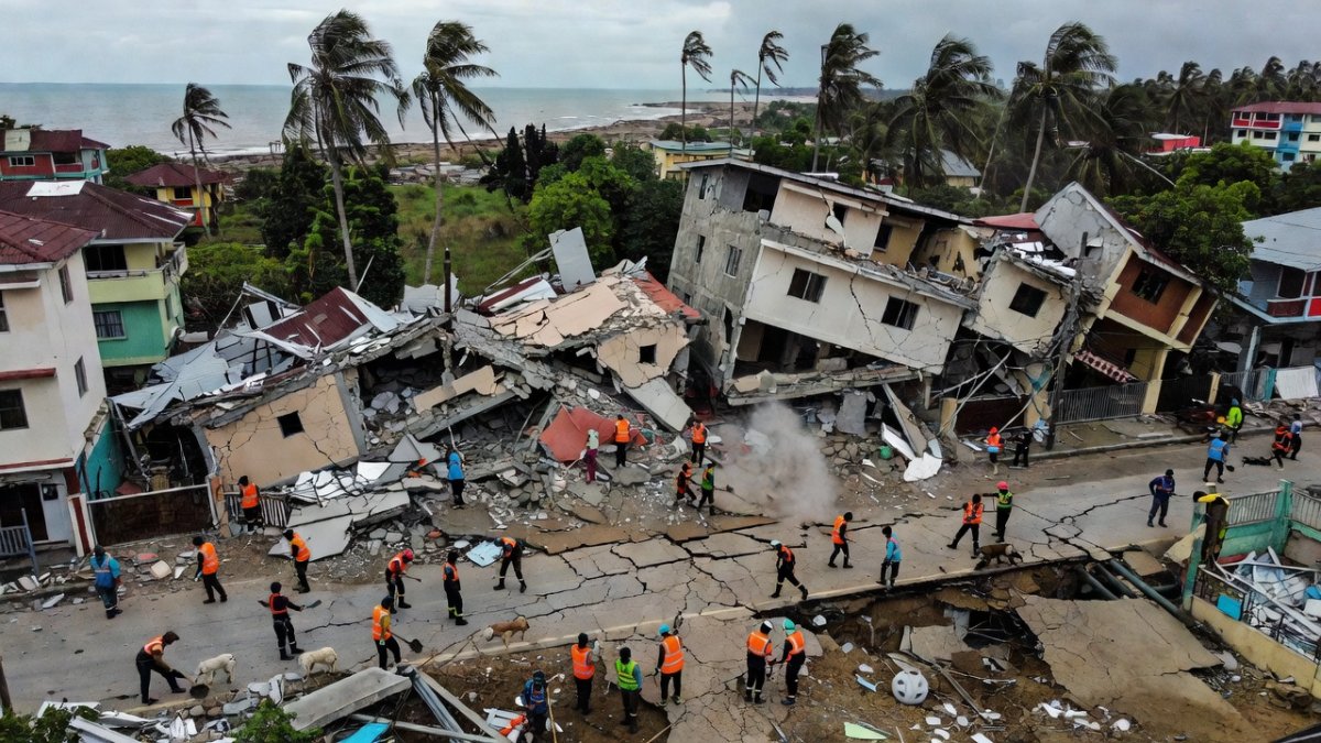
A powerful 7.8-magnitude earthquake struck off the southern Philippines on the morning of June 8, 2026, sending shockwaves through Mindanao and triggering immediate tsunami warnings across multiple nations. The shallow 10-kilometre depth amplified ground shaking, collapsing structures in General Santos City and disrupting the first day of school across affected regions. This ev
Seismic Parameters and Official Confirmation
The United States Geological Survey (USGS), the Philippine Institute of Volcanology and Seismology (PHIVOLCS), and Germany's GFZ all recorded the event at magnitude 7.8. The epicentre lay 13 kilometres southwest of General Santos City in the Celebes Sea, with the quake occurring at 7:37 AM local time (23:37 GMT on June 7). Although Bloomberg reported 8.1 and Al Jazeera cited 8.2, the confirmed figure remains 7.8. The shallow depth of just 10 km intensified surface effects, causing buildings to sway violently in nearby Davao City.
Tsunami Warnings and Regional Evacuations
The Pacific Tsunami Warning Center immediately issued alerts for the Philippines, Indonesia, Papua New Guinea, and Japan, warning of possible waves reaching 3 metres (10 feet). Coastal communities began evacuations as sirens sounded. PHIVOLCS maintained close monitoring throughout the day, coordinating with local authorities to move residents inland. At least one fatality has been confirmed, and a Jollibee restaurant in General Santos City collapsed under the intense shaking.
Ground Impact and Immediate Disruptions
The timing on the first day of school compounded chaos, with classes suspended across Mindanao. Reports indicate widespread structural damage in General Santos City and surrounding areas, though detailed casualty figures are still being compiled. The Celebes Sea location placed the rupture along active tectonic boundaries that regularly generate large events in this segment of the Pacific Ring of Fire.
India's Tsunami Early Warning Infrastructure
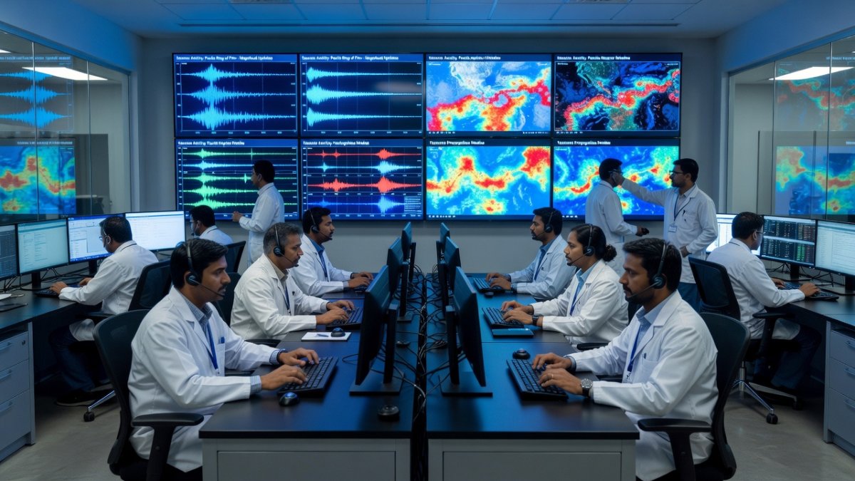
India's Indian Tsunami Early Warning Centre (ITEWC) at the Indian National Centre for Ocean Information Services (INCOIS) in Hyderabad was established after the 2004 Indian Ocean tsunami that killed more than 227,000 people across 14 countries. The centre now integrates seismic data from the India Meteorological Department (IMD) and the Wadia Institute of Himalayan Geology to issue alerts within minutes. The Andaman and Nicobar Islands remain particularly vulnerable due to their position along the Sumatra-Andaman subduction zone, a setting tectonically analogous to the Manila Trench responsible for the June 8 event.
Comparative Lessons for NDMA and Coastal States
India's National Disaster Management Authority (NDMA) maintains frameworks that could incorporate PHIVOLCS-style rapid dissemination protocols. The 2004 disaster prompted upgrades to India's seismic network, yet gaps persist in real-time coastal evacuation drills for the Andaman and Nicobar Islands. Policymakers in New Delhi and state capitals such as Chennai and Port Blair can study how PHIVOLCS coordinated with the Pacific Tsunami Warning Center to achieve swift public alerts. Strengthening these linkages would directly benefit populations along India's eastern seaboard and island territories.
The Bottom Line
The 7.8-magnitude Mindanao earthquake underscores that shallow-depth events near population centres demand both precise monitoring and rapid public communication. For India, the parallels with the Andaman-Sumatra system are clear: continued investment in INCOIS capabilities, regular NDMA-led drills in the Andaman and Nicobar Islands, and tighter integration with regional warning centres will determine how effectively the country mitigates the next major subduction-zone rupture. The data from PHIVOLCS and the Pacific Tsunami Warning Center provide a practical benchmark that Indian agencies can adopt without delay. — By Dr. Raj Patel, Staff Writer
What's Your Reaction?
 Like
0
Like
0
 Dislike
0
Dislike
0
 Love
0
Love
0
 Funny
0
Funny
0
 Wow
0
Wow
0
 Sad
0
Sad
0
 Angry
0
Angry
0
Caribbean Correspondent at Global1.News. Based in Port of Spain, Trinidad, covering Caribbean politics, economy, energy, climate, and culture. Amplifying the voices and stories of the Caribbean region.


Comments (0)