
'Domeng' slightly gains strength as it stays over Philippine Sea
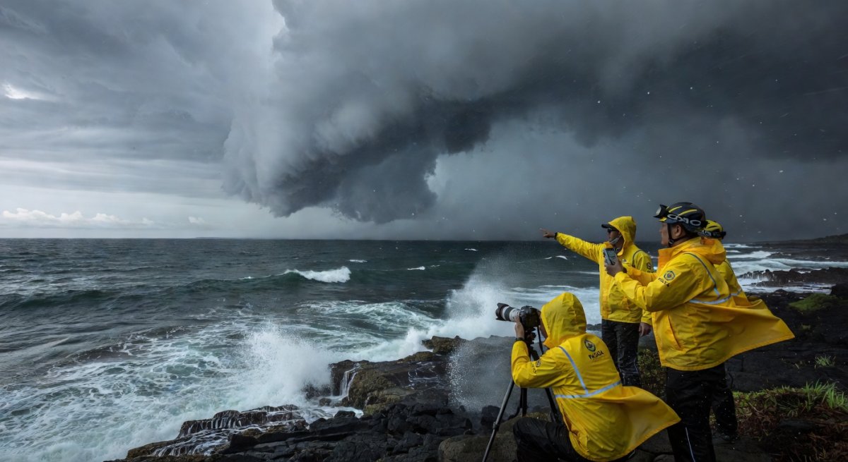
Severe Tropical Storm Domeng, known internationally as Jangmi, has slightly strengthened while remaining positioned over the Philippine Sea east of Northern Luzon, according to the state weather bureau on May 30. The storm’s northwestward movement keeps it offshore for now, yet its gradual intensification raises the stakes for coastal communities and disaster planners across the northern Philippines. With the country already deep into the annual typhoon season, any uptick in strength carries immediate implications for maritime safety, agriculture, and emergency preparedness in a region still recovering from previous weather disturbances.
The timing matters because Northern Luzon remains a gateway for systems that can either drift harmlessly into the open Pacific or curve toward land. Domeng’s current trajectory and modest strengthening mean authorities must monitor closely without overreacting, while residents weigh routine precautions against potential escalation.
Current Position and Intensity Trends
The Philippine Atmospheric, Geophysical and Astronomical Services Administration reported that Domeng has maintained its status as a severe tropical storm while showing slight gains in organization. Located well east of Northern Luzon, the system continues to track northwestward across the Philippine Sea. This path keeps the center far enough from land to limit immediate rainfall threats, yet the distance also allows uninterrupted interaction with warm sea-surface temperatures that favor further development. Slight intensification at this stage often signals improving structure rather than rapid strengthening. Forecasters note that the absence of significant wind shear in the area supports gradual consolidation of the storm’s circulation. Because the system remains over open water, its core remains compact, reducing the chance of sudden erratic movement in the short term. Maritime interests east of Luzon, including fishing fleets and inter-island vessels, have already received advisories to exercise caution as swells and gusty winds extend outward from the center.Why Northern Luzon Remains the Focal Point
Northern Luzon’s exposed eastern seaboard makes it the logical first area of concern whenever a system lingers in the Philippine Sea. Even while Domeng stays offshore, its outer rain bands could reach parts of Cagayan, Isabela, and Aurora within the next day or two if the track shifts slightly westward. Agricultural provinces in these regions rely heavily on timely harvests; prolonged periods of enhanced moisture, even without a direct landfall, can delay fieldwork and increase post-harvest losses. Beyond farming, the region’s coastal infrastructure faces repeated stress during the season. Ports in Aparri and other northern entry points handle significant cargo volumes that feed into the rest of Luzon. Any advisory that forces temporary closures disrupts supply chains already stretched by fuel costs and seasonal demand. Local government units have therefore begun reviewing evacuation protocols for low-lying barangays, even though current guidance does not yet call for widespread preemptive measures.Broader Context Within the Philippine Typhoon Season
The Philippines experiences an average of twenty tropical cyclones each year, with the period from June through October typically the most active. Systems that form or pass through the Philippine Sea often follow recurving paths that spare the main archipelago yet still generate dangerous swells along the eastern coastline. Domeng’s modest strengthening fits the pattern seen in many early-season storms that intensify just enough to warrant attention before either dissipating or moving away. This season’s early activity has already prompted the National Disaster Risk Reduction and Management Council to remind local officials of the need for updated contingency plans. Past events have shown that even storms remaining offshore can produce flash floods in mountainous terrain once orographic lift enhances rainfall. The Cordillera Administrative Region, in particular, has learned through experience that secondary effects such as landslides can occur far from the storm’s center. Domeng’s current distance therefore serves as a useful window for communities to test communication lines and preposition relief goods without the pressure of an imminent landfall.Maritime and Aviation Considerations
The Philippine Sea serves as a vital corridor for both domestic and international shipping. With Domeng moving northwestward, the storm’s extended wind field could affect routes between the Philippines and East Asia. Shipping companies routinely adjust schedules when severe tropical storms are present, and this system’s persistence over the same general area increases the likelihood of rerouting. Fisherfolk associations in eastern Luzon have likewise been advised to keep vessels in port until clearer signals emerge. Aviation authorities at airports in Tuguegarao and Laoag monitor the situation for possible flight disruptions. While the storm remains distant, crosswinds and reduced visibility from peripheral clouds can still affect smaller aircraft and helicopter operations used in medical evacuations or supply drops. The Civil Aviation Authority of the Philippines maintains continuous coordination with PAGASA to issue timely notices to airmen, underscoring how even distant tropical systems influence daily operations across multiple sectors.Looking Ahead: Monitoring and Next Steps
Forecasters expect Domeng to continue its northwestward movement over the next 24 to 48 hours, with further slight intensification possible if environmental conditions remain favorable. The key variables to watch include any change in steering winds that could bring the center closer to land or allow it to accelerate away from the archipelago. Should the storm maintain its current distance, impacts will likely remain limited to increased swells and intermittent rains along the eastern seaboard. Local governments have been instructed to maintain heightened alert status without declaring full-scale emergencies. This calibrated approach allows resources to stay available for other contingencies while ensuring that early-warning systems function properly. Residents are encouraged to stay informed through official channels and avoid unnecessary travel across exposed coastal roads. As the weekend concludes, the focus remains on sustained vigilance rather than immediate action. The slight strengthening of Domeng serves as a reminder that tropical systems in the Philippine Sea can evolve quickly, and consistent monitoring remains the most effective defense against surprises.By Bella Reyes, Staff Writer
This article was produced with AI-assisted research and editorial support. Reporting is based on sources cited in the article.
What's Your Reaction?
 Like
0
Like
0
 Dislike
0
Dislike
0
 Love
0
Love
0
 Funny
0
Funny
0
 Wow
0
Wow
0
 Sad
0
Sad
0
 Angry
0
Angry
0

Isabella "Bella" Reyes
Philippines/Southeast Asia Correspondent at Global1.News. Manila-based journalist covering Philippine politics, environment, maritime security, and social issues. Passionate about marine conservation and the communities protecting the Philippines' natural heritage.














Comments (0)