
'Domeng' now a typhoon
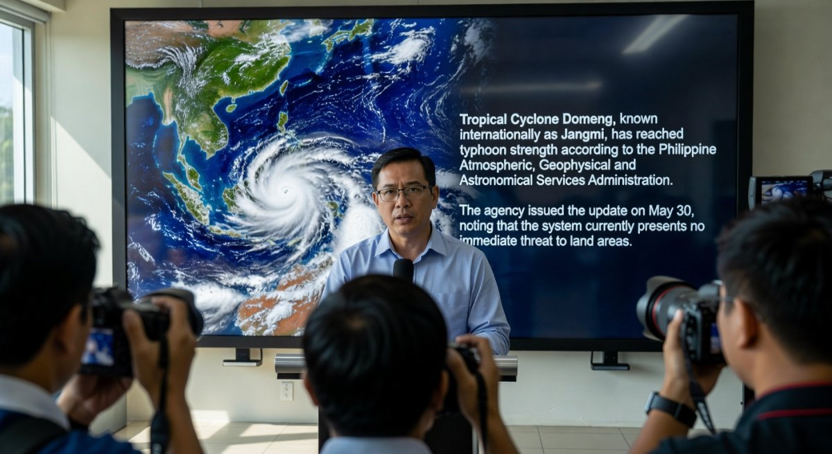
Tropical Cyclone Domeng, known internationally as Jangmi, has reached typhoon strength according to the Philippine Atmospheric, Geophysical and Astronomical Services Administration. The agency issued the update on May 30, noting that the system currently presents no immediate threat to land areas. This development highlights the ongoing need for continuous monitoring of tropical systems that form in the western Pacific basin, where conditions can support rapid changes in intensity.
The absence of an immediate land threat allows authorities and communities additional time to assess any potential shifts in movement. PAGASA continues to track the cyclone as part of its routine responsibilities during the cyclone season.
Details of the Intensification
PAGASA confirmed the upgrade to typhoon status based on the latest available observations. The transition reflects the storm's organizational structure and sustained winds, though specific measurements remain under ongoing evaluation. Because the cyclone remains over open waters at this stage, its path and strength can still evolve before any possible approach to coastal regions. The agency emphasized that no land areas face direct risk in the near term. This assessment provides a window for preparatory measures if the system later alters course. Updates from PAGASA will continue to guide public awareness as new data become available.Role of Official Weather Monitoring
State weather services play a central part in issuing timely advisories for tropical cyclones that develop within or near Philippine responsibility areas. PAGASA maintains a network of observation tools and coordination mechanisms to detect changes in storm structure. The report issued on May 30 fits within this established process of regular bulletins during periods when cyclones are active. Accurate and frequent information from the agency helps reduce uncertainty for maritime interests, aviation routes, and coastal planning. When a system such as Domeng reaches typhoon classification without an immediate land target, the focus stays on sustained observation rather than immediate protective actions on shore.Broader Context of Tropical Cyclones in the Region
The western Pacific experiences frequent tropical cyclone activity, particularly from mid-year onward. Systems can intensify when sea surface temperatures and atmospheric conditions align, sometimes within a short period. Domeng’s upgrade serves as a reminder that even storms positioned away from land require attention because steering patterns can shift. Public understanding of cyclone behavior benefits from consistent communication by official sources. PAGASA’s statements help distinguish between current conditions and possible future developments, supporting informed decisions across different sectors. The current status of Domeng illustrates how a cyclone can strengthen while still remaining distant from populated areas.Next Steps in Tracking and Communication
Further bulletins from PAGASA will indicate whether Domeng maintains its intensity or undergoes additional changes. The agency’s standard practice involves releasing updates at regular intervals when a named cyclone is present. Residents and maritime operators are advised to consult these official releases rather than secondary interpretations. As the situation develops, any alteration in track or strength will be communicated through established channels. The current assessment of no immediate land threat remains the operative guidance until subsequent reports indicate otherwise. Continued vigilance through verified sources supports effective response if conditions evolve.By Bella Reyes, Staff Writer
This article was produced with AI-assisted research and editorial support. Reporting is based on sources cited in the article.
What's Your Reaction?
 Like
0
Like
0
 Dislike
0
Dislike
0
 Love
0
Love
0
 Funny
0
Funny
0
 Wow
0
Wow
0
 Sad
0
Sad
0
 Angry
0
Angry
0

Isabella "Bella" Reyes
Philippines/Southeast Asia Correspondent at Global1.News. Manila-based journalist covering Philippine politics, environment, maritime security, and social issues. Passionate about marine conservation and the communities protecting the Philippines' natural heritage.













Comments (0)