
Pacific Storm Threat Looms Over Mexico's Southwestern Coast
Pacific Storm Threat Looms Over Mexico's Southwestern Coast Two areas of low pressure churning over the Pacific waters southwest of Mexico have forecasters watching closely this week, as both systems carry a meaningful chance of organizing into
Pacific Storm Threat Looms Over Mexico's Southwestern Coast
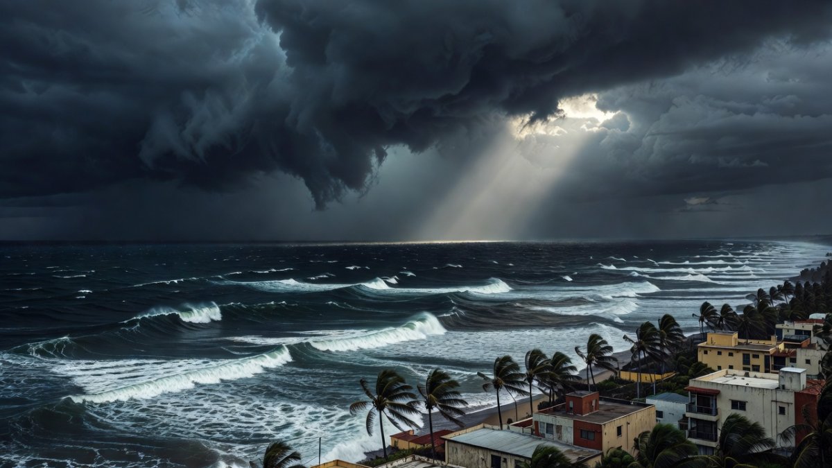
Two areas of low pressure churning over the Pacific waters southwest of Mexico have forecasters watching closely this week, as both systems carry a meaningful chance of organizing into tropical storms in the coming days. If they strengthen, they would receive the names Elida and Fausto — becoming the fifth and sixth named storms of the 2026 Pacific hurricane season — and could bring heavy rains, strong winds and dangerous surf to several coastal states.
Mexico's National Meteorological Service (SMN), which operates under CONAGUA, continues to monitor both systems with daily updates. For families living in fishing villages and small towns along the southwestern coastline, these bulletins have become essential listening as the community prepares for what could be an active week ahead.
Tags: Elida, Fausto, tropical storms Mexico, Pacific coast weather, CONAGUA monitoring, Fujiwhara effect, Saharan dust Mexico, Guerrero Michoacan
Elida Shows Strong Signs of Development
The first system, expected to be named Elida if it reaches storm strength, currently sits roughly 525 kilometers southwest of Punta San Telmo in Michoacan. It holds a 90 percent chance of becoming a tropical depression within the next 48 hours and a near-certain 100 percent chance within seven days. Its projected path points west-northwest, keeping it well offshore with no immediate direct threat to land.
Fishermen in the coastal towns of Michoacan are already checking their gear and securing smaller vessels closer to shore as they watch the steady strengthening of the system. Many families who rely on daily catches know that even the possibility of rough seas means staying alert and sharing updates with neighbors through local radio and word of mouth. These quiet preparations reflect the deep respect coastal communities hold for the ocean's changing moods.
CONAGUA has issued specific advisories urging caution for mariners and residents along the Michoacan shoreline, highlighting the need to avoid unnecessary trips and to monitor updates throughout the coming days. Port operations in Lazaro Cardenas are adjusting schedules, with authorities slowing cargo movements and advising larger vessels to seek sheltered areas if conditions worsen. These steps help protect both workers and the vital supply lines that connect the region to the rest of the country.
Small boat owners are tying down equipment and moving craft to protected inlets, drawing on years of experience with Pacific weather patterns. This collective attention helps keep everyone safer while the community waits to see how the system continues to organize.
Fausto Could Form Closer to Shore
The second system, likely to become Fausto, sits south of Tecpan de Galeana in Guerrero. It carries a 70 percent chance of development within seven days, and the National Hurricane Center indicates a tropical depression is likely to form by the weekend if conditions remain favorable. Because this system sits nearer the coastline, any strengthening could affect Guerrero and neighboring states more directly.
Communities across Guerrero carry a long memory of storms that develop quickly near the coast, prompting families to review emergency plans and stock basic supplies well in advance. In both larger cities and smaller towns, residents know that systems forming close to shore can bring sudden heavy rains and strong winds with little warning time. This shared history encourages everyone to stay connected and ready.
Proteccion Civil teams in Acapulco and surrounding areas are already coordinating with local leaders to check shelters and communication networks. In hillside colonias, neighbors work together to clear drainage paths and identify safe gathering spots, understanding how quickly water can move down steep slopes. These efforts strengthen the sense of looking out for one another that defines daily life in the region.
Families living near flood-prone arroyos make simple but important adjustments, such as moving belongings to higher ground and agreeing on meeting points if waters rise. This practical approach helps protect homes and keeps the focus on community safety during uncertain weather.
Possible Fujiwhara Interaction Between the Two Systems
The two low-pressure areas lie relatively close to each other. When two cyclones form near one another, they can begin to rotate around a shared center — an interaction known as the Fujiwhara effect, first described by Japanese meteorologist Sakuhei Fujiwhara. If this phenomenon occurs, the exact tracks of both systems could shift in ways that become difficult to forecast days ahead.
CONAGUA meteorologists emphasize that any such interaction remains only a possibility at this stage and will be clarified as the systems evolve. Satellite imagery shows the two systems sharing the same general region of the eastern Pacific, which increases the likelihood that they may influence each other's behavior as they organize. Forecasters at the National Hurricane Center in Miami are also tracking the situation, coordinating with their Mexican counterparts to refine models as new data arrives.
For communities watching from shore, the Fujiwhara effect is a reminder that tropical weather systems can behave in ways that challenge even the most sophisticated forecasting tools. It underscores why local officials continue to emphasize preparation over prediction — because no matter how the systems interact, being ready is the most important step.
Expected Effects for Coastal States
Should either system organize, forecasters anticipate periods of heavy rain, gusty winds and elevated surf along the coasts of Guerrero, Michoacan, Colima and Oaxaca. These conditions could disrupt daily life for families who rely on fishing, small-scale farming and weekend tourism. In many towns, people remember past seasons when even distant storms brought enough rain to swell rivers and make rural roads muddy.
Pacific storms have long shaped life along Mexico's southern and western coasts, sometimes overwhelming rural roads and bridges that connect small towns to larger markets. Power lines in these areas often face challenges from gusty winds and fallen branches, leaving families without electricity for days while crews work to restore service. These recurring concerns remind everyone of the need for steady infrastructure improvements that support daily routines.
Campesinos and pescadores feel the effects most directly, as heavy rain can delay planting or damage equipment while elevated surf keeps boats at the dock. In places like Zihuatanejo and Puerto Escondido, tourism businesses watch bookings closely, knowing that even the forecast of rough conditions can shift visitor plans and affect the many families who depend on seasonal work. The ripple reaches local markets and transportation services that support both residents and travelers.
Across Guerrero, Michoacan, Colima, and Oaxaca, these overlapping impacts highlight how weather events touch every part of coastal life, from agriculture fields to fishing docks and hotel lobbies. Communities respond by sharing resources and information, keeping the focus on protecting livelihoods and staying connected through the season.
Saharan Dust Adds Another Layer This Week
While attention focuses on the Pacific, a plume of Saharan dust is moving across the Atlantic and is expected to reach the Yucatan Peninsula and Gulf states through Saturday. The dust typically creates grayish tones in the sky during daytime and can turn sunsets a deeper reddish hue. For people with respiratory sensitivities, the dust may cause minor irritation, and health workers recommend keeping windows closed during peak dust hours.
CONAGUA continues to track the dust plume as it moves toward the Yucatan and Gulf states, where residents can expect continued grayish skies and reduced visibility in the coming days. This annual visitor from across the Atlantic often arrives during the heart of hurricane season, bringing a hazy layer that changes the usual bright tropical light. People in Merida, Campeche, and Veracruz notice the difference in the air and adjust outdoor plans accordingly.
The dust plays a quiet but notable role in the broader weather picture by helping to suppress the quick development of some tropical systems. While it does not stop all activity, it can influence how moisture builds over the region, adding another factor for forecasters to consider alongside the Pacific systems. This natural process repeats most years, becoming a familiar part of late-summer conditions for Gulf communities.
Health officials remind families with respiratory sensitivities to limit time outside during peak dust periods and to keep windows closed when possible. The shared experience of these dusty weeks brings communities together as they watch both the Pacific developments and the hazy skies overhead, staying informed and supportive of one another.
Community Response and Civil Protection Readiness
Across the southwestern states, families balance normal routines with quiet preparation. Markets in Acapulco and Manzanillo still see steady sales of canned goods and bottled water, yet shopkeepers report no rush that would suggest panic. Instead, conversations in town squares often turn to how neighbors can support one another if heavy rain does arrive. CONAGUA and state civil-protection offices continue to issue twice-daily bulletins that help keep communities calm and informed.
Local radio stations translate technical forecast language into plain Spanish so that older residents who may not use smartphones can stay informed. This steady flow of information, combined with community networks that have been tested in previous storm seasons, helps ensure that no one is left unaware of what the coming days may bring. Proteccion Civil teams have also pre-positioned equipment and personnel in the most vulnerable areas, ready to respond if needed.
In towns from Zihuatanejo to Puerto Escondido, people continue their daily work while keeping one ear tuned to the latest marine forecast. That steady, community-centered approach has long helped Mexican coastal families weather whatever the Pacific season brings.
What to Watch For in the Days Ahead
Weather patterns can shift quickly, so exact land impacts remain uncertain. Officials stress that current projections show Elida staying farther offshore while Fausto carries a higher — though still not guaranteed — chance of affecting coastal zones. Updates from CONAGUA and the National Hurricane Center will clarify any changes in strength or direction over the next several days.
For now, the focus stays on readiness rather than alarm. Families along the coast are encouraged to monitor official sources, review emergency plans, and check on neighbors who may need assistance. The 2026 Pacific hurricane season is still in its early stages, and these developing systems serve as a reminder that preparation is a year-round commitment for communities that live in harmony with the ocean and the sky.
By Rosa Martinez, Staff Writer
This article was produced with AI-assisted research and editorial support. Reporting is based on sources cited in the article.
What's Your Reaction?
 Like
0
Like
0
 Dislike
0
Dislike
0
 Love
0
Love
0
 Funny
0
Funny
0
 Wow
0
Wow
0
 Sad
0
Sad
0
 Angry
0
Angry
0
Latin America/Andes Correspondent at Global1.News. Based in Bogota, covering politics, environment, energy, and social movements across the Andean region. Passionate about environmental journalism and communities protecting their land.















Comments (0)