
Indonesian Wildfire Haze Chokes the Philippines in Southeast Asia's Worst Haze Since 2015
Smoke from forest and peat fires in Indonesian Kalimantan has blanketed the Philippines and much of Southeast Asia in the worst transboundary haze since 2015, forcing health warnings, school closures and flight disruptions across the region.
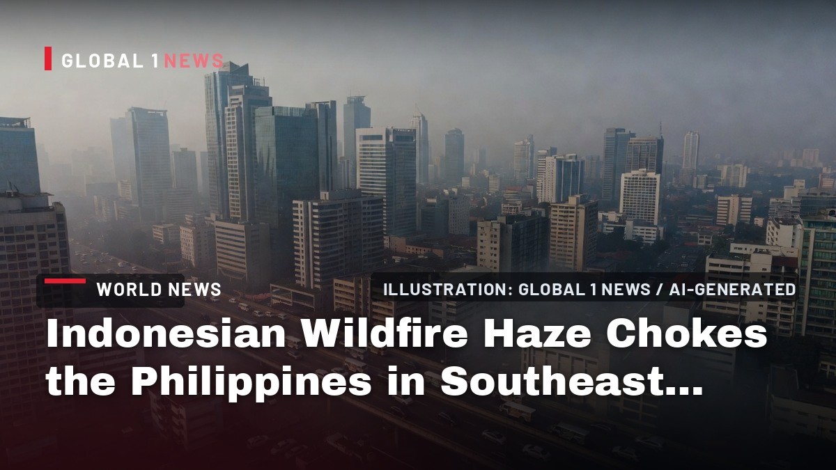
The sky over Metro Manila has not been this color in eleven years. Since September 1, a thick, acrid haze has blanketed the Philippine capital and spread outward into Central Luzon, CALABARZON, MIMAROPA, and parts of Central Visayas, forcing millions to confront a familiar but dangerous seasonal enemy. This is not local pollution. According to the Department of Environment and Natural Resources-Environmental Management Bureau (DENR-EMB), the smoke is being carried directly from forest and peat fires burning in Kalimantan, the Indonesian portion of Borneo, riding the Southwest Monsoon—known locally as the Habagat—across the South China Sea and into the archipelago. We are witnessing the worst transboundary haze crisis in Southeast Asia since 2015, and it is no longer just Indonesia’s problem.
The Smoke Arrives in the Philippines
The numbers coming out of the Philippines are stark. Between September 1 and 2, eleven air-monitoring stations in Metro Manila recorded PM2.5 levels classified as "acutely unhealthy," with four more stations registering "very unhealthy" conditions. PM2.5 refers to fine particulate matter—tiny particles that penetrate deep into the lungs and enter the bloodstream. For residents of Quezon City, Makati, and Manila proper, stepping outside meant breathing air that health officials explicitly warn against.
By September 3 and 4, the haze had not relented. Philstar reported on September 4 that air quality in parts of the Visayas and Mindanao remained "very unhealthy." The DENR-EMB recorded unhealthy particulate levels in Talisay City and Zamboanga City. Readings classified as "unhealthy for sensitive groups" were logged at Palawan State University, Ateneo de Naga University, Iloilo City, Tacloban City, and Calinan National High School in Davao City. This is not a Manila story. This is a national story.
Jundy del Socorro, chief of the DENR-EMB’s environmental quality management division, initially suggested the haze might last from September 1 to 3, with potential improvement by September 4 to 6 if rainfall remained widespread and wind patterns shifted. But he cautioned that conditions beyond September 6 depend entirely on whether the Kalimantan fires keep generating smoke and whether new hotspots emerge. Dr. Gerry Bagtasa of the University of the Philippines Institute of Environmental Science and Meteorology offered a more sobering explanation: the monsoon winds carrying the haze were dry, not moist. Without recent rainfall over the West Philippine Sea, the pollutants drifted uninterrupted, straight into the country’s most densely populated regions.
What Is Burning in Kalimantan
To understand what is choking the Philippines, you have to look southwest, across the sea, to the Indonesian side of Borneo. Kalimantan is the Indonesian two-thirds of the world’s third-largest island, a region of dense rainforest, peatlands, and—critically—industrial agriculture. For weeks, fires have raged across Kalimantan and neighboring Sumatra. These are not random wildfires. Indonesian Forestry Minister Raja Juli Antoni stated on September 1 that most of the fires were almost certainly deliberately set by individuals or companies to clear land for plantations. "September is the peak of El Nino," he said. "September is the main fight for us."
The scale of the burning is staggering. Al Jazeera, citing Indonesian government data, reported that fires have burned more than 200,000 hectares—roughly 494,000 acres—between January and July. That is an area about three times the size of Jakarta. Nearly 95,000 hectares burned in July alone. The BBC, citing the Forestry Ministry, put the figure at 107,465 hectares burned from January to July, a 110 percent increase over the same period in 2023, the last El Nino year. Indonesia’s disaster agency, BNPB, counted 182 active fires across the two islands in early September, with over 145 of them in Kalimantan alone.
Environmental group WALHI has been tracking the crisis with satellite data. They recorded 6,902 hotspots between August 25 and 31, with the highest concentration in Kalimantan at 5,201. Their satellite analysis suggests that nearly 50 percent of those hotspots sit within operational areas of forestry and oil-palm corporations. The fingerprints of industry are all over this disaster.
Why This Year Is Different
Every few years, Southeast Asia plays host to this grim ritual. But 2026 is shaping up to be exceptionally bad, and the reason is meteorological. Strong El Nino conditions are currently developing, with experts at Universiti Malaya, including Dr. Helena Varkkey, warning that the event could be heading toward "super" strength. The National Oceanic and Atmospheric Administration (NOAA) has tracked the event strengthening through 2026, projecting a very strong El Nino by autumn.
El Nino brings drier conditions to Indonesia, and this year, those conditions are extreme. NASA reported that about 90 percent of Indonesia received little to no rainfall in early August. The dry season, which peaks in August and September, has left the land parched and primed for burning. Indonesia’s meteorology agency, BMKG, forecasts that meaningful rainfall may not return until early October. That is weeks away. Weeks of continued burning. Weeks of continued smoke.
The peat factor makes this crisis uniquely toxic. Indonesia holds about 36 percent of the world’s tropical peatlands. When these ancient, carbon-rich soils catch fire, they do not just burn on the surface. Peat fires can smolder underground for weeks, generating enormous amounts of smoke and fine particulate matter. According to NASA, peat fires generate roughly three times more fine particulate matter than other tropical forest fires. This is not ordinary smoke. This is a chemical cocktail of incompletely combusted organic material, and it is drifting directly into Philippine cities.
The Regional Toll: Malaysia, Brunei, Singapore
The Philippines is not the only neighbor suffering. Malaysia has been hit hard, particularly the eastern states on Borneo. Six areas of Sarawak recorded hazardous air quality, with readings above 300 on the Air Pollutant Index. Kuching hit 407. Serian hit 408. For context, anything above 300 is classified as hazardous, a level at which health officials advise the general public to avoid outdoor activity entirely. Some Malaysian schools have shifted to online classes, and outdoor Independence Day celebrations were cancelled. Malaysia has scheduled cloud-seeding operations for early September in an attempt to wash the sky clean.
Brunei, the small oil-rich sultanate on Borneo’s north coast, has issued a health ministry advisory. In the capital, Bandar Seri Begawan, PM2.5 levels reached 13 times the World Health Organization’s safety thresholds. Singapore, which has historically been one of the most affected by Indonesian haze, has so far been spared the worst. But the National Environment Agency has flagged the possibility of haze reaching the city-state in the coming weeks. The ASEAN secretariat has activated its highest transboundary haze alert, Level 3, for the southern region. This is a regional emergency, officially recognized as such.
Indonesia’s Health Crisis
Before the smoke ever reached Philippine shores, it was sickening Indonesians by the tens of thousands. Deputy Health Minister Dante Saksono Harbuwono reported that approximately 13,500 people were treated for respiratory infections in July and August. Roughly 5.5 million people across Borneo and Sumatra have been directly exposed to the smoke. Later reports put the number of hospitalizations for respiratory infections at more than 50,000 since the fires began. These are not abstract statistics. These are people struggling to breathe.
The air quality readings in Indonesian cities are apocalyptic. Palangkaraya, the capital of Central Kalimantan, reached 780 on IQAir’s index. Pontianak, in West Kalimantan, hit 593. For comparison, an index reading above 300 is considered hazardous. West and Central Kalimantan have been consistently "unhealthy" to "hazardous" over the past week. Schools have been closed, with thousands shifting to online classes. Nine national parks have been shut. Flights have been disrupted, including in Pontianak. The Indonesian government has deployed 34 aircraft for water bombing, but operations have been hampered by thick haze, poor visibility, and limited water supplies. Cloud-seeding operations are underway to try to induce rain. Police have arrested 72 people suspected of setting fires. It is a massive response, and it is not nearly enough.
The Carbon Bomb and the Climate Connection
Beyond the immediate health crisis, these fires are pouring carbon into the atmosphere at a terrifying rate. The BBC reports that the 2026 fires have produced an estimated 58 million tonnes of carbon so far—nearly double the 32-million-tonne average for this point in the year between 2003 and 2025. The Copernicus Atmosphere Monitoring Service has tracked 46 megatonnes of carbon released in August and September alone, roughly equivalent to the annual emissions of 45 coal-fired power plants. That is the highest figure for this period since 2003, with about 38 megatonnes coming from Kalimantan alone.
NASA, monitoring from space, noted on September 2 that the 2026 fires had released about 10 percent as much carbon as the catastrophic 2015 fires. To put that in perspective, the 2015 fires released 1.75 billion tonnes of greenhouse gases over three months—more than Japan emits in an entire year. We are not there yet. But the trajectory is deeply concerning, and the season is far from over.
Copernicus scientist Mark Parrington has warned that if emissions continue to increase through September and October, smoke and air-quality impacts could persist for several weeks. The smoke trajectory, he notes, may extend to southern Thailand, Cambodia, and Vietnam. This is a crisis that keeps expanding its footprint.
New Fronts and Wildlife Casualties
The fires have also spread to an unusual area: Papua, specifically the Merauke district. This is a new front in the crisis, and WALHI’s Yosi suspects the burning is linked to land clearing for food-estate and energy projects. The expansion of fire into Papua, an area not typically associated with this scale of burning, suggests that the drivers of deforestation are shifting and intensifying.
The wildlife toll is heartbreaking. Bornean orangutans, already critically endangered, are struggling to breathe. Volunteers are rescuing orangutans affected by the smoke, including one farmer’s rescue of an orangutan found on a palm-oil plantation near Ketapang in West Kalimantan. These are sentient beings, our closest relatives, gasping for air in a landscape we have set ablaze. The fires are not just an environmental disaster. They are an ethical one.
What the Philippine Government Is Telling You to Do
Back in the Philippines, the Department of Health (DOH), led by Health Secretary Edwin Mercado, has issued clear guidance. The elderly, pregnant women, and children should stay indoors. Everyone else should limit outdoor activity. If you must go out, wear an N95 mask—or two surgical masks if an N95 is unavailable. Use air filters at home. Set your air-conditioning to recirculation mode. The symptoms of haze exposure are unmistakable: difficulty breathing, cough, chest pain, watering eyes, itchy nose, and worsened asthma. If you feel these, the DOH says, seek medical attention.
These are sensible precautions, but they are also a band-aid on a bullet wound. Masks and air conditioners do not stop the fires. They do not stop the corporations that set them. They do not stop the El Nino that is making everything worse. They simply help you survive the immediate crisis. The underlying problem—the systematic clearing of land by fire for profit—remains untouched.
What Happens Next
The immediate forecast is grim but not hopeless. Jundy del Socorro of the DENR-EMB has said that air quality in the Philippines could improve between September 4 and 6 if rainfall remains widespread and wind patterns shift. But that is a conditional improvement. Beyond September 6, everything depends on what happens in Kalimantan. If the fires keep burning, the smoke will keep coming. The BMKG forecast suggests meaningful rainfall may not return to Indonesia until early October. That means we are looking at potentially weeks more of haze.
The 2015 crisis, the worst in the region’s history, exposed tens of millions of people to toxic smoke and caused more than 500,000 respiratory illnesses across Southeast Asia. We are not there yet. But the conditions are aligning for a repeat. El Nino is strengthening. The fires are spreading to new areas like Papua. Emissions are tracking at nearly double the historical average. And the political will to address the root cause—the deliberate burning of land for agricultural expansion—remains as weak as ever.
For the Philippines, the immediate priority is public health. Wear the mask. Stay indoors. Check on your elderly neighbors. But the longer-term question is one that no mask can answer: How many more years will we allow one country’s land-clearing practices to become another country’s public health emergency? The smoke drifting over Manila is not just pollution. It is a policy failure, made visible in the sky.
This article was produced with AI-assisted research and editorial support. Sources: Reuters, CNA, BBC News, Al Jazeera, Rappler, GMA News, Philstar, NASA Earth Observatory, DENR-EMB, Philippine Department of Health.
By Jessica Ali, Staff Writer
What's Your Reaction?
 Like
0
Like
0
 Dislike
0
Dislike
0
 Love
0
Love
0
 Funny
0
Funny
0
 Wow
0
Wow
0
 Sad
0
Sad
0
 Angry
0
Angry
0

Editor-in-Chief at Global1.News. Atlanta-based journalist who cuts through the BS and tells it like it is. Lead anchor, host, and the voice you hear when the spin stops and the truth starts.











Comments (0)