
Hurricane Marie Sends Dangerous Surf to Southern California Over Labor Day Weekend
Hurricane Marie, spinning hundreds of miles off Mexico’s Pacific coast, is not expected to make landfall—but its reach is already being felt from the beaches of Southern California to the flood-prone streets of Baja California. As millions of Americans cap off Labor Day weekend at the shore, forecasters are warning of deadly rip currents, large breaking waves, and minor coastal flooding through at least Tuesday.
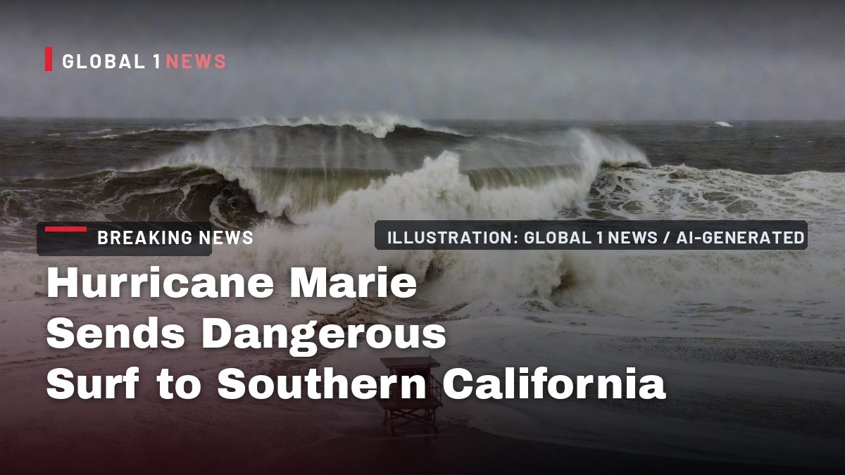
Hurricane Marie, spinning hundreds of miles off Mexico’s Pacific coast, is not expected to make landfall—but its reach is already being felt from the beaches of Southern California to the flood-prone streets of Baja California. As millions of Americans cap off Labor Day weekend at the shore, forecasters are warning of deadly rip currents, large breaking waves, and minor coastal flooding through at least Tuesday. The storm, now a Category 1 hurricane, is also pulling tropical moisture northward, bringing a rare chance of rain and thunderstorms to Los Angeles County on Sunday.
Dangerous Surf Heads for Southern California Beaches
The National Weather Service (NWS) says it has high confidence in potentially deadly rip currents and large waves through the Labor Day weekend, especially at south-facing beaches. A high surf advisory and coastal flood advisory are in effect until 11 p.m. Tuesday for portions of the Los Angeles County and Orange County coasts. Forecasters are urging beachgoers to take the warnings seriously, particularly with holiday crowds expected to pack the sand.
Large breaking waves of 6 to 10 feet are expected for south- and southwest-facing beaches, with 4 to 7 feet for west-facing beaches. Strong and dangerous rip currents and longshore currents are likely, and officials warn that even experienced swimmers could be pulled offshore. The NWS emphasized that the combination of high surf and high astronomical tides creates a moderate risk of coastal flooding, with high tides expected to exceed 7 feet by Monday.
Minor coastal flooding is possible along vulnerable south-facing shores, with Avalon, Long Beach’s Alamitos Peninsula, Malibu and Point Mugu identified as areas of greatest concern. The flooding threat is not expected to be catastrophic, but forecasters say water could encroach onto low-lying roads, parking lots and beach access points during peak high tides.
Marie's Path: From Tropical Storm to Hurricane
Hurricane Marie is the 13th named storm of the 2026 Eastern Pacific hurricane season. It formed Tuesday, September 1, as a tropical storm off the coast of Colima, Mexico, and strengthened into a hurricane Wednesday evening, September 2, according to the U.S. National Hurricane Center (NHC). The storm reached Category 2 strength Thursday night into Friday before beginning a slow weakening trend.
In the NHC’s latest advisory, issued at 2 a.m. today, Marie is a Category 1 hurricane with maximum sustained winds of 150 km/h (90 mph), gusts to 185 km/h (115 mph), and a minimum central pressure of 970 millibars. The center of the storm was roughly 1,020 km (635 miles) west of the southern tip of Baja California Sur, moving northwest at a slow 13 km/h (about 8 mph).
Marie is hundreds of miles offshore and is not expected to make landfall in the U.S. or Mexico. Forecasters expect gradual weakening as the storm moves over cooler waters, but it is expected to remain at hurricane strength through at least Sunday, September 6. That means the dangerous swell generation will continue for another day or more before conditions begin to ease.
Flooding and Alerts Across Mexico
While Marie stays offshore, its outer bands have already caused significant flooding in Mexico. Seventeen Mexican states are under alert. Before the storm even reached hurricane strength, streets flooded in Pachuca, Hidalgo on Tuesday, September 1. As the storm intensified offshore, overflow from the Lagunitas creek flooded parts of San Lucas. Recent reports and video from ABC7 Los Angeles show streets flooded in Cabo San Lucas on Mexico’s Baja California peninsula, a popular tourist destination that has been feeling the storm’s outer effects.
The flooding threat is not the only concern for Mexico. Mexican states including Sinaloa and Oaxaca face both heavy rain risk and extreme heat, with forecast highs of 40 to 45 degrees Celsius (104 to 113 degrees Fahrenheit) in parts of Leon, Tamaulipas, Tabasco and Oaxaca. A wider band of 14 states, including Baja California Sur, Jalisco, Veracruz and Guerrero, will see highs of 35 to 40 degrees Celsius (95 to 104 degrees Fahrenheit).
The combination of heavy rain and extreme heat creates a complex hazard picture for emergency managers across Mexico. While Marie’s core remains far from land, its moisture bands are interacting with a broader weather pattern that is producing both torrential downpours and oppressive heat. Residents in affected areas are being urged to monitor local alerts and avoid crossing flooded roadways.
Rain, Thunderstorms and Slick Roads
Tropical moisture from Marie will increase across Southern California through the weekend, bringing a chance of light to moderate rain, particularly on Sunday. The NWS puts the chance of rain Sunday at 50% to 80% in Los Angeles County. Rainfall is expected to be focused over the eastern side of the county, with about a quarter-inch for most areas, higher amounts in the San Gabriel Valley foothills (half an inch) and the eastern San Gabriel Mountains (around 1 inch).
There is also a 5% to 15% chance of thunderstorms, mainly in the LA County mountains and urban areas. Forecasters warn that any stalled or repeatedly developing storms could produce more than a quarter-inch of rain in an hour, which could lead to localized ponding on roads and poor drainage areas. The rain is not expected to be widespread or heavy enough to cause significant flooding, but it will be enough to make roads slick.
Officials are reminding drivers that roads could become slick with any wetting rain because of oils that accumulated during the dry summer months. Even a light shower can create hazardous driving conditions, especially on freeways and surface streets that have not seen rain in weeks. Humidity will also increase, with increased cloud cover through the weekend, and overnight temperatures could stay in the 70s along southern coastal areas and coastal valleys.
Officials Urge Caution as Crowds Hit the Coast
With the Labor Day holiday drawing large crowds to Southern California beaches, officials are emphasizing public safety. The NWS issued a direct warning: “With huge crowds expected at the beaches for the Labor Day holiday, the emphasis for these statements is to alert the public to be extra careful in and near the ocean.” Officials are urging inexperienced swimmers to stay out of the water entirely, and even experienced swimmers should think twice before entering the surf given the strong rip and longshore currents.
Los Angeles Mayor Karen Bass said her office will continue coordinating with the Emergency Management Department, Los Angeles Fire Department, Los Angeles Police Department, Los Angeles County Public Works and other departments to ensure personnel are ready to respond. The coordination is largely precautionary, but officials want to be prepared for water rescues, coastal flooding impacts and any weather-related incidents over the holiday weekend.
Lifeguards are expected to be out in force at popular beaches, but the sheer number of visitors could strain resources. The NWS advisory covers a wide stretch of coastline, and forecasters are urging people to heed posted warnings and flags. The message is simple: the ocean is not a place to take risks this weekend, no matter how calm the surface may look.
A Busy Pacific: Hurricane Lowell and Hawaii's Swells
Marie is not the only storm making waves in the Pacific. Hurricane Lowell strengthened to a Category 5 storm hundreds of miles south of Hawaii and was expected to remain powerful over several days. Swells from Lowell are likely to affect portions of the Hawaiian islands, and the NHC warns that swells from both Marie and Lowell “are likely to cause life-threatening surf and rip current conditions.”
Marie’s swells were expected to spread to Southern California over the weekend, and the National Weather Service office in San Francisco issued a beach hazards statement warning of 10-foot waves and strong rip currents beginning Friday morning through Monday evening. That advisory extends the threat northward beyond the Los Angeles and Orange County coasts, meaning the entire Southern and Central California coastline is under some form of elevated surf risk.
The simultaneous activity of Marie and Lowell highlights how active the Eastern and Central Pacific basins have become. While neither storm is an immediate landfall threat, their swells are traveling thousands of miles to impact coastlines. Forecasters are reminding residents and visitors that the danger from a hurricane is not always the wind or rain—it can be the waves that arrive days later on distant shores.
What Comes Next
After Marie moves on, Southern California faces another heat wave. Temperatures are expected to climb into the 90s in many areas beginning Tuesday and peaking Wednesday and Thursday. The brief cooldown and rain chance from Marie will give way to more typical late-summer heat, and officials are already advising residents to prepare for hot conditions later in the week.
For now, the focus remains on the immediate hazards: dangerous surf, rip currents, minor coastal flooding and the chance of thunderstorms. The NWS will continue to monitor Marie’s track and intensity, but the storm is expected to weaken gradually as it moves over cooler waters. The high surf advisory and coastal flood advisory remain in effect until 11 p.m. Tuesday, meaning the danger will persist even after the holiday weekend ends.
Residents and visitors should stay informed through local weather updates and heed all warnings from lifeguards and emergency officials. The ocean is powerful, and this Labor Day weekend, it demands respect.
By Jessica Ali, Staff Writer
This article was produced with AI-assisted research and editorial support. Sources: The Associated Press, U.S. National Hurricane Center, National Weather Service, Fox Weather, KTLA, ABC7 Los Angeles, FOX 5 San Diego/KUSI, MyNewsLA, USA Inquirer.
What's Your Reaction?
 Like
0
Like
0
 Dislike
0
Dislike
0
 Love
0
Love
0
 Funny
0
Funny
0
 Wow
0
Wow
0
 Sad
0
Sad
0
 Angry
0
Angry
0

Editor-in-Chief at Global1.News. Atlanta-based journalist who cuts through the BS and tells it like it is. Lead anchor, host, and the voice you hear when the spin stops and the truth starts.











Comments (0)