
A 5.7 Quake Hits Kumamoto Before Dawn and Minamata Tells 22,000 to Leave
A preliminary magnitude 5.7 earthquake struck Kumamoto Prefecture before dawn, prompting Minamata City to order its entire population of more than 22,000 to evacuate as the region still recovers from July's disaster that killed 43.
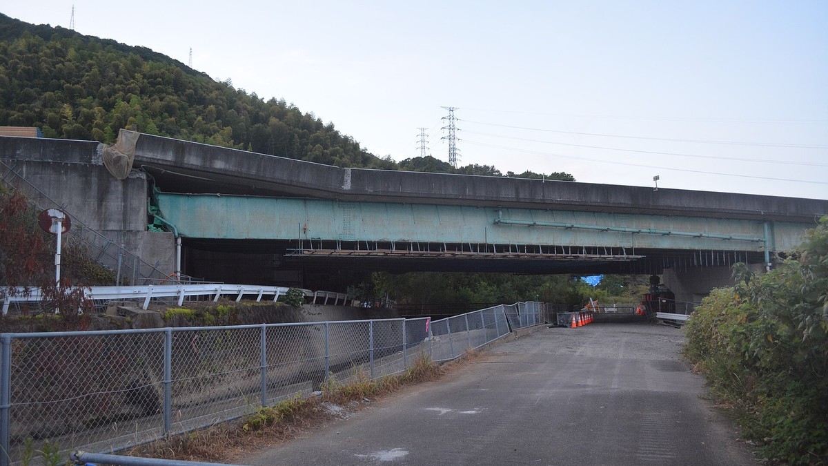
An earthquake of preliminary magnitude 5.7 struck Kumamoto Prefecture before dawn on Thursday, jolting residents awake across southwestern Japan and prompting Minamata City to order its entire population to evacuate. The quake belongs to the seismic sequence that has unsettled the region since late July. Shaking reached fourteen prefectures. As of the latest official statements, it had not been linked to a single injury or a single damaged building.
A 5.7 Quake Hits Kumamoto Before Dawn and Minamata Tells 22,000 to Leave
Minamata, Japan - November 19, 2026 - The earthquake struck at 2:22 a.m. Japan Standard Time, with its epicenter in the Amakusa-Ashikita region of Kumamoto Prefecture at a depth of about 10 kilometers, according to the Japan Meteorological Agency. Minamata City issued a Level 4 evacuation order covering the whole city at 4:05 a.m., and the order remained in force after dawn.
Two Twenty-Two in the Morning, and the Ground Moved Again
The Japan Meteorological Agency recorded a crustal earthquake on a strike-slip fault, with a tension axis running north-northwest to south-southeast. The agency placed it inside the sequence of the Reiwa 8 Kumamoto Earthquake, the designation it gave the magnitude 7.1 event of July 28, and noted that the Hinagu fault zone lies near Thursday's epicenter. No tsunami warning was issued. Long-period ground motion of class 2, the slow swaying that can set tall buildings rocking, was observed in the Kumamoto region and in the Amakusa-Ashikita area. The agency's lower 5 reading describes shaking in which most people feel fear and want to hold onto something. Dishes and books can fall, unfixed furniture can shift, gas meters with safety devices cut the supply, and water or power can fail.
Five Towns at Lower Five, and Shaking Felt in Fourteen Prefectures
Maximum intensity of lower 5 was recorded in five municipalities, according to the agency's readings: Minamata City, Ashikita Town and Tsunagi Town along the Yatsushiro Sea coast, and Kumamura village and Asagiri Town inland in the Kuma region. Intensity 4 reached Yatsushiro City, Hitoyoshi City, Kamiamakusa City, Uki City, Amakusa City, Misato Town, Hikawa Town, Nishiki Town, Taragi Town and Yamae Village in Kumamoto Prefecture, plus Miyazaki City and Kobayashi City in Miyazaki Prefecture and Izumi City, Satsumasendai City, Isa City, Satsuma Town and Nagashima Town in Kagoshima Prefecture. Intensity 3 covered all five wards of Kumamoto City and reached Fukuoka, Saga, Nagasaki and Oita prefectures. Shaking of intensity 1 or higher was recorded in fourteen prefectures, including Yamaguchi, Hiroshima, Shimane, Tottori, Ehime, Kochi and Kagawa.
Minamata Told 22,000 People to Leave, and Opened Seven Shelters
Minamata's order covered 11,126 households and 22,133 people, NHK reported. The city opened seven shelters: City Hall, Kasai-kan, Orange-kan, Airin-kan, Moyai-kan, the Budokan and the Sogo Taiikukan, and residents were told to bring their own water and food. Kumamura village ordered its whole population out just after 2:20 a.m., a notice covering 1,156 households and 2,487 people. Tsunagi Town issued a Level 3 order for elderly and other vulnerable residents at 3:40 a.m. Minamata set up a disaster warning headquarters at the moment of the quake, and more than 30 staff had gathered at City Hall by about 4:30 a.m. to work the phones and prepare survey teams. A City Hall employee described "a big, thrusting kind of shaking" that went on for several seconds, and said nothing had been confirmed falling or breaking inside the building at that point. Shigeyuki Kama, 64, was at a convenience store in Tsunagi Town when it hit. "It shook quite a lot for about 10 seconds," he said. "I held on to the counter and endured it. Two or three snack bags fell."
The Warning Came 4.3 Seconds After the First Wave
The emergency earthquake early warning system detected the first seismic wave at 2:22:25.8 and issued its alert 4.3 seconds later, the agency said. The first report predicted lower 5 or stronger for the Amakusa-Ashikita region and for Satsuma in Kagoshima Prefecture, and 4 or stronger for the Kumamoto and Kuma regions. The third report, 5.5 seconds after detection, estimated magnitude 5.9 and raised the Amakusa-Ashikita prediction to upper 5 to lower 6. The sixteenth and final report, 56.7 seconds after detection, gave magnitude 5.7 at a depth of 10 kilometers and predicted upper 5 for Amakusa-Ashikita, lower 5 for Satsuma and the Kumamoto region, and 4 for the Kuma region. The ground delivered lower 5, one step under the final call. In the Kuma region, predicted at 4, both Kumamura and Asagiri recorded lower 5.
Thirty Aftershocks by Dawn, and the Rate Was Not Falling
The agency counted 21 quakes of intensity 1 or higher in the same source area by 3:55 a.m., two of them at intensity 3, five at intensity 2 and fourteen at intensity 1. By 4:41 a.m. the tally had reached 30, distributed at roughly ten an hour across the 2 a.m., 3 a.m. and 4 a.m. hours, so the rate was not easing. The strongest were a magnitude 3.7 at about 2:36 a.m. and a magnitude 3.5 at about 2:25 a.m., both registering intensity 3. Forty-three minutes before the mainshock, at 1:39 a.m., a magnitude 2.7 quake in the same area had registered intensity 2. The activity carried on into daylight, with a magnitude 3.6 at 9:38 a.m. that reached intensity 3 in Ashikita Town and intensity 2 in Minamata, Kamiamakusa, Amakusa, Tsunagi, Yatsushiro and Kumamura.
A Sequence That Has Not Stopped Since July
Seismicity in the area never returned to background after July. In November alone, before Thursday, thirteen quakes of intensity 1 or higher had struck the same source region, including a magnitude 4.3 at 10:53 a.m. on November 8 that registered intensity 4, a magnitude 3.8 at 6:17 a.m. on November 15 at intensity 3, and a magnitude 3.3 at 2:54 a.m. on November 18 at intensity 3. The pattern matters more than any single jolt. After the July 28 disaster the agency said the elevated rate would continue for the time being, and on September 24 it put the likelihood of a lower-5-or-stronger quake below roughly one a month. Thursday's event met that threshold in a region already exhausted by one.
The Toll Had Already Reached 43
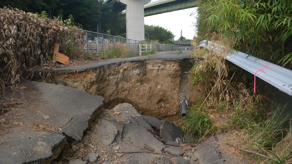
The July 28 quake struck at 4:27 p.m. at magnitude 7.1, with a maximum intensity of 7 in Uki City and Hikawa Town, the top of the Japanese scale. The Fire and Disaster Management Agency's 67th report, issued at 5 p.m. on November 18, recorded 43 deaths, 388 people injured including 54 seriously, 2,674 homes completely destroyed, 9,376 half-destroyed and 71,279 partially damaged, for 83,329 homes affected. Deaths by municipality included 21 in Yatsushiro, eight in Kashima, eight in Hikawa, three in Uki, one in Kosa and one in Tsunagi, plus one recorded as possibly caused by the physical strain of the disaster. Five further deaths were certified as disaster-related on November 10, more than three months after the ground moved.
A Thousand People Were Still Living in Shelters
Three months after the quake, 1,073 people were still in shelters at 21 centers in seven municipalities as of October 28, including 579 in Yatsushiro, 263 in Uki, 155 in Hikawa and 65 in Uto. About 2,685 had moved into temporary housing by October 23, with roughly 1,200 units in use and many households still on waiting lists. Publicly funded demolition began in September, yet by October 21 only one house had come down. On October 27 the prefecture published a draft reconstruction plan running through fiscal 2028. On November 13, Prime Minister Sanae Takaichi said the government would put 52 billion yen into a prefecture recovery fund and ordered prefabricated emergency housing finished by the end of the year, noting that winter had arrived more than 100 days after the quake.
Roads Closed, the Shinkansen Slowed, a Prime Minister in China
NEXCO West Japan shut the Kyushu Expressway between the Hitoyoshi and Yatsushiro interchanges and the Minamikyushu West Ring Expressway between Yatsushiro-minami and Hinagu in both directions from 2:24 a.m. for safety checks, with no prospect of reopening as of 7 a.m. JR Kyushu reported suspensions and delays on the Kyushu Shinkansen between Hakata and Kagoshima-Chuo as of 5:32 a.m., cancelling Sakura No. 420 and Mizuho No. 600 over that stretch and running at reduced speed between Shin-Yatsushiro and Izumi. Hisatsu Orange Railway held services between Yatsushiro and Izumi from the first train. Takaichi, travelling in China for the APEC summit, wrote on X that she had instructed officials to grasp the damage and give the public accurate information, and asked people to stay careful about similar quakes.

What the Next Week Looks Like
The agency expects activity to continue in the Amakusa-Ashikita region, with quakes of up to about lower 5 possible for roughly a week and the strongest shaking most likely in the first two to three days. It pointed to past cases in which earthquakes of similar size kept coming for about a week after a large one, and warned that something stronger remains possible. Residents in the hardest-shaken areas were told to watch for rockfalls and slope failures, which grow likelier once the ground has been loosened. Minamata's order stood after sunrise, and the city's emergency page still carried the Level 4 notice at 4:42 a.m. Hiroaki Tagami, who runs the city's crisis management division, said City Hall itself had come through largely intact and that survey teams would move once there was light. What those teams find will decide how much this region has to carry on top of July.
By Jessica Ali, Staff Writer
This article was produced with AI-assisted research and editorial support. Photographs: a surface rupture near the Myoken Daiichi Bridge in Yatsushiro City by Katorisi, and Prime Minister Sanae Takaichi at the Prime Minister's Residence in Tokyo on November 16 by Haruna Naka, both via Wikimedia Commons and Sankei Shimbun. Lead image: quake-damaged Kawada Bridge on the Kyushu Expressway in Yatsushiro City, by Katorisi, via Wikimedia Commons, CC BY-SA 4.0. Social cover card: Global 1 News editorial image. Sources: Japan Meteorological Agency; Fire and Disaster Management Agency; Kumamoto Prefecture; Minamata City; Kumamoto Nichinichi Shimbun; NHK; Jiji Press; Kyodo News; Nippon Television; Sankei Shimbun; Ministry of Land, Infrastructure, Transport and Tourism; Japan Society of Civil Engineers.
What's Your Reaction?
 Like
0
 Dislike
0
 Love
0
 Funny
0
 Wow
0
 Sad
0
 Angry
0

Editor-in-Chief at Global1.News. Atlanta-based journalist who cuts through the BS and tells it like it is. Lead anchor, host, and the voice you hear when the spin stops and the truth starts.









Comments (0)