
Isaias Becomes a Category 3 Hurricane Hours From the Gulf Coast as a Record-Late Season Finally Produces Its First Storm
Hurricane Isaias has strengthened into a Category 3 storm hours from the northern Gulf Coast, the first hurricane of a record-late 2026 Atlantic season, as Alabama, Florida and Mississippi declared states of emergency and coastal evacuations were ordered.

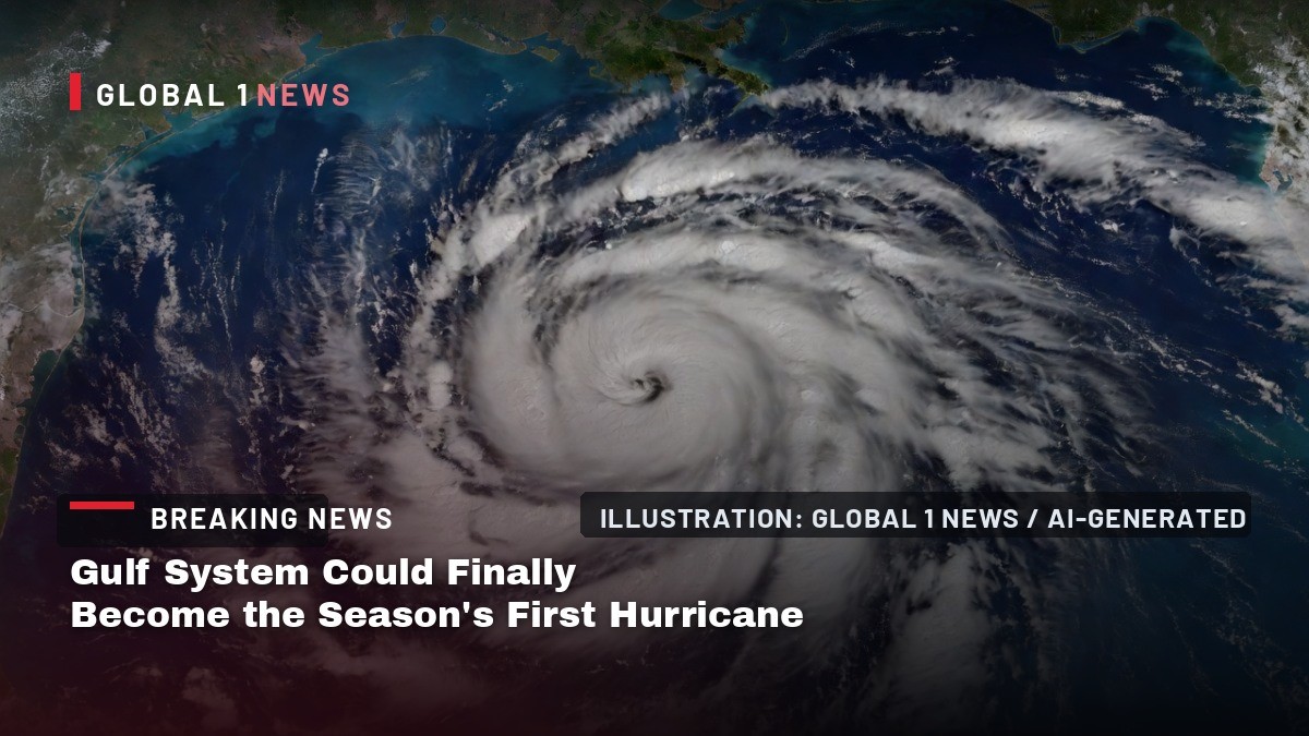
Hurricane Isaias is hours from the northern Gulf Coast and now a Category 3 storm, the first hurricane of a 2026 Atlantic season that went four months without one. States of emergency are in force in Alabama, Florida and Mississippi, mandatory evacuations have been ordered along parts of the coast, and the National Hurricane Center is warning of a life-threatening storm surge across the Florida Panhandle and Alabama shoreline.
Isaias Becomes a Category 3 Hurricane Hours From the Gulf Coast as a Record-Late Season Finally Produces Its First Storm
Pensacola, Florida — Emergency crews and National Guard units moved into position along the Gulf Coast on Friday as Hurricane Isaias intensified into a Category 3 storm ahead of an evening landfall.
A Category 3 Storm Hours From Landfall
Hurricane Isaias strengthened into a Category 3 storm on Friday morning as it closed on the northern Gulf Coast, the National Hurricane Center said in its 10 a.m. CDT advisory. Maximum sustained winds were near 120 mph, with a minimum central pressure of 959 mb. The center sat about 195 miles south of Pensacola, Florida, and about 145 miles southeast of the mouth of the Mississippi River, moving north-northeast near 16 mph.
The hurricane center warned of "life-threatening storm surge and devastating winds" along the Florida Panhandle and Alabama coasts, with landfall expected this evening. Isaias is forecast to be "at or near major hurricane strength when it makes landfall," the center said. Hurricane-force winds extend outward up to 35 miles, and tropical-storm-force winds up to 205 miles, so the deteriorating weather will arrive well ahead of the eye. Weakening is expected tonight, with the storm likely post-tropical by late Saturday.
A Record That Took 121 Years to Tie
Isaias is the first hurricane of the 2026 Atlantic season, and its arrival is historically late. NOAA's satellite service, The Weather Channel and The Conversation report that Isaias tied the record, set in 1905, for the latest-forming first hurricane of an Atlantic season. The 1905 season's first Atlantic hurricane formed on 8 October of that year.
The Associated Press reported a different reading of the same history, saying Isaias came one day short of tying the 121-year-old record. Both accounts rest on the same calendar, and both describe a season that spent four months producing tropical storms and nothing stronger. Isaias developed about 57 days later than the typical formation date for the season's first Atlantic hurricane, according to Yale Climate Connections. The storm, pronounced "ees-ah-EE-ahs," formed from a disturbance in the Bay of Campeche, organizing into Tropical Depression Nine on 6 October and reaching hurricane strength on the night of 7-8 October.
The Season That Went Missing
The 2026 Atlantic season was the first in the modern satellite era without a single hurricane in September, normally the peak month, according to The Weather Channel and Local 10. Before Isaias, eight named storms had formed and faded without crossing the hurricane threshold. Isaias is the season's ninth named system and its first hurricane.
No Atlantic season had gone this late in the year without a hurricane since 1905. The last hurricane of the previous season was 342 days before Isaias reached hurricane strength, the Latin Times reported. In a typical season the first Atlantic hurricane forms around 11 August. Meteorologists attribute the quiet season mainly to an intensifying El Niño, which raises vertical wind shear and brings dry, sinking air over the tropical Atlantic, according to The Weather Channel and CBS News.
Why This One Broke Through
Isaias formed over the western Gulf of Mexico rather than the deep tropics, where shear was still hostile, The Conversation reported. Gulf waters along its path ran 3.5 to 4.5 degrees Fahrenheit above average for early October, according to Climate Central's Climate Shift Index, as reported by meteorologist Shel Winkley. That warmth is the fuel a late-season storm needs.
University of Miami meteorologist Brian McNoldy said Isaias would pass over "a deep reservoir of warm water" with very high ocean heat content on Friday morning, offering "an interesting battle against the increasing wind shear." The National Hurricane Center expects a large increase in shear before landfall, which will probably cause some weakening. Even so, the center noted that "it would only take about a 6-hour delay in the onset of the shear to bring a stronger hurricane than expected onshore."
What the Water Will Do
Storm surge is the forecast's most dangerous number. The National Hurricane Center projects 6 to 9 feet from the Alabama-Florida border to Grayton Beach, Florida. Dauphin Island, Alabama, to the Alabama-Florida border could see 4 to 6 feet. Grayton Beach to Indian Pass, Florida, is forecast at 4 to 7 feet, and Indian Pass to the Steinhatchee River at 4 to 6 feet.
From the Steinhatchee River to the Suwannee River, surge of 3 to 5 feet is expected. The mouth of the Mississippi River to Dauphin Island, and Mobile Bay, could see 3 to 5 feet. Suwannee River to Yankeetown, Florida, is forecast at 2 to 4 feet. A storm surge warning runs from the mouth of the Mississippi River to the Suwannee River, and a storm surge watch covers Suwannee River to Yankeetown.
What the Wind and Rain Will Do
Rainfall of 4 to 8 inches is forecast across southern Alabama, the Florida Panhandle and Big Bend, and southwest Georgia, with localized totals up to 15 inches, the National Hurricane Center said. Another 2 to 5 inches is expected across much of the rest of the Southeast, with localized totals up to 10 inches, especially in the Southern Appalachians and coastal Carolinas. The Associated Press reported that heavy rain and flooding are possible into the weekend as far north as Tennessee and North Carolina.
Flash and urban flooding are likely, and river flooding is expected, "some of which could be significant," the center said. The tornado risk begins late Friday afternoon and continues overnight in coastal Alabama, the Florida Panhandle and far southwest Georgia, then continues Saturday across eastern Alabama, the Florida Panhandle, Georgia and the Carolinas. Hurricane conditions are expected in the warning area tonight into early Saturday.
Evacuations, Emergency Orders and Closed Schools
States of emergency were declared in Alabama, Florida and Mississippi, The Guardian reported. Florida Governor Ron DeSantis declared a state of emergency for dozens of counties, according to the Associated Press. Alabama Governor Kay Ivey ordered non-residents to immediately evacuate Gulf Shores, Orange Beach and Dauphin Island, the Associated Press reported via NPR. Okaloosa County announced mandatory evacuations for some coastal areas, and at least four Florida school districts cancelled classes.
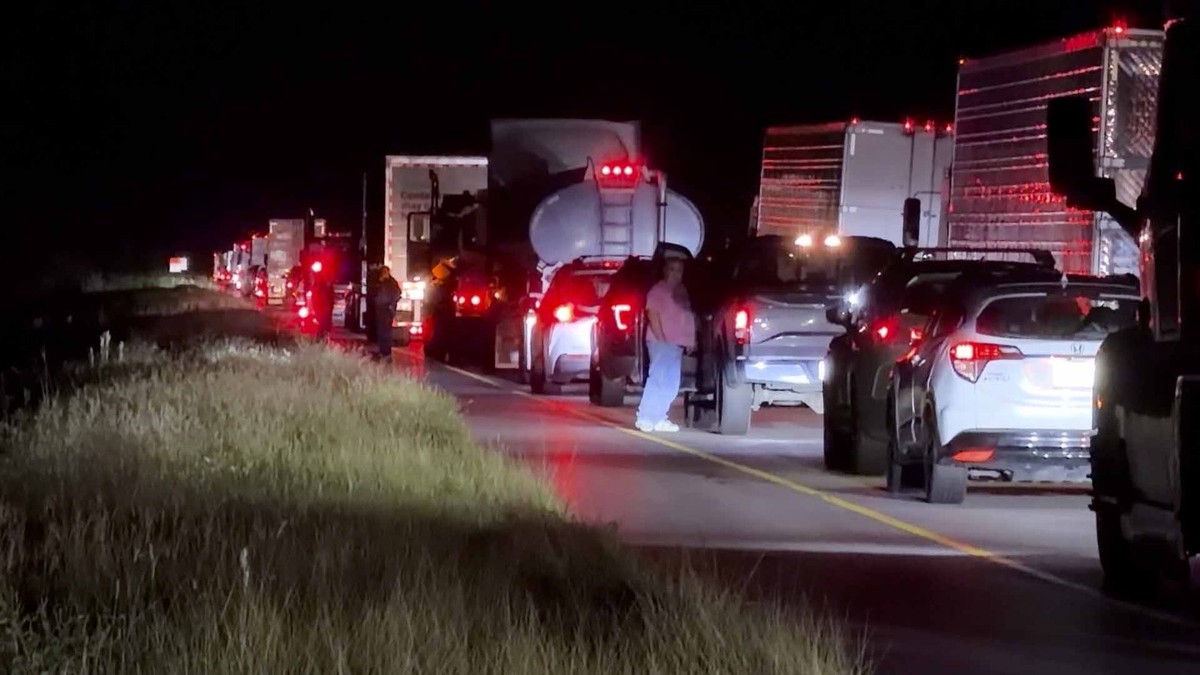
Gulf Shores and Orange Beach jointly encouraged people in low-lying areas to evacuate voluntarily. Video on social media showed traffic at a standstill on a highway leading out of Gulf Shores, where double-red beach flags signalled that the water was closed. Dauphin Island Mayor Jeff Collier said: "I do not anticipate substantial damage, but at the same time, these things are very fickle and a little jog here or there, or some last-minute increase in strength — we just have to be prepared for the worst." Mississippi Governor Tate Reeves said: "Obviously no need to panic at this point. This is really about preparation."
Oil, Refineries and a Football Saturday
Some Gulf oil wells paused production, and the cuts are steep enough to affect markets, though other Gulf hurricanes have caused larger disruptions, said Jim Burkhard, global head of crude oil market research for S&P Global Energy, according to the Associated Press. More concerning, he said, is whether Isaias strikes as a powerful storm near refineries.
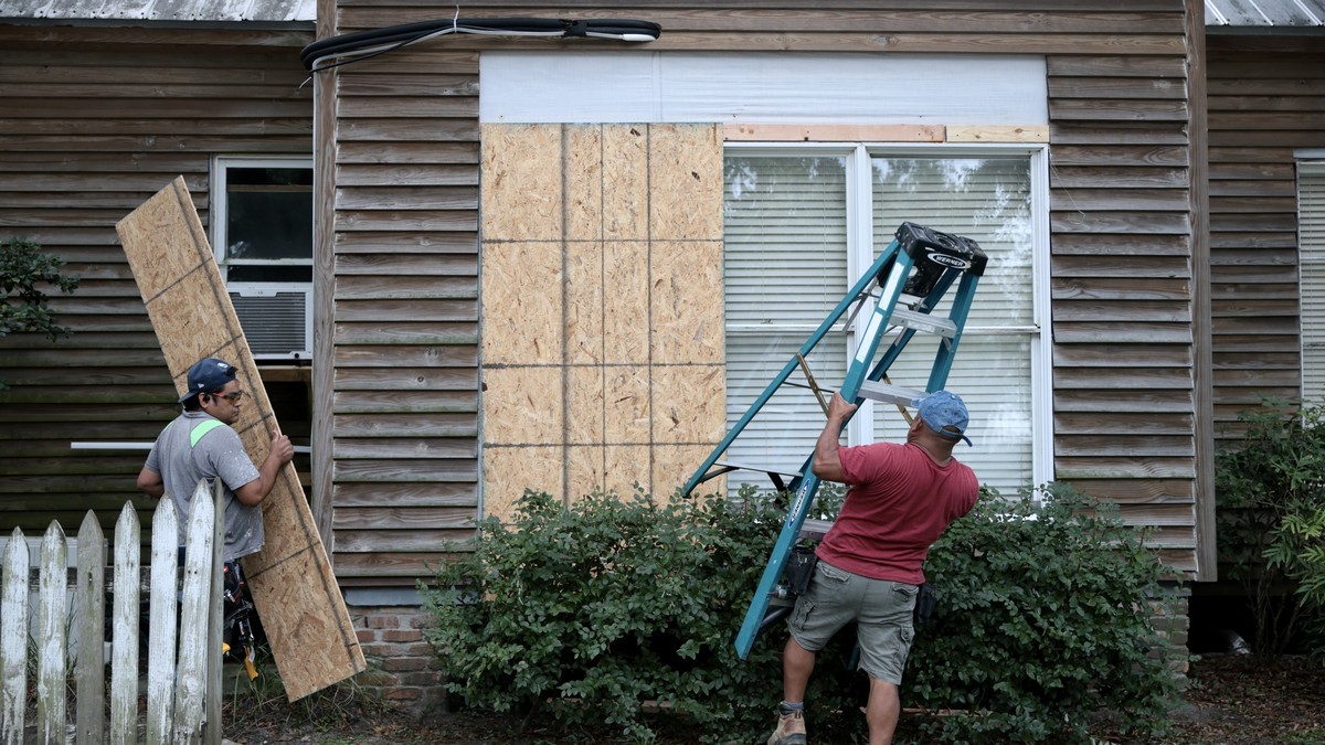
Thousands of National Guard soldiers were deploying, the Associated Press said, and the 403rd Wing relocated its aircraft from Keesler Air Force Base, Mississippi, on Thursday, according to The Weather Channel and the Florida National Guard Public Affairs Office. Residents boarded up windows and stacked sandbags, fishing crews secured their boats, and shoppers cleared gas and groceries off the shelves, the Associated Press reported via NPR. In Loxley, Alabama, county officials urged voluntary evacuations, and resident Nichole Eubanks prepared to ride out the storm on a farm holding pigs, donkeys and about 20 rescued cats.
What Comes Next
The National Weather Service in Mobile, Alabama, said Isaias is most likely to strike along the Alabama-Florida state line and bring life-threatening storm surge across Pensacola Bay, the Associated Press reported. There is a small chance it hits further west with a major impact on Mobile, or further east with strong effects on Pensacola and Destin. The Associated Press reported expected landfall between Mobile Bay on the Alabama coast and Choctawhatchee Bay in the Florida Panhandle, in the evening.
National Hurricane Center director Michael Brennan said: "We are expecting Isaias to be a dangerous hurricane when it makes landfall." He added: "Today is the day to prepare and get ready and be in your safe place by tomorrow as conditions will rapidly deteriorate along the northern Gulf Coast as Isaias approaches." The next intermediate advisory is due at 1 p.m. CDT, and the next complete advisory at 4 p.m. CDT.
What This Storm Should Teach Us
The 2026 season showed how far a hurricane season can drift from its own calendar. A peak month passed without a single hurricane. Eight named storms formed and faded. Then a system organized in the Bay of Campeche, crossed unusually warm Gulf water and reached Category 3 in a matter of days, giving coastal communities days of warning rather than weeks.
That short runway is the lesson. Officials in three states declared emergencies before landfall, coastal counties ordered evacuations, and the National Hurricane Center's message stayed consistent: conditions will deteriorate rapidly, and preparation is a task for the hours before the storm, not during it. Isaias is expected to weaken tonight and to become post-tropical by late Saturday, but the water it pushes ashore and the rain it leaves behind will outlast the wind.
By Jessica Ali, Staff Writer
This article was produced with AI-assisted research and editorial support. Sources: National Hurricane Center, Associated Press, The Guardian, NPR, The Weather Channel, Yale Climate Connections, CBS News, The Conversation, Latin Times, Local 10 and Climate Central.
What's Your Reaction?
 Like
0
Like
0
 Dislike
0
Dislike
0
 Love
0
Love
0
 Funny
0
Funny
0
 Wow
0
Wow
0
 Sad
0
Sad
0
 Angry
0
Angry
0

Editor-in-Chief at Global1.News. Atlanta-based journalist who cuts through the BS and tells it like it is. Lead anchor, host, and the voice you hear when the spin stops and the truth starts.














Comments (0)