
GISTDA Warns of Flood Risks Across 3,900 sq km in North
Satellite Eyes on the Skies: GISTDA Flags Flood Risk Across 3,900 Square Kilometers in the North BANGKOK — The heavens have opened over the upper central plains, and the Geo-Informatics and Space Technology Development Agency (GISTDA) is watching every drop. On Friday, the agency released its latest flood risk assessment, a sobering update for communities across the lower North.

Satellite Eyes on the Skies: GISTDA Flags Flood Risk Across 3,900 Square Kilometers in the North
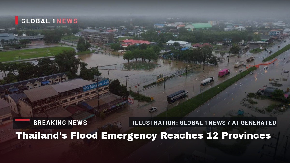
BANGKOK — The heavens have opened over the upper central plains, and the Geo-Informatics and Space Technology Development Agency (GISTDA) is watching every drop. On Friday, the agency released its latest flood risk assessment, a sobering update for communities across the lower North. Using its high-accuracy satellite imagery and the "Check Nam" application, GISTDA has identified a vast, interconnected floodplain stretching across more than 3,900 square kilometers, an area larger than the province of Phuket, now classified as being at very high risk of inundation.
The data, updated in real time, paints a picture of a region bracing for the worst of the monsoon. The red zones on GISTDA's maps—indicating the most severe danger—are not isolated pockets. They form a continuous band of waterlogged earth that spills across provincial borders, a reminder that rivers and floods do not respect the lines drawn on administrative maps. For the farmers, families, and local officials in Sukhothai, Phitsanulok, and their neighbors, this is not just a weather forecast; it is a call to action.
The Heart of the Floodplain: Sukhothai Under Pressure
Sukhothai, the ancient capital of Siam and a province steeped in history, is bearing the brunt of this year's deluge. GISTDA's analysis shows large swathes of the province, particularly its central and lower districts, are now sitting in the red zone. The districts of Sawankhalok, Si Samrong, Mueang Sukhothai, and Kong Krailat are identified as major areas of concern, with parts of Si Satchanalai in the province's north also facing significant risk.
For residents of Mueang Sukhothai, the provincial seat, the Yom River is a lifeline that can quickly become a threat. The low-lying paddy fields that surround these districts, which have fed the nation for centuries, are now at the mercy of the rising waters. The sight of the Yom swelling beyond its banks is a familiar, yet always anxious, monsoon ritual. GISTDA's warning on Friday serves as a crucial heads-up for these communities, many of whom are already moving their belongings to higher ground and preparing sandbag barriers.
Phitsanulok's Connected Crisis: Water Flowing South
The situation in Phitsanulok is intrinsically linked to the flow from its northern neighbor. GISTDA noted that the floodwater in Phitsanulok is directly connected to the runoff coming down from Sukhothai, creating a cascading effect that is hard to manage. The central and western parts of Phitsanulok are now marked as extensive high-risk areas, with the districts of Phrom Phiram, Bang Rakam, and Mueang Phitsanulok facing the most immediate danger. Parts of Wat Bot district are also on alert.
Bang Rakam is particularly vulnerable. Known as a major rice-growing area, its flat, low-lying geography makes it a natural retention basin for excess water. This week, as the water from the north pushes southward, the district is once again acting as a sponge, protecting downstream communities but at a great cost to its own agricultural output. The interconnectedness of these provinces highlights a critical challenge for Thai disaster management: you cannot protect one area without understanding the impact on another.
Beyond Borders: Uttaradit, Phichit, and Kamphaeng Phet on Alert
The risk does not stop at the boundaries of Sukhothai and Phitsanulok. GISTDA's satellite imagery has detected both very high-risk zones (red) and lower-risk zones (yellow) extending into parts of Uttaradit, Phichit, and Kamphaeng Phet provinces. This regional spread underscores the scale of the current weather system, which is saturating the entire Yom and Nan river basins.
For Phichit, located further south, the floodwaters are a preview of what may come in the next few days. The province often serves as a downstream collection point for the combined flows of the Yom and Nan rivers. Similarly, Kamphaeng Phet, to the west, is monitoring the situation along its own waterways. This is a regional event, and GISTDA's data allows authorities in these provinces to prepare not just for today's rain, but for the surge of water that is traveling through the system. The agency's advice is clear: residents in these affected and nearby areas should monitor the situation around the clock.
Why This Matters: The Monsoon's Grip on Thai Agriculture and Transport
For Thai readers, this warning is more than just a news item; it is a direct concern for food security and daily life. The affected provinces are the heartland of Thai rice production. Sukhothai and Phitsanulok are crucial to the national supply chain, and widespread flooding here can impact rice prices and availability across the country. The timing is particularly cruel, as many farmers are either preparing their fields or have young crops that cannot survive prolonged submersion.
Beyond agriculture, the flooding poses a significant threat to transportation. The main rail line to the North runs through Phitsanulok, and any disruption to this route would sever a vital link between Bangkok and Chiang Mai. Roads, including major highways, are also at risk of being cut off, isolating communities and hampering relief efforts. The "Check Nam" application, by providing real-time data, becomes an essential tool for the Department of Disaster Prevention and Mitigation (DDPM) and the Royal Irrigation Department (RID) to coordinate their response, manage water gates, and issue timely evacuation orders.
A Regional Perspective: The Mekong Basin and ASEAN Resilience
This flood event in the Chao Phraya basin is a stark reminder of the shared vulnerabilities within Southeast Asia. While the immediate impact is on the Yom and Nan rivers, which are tributaries of the Chao Phraya, the broader weather patterns affecting Thailand are part of a larger monsoon system that impacts the entire Mekong region. When the monsoon is this intense, it is not just Thailand that feels the effects. Downstream nations like Laos, Cambodia, and Vietnam are also monitoring their river levels, aware that heavy rainfall in the upper basin can lead to severe flooding further south.
For ASEAN, this event underscores the need for greater regional cooperation on disaster management and climate resilience. The data provided by GISTDA is a valuable asset, not just for Thailand, but for the region as a whole. Sharing satellite imagery and hydrological data across borders can help all nations in the Mekong basin better predict and prepare for these annual challenges. The resilience of Thai communities, from the farmers in Bang Rakam to the monks in Sukhothai's ancient temples, is a testament to the nation's spirit, but modern technology is now a critical partner in that age-old struggle against the flood.
Looking Ahead: Preparedness and Community Spirit
As the rain continues to fall, the focus now shifts to the ground-level response. GISTDA's role is to provide the intelligence, but the action lies with the local authorities and the people. In the coming days, we can expect to see the Royal Irrigation Department managing the flow through major dams and weirs, while local officials in the red-zone districts coordinate evacuations and set up temporary shelters. The "Check Nam" app will be a vital tool for residents to see if their specific area is in danger.
There is a deep cultural resilience in these communities. The people of the Chao Phraya basin have lived with the rhythms of the monsoon for centuries, building their homes on stilts and their lives around the ebb and flow of the rivers. This year, the scale of the risk is significant, but so is the level of preparation. The warning from GISTDA on Friday is a clear signal that this is not a time for complacency. It is a time for neighbors to help neighbors, for communities to come together, and for everyone in the affected areas to stay vigilant and heed the advice of officials. The water is coming, but with the right information and a strong community spirit, the North will weather this storm.
By Ann Srisawat, Staff Writer
This article was produced with AI-assisted research and editorial support. Sources: Khaosod English.
What's Your Reaction?
 Like
0
Like
0
 Dislike
0
Dislike
0
 Love
0
Love
0
 Funny
0
Funny
0
 Wow
0
Wow
0
 Sad
0
Sad
0
 Angry
0
Angry
0

Southeast Asia Correspondent at Global1.News. Based in Bangkok, covering Thai and Southeast Asian politics, economy, technology, and culture. Deep regional perspective on one of the world's most dynamic regions.













Comments (0)