
Edouard Targets Gulf Coast: Hurricane Watch Issued
The Gulf of Mexico has a name on its lips this morning, and it’s Edouard. What started as a disorganized tropical depression off the northern Gulf coast on Monday afternoon has rapidly organized into a formidable tropical storm, one that is now bearing down on the Texas-Louisiana border with a ferocity that has forecasters on edge.
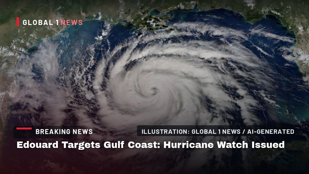
The Gulf of Mexico has a name on its lips this morning, and it’s Edouard. What started as a disorganized tropical depression off the northern Gulf coast on Monday afternoon has rapidly organized into a formidable tropical storm, one that is now bearing down on the Texas-Louisiana border with a ferocity that has forecasters on edge. As of Tuesday morning, this system is not just a rainmaker; it’s a wind machine, a surge producer, and a potential hurricane all wrapped into one, and it’s knocking on the door of the Gulf Coast right now.
Edouard Targets Gulf Coast: Hurricane Watch Issued
Gulf of Mexico — The clock is ticking for coastal communities from Port Bolivar, Texas, to the Vermilion/Cameron Parish line in Louisiana. Tropical Storm Edouard, the fifth named storm of the 2026 Atlantic hurricane season, is charging toward landfall with sustained winds near 50 mph and peak winds that have reached 65 mph. The National Hurricane Center’s Tuesday morning advisory places the storm’s center near 29.0 degrees north latitude and 92.8 degrees west longitude, a position that puts it squarely on a collision course with the upper Texas and southwestern Louisiana coasts. This is not a drill, and it’s not a distant threat; this is a live, breathing weather event that is about to make landfall.
Storm Status: A Rapid Intensification Story
Edouard’s life has been short but explosive. It was first tracked as Tropical Depression Five on Monday afternoon, August 31, in the northern Gulf of Mexico, according to the National Hurricane Center via nola.com. Within hours, it had organized into a tropical storm, earning the name Edouard and becoming the fifth named storm of a season that has been anything but quiet. The system’s rapid development is a testament to the warm waters of the Gulf, which are providing ample fuel for intensification.
As of Tuesday morning, the storm’s maximum sustained winds are hovering around 50 mph, but that number is expected to climb. Forecasters quoted by the Sun Sentinel and weathernews say Edouard could reach near-hurricane strength—the 74 mph threshold—before it makes landfall. That’s a significant jump, and it means that residents in the warning zone should not let their guard down. A tropical storm at 50 mph is dangerous; a tropical storm at 70 mph is a completely different beast, one that can cause widespread damage and life-threatening conditions.
The storm’s forward motion is also a concern. It’s not stalling; it’s moving, and it’s moving with purpose. The projected landfall is near the Texas-Louisiana state line, a region that is no stranger to tropical systems but one that is always vulnerable to the whims of the Gulf. The NHC’s forecast graphic, as reported by Yahoo and Naples News, shows the center crossing the coast on September 1, which is today. This is a same-day landfall event, and there is no time for complacency.
Warnings in Effect: Who Is Under the Gun?
The National Hurricane Center has issued a Tropical Storm Warning from Port Bolivar, Texas, eastward to the Vermilion/Cameron Parish line in Louisiana. This is a broad swath of coastline that includes two major metropolitan areas: Houston and Galveston. The Weather Channel and WAFB are both reporting that winds of 40 mph or greater are expected to begin hitting these areas as early as Tuesday morning, with the potential for much higher gusts as the storm’s core approaches.
In addition to the Tropical Storm Warning, a Hurricane Watch has been issued for parts of the upper Texas and southwestern Louisiana coasts. This is a serious escalation. A hurricane watch means that hurricane conditions are possible within the watch area, and it’s a signal that residents should be prepared to act if the storm intensifies further. The Sun Sentinel, USA Today, and Yahoo News are all carrying this advisory, and it’s a clear indication that forecasters are taking the possibility of a hurricane landfall very seriously.
For residents in these areas, the message is simple: this is not a typical summer thunderstorm. The combination of a hurricane watch and a tropical storm warning means that you need to be in your safe place, with your supplies ready, and your plan in motion. The time for preparation is now, not when the winds start howling.
Hazards: Surge, Rain, Wind, and Tornadoes
Edouard is not a one-trick pony. This storm is packing a multi-pronged threat that includes storm surge, heavy rainfall, gusty winds, and even the possibility of isolated tornadoes. AccuWeather is highlighting all of these hazards, and they are all serious. Storm surge is often the deadliest part of a tropical system, and the low-lying coastal areas of Texas and Louisiana are particularly vulnerable. The surge can inundate roads, flood homes, and trap people in their vehicles, so heeding evacuation orders—if they are issued—is critical.
Heavy rainfall is another major concern. The storm is expected to dump significant amounts of rain over a short period, leading to flash flooding and river flooding. Flood warnings have already been issued along the Gulf Coast, according to Yahoo, and the potential for widespread inundation is high. The ground in this region is often saturated from previous storms, which means that even moderate rainfall can lead to severe flooding.
Wind is the third component of this threat matrix. Tropical storm force winds are expected to arrive along the Texas coast by 8 a.m. on September 1, according to USA Today. These winds can down trees, knock out power, and turn loose objects into projectiles. The elevated wind and wave hazards, as noted by weathernews, are a particular concern for maritime interests and coastal residents. And then there’s the tornado threat. Isolated tornadoes can spin up quickly in the outer bands of a tropical system, and they add an unpredictable element to an already dangerous situation.
Season Context: The Fifth Named Storm, and Maybe the First Hurricane
Edouard is not just another storm; it’s a milestone in the 2026 Atlantic hurricane season. As of Monday, August 31, all of the season’s named storms had maintained tropical storm force, but none had strengthened into hurricanes. Edouard could be the first to break that streak. The Spokesman-Review is reporting that this is a notable distinction, and it underscores the potential for this storm to be a significant event.
The 2026 season has been active, and Edouard is the fifth named storm. This is a reminder that we are in the heart of hurricane season, and the Gulf of Mexico is a breeding ground for these systems. The warm waters, the atmospheric conditions, and the time of year all combine to create a perfect environment for tropical development. Edouard is a product of that environment, and it’s a warning that more storms are likely on the way.
It’s also worth noting that the remnants of Dolly are bound for Florida, according to the same source. This means that even as Edouard is making landfall, the Gulf and the Atlantic are still churning with activity. The season is far from over, and residents across the Southeast and Gulf Coast need to remain vigilant.
What Residents Should Do: Preparedness Is Key
If you are in the warning zone, the time to act is now. The National Hurricane Center and local officials are urging residents to complete their preparations immediately. This means securing loose outdoor items, filling your car’s gas tank, charging your devices, and having a supply of food, water, and medications that can last at least 72 hours. It also means knowing your evacuation route and having a plan for where you will go if you need to leave.
Do not wait for the winds to pick up before you decide what to do. The window for safe preparation is closing, and the storm is moving fast. Listen to local officials and heed their advice. If they tell you to evacuate, evacuate. If they tell you to shelter in place, do so in a sturdy building, away from windows, and in the lowest level of the structure. The storm surge is a particular concern, so if you are in a low-lying coastal area, you need to take that threat seriously.
It’s also important to remember that the danger does not end when the storm makes landfall. Inland flooding can occur for days after the storm passes, and downed power lines and debris can create hazards. Stay indoors until officials say it is safe to go outside, and never drive through flooded roadways. Turn around, don’t drown. This is a simple but life-saving rule.
What’s Next: Post-Landfall Weakening and Inland Flooding
After Edouard makes landfall, the storm is expected to weaken as it moves inland. The loss of warm ocean water will cut off its fuel supply, and the system will likely degrade into a tropical depression within 24 to 48 hours. However, weakening does not mean the threat is over. The storm will continue to produce heavy rainfall as it moves inland, and that rain can cause significant flooding in areas far from the coast.
The remnants of Edouard could linger for days, bringing rain and gusty winds to parts of Texas, Louisiana, and possibly beyond. Residents in inland areas should monitor the forecast and be prepared for the possibility of flash flooding. The storm’s path after landfall is still uncertain, but the potential for a prolonged rainfall event is real.
Meanwhile, the Atlantic basin remains active. A separate storm is moving toward Hawaii, according to News4Jax, and the remnants of Dolly are heading for Florida. This is a busy time in the weather world, and it’s a reminder that we are in the thick of the season. The Gulf Coast is dealing with Edouard today, but the broader picture is one of ongoing tropical activity that requires constant vigilance.
For now, all eyes are on the Texas-Louisiana border. Edouard is coming, and it’s coming fast. The storm is a test of preparedness, a test of resilience, and a reminder that nature is a force to be respected. Stay safe, stay informed, and stay indoors if you are in the path of this storm. The Global1.news team will continue to monitor this situation and bring you updates as they become available.
By Jessica Ali, Staff Writer
This article was produced with AI-assisted research and editorial support. Sources: National Hurricane Center, USA Today, The Weather Channel, AccuWeather, WAFB, nola.com, Sun Sentinel, Spokesman-Review.
What's Your Reaction?
 Like
0
Like
0
 Dislike
0
Dislike
0
 Love
0
Love
0
 Funny
0
Funny
0
 Wow
0
Wow
0
 Sad
0
Sad
0
 Angry
0
Angry
0

Editor-in-Chief at Global1.News. Atlanta-based journalist who cuts through the BS and tells it like it is. Lead anchor, host, and the voice you hear when the spin stops and the truth starts.













Comments (0)