
DENR Warns 9,085 Barangays of Landslide and Flood Risks as Habagat Continues to Batter Luzon
DENR has warned 9,085 barangays nationwide of landslide and flood risks as the southwest monsoon batters Luzon. With six reported deaths still being validated and 74,800 families affected, officials urge residents to check hazard maps, monitor PAGASA advisories, and prepare evacuation plans.
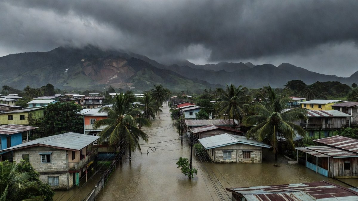
The Department of Environment and Natural Resources has warned 9,085 barangays across the country of possible landslides and flooding as the southwest monsoon or habagat continues to bring rains to Luzon. The warning, issued through the Mines and Geosciences Bureau, urges communities to check their vulnerability and stay alert as rains are expected to persist until next week.
What the DENR Warning Means for Barangays
The environment agency, through its Mines and Geosciences Bureau, urged thousands of barangays to check if their areas are vulnerable to landslides and floods. A full list of barangays with potential flood and landslide risks has been provided by the agency. The warning is valid until 8 p.m. on August 9. The agency urged the public to consistently check flood levels, immediately report signs of landslides, and inform authorities should they notice any cracks in their houses, especially those who live near the sea or in sloping areas. They advised checking hazards through the MGB Geohazard Portal and Hazard Hunter at hazardhunter.georisk.gov.ph.
In many communities, kapitbahay are already helping one another prepare sandbags and clear drainage near sari-sari stores and narrow streets where water often pools quickly.
Ordinary residents can access the MGB Geohazard Portal by entering their exact address or barangay name into the online map interface, which displays color-coded layers showing flood-prone zones and landslide susceptibility levels. Hazard Hunter works similarly by allowing users to generate a customized risk report that highlights whether an area falls into high or very high susceptibility categories based on slope, soil type, and historical data. These tools help families understand their exposure before heavy rains arrive, allowing them to plan relocations in advance rather than react during an emergency.
Knowing their hazard zone lets households prioritize actions such as elevating valuables or mapping routes to higher ground. Barangay captains play a central role by receiving official bulletins from the Mines and Geosciences Bureau and holding community meetings to explain the maps in local terms, often printing simplified versions for distribution to households without internet access. Local government units support this effort by integrating the hazard data into their disaster preparedness plans.
Human Stories Behind the Numbers
Weather systems have affected around 74,800 families or 261,000 people as of Saturday morning. Around 2,500 families are staying in 83 evacuation centers; about 2,200 individuals are being assisted outside evacuation centers. At least 63 areas have been reported flooded, most in Ilocos Region, Central Luzon and parts of Calabarzon. Families in these centers share stories of leaving homes at dawn, carrying children and a few belongings while tricycle drivers offered rides through rising waters.
Farmers in low-lying areas watch their fields turn into lakes, knowing that even a few more days of rain could wipe out months of work. Students in affected towns wonder when classes will resume, while jeepney drivers wait for roads to clear so they can return to earning for their households.
Updates from the Office of Civil Defense
Six people have reportedly died as tropical cyclones Luis and Maymay and the southwest monsoon brought days of heavy rains, flooding and landslides across parts of Luzon, per the Office of Civil Defense. Reported deaths still being validated include two in Rodriguez, Rizal; two in Benguet; and two in La Union. Seven injuries in Benguet are also being validated. OCD Deputy Administrator and Assistant Secretary Bernardo Rafaelito Alejandro IV gave the update on Dobol B TV Saturday, August 8.
Alejandro advised postponing trips to Baguio and other parts of the Cordillera, particularly Benguet, where landslides and rockslides have occurred. Local government units and the Department of the Interior and Local Government are working with barangays to keep evacuation centers ready and supply basic needs for displaced families.
PAGASA Rainfall Outlook and River Alerts
As of 8 a.m. on Friday, August 7, state weather bureau PAGASA said low pressure area Maymay had dissipated but issued a heavy rainfall outlook for the next three days in several areas. Up to 200 millimeters of rain may drench Zambales, Bataan and Occidental Mindoro; 50-100 mm forecast over Metro Manila, Ilocos Sur, La Union, Pangasinan, Abra, Benguet, Tarlac, Pampanga, Bulacan, Cavite, Batangas and Antique. PAGASA identified rivers and tributaries in the Marikina-Laguna de Bay basin that may be affected, including the upper and lower Marikina River, Pasig River, San Juan River, the main Laguna de Bay basin, Pagsanjan, Tanay, Morong, San Isidro, Biñan and San Juan rivers, and tributaries in Rodriguez, Marikina, San Mateo, Antipolo, Quezon City, Pasig, Cainta and Taytay.
Road and street flooding may occur due to accumulated rainwater, poor or clogged drainage and higher tide levels. Heavy rain may persist through the weekend; rainfall may be higher in mountainous and elevated areas; flood and landslide impacts may be worsened by rain that has already saturated the ground. A red rainfall warning was raised over Metro Manila and several Luzon areas at 2 p.m. Saturday, August 8.
How Communities Are Responding
Across Luzon, ordinary Filipinos are drawing on bayanihan to face the rains. In flooded barangays, neighbors help carry elderly residents to higher ground while sari-sari store owners share what little dry goods they have left. Evacuation centers buzz with activity as volunteers from local government units distribute meals and check on families who lost homes to landslides.
Students whose schools have turned into temporary shelters help watch over younger children, turning hardship into quiet acts of solidarity.
Families arriving at evacuation centers typically carry only essentials — clothing, cooking utensils, and important papers wrapped in plastic — leaving behind larger household goods that cannot be transported quickly. The Department of Social Welfare and Development coordinates with local government units to deliver standardized food packs containing rice, canned goods, and instant noodles along with family kits that include hygiene supplies and sleeping mats, though supplies can run low during extended periods of rain that stretch resources thin. Bayanihan becomes essential because neighbors pool labor to cook communal meals and rotate shifts watching over children.
Tricycle and jeepney drivers face immediate income loss when routes flood, forcing many to take temporary work clearing debris just to cover daily expenses. Market vendors who sell fresh produce watch their stocks spoil in humid conditions without refrigeration, while farmers in low-lying fields confront the prospect of entire harvests being submerged, leading to months of financial strain that affects school fees and medical needs. These disruptions show monsoon impacts extend beyond immediate safety into long-term economic recovery.
Broader Context of Philippine Weather Patterns
Maymay made landfall in Magsingal, Ilocos Sur before dawn on Thursday, August 6; exited the Philippine landmass that afternoon; weakened into a low pressure area on Friday. Tropical Depression Luis dissipated on August 4. Monsoon rains are expected to persist until next week. The Philippines is among the first major landmasses exposed to the Pacific cyclone belt and is hit by an average of 20 tropical cyclones each year, leaving millions vulnerable to weather-related disasters. Scientists have warned that human-driven climate change is making extreme weather events more frequent, prolonged and intense.
Typhoon Dolphin remained outside the Philippine area of responsibility, about 1,095 kilometers northeast of extreme Northern Luzon as of 3 a.m. Friday. DENR continues to remind residents near sloping areas and the sea to stay vigilant and use the available online tools to understand local risks.
The southwest monsoon often proves more destructive than a named storm because it can linger for days or even weeks without the clear structure of a typhoon, saturating soil and overwhelming drainage systems in ways that sudden passages do not. Climate change intensifies these risks by increasing atmospheric moisture, which leads to heavier downpours during monsoon episodes and raises the likelihood of flash floods in urban and rural settings alike. Geography and changing climate patterns mean communities must maintain year-round readiness, not just during peak typhoon months.
What Families Can Do to Stay Safe
Residents should first consult the MGB Geohazard Portal and Hazard Hunter by typing their barangay name to view detailed susceptibility maps that indicate high or very high risk zones for landslides and flooding. They must also monitor PAGASA updates on rainfall advisories, paying close attention to red, orange, and yellow warnings that signal escalating threats and help determine when to move to safer locations. A go-bag with birth certificates, medicines, a flashlight, water, and canned goods ensures quick departure if evacuation orders come.
Identifying the nearest evacuation center and practicing the route in advance reduces confusion during heavy rain. Families living near slopes or coastal areas need to report any new cracks in walls or ground movement to barangay officials right away so that assessments can be conducted before conditions worsen. Avoiding flooded streets and rivers remains critical, especially after dark when water depth is hard to judge, while staying tuned to local radio broadcasts and verified social media accounts from government agencies provides the most current instructions for each area.
By Bella Reyes, Staff Writer
This article was produced with AI-assisted research and editorial support. Reporting is based on sources cited in the article.
What's Your Reaction?
 Like
0
Like
0
 Dislike
0
Dislike
0
 Love
0
Love
0
 Funny
0
Funny
0
 Wow
0
Wow
0
 Sad
0
Sad
0
 Angry
0
Angry
0

Philippines/Southeast Asia Correspondent at Global1.News. Manila-based journalist covering Philippine politics, environment, maritime security, and social issues. Passionate about marine conservation and the communities protecting the Philippines' natural heritage.











Comments (0)