
Typhoon Chan-hom Makes Historic First-Ever Landfall in Japan's Ibaraki Prefecture
Folks, grab a seat, because Mother Nature just threw a curveball that has meteorologists scratching their heads and residents of eastern Japan bracing for impact. We are looking at a typhoon that has done something that has never, ever happened since records began — and it is happening right now, in real time, as we speak.
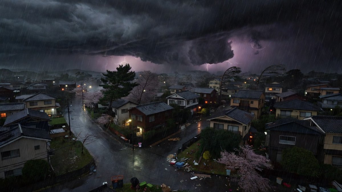
Folks, grab a seat, because Mother Nature just threw a curveball that has meteorologists scratching their heads and residents of eastern Japan bracing for impact. We are looking at a typhoon that has done something that has never, ever happened since records began — and it is happening right now, in real time, as we speak. This isn't just another storm; this is a history-making, statistically unprecedented event that flipped the script on everything we thought we knew about Pacific typhoons.
Typhoon Chan-hom Makes Historic First-Ever Landfall in Japan's Ibaraki Prefecture
Tokyo, Japan — article continues...
A Historic First for Ibaraki
At approximately 8:00 p.m. Japan Standard Time on Tuesday, August 11, 2026, Typhoon Chan-hom — officially designated Typhoon 15 — slammed into the southern coast of Ibaraki Prefecture. Now, I need you to understand the gravity of this moment. This is not just another landfall on a map. This is the first typhoon landfall in Ibaraki Prefecture since the Japan Meteorological Agency, or JMA, began keeping statistics back in 1951. That is 75 years of data, folks. Seventy-five years of storms tracking across the Pacific, and not a single one had ever made landfall in this specific prefecture until tonight.
Let that sink in for a second. We are witnessing something that has never happened in the lifetime of anyone reading this article. The JMA is calling it "statistically the first in history" — and in Japanese meteorological circles, that phrase, 統計史上初, carries enormous weight. This isn't hyperbole. This isn't media spin. This is a hard, verifiable fact from the agency that has been tracking these storms since the Truman administration was in the White House.
And here is the kicker, folks. This is the second typhoon to make landfall in Japan this year, following Typhoon 6 which hit Wakayama Prefecture back in June. But while that was notable, this one is in a completely different league. Ibaraki is not a place that gets hit. It is a place that watches other places get hit. And now, the rules have changed.
'Statistically the First in History'
Let me break down exactly what the JMA is telling us, because the language they are using is extraordinary. When the agency says this is "statistically the first in history," they are not being dramatic. They are being precise. Since 1951, the JMA has meticulously tracked every single typhoon that has made landfall anywhere in the Japanese archipelago. That is a massive dataset, compiled over decades, through multiple eras of meteorological science — from early radar systems to modern satellite imagery. And in all that time, Ibaraki Prefecture has remained untouched. Until tonight.
The Xinhua News Agency, reporting on the JMA's warnings, has confirmed that the agency is urging extreme caution against violent winds, high waves, and heavy rain. This is not a routine advisory, folks. This is a "drop everything and pay attention" moment. The JMA does not use language like "statistically the first in history" lightly. They are telling us that this storm is breaking the mold, and that means the standard playbook for how to prepare and respond may not apply.
What makes this even more remarkable is the track the storm took to get here. At 4:00 p.m. on Tuesday, just four hours before landfall, the typhoon was located approximately 110 kilometers east of Mito City, the capital of Ibaraki Prefecture. It approached from the Pacific Ocean, gathering strength over warm waters, and then made its historic landfall. The timing, the location, the trajectory — every single element of this storm's path is rewriting the meteorological record books.
10,000 Homes in the Dark
Now let's talk about the human impact, because that is what really matters here. TV Asahi News Station is reporting that more than 10,000 households in Ibaraki Prefecture have lost power. Ten thousand. That is not a rounding error. That is tens of thousands of people sitting in the dark, listening to the wind howl, wondering when the lights are going to come back on. And the outages are not confined to Ibaraki. The TEPCO Power Grid service area, which covers the entire Kanto region, is reporting outages across parts of Chiba, Saitama, Tokyo, and surrounding areas.
Fallen trees are being reported in multiple locations across the affected region. And here is a number that should make you sit up straight: in Kitaibaraki City, a maximum instantaneous wind gust of 29.3 meters per second was recorded. For those of you who don't speak meteorologist, that is roughly 65 miles per hour. That is not a breeze, folks. That is a force that snaps tree trunks, tears off roofing, and turns loose objects into projectiles.
The Yomiuri Shimbun is reporting that at least three people have been lightly injured by the strong winds. Three people. And while we are grateful that the injuries are not more severe, I want to emphasize that this storm is still in its early stages. The center of the typhoon passed near the Kanto region at around 9:00 p.m. JST, with a central pressure of approximately 985 hPa. That is a significant system, and it is not done with us yet.
The Danger Comes After the Center Passes
Here is where I need you to really pay attention, because this is the part that most people get wrong. When the eye of the storm passes, when the winds seem to die down, when the rain seems to let up — that is not the end. That is the intermission. Meteorologists are warning, in no uncertain terms, that winds and rain often intensify AFTER the center passes. This is what they call the dangerous backside of the storm, and it is where a lot of the real damage happens.
Think of it this way, folks. A typhoon is not a single event. It is a rotating system with multiple bands of intense weather. The center passes, and people breathe a sigh of relief. They step outside. They start assessing the damage. And then the backside hits, and it hits hard. The JMA is explicitly warning that rain and wind can strengthen on the back side of the storm, and they are urging caution even after the center has moved through.
This is not theoretical. This is a well-documented phenomenon in tropical meteorology. The backside of a typhoon often brings the heaviest rainfall because of the way the storm's circulation interacts with the surrounding environment. And with the ground already saturated from the initial bands, the risk of landslides, flooding, and river rises goes up exponentially. The JMA is not being cautious for the sake of being cautious. They are being cautious because they know what is coming.
A Rare East-to-West Crossing
Now let's talk about the elephant in the room — or rather, the path of the elephant. Typhoon Chan-hom is doing something that has drawn the attention of meteorologists around the world. It is crossing the Japanese archipelago from east to west. That is a "westward traverse" across Honshu, the main island of Japan. And folks, that is not how these storms usually work.
Typically, typhoons that hit Japan come from the south or southwest, moving north or northeast. They form in the warm waters of the western Pacific, track northwest, and then curve northward as they approach the Japanese coast. That is the standard playbook. That is what the models are built to predict. But Chan-hom is not reading the playbook. It came from the Pacific, hit Ibaraki on the east coast, and is now moving westward across the island. This is an atypical path, and it is causing serious concern among forecasters.
Why does the path matter? Because it changes the risk profile. When a typhoon crosses from east to west, it affects areas that are not typically in the crosshairs. It brings heavy rain and wind to regions that may not have the same level of preparedness. It also means that the storm is interacting with the terrain of Honshu in ways that are less well-understood, making predictions about rainfall and wind intensity more uncertain. Weathernews and tenki.jp, the Japan Weather Association, are both highlighting this unusual track as a key factor in their forecasting.
Warnings Through August 12
The JMA is not mincing words about the timeline here. They are issuing warnings for violent winds, high waves, and heavy rain that extend through August 12. That is not just tonight, folks. That is tomorrow. And the warnings are specific: the agency is warning of landslides, flooding, and river rises across the Pacific side of the Kanto and Tohoku regions. These are not generic advisories. These are targeted, specific warnings for specific geographic areas.
Let me translate what that means for the people on the ground. Landslides mean hillsides giving way. Flooding means water rising into homes and businesses. River rises mean waterways that are normally calm turning into raging torrents. And all of this is happening in areas that are not used to dealing with typhoon impacts. The infrastructure, the emergency services, the residents — they are all being tested in ways they have never been tested before.
The Asahi Shimbun and Nikkei are both reporting on the severity of these warnings, and the message is consistent: do not let your guard down. The center of the storm may have passed, but the danger has not. The JMA is explicitly urging caution even after the center passes, because the back side of the storm can bring renewed intensity. This is not a drill, and it is not a time for complacency.
What Travelers and Families Should Know
Now, I know a lot of you reading this are not in Japan. But I also know that many of you have family there, or friends, or business connections. And I know that some of you are planning travel to the region. So let me give you the straight talk on what you need to know.
If you have loved ones in the Kanto or Tohoku regions, reach out to them now. Not tomorrow. Now. Check on their safety, and make sure they understand the risk of the backside of the storm. If they are in an area prone to landslides or flooding, encourage them to stay indoors and away from windows. If they have lost power, remind them to use flashlights instead of candles, and to keep their phones charged in case of emergency.
If you are planning to travel to Japan in the next 48 hours, check with your airline and your hotel. Expect disruptions. Expect delays. Expect cancellations. The transportation network in the affected regions is going to be dealing with fallen trees, flooded roads, and power outages. And if you are already in Japan, do not — I repeat, do not — go sightseeing in the affected areas. This is not a time for adventure. This is a time for common sense.
The JMA's warnings are clear, and they are based on data. The storm is historic. The path is unprecedented. And the danger is real. Treat it that way.
The Bottom Line
Folks, here is the bottom line. We are watching a storm that has broken a 75-year statistical streak. Typhoon Chan-hom has made landfall in a place that has never seen a typhoon landfall. It has knocked out power to more than 10,000 households in Ibaraki alone, with more outages across the Kanto region. It has injured at least three people. And it is not done yet.
The JMA is telling us that the danger is not over when the center passes. The backside of the storm is coming, and it can be worse than the front. Landslides, flooding, river rises — these are the threats that are going to unfold over the next 24 hours. And because this storm is following an unprecedented east-to-west track, we are in uncharted territory.
So here is what I need you to do. If you are in the affected areas, stay safe. Stay indoors. Stay informed. Listen to local authorities. Do not let your guard down just because the wind seems to have died. If you have family or friends in Japan, reach out to them. If you are planning travel, be flexible and be prepared. And for everyone else, keep an eye on this story, because it is not over.
This is what climate change looks like, folks. This is what unprecedented means. And this is a moment where we all need to pay attention, because the rules are changing, and we need to change with them. Stay safe, stay smart, and stay tuned. We will be watching this storm every step of the way.
This article was produced with AI-assisted research and editorial support. Sources: Japan Meteorological Agency, Xinhua News Agency, Asahi Shimbun, Nikkei, Yomiuri Shimbun, TV Asahi News Station, Weathernews, tenki.jp.
By Jessica Ali, Staff Writer
===SUMMARY=== Typhoon Chan-hom made historic first-ever landfall in Japan's Ibaraki Prefecture, breaking 75 years of records. Over 10,000 homes lost power, injuries reported, and dangerous backside of storm threatens landslides and flooding through August 12.What's Your Reaction?
 Like
0
Like
0
 Dislike
0
Dislike
0
 Love
0
Love
0
 Funny
0
Funny
0
 Wow
0
Wow
0
 Sad
0
Sad
0
 Angry
0
Angry
0

Editor-in-Chief at Global1.News. Atlanta-based journalist who cuts through the BS and tells it like it is. Lead anchor, host, and the voice you hear when the spin stops and the truth starts.













Comments (0)