
Champi Becomes a Typhoon and Guam Goes to COR 1 Hours Before a Category 3 Pass
Typhoon Champi became a typhoon on Saturday and kept intensifying as it closed on Guam, where the governor placed the island in its highest readiness condition. Forecasters expect a Category 3 pass overnight, and the Philippines is watching a storm that may arrive as Rosal.

Typhoon Champi strengthened into a typhoon on Saturday and kept intensifying as it closed on Guam. Governor Lourdes A. Leon Guerrero placed the island in Condition of Readiness 1 at 1 p.m., hours before forecasters expect a Category 3 pass. Folks on Guam have until sunset to be in a safe shelter.
Champi Becomes a Typhoon and Guam Goes to COR 1 Hours Before a Category 3 Pass
Hagatna, Guam — Champi is a typhoon, and Guam is at its highest readiness level. The storm is forecast to pass just south of or over southern Guam late Saturday night into Sunday morning as a Category 3 typhoon, and officials say all of Guam will feel typhoon-force conditions.
The Storm That Strengthened Twice in One Afternoon
Champi began as a disturbance the National Weather Service in Guam tracked on 14 October as Invest 96W, northeast of Pohnpei. The Joint Typhoon Warning Center issued its first warning on 29W that day, and the Japan Meteorological Agency upgraded the system to Tropical Storm Champi on 15 October.
The name was contributed by Laos and means "red jasmine flower" in the Lao language. Orbis Weather describes Champi as the 30th named storm of the 2026 Pacific season. At 3:06 p.m. ChST on Saturday, the National Weather Service office in Tiyan posted a blunt headline: "CHAMPI UPGRADED TO TYPHOON AND BARRELING TOWARD THE MARIANAS." The same office described the storm as "undergoing a period of rapid intensification."
The upgrade came in stages across the day. The National Weather Service local statement at 1 p.m. put the centre near 12.5N 148.0E, about 225 miles east-southeast of Guam, moving west-northwest at 18 mph, and stated: "Storm intensity has increased to 100 mph, making it a Category 2 typhoon." At 7 a.m. the same storm had carried 85 mph winds. Brandon Aydlett, science and operations officer for the weather service in Tiyan, said rapid intensification had begun. "We're looking at an intensifying Category 3 typhoon as it passes near Guam," he said.
Guam Moves to Condition of Readiness 1
Governor Leon Guerrero placed Guam in Condition of Readiness 1 as of 1 p.m. Saturday. The Joint Information Center released the order with a single instruction: "Remain indoors until COR 4." Guam had been in COR 2 as of 6 a.m., and the move to COR 1 had been announced earlier in the morning for 1 p.m.
Under Guam Homeland Security's own scale, COR 1 means damaging winds of 39 mph or more are expected within 12 hours, and only emergency personnel and vehicles should be outside. Joint Region Marianas and its installations transition to TCCOR 1 at 3 p.m. Saturday. The All Hazards Alert Warning System sirens will broadcast emergency instructions during the storm.
The Joint Information Center said southern Guam is expected to be severely impacted, and that all residents must be in a safe shelter before sunset, remaining indoors in a secured, concrete-reinforced shelter.
A Category 3 Pass, South of or Over the Island
The National Weather Service is explicit about the track: "This general forecast track will take Champi just south of Guam as a Category 3 typhoon as it intensifies further the next few days." The Joint Information Center frames the same track slightly wider: "On its current track, Champi is expected to pass either just south or over southern Guam late Saturday night into Sunday morning as a Category 3 typhoon."
Stars and Stripes reports that the Joint Typhoon Warning Center's latest forecast track shows Champi clipping the southern edge of the island early Sunday morning. The warning centre projects the storm to rumble over southern Guam at around sunrise Sunday as a Category 3-equivalent typhoon, with 120-mph sustained winds and 145-mph gusts at the centre.
The exact point of closest approach is not settled, and the storm has not made landfall anywhere. The Joint Information Center defines the expected category plainly: "CAT-3 means 111 to 129 mph sustained winds, with wind gusts 140 to 164 mph possible." It adds: "All of Guam will experience Category 3 typhoon force conditions."
Six Shelters, 1,964 Beds and a Hard Sunset Deadline
The Guam Department of Education opened five Emergency Evacuation Centers at 10:00 a.m. Saturday, with space for up to 1,964 people. Capacity is limited at each site: Machananao Elementary School 334, Astumbo Elementary School 287, Maria A. Ulloa Elementary School 349, George Washington High School 683 and Talofofo Elementary School 311.
A sixth center opened at Inalåhan Middle School for the southern region, ready to receive residents at 2:00 p.m. Its capacity had not been determined. Households are told to bring a seven-day supply of food and water per person, bedding, hygiene products, medications, infant supplies, photo ID and important documents.
Registration is required on arrival, children must be supervised at all times, and alcohol, drugs, weapons, pets and cooking devices are barred. Occupants must remain until authorities declare it safe to leave. The Joint Information Center added one warning of its own: "Do not stay in a metal roof or container home."
The American Red Cross is opening 13 shelters of its own and says more than 150 people from the US mainland are travelling to the region to help. It calls Champi the third strong typhoon to hit the region since April, after Super Typhoon Sinlaku and Super Typhoon Bavi, and says many families are still living in tents that must be taken down before the storm.
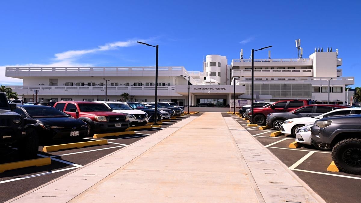
Guam Memorial Hospital's emergency department stays open around the clock, and the Southern Region Community Health Center will handle minor and non-life-threatening injuries.
What Guam Is Being Told to Expect
The National Weather Service impact figures, carried by Pacific Daily News, project 12 to 20 inches of rain for Guam, peak winds of 105 to 120 mph with gusts to 155 mph Sunday morning, surf up to 35 feet and coastal inundation of 5 to 7 feet. Rota is projected at 10 to 15 inches of rain and gusts to 115 mph. Tinian and Saipan are projected at 4 to 6 inches and gusts to 80 mph.
The marine message warns of "significant sea heights reaching as high as 35 feet during closest passage of Champi." The Joint Information Center calls the coastal inundation "life-threatening" and advises southern villages to evacuate from coastal and flood-prone areas.
The timing has moved during the day, and both versions are on the record. Release No. 4 put damaging winds of 39 mph or more "as early as 8 p.m. tonight" and typhoon-force winds "as early as 5 a.m. Sunday." Release No. 7, hours later, put damaging winds "by this early evening" and typhoon-force winds "as early as 6 a.m. Sunday."
Forecasters also warned that a sudden calm would not mean the storm had passed. Tents, canopies, tarps and wooden shelters will not protect anyone from typhoon-force winds, and if the centre crosses the island the far side of the eyewall can arrive soon after the eye.
The Ports Are Already Shut to Normal Work
The Captain of the Port set Port Heavy Weather Condition ZULU for the Ports of Guam and the Northern Marianas, including Saipan, Tinian and Rota, as of 0700 on 17 October. The US Coast Guard had set Port Condition YANKEE on 16 October.
The National Weather Service marine precaution is direct: "Prepare for the passage of a typhoon Sunday morning. Secure all vessels. Conditions are expected to be catastrophic for small craft, and extremely dangerous for any vessels of larger size." It adds: "Destructive winds will produce dangerous seas that could damage, capsize or sink vessels, along with drastically reducing visibilities in heavy rain."
Dangerous sea conditions may continue into Monday. A Typhoon Warning is in effect for Guam and Rota and the adjacent waters. A Tropical Storm Warning and a Typhoon Watch are in effect for Tinian and Saipan. A Flood Watch covers all of Guam and the Northern Marianas, with a coastal flood watch and high surf warning for Guam and Rota.
Why Manila and Guam Quote Different Wind Speeds
PAGASA and the US National Weather Service are describing the same storm with two measuring conventions, and the gap between their numbers is a product of averaging time, not disagreement about the system. PAGASA reported maximum sustained winds of 140 km/h near the centre at 3 a.m. on 17 October, averaged over ten minutes.
The National Weather Service and the Joint Typhoon Warning Center reported 100 mph, about 161 km/h, at 1 p.m. ChST, averaged over one minute. A one-minute average is routinely higher than a ten-minute average for the same storm. Neither figure is wrong; the two describe the same system.
The distinction matters for readers comparing headlines across the Pacific. The Joint Typhoon Warning Center expects sustained winds near 240 km/h by Tuesday.
The Philippines Is Watching, Not Yet Warning
Champi remains outside the Philippine area of responsibility, and PAGASA has raised no tropical cyclone wind signal. In its 4:00 a.m. bulletin, PAGASA placed the centre at 2,675 km east of Eastern Visayas, at 11.9N 150.0E, moving west-northwestward at 25 km/h with gustiness up to 170 km/h.
PAGASA says the typhoon may enter the Philippine area of responsibility by Tuesday. Its trough, or extension, may bring rains over parts of Visayas and Mindanao as early as Monday. Weather specialist Daniel James Villamil said cloudy skies with scattered rains are expected from the trough in those areas as early as Monday.
Once inside the Philippine area, the storm will be assigned the local name Rosal. ABS-CBN News reports it would be the first storm in the country this October and the 18th overall this year. PAGASA advises the public to "continuously monitor updates on this weather disturbance, as its forecast tracks and intensity will still change."

Rosal's Track Points Away From a Landfall
The projected track keeps the storm offshore. ABS-CBN News reports: "The potential super typhoon is less likely to make landfall over any part of the country. Current projections indicate it will move northwestward over the Philippine Sea toward Ryukyu Islands or Taiwan before the end of next week."
The same report adds: "However, the trough or extension of the tropical cyclone may affect the eastern sections of Luzon and Visayas." Orbis Weather assessed on 17 October that Champi "is not a threat to any Southeast Asian country today." No Philippine evacuation has been ordered and no wind signal has been raised.
ABS-CBN describes the storm as possibly entering the Philippine area "as a super typhoon," the highest tier on PAGASA's wind classification. It has not yet been classified as one. Forecasters project strengthening, but the super typhoon label remains a forecast, not a current status.
What the Next Seventy-Two Hours Look Like
Saturday evening: damaging winds of 39 mph or more are expected by early evening, and all residents are to be in shelter before sunset. Conditions were forecast to begin deteriorating by noon.
Sunday morning: typhoon-force winds of 74 mph or more are expected as early as 6 a.m., with the centre passing just south of or over southern Guam around sunrise. Peak winds of 105 to 120 mph with gusts to 155 mph are projected. The National Weather Service warns that "any deviation north could bring worse conditions over Rota, Tinian, and Saipan."
Sunday night into Tuesday: damaging winds continue into at least Sunday night, possibly longer, and dangerous seas may persist into Monday. The storm then tracks northwest over the open Pacific, toward the Ryukyu Islands or Taiwan, and may enter the Philippine area of responsibility as Rosal. The Joint Information Center hotline is (671) 478-0210, (671) 478-0208 and (671) 478-0209.
By Jessica Ali, Staff Writer
This article was produced with AI-assisted research and editorial support. Sources: the Guam Joint Information Center (Releases No. 4 and No. 7), the US National Weather Service office in Tiyan, Guam, the Philippine Atmospheric, Geophysical and Astronomical Services Administration (PAGASA), the Philippine Daily Inquirer, Philstar.com, ABS-CBN News, Stars and Stripes, Pacific Daily News and Guam News Network.
What's Your Reaction?
 Like
0
Like
0
 Dislike
0
Dislike
0
 Love
0
Love
0
 Funny
0
Funny
0
 Wow
0
Wow
0
 Sad
0
Sad
0
 Angry
0
Angry
0

Editor-in-Chief at Global1.News. Atlanta-based journalist who cuts through the BS and tells it like it is. Lead anchor, host, and the voice you hear when the spin stops and the truth starts.














Comments (0)