
Satellite Images Expose Widespread Destruction Across Gaza Amid Fragile Ceasefire
New satellite imagery released by Al Jazeera English on 29 September 2026 offers a stark visual account of the devastation that has unfolded in Gaza since the conflict intensified.
New satellite imagery released by Al Jazeera English on 29 September 2026 offers a stark visual account of the devastation that has unfolded in Gaza since the conflict intensified. The high‑resolution pictures, captured from space, reveal entire neighbourhoods reduced to rubble, coastlines littered with makeshift shelters, and iconic institutions erased from the map. While the images cannot convey the human suffering that underlies the destruction, they provide an undeniable record of how the landscape of Gaza has been reshaped by a war that continues despite a fragile ceasefire.
The Scope of Destruction Seen From Space
The satellite photographs show that the scale of destruction stretches for kilometres across the territory. In several sectors, the devastation spans roughly four kilometres, a distance that can be measured directly on the images. This breadth of damage has grown even as a ceasefire, brokered by the United Nations and other actors, was meant to pause hostilities.
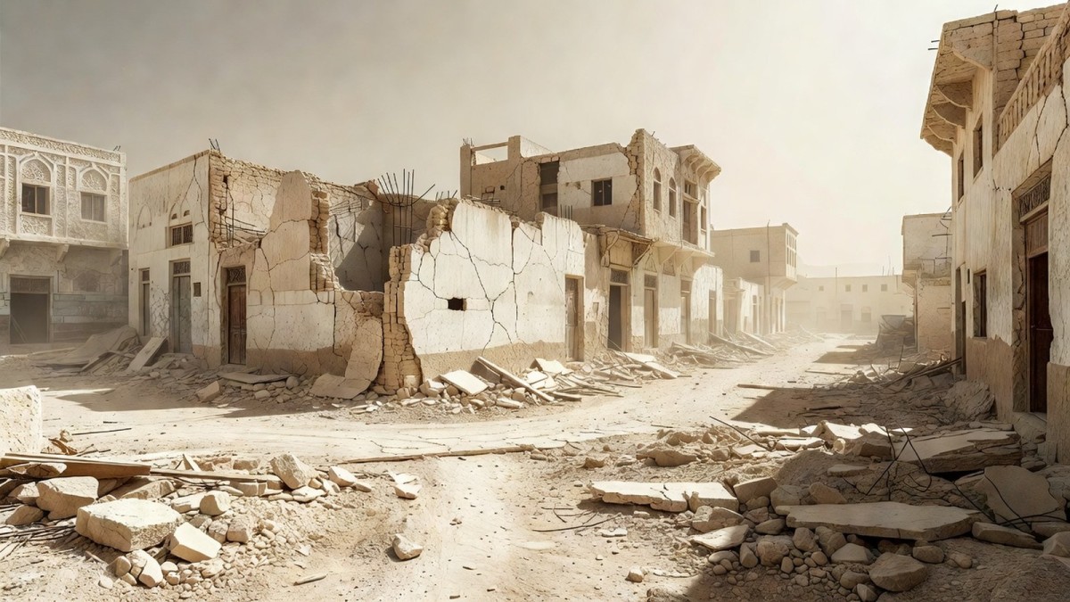
Comparisons with earlier images taken in 2022 highlight the dramatic transformation of the built environment. In the southern city of Rafah, whole sections that once housed homes and businesses have been completely erased. The satellite view makes it clear that the changes are not isolated incidents but part of a broader pattern of urban flattening.
Gaza City, the administrative and cultural heart of the enclave, shows a similar story of loss. The Islamic University of Gaza, once a cornerstone of higher education and a symbol of resilience, now appears as a field of debris. The university’s campus, which previously featured multiple buildings and green spaces, is reduced to a scar on the ground, underscoring the depth of the conflict’s impact on civil society.
Ceasefire and the Continuing Rise in Damage
According to the United Nations Satellite Centre, the number of destroyed structures grew by nine percent during the period following a US‑brokered truce that began nearly a year earlier. This increase occurred despite the truce’s intention to halt active combat. The satellite data therefore suggest that the ceasefire has not translated into a measurable reduction in physical destruction on the ground.
The timing of the new images coincides with a period when the ceasefire was being tested. The footage captured by Al Jazeera’s correspondents indicates that the destruction has continued to expand, reinforcing concerns that the truce is fragile and that hostilities may have resumed in certain sectors.
These observations raise questions about the effectiveness of diplomatic efforts to protect civilian infrastructure. While the UN Satellite Centre’s figures provide a quantitative glimpse, the satellite images themselves offer a visual confirmation that the war’s footprint is still growing, even under the banner of a ceasefire.
Human Displacement and the Rise of Temporary Shelters
The satellite view also captures the proliferation of temporary shelters that now dominate much of Gaza’s coastline and urban areas. Rows of tents and makeshift structures have sprung up in places that once hosted bustling markets, schools, and homes. In Gaza City, the port—once the lifeblood of the local fishing industry—has been overtaken by these temporary encampments.
These shelters are a direct response to the forced displacement of 1.9 million Palestinians, a figure highlighted in the Al Jazeera report. The sheer number of displaced individuals underscores the humanitarian crisis that has unfolded alongside the physical destruction. The satellite images do not show the people themselves, but the scale of the shelter clusters hints at the magnitude of the population that has been uprooted.
Beyond the visual evidence, the displacement figures illustrate how the conflict has reshaped daily life for nearly half of Gaza’s residents. Families that once lived in permanent homes now rely on tents for shelter, schooling, and basic services, a shift that will have long‑term social and economic repercussions for the enclave.
Impact on Education and Cultural Institutions
The reduction of the Islamic University of Gaza to rubble is more than a loss of bricks and mortar; it represents a blow to the educational aspirations of an entire generation. The university had served as a hub for research, cultural exchange, and professional training. Its destruction signals a broader assault on the intellectual infrastructure of Gaza.
Other cultural landmarks, though not detailed in the satellite imagery, are likely to have suffered similar fates given the pattern of widespread demolition. The loss of such institutions erodes community cohesion and hampers the ability of Gazans to rebuild after the conflict ends.
Al Jazeera’s correspondent Lina Abu Akleh notes that the images, while silent on the human cost, reveal the scale of the transformation. The visual disappearance of a university campus serves as a stark reminder that the war is not only reshaping streets and buildings but also the future prospects of the people who once walked those corridors.
Environmental Consequences of Urban Ruin
From an environmental perspective, the flattening of urban areas and the spread of temporary shelters have immediate and longer‑term implications. The removal of concrete structures and the exposure of soil can lead to increased dust and particulate matter in the air, exacerbating health risks for residents already living in cramped conditions.
The port’s conversion from a functional fishing hub to a field of tents also disrupts marine ecosystems. Fishing activities that once sustained local livelihoods have been halted, potentially altering fish populations and the broader coastal ecology.
While the satellite images do not capture vegetation loss directly, the extensive demolition of built environments often coincides with the removal of green spaces, further reducing urban resilience to heat and flooding. In a region already vulnerable to climate stressors, the added environmental degradation compounds the challenges faced by Gaza’s population.
International Implications and the Role of Satellite Monitoring
The release of these satellite images by Al Jazeera underscores the growing importance of remote sensing in conflict monitoring. By providing an objective visual record, satellite imagery can serve as a tool for accountability, allowing international bodies and civil society to verify claims of destruction and displacement.
The United Nations Satellite Centre’s involvement in estimating the increase in destroyed structures demonstrates how multilateral institutions are integrating space‑based data into their assessments. This partnership between media outlets and UN agencies enhances transparency, especially in conflict zones where access on the ground is restricted.
However, the images also reveal the limits of remote monitoring. While they capture the physical footprint of the war, they cannot convey the human stories, the trauma, and the daily struggles of those living among the ruins. The visual evidence must therefore be paired with on‑the‑ground reporting, humanitarian assessments, and political analysis to form a comprehensive picture of the crisis.
By Elena Vasquez, Staff Writer
This article was produced with AI-assisted research and editorial support. Reporting is based on the source material cited below. Sources: Al Jazeera English video report (29 September 2026); Al Jazeera English; Global1.News
What's Your Reaction?
 Like
0
Like
0
 Dislike
0
Dislike
0
 Love
0
Love
0
 Funny
0
Funny
0
 Wow
0
Wow
0
 Sad
0
Sad
0
 Angry
0
Angry
0

Latin America Correspondent at Global1.News. Based in Mexico City, covering politics, economics, energy, and culture across the region. Brings an on-the-ground perspective to stories spanning from the Rio Grande to Patagonia.














Comments (0)