
Nor'easter Shuts Outer Banks Highway as New Jersey Declares State of Emergency
A slow-moving nor'easter forced New Jersey to declare a state of emergency, closed a 16-mile stretch of N.C. Highway 12 on the Outer Banks and drove coastal flood warnings from Virginia to New England.
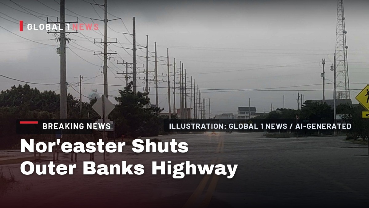
A slow-moving nor'easter is crawling north along the US East Coast, forcing New Jersey to declare a State of Emergency and closing a 16-mile stretch of North Carolina's N.C. Highway 12. The National Weather Service has issued coastal flood warnings from New Jersey through southern Connecticut, warning of flooding across several high-tide cycles into Sunday. The most severe impacts are expected Friday night through Sunday. The storm began affecting the Carolinas on Wednesday.
Nor'easter Shuts Outer Banks Highway as New Jersey Declares State of Emergency
Outer Banks, North Carolina — The storm has already carved up this stretch of coastline, and forecasters say the worst is still ahead.
A September Storm Nobody Expected This Early
A nor'easter in September is an early-season rarity. The FOX Forecast Center's historical analysis places the unofficial nor'easter season from September through April, peaking in December and January, when temperature contrasts across the coast are at their sharpest.
This system arrived anyway, spinning up off the East Coast and crawling north. NOAA's GOES-East satellite captured imagery of the storm. It is not a tropical storm. FOX Weather hurricane specialist Bryan Norcross said that if the system sat and spun over the extra-warm ocean off the Mid-Atlantic it would have a good chance of evolving into a tropical storm. But the ocean temperature under the stalled nor'easter is in the 60s to near 70, normally too cool for significant tropical development.
Nor'easters typically develop within a few hundred miles of the coastline, often between Georgia and New Jersey, and pick up moisture from the warm waters of the Gulf Stream. NOAA defines a nor'easter as a storm named for the northeast winds that blow across the Mid-Atlantic and New England.
This one is a rain event, not a snowstorm, despite landing in late September.
Why This Storm Will Not Leave
The storm is stalled, and that is the problem. The FOX Forecast Center's model shows wind gusts through Monday topping out between 60 and 70 mph in exposed coastal zones such as Atlantic City and Boston.
Seas off the coast could build to 8 to 20 feet, the National Weather Service said. ABC News reported waves up to 19 feet have already been recorded along North Carolina's Outer Banks.
Rainfall totals will be broad. A swath of 3 to 5 inches is expected from the Jersey Shore up through New York City, Long Island, coastal Connecticut and Rhode Island into eastern Massachusetts, per the FOX Forecast Center. The highest totals are slated for exposed coastal areas like Montauk and Boston, where localized rain could reach 5 to 8 inches.
FOX Forecast Center meteorologists say the storm is following a similar track to Sandy toward the Mid-Atlantic and New England, but the two are fundamentally different in both power and structure.
The Outer Banks Take the First Blow
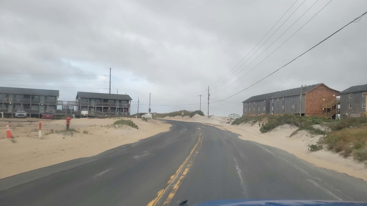
The North Carolina Department of Transportation closed N.C. Highway 12 between the Marc Basnight Bridge and Rodanthe after Thursday morning's high tide breached a dune at the Pea Island Visitor Center, causing major ocean overwash.
NCDOT's initial Thursday assessment found approximately 500 feet of undermined or broken pavement near the Pea Island Visitor Center. That assessment was made before Thursday night's high tide brought additional overwash. On Friday, NCDOT reported heavy overwash and thick sand deposits that made it impossible to immediately assess the full extent of structural pavement damage underneath the water.
Weather.com reported a 16-mile stretch of N.C. 12 closed in both directions, from Sea Oats Drive to Oregon Inlet Road in Dare County. There was no estimate Friday morning for when the closed section would reopen.
An NCDOT live camera captured a large crack forming on N.C. 12 near the Pea Island Visitor Center, just north of Rodanthe, around 8 a.m. Thursday. A state vehicle was struggling to pass.
Two More High Tides Before This Is Over
Friday's oceanfront high tides on the Outer Banks are around 7 a.m. and 7:30 p.m., with overwash possible for several hours on either side of high tide. More tide cycles follow.
Hatteras and Ocracoke islands remain under a Coastal Flood Warning through 11 p.m. Friday. Forecasters said 2 to 4 feet of inundation above ground level is possible in vulnerable oceanside areas, with up to 1 foot of soundside flooding possible from Buxton southward and westward and on Ocracoke.
Breaking waves of 10 to 15 feet are forecast along Hatteras Island, where a High Surf Advisory remains in effect through 8 p.m. Saturday. A Wind Advisory remained in effect through 8 p.m. Friday for the Dare County beaches, with north winds of 25 to 30 mph gusting to 50 mph.
Winds recorded: a 55 mph gust in Avon on Thursday evening, gusts to 48 mph in the Rodanthe-Waves area, and 47 mph in Buxton, Frisco and near Ocracoke. Minor soundside flooding returned to Hatteras village Friday morning, including along Eagle Pass Road. Minor soundside flooding was also reported in Ocracoke village.
New Jersey Declares a State of Emergency
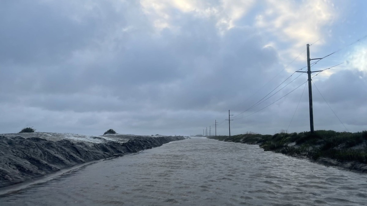
New Jersey Governor Mikie Sherrill declared a State of Emergency across eight counties effective 5:00 p.m. Friday, under Executive Order No. 25. The counties are Atlantic, Burlington, Cape May, Cumberland, Middlesex, Monmouth, Ocean and Salem.
The order activates the State Emergency Operations Center, coordinating the New Jersey State Police, Department of Environmental Protection, Department of Transportation and county Offices of Emergency Management to share real-time information, deploy resources and respond to storm-related emergencies. The governor's office said the eight named counties face the greatest risk.
Governor Sherrill said: "Starting tonight, this nor'easter is expected to bring damaging winds, heavy rain, significant coastal flooding, and resulting beach erosion, with these eight counties facing the greatest risk."
She added: "We are focusing state resources where the storm is expected to hit hardest, while closely monitoring conditions across New Jersey and standing ready to respond wherever needed should other counties reach out."
Manasquan Tells Its Residents to Leave
Manasquan officials issued a voluntary evacuation notice, Tier 1, ahead of a Coastal Flood Warning. All three primary beach access roads, including Main Street and Ocean Avenue, are expected to become impassable for several hours across multiple tide cycles, severely restricting access to and from the beachfront. Major inundation is expected in the community from Friday evening through Sunday morning.
Manasquan Mayor Michael Mangan said: "There's going to be a lot of water in the streets for a long time. So we need people to prepare accordingly."
The Manasquan community is described by FOX Weather as no stranger to flooding, but the storm's impacts threaten waterfront homes. Coastal Flood Warnings in New Jersey and Delaware were extended until 2 p.m. Saturday, with 1 to 2 feet of inundation forecast in low-lying shoreline and tidal-waterway areas, widespread roadway flooding and possible damage to vulnerable structures.
High Surf Advisories for the Jersey Shore and Delaware beaches remained in effect through 8 p.m. Saturday, with breaking waves up to 12 feet. A High Wind Watch covered exposed coastal areas from Friday evening through Saturday afternoon, when northerly gusts up to 60 mph were possible.
New York City Moves the Forecast Closer
The National Weather Service updated the storm's expected track farther west and closer to New York City. Forecasts now call for 2 to 3 inches of rain citywide, up from approximately 1 to 1.5 inches, with locally higher amounts possible. Wind gusts are now expected to reach 40 to 50 mph, with the strongest winds from Friday night through Saturday night.
Mayor Zohran Kwame Mamdani and New York City Emergency Management issued a Travel Advisory from 2 p.m. Friday through the morning of Sunday. Coastal flooding is expected during the Friday evening and Saturday morning high tides. Moderate coastal flooding is possible in southern Queens, including the Rockaways and around Jamaica Bay, and along portions of the Staten Island and Brooklyn shorelines. Minor to moderate flooding is possible around Flushing Bay, with minor flooding expected near the Battery. Coastal Flood Watches covered parts of New York City and Long Island for the high tides from Friday evening into Saturday, with an increasing risk of major flooding at some locations around the South Shore bays of Long Island.
Mayor Mamdani said: "The forecast path of this storm has moved closer to our city, and it is bringing more rain and stronger winds with it."
NYCEM Commissioner Christina Farrell said the city is watching the Friday evening and Saturday morning high tides, especially in the Rockaways, around Jamaica Bay and along the Staten Island and Brooklyn shorelines.
Norfolk Is Already Underwater
The National Weather Service office in Wakefield extended the Coastal Flood Warning for Norfolk, Portsmouth, Suffolk, Chesapeake, Hampton and Poquoson until 11 a.m. EDT on Saturday, with 2 to 3 feet of inundation above ground level expected in vulnerable shoreline and tidal-waterway areas. Numerous road closures are possible and homes and businesses are threatened.
Wakefield reported widespread moderate to locally major tidal flooding expected to continue through Friday night at most locations, with some sites around the middle Chesapeake Bay possibly seeing moderate coastal flooding into Saturday or Sunday.
In Norfolk, repeated high-tide cycles flooded roads and disrupted municipal operations. Drone video captured cars stalled in floodwaters after sunset.
A high wind warning is in effect along the Atlantic coasts of New Jersey and Delaware, where gusts could reach 60 mph. The National Weather Service has issued coastal flood warnings for parts of New Jersey, New York City, Long Island and southern Connecticut, warning the storm could trigger flooding through several high-tide cycles into Sunday.
The Weekend, Cancelled
The 2026 Global Citizen Festival, scheduled for Saturday on Central Park's Great Lawn, was canceled in consultation with the City of New York and local officials because of the incoming nor'easter.
The three-day All Things Go NYC festival at Forest Hills Stadium was canceled after organizers consulted local officials, venue leaders and weather advisers over severe weather conditions including high winds. The Oceans Calling Festival in Ocean City, Maryland, a three-day event, was canceled after beach erosion disrupted preparations at the site. Attendees who had already arrived were urged to stay safe as storm impacts moved into the resort town.
The New York Renaissance Faire in Tuxedo Park announced it will be closed both Saturday and Sunday. The Greenport Maritime Festival on Long Island was postponed until October. The St. Jude Walk Boston moved Saturday's event indoors. The Tunnel to Towers 5K was, at the time of reporting, still scheduled to go ahead.
Forbes reported that the Federal Aviation Administration's operations plan from 2 p.m. EDT on Friday cited winds as the reason for ground delays at LaGuardia and Kennedy airports Friday afternoon, with a potential ground delay at Newark.
What to Do Before Tonight's High Tide
Governor Sherrill urged residents to prepare: "I urge all New Jerseyans to take this storm seriously, stay safe, and be prepared. Please charge your phones, secure loose items outside, stock up on food and water, and stay off the roads if possible."
She also warned: "Do not drive through flooded-out roads. We've had too many people have to rescue people from these flooded-out roads and damage to the cars."
New York City issued preparedness guidance with its advisory: never drive around traffic barricades; secure outdoor furniture, grills, planters and garbage cans including items on balconies, rooftops and patios; during strong winds stay away from trees, power lines, scaffolding and construction sites; charge phones and devices and register electrically powered medical equipment with your utility.
Residents should check on neighbors who may need help, especially older adults, people with disabilities and anyone living in a basement or low-lying home. Anyone attending an outdoor event this weekend should check with organizers for schedule changes. Call 911 if in immediate danger, report non-emergency issues to 311.
By Jessica Ali, Staff Writer
This article was produced with AI-assisted research and editorial support. Sources: the National Weather Service, the North Carolina Department of Transportation, Cape Hatteras National Seashore, Island Free Press, weather.com, FOX Weather, Forbes, ABC News, and the offices of New Jersey Governor Mikie Sherrill and New York City Mayor Zohran Kwame Mamdani.
What's Your Reaction?
 Like
0
Like
0
 Dislike
0
Dislike
0
 Love
0
Love
0
 Funny
0
Funny
0
 Wow
0
Wow
0
 Sad
0
Sad
0
 Angry
0
Angry
0

Editor-in-Chief at Global1.News. Atlanta-based journalist who cuts through the BS and tells it like it is. Lead anchor, host, and the voice you hear when the spin stops and the truth starts.














Comments (0)