
Thailand's Flood Emergency Reaches 12 Provinces as the Chao Phraya Keeps Rising
Thailand's flood emergency covered 12 provinces and 37,036 people on 25 September 2026, with water still rising in Suphan Buri, Chachoengsao and Sa Kaeo as the Chao Phraya Dam discharged 1,750 cubic metres per second.

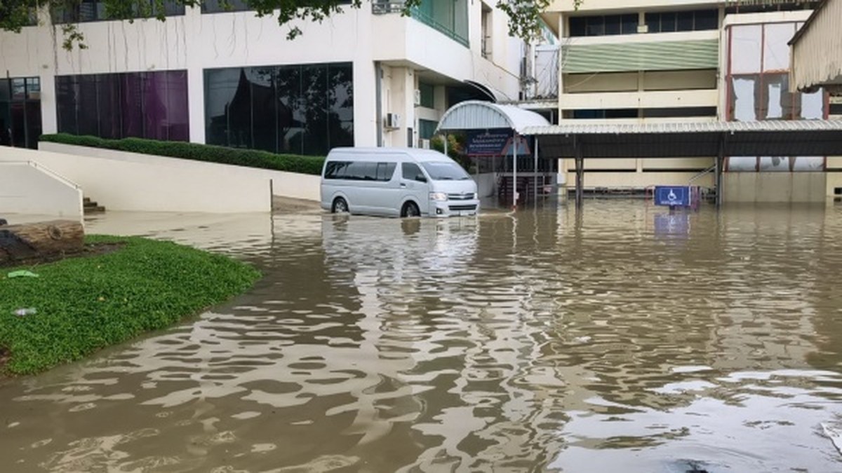
Thailand's flood emergency covered 12 provinces and 37,036 people as of the Department of Disaster Prevention and Mitigation's 06:00 situation report on 25 September 2026, with water still rising in Suphan Buri, Chachoengsao and Sa Kaeo. The Chao Phraya Dam was discharging 1,750 cubic metres per second, and the Office of the National Water Resources has 24 provinces under warning for waterlogging, flash floods, forest runoff and mudslides. A mudslide at a Chanthaburi forest monastery killed one monk.
Thailand's Flood Emergency Reaches 12 Provinces as the Chao Phraya Keeps Rising
Bangkok, Thailand — The flooding stretches from the northern valleys through the central plains to the eastern border provinces, and the Thai state is moving water on several fronts at once. Along the Chao Phraya, the C.2 measuring station at Nakhon Sawan recorded a flow of 1,795 cubic metres per second at 06:00, with the water level 3.53 metres below bank. Officials expect the dam's releases to be adjusted upward within days as northern runoff arrives from the upper basin.
What Thailand's Disaster Agency Counted by Friday Morning
The Department of Disaster Prevention and Mitigation's 06:00 report on 25 September listed flooding in Phetchabun, Nakhon Sawan, Uthai Thani, Sing Buri, Suphan Buri, Saraburi, Phra Nakhon Si Ayutthaya, Prachin Buri, Chachoengsao, Sa Kaeo, Trat and Surin. The national totals were 38 districts, 143 sub-districts, 596 villages, 11,796 households and 37,036 people. In Phetchabun, flooding covered Lom Sak district across two sub-districts, eight villages and 280 households, with water receding. Nakhon Sawan reported six districts, 26 sub-districts, 131 villages and 184 households, with the level steady. Uthai Thani listed three districts, three sub-districts, four villages and 60 households, receding. Sing Buri's In Buri district recorded one sub-district, three villages and five households, steady. Saraburi reported three districts, six sub-districts, 17 villages and 179 households, receding. Trat's Bo Rai district recorded one sub-district, one village and 30 households, receding, while Surin's Phanom Dong Rak district listed one sub-district and one village with a damage survey under way. DDPM deployed truck-mounted pumps, flood-relief vehicles and high-capacity mobile pumping units, helped residents lift belongings and moved vulnerable groups to safety.
Where the Water Is Still Gaining
Three provinces reported rising water in the DDPM's 06:00 count. Suphan Buri was the heaviest affected, with five districts — Bang Pla Ma, Song Phi Nong, Mueang, Si Prachan and Don Chedi — covering 24 sub-districts, 133 villages and 5,548 households. Chachoengsao reported three districts — Bang Nam Priao, Phanom Sarakham and Bang Khla — across eight sub-districts, 22 villages and 117 households. Sa Kaeo listed six districts — Mueang, Watthana Nakhon, Aranyaprathet, Khok Sung, Khlong Hat and Wang Nam Yen — across 14 sub-districts, 32 villages and 227 households. Ayutthaya remained steady but accounted for the second-largest household count at 5,030, spread across six districts, 55 sub-districts and 240 villages. Prachin Buri reported two districts, two sub-districts, four villages and 136 households, steady. The pressure upstream continued: the Chum Saeng station in Nakhon Sawan was trending upward and still 2.12 metres below bank.
The Dam That Decides What Happens Downstream
The Chao Phraya Dam was discharging 1,750 cubic metres per second on the morning of 25 September, against a flow of 1,795 cubic metres per second recorded at the C.2 station in Nakhon Sawan. Over the next one to nine days the dam may adjust its discharge into a range of 1,500 to 2,000 cubic metres per second, and downstream water levels could rise by about 0.70 to 1.70 metres. The Office of the National Water Resources expected northern runoff to pass the dam at about 1,500 cubic metres per second, raising downstream levels about 0.75 to 1.25 metres and affecting low-lying land outside flood barriers at Sapphaya in Chai Nat, In Buri in Sing Buri and Mueang Ang Thong. The Royal Irrigation Department said management rests on three measures: keeping upstream water levels below target thresholds, maximising diversion into the eastern and western irrigation networks, and increasing dam releases incrementally in line with incoming flows. Communities behind flood barriers were not currently expected to be directly affected by the increased discharge.
A Low-Pressure Cell, a Monsoon Trough, and 24 Provinces on Notice
The Office of the National Water Resources' announcement No. 5/2569, issued on 22 September, flagged 24 provinces for waterlogging, flash floods, forest runoff and mudslides between 22 and 26 September. In the North: Mae Hong Son, Tak, Phitsanulok and Uthai Thani. In the Northeast: Si Sa Ket. In the Central region: Lop Buri, Saraburi, Pathum Thani, Nonthaburi, Bangkok and Samut Prakan. In the West: Kanchanaburi and Ratchaburi. In the East: Nakhon Nayok, Prachin Buri, Sa Kaeo, Chonburi, Chanthaburi and Trat. In the South: Ranong, Songkhla and Narathiwat. The cause was a strong low-pressure cell off central Vietnam moving inland along a monsoon trough over upper Thailand, with a strengthening southwest monsoon over the Andaman Sea, the South and the Gulf of Thailand. ONWR told agencies to watch areas with more than 90 millimetres of accumulated rain in 24 hours, inspect river banks and drainage channels, clear obstructions and pre-drain to absorb heavy rain.
Rain Piles Up in Bangkok's Eastern Districts
Rain began in Bangkok about 02:00 on 25 September and was expected to continue through the day. By 04:00 the Meteorological Department had tracked a low-pressure cell moving from Cambodia to sit over the city. The heaviest overnight rainfall was 99 millimetres in Min Buri district, followed by Khlong Sam Wa, Lat Krabang and Sai Mai — all on the eastern side of the capital. The city's flood control centre reported that several sections of the Prawet Burirom canal had risen above their thresholds and were at critical red level, with the On Nut area among the points of concern. Bangkok's governor, Chadchart Sittipunt, ordered the response concentrated on the eastern districts, with water from the Prawet Burirom canal drained out through Phra Khanong. The Chao Phraya at Pak Khlong Talat stood at 0.88 metres, well below the three-metre flood barrier. Bangkok's cumulative rainfall this year has reached 983.5 millimetres — below the same point last year, but the accumulation curve has steepened.
The Evacuation Orders That Went Straight to People's Phones
DDPM issued an urgent evacuation warning for villages M.12 and M.13, Ban Thao Sao, Muak Lek sub-district, Muak Lek district, Saraburi, after continuous heavy rain and rising runoff. Residents were told to move immediately to a temporary shelter at Ban Khao Mai Kwian school, Moo 12, Muak Lek. The alert went out by Cell Broadcast in cooperation with mobile operators AIS, True and NT. The same method was used on 25 September for a flash-flood warning in Khao Chamao district, Rayong, sent at 15:06, and the previous evening for Mae Hong Son city and Khun Yuam district, sent on 24 September at 22:33. The public can report incidents and request help through the DDPM Line account "@1784DDPM" or the 24-hour safety hotline 1784.
One Death, and a Monastery Buried in Mud
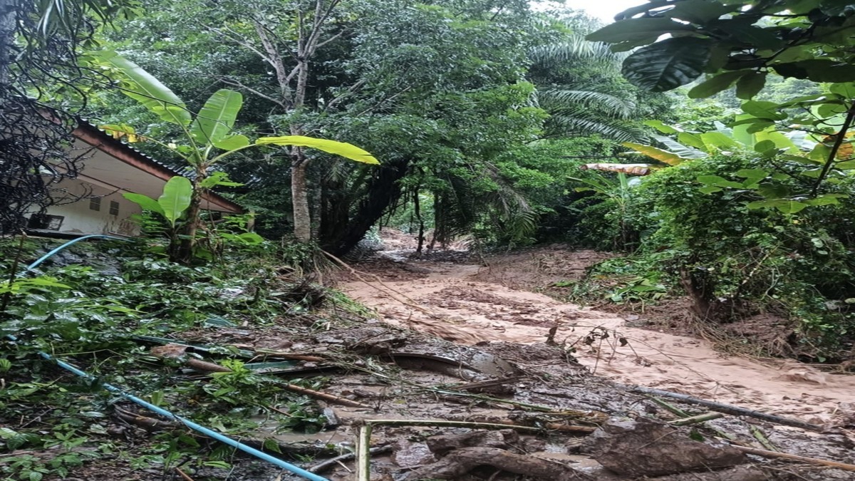
A mudslide buried a monks' dwelling at the Huap Bon Wan forest monastery in Kaeng Hang Maeo district, Chanthaburi. Several monks were injured and one monk died. In Khao Khitchakut district, Chanthaburi, forest runoff and flash floods hit four sub-districts — Chanthakhlem, Khlong Phlu, Takhian Thong and Chak Thai — covering 12 villages and 29 households. Homes were flooded, travel routes cut and some bridges eroded. Local officials, the sub-district administration and volunteers set up barriers and traffic cones on flooded routes and prepared tents for affected residents. Trat had already seen flash flooding in Bo Rai and Khao Saming after 140 millimetres of rain fell in five hours. Sa Kaeo recorded the country's highest accumulated rainfall at 211 millimetres, with Buri Ram second at 156 millimetres.
The Northeast Is Filling Up Too
Rain fell across 32 districts of Nakhon Ratchasima. Pak Chong recorded 160 millimetres, Phra Thong Kham 56.5 millimetres, Wang Nam Khiao 55 millimetres and Khon Buri 25 millimetres. Forest runoff from Khao Yai national park flooded five sub-districts — Mu Si, Phaya Yen, Khanong Phra, Pak Chong and Chanthuek — in five villages, damaging 20 houses. Four people trapped in a house at Ban Nong Mai Daeng, Moo 14, Phaya Yen — two men, one woman and a small child — were evacuated safely and housed at the Phaya Yen sub-district administration building, with food, drinking water and milk provided. Nakhon Ratchasima irrigation officials reported four large dams below 50 per cent of storage, while three medium reservoirs — Lam Chiang Krai upper, Lam Chiang Sa and San Kamphaeng — exceeded 100 per cent and were spilling. Muang Pak Chong was put on standby with pumps, sandbags and 24-hour staffing.
What the Reservoir Numbers Do and Do Not Tell You
Reservoirs nationwide hold 59,861 million cubic metres, or 74 per cent of capacity, with usable water at 35,739 million cubic metres. Eight large reservoirs are above 80 per cent. Krasiao reservoir is below 30 per cent. The spread between the fullest and the emptiest is the reason a single national figure cannot describe the risk on the ground. The Office of the National Water Resources said it is monitoring the Chao Phraya basin and reservoirs nationwide ahead of more heavy rain on 26 and 27 September. GISTDA, the Geo-Informatics and Space Technology Development Agency, marked high flood-risk areas in red across Nakhon Sawan, Phichit, Phetchabun, Lop Buri, Saraburi and Suphan Buri, extending south to Pathum Thani, Nonthaburi and parts of Bangkok, with dense high-risk clusters along river basins in Surin, Si Sa Ket, Buri Ram and Roi Et.
What Happens in the Next Nine Days
The days ahead turn on two things: how much rain falls across the upper river basin between 23 and 27 September, and how the Chao Phraya Dam manages what it releases. DDPM warned communities along the Chao Phraya to prepare for water levels rising 0.61 to 1.50 metres over a one-to-nine-day window. Low-lying land outside flood embankments in Ayutthaya and Ang Thong could see levels rise 0.75 to 1.25 metres. Authorities urged farmers in low-lying floodplain areas to accelerate harvesting and prepare land for possible inundation. The Meteorological Department kept heavy to very heavy rain in effect through 27 September across the North, lower Northeast, Central region including Bangkok and its vicinity, the East and the South, and ONWR is watching the eastern provinces through the same period. The public can report incidents and request help through the DDPM Line account "@1784DDPM" or the 24-hour safety hotline 1784.
By Jessica Ali, Staff Writer
This article was produced with AI-assisted research and editorial support. Sources: the Department of Disaster Prevention and Mitigation via Daily News and Thai PBS; PostToday; the Office of the National Water Resources; The Nation Thailand; GISTDA; Bangkok Post; Thai PBS; Bangkok Biz News; Siam Rath; Thai Post; and Global1.News.
What's Your Reaction?
 Like
0
Like
0
 Dislike
0
Dislike
0
 Love
0
Love
0
 Funny
0
Funny
0
 Wow
0
Wow
0
 Sad
0
Sad
0
 Angry
0
Angry
0

Editor-in-Chief at Global1.News. Atlanta-based journalist who cuts through the BS and tells it like it is. Lead anchor, host, and the voice you hear when the spin stops and the truth starts.















Comments (0)