
Ontario's Worst Wildfire Season on Record: 7,250 Square Kilometres Burned
Ontario is facing its most destructive wildfire season on record, with more than 7,250 square kilometres already consumed by flames across the north. This figure surpasses the previous provincial benchmark set in 2021 and has triggered widespread evacuations, air-quality alerts, and federal-provincial coordination on an unprecedented scale. The crisis underscores the growing pressures of climate-driven fire behaviour on remote communities and boreal ecosystems alike.
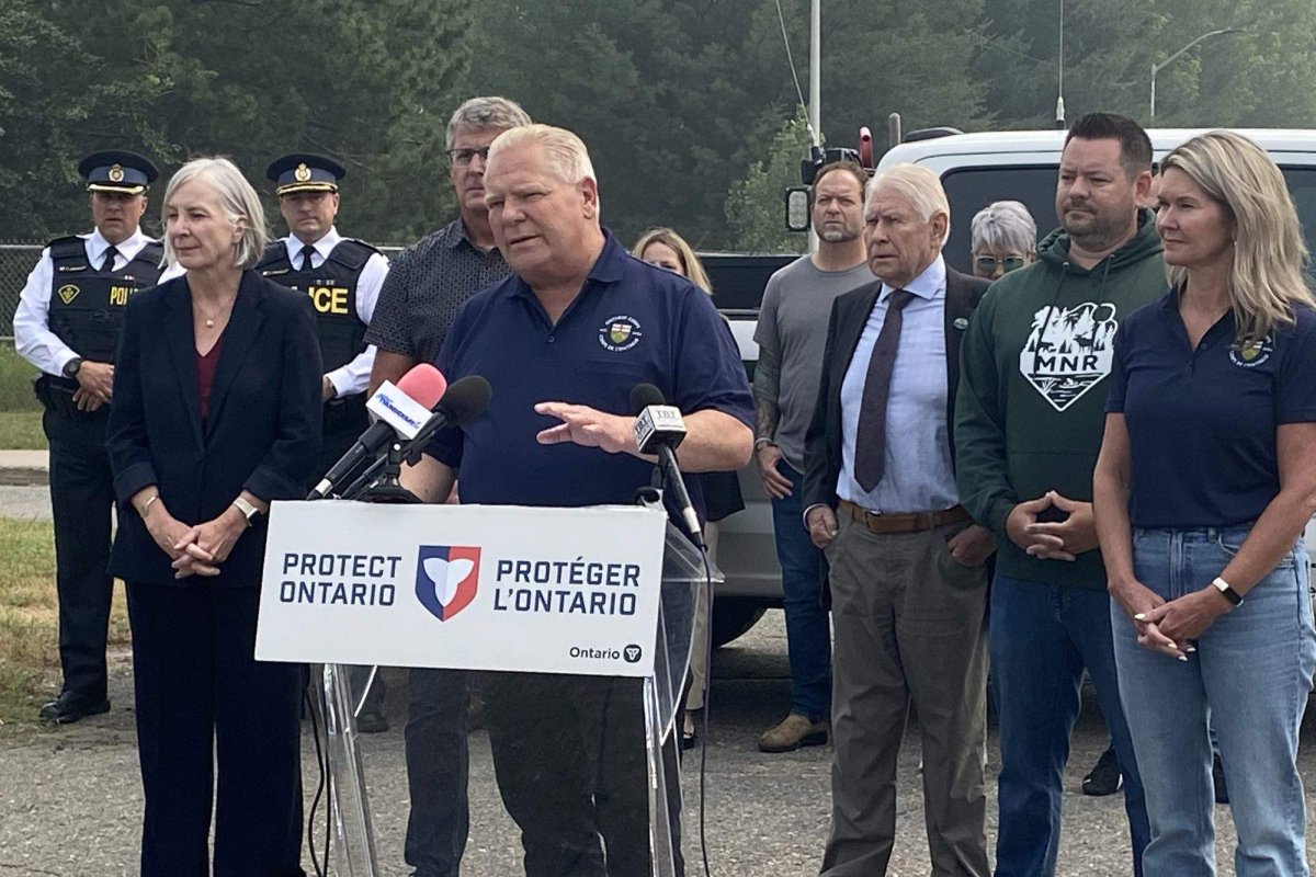
Ontario's Worst Wildfire Season on Record: 7,250 Square Kilometres Burned
Scale of the 2026 Season
The 2026 wildfire season in Ontario has already eclipsed previous benchmarks in dramatic fashion, with 7,250 square kilometres consumed by mid-summer. Placed against the federal record maintained since 1972, this figure ranks among the five largest annual totals nationwide, surpassing the 2021 Ontario record of 4,896 square kilometres and dwarfing the 1995 total of 3,210 square kilometres. In geographic terms, the burned area approximates the combined landmass of Prince Edward Island and several surrounding islands, or roughly twice the size of the Greater Toronto Area, underscoring the profound ecological disruption across boreal forests and peatlands. Preliminary estimates from the Ontario Ministry of Natural Resources and Forestry remain subject to upward revision as satellite mapping and ground crews complete assessments of smouldering zones, a process that historically adds 15 to 25 percent to final tallies once interior burns are fully delineated.
The burned area has expanded rapidly in recent days, driven by a combination of extreme heat and lightning activity. Federal records maintained since 1972 show no comparable single-season total for Ontario at this point in the calendar. Officials caution that the season remains far from concluded, with conditions into August projected to stay hotter and drier than normal across northern regions. Comparisons with 2012 and 2018 further illustrate the exceptional scale, as those seasons recorded 2,845 and 3,672 square kilometres respectively within provincial boundaries. The current trajectory aligns with broader national patterns tracked by the Canadian Interagency Forest Fire Centre, where cumulative area burned has trended upward over the past two decades amid prolonged dry spells.
Public safety agencies continue to monitor multiple active fronts, while smoke plumes have affected air quality from the northwest through to southern population centres and beyond provincial borders. The situation has prompted renewed attention to federal-provincial coordination on emergency response and long-term climate adaptation measures. Such revisions often occur when remote sensing identifies additional hotspots missed during initial aerial surveys, particularly in inaccessible northern regions where access is limited to helicopter or floatplane.
The Dominant Fire North of Thunder Bay
A single blaze covering 3,188 square kilometres north of Thunder Bay accounts for the largest share of the season's total. The vast majority of that area burned within the past ten days amid severe thunderstorms and a heat wave that pushed temperatures roughly 15 degrees above seasonal averages. This blaze originated in the rugged terrain of the Canadian Shield surrounding Lake Nipigon, where granite outcrops and dense jack pine stands facilitated rapid spread under extreme fire weather indices. A persistent high-pressure ridge stalled over the region, suppressing cloud formation and amplifying solar radiation on already parched fuels, while lightning strikes accounted for over 80 percent of ignitions province-wide compared to human causes that typically dominate southern zones.
Fire behaviour specialists at the provincial centre employ infrared mapping and wind profiling to monitor growth rates exceeding 500 hectares daily during peak conditions. Recent rainfall totalling 12 millimetres across the fire perimeter has provided temporary relief, dampening surface fuels for an estimated five to seven days before drying resumes, though deeper duff layers remain vulnerable to re-ignition without sustained precipitation. Liam Buchart, fire weather specialist with the Canadian Forest Service, stated that recent rainfall has provided only temporary relief. "There hasn't been enough rain in the northwestern part of Ontario to really knock things down for the long term," Buchart said. He added that a complete reprieve does not appear in current forecasts.
Evacuations and First Nation Communities
More than a dozen communities, predominantly First Nations including the Eabametoong, Neskantaga, and Marten Falls First Nations, have faced mandatory evacuations amid the advancing flames. The displacement underscores ongoing challenges in Indigenous relations and emergency management, particularly in remote northern areas where access routes and infrastructure can limit rapid response options. Logistical hurdles in these fly-in only locales compound the crisis, as winter roads remain impassable during summer and airlift capacity is constrained by limited aircraft availability and short runways. Indigenous emergency management protocols emphasise community-led decision-making through band councils, coordinated with provincial authorities under the Emergency Management and Civil Protection Act.
Provincial and federal agencies are working to ensure adequate support services for evacuees, including temporary housing and health care coordination. Smoke drifting across wide areas has also raised public health concerns, prompting air-quality advisories in multiple municipalities. Wildfire smoke has triggered acute respiratory distress among elders and children in host centres hundreds of kilometres south, with particulate levels frequently exceeding safe thresholds for days. Long-term displacement raises concerns over cultural disconnection from traditional territories, disrupted schooling, and mental health strains that persist well beyond containment, echoing patterns observed in previous northern evacuations. The situation highlights the interconnected nature of wildfire impacts, extending well beyond the immediate fire perimeters.
Climate Change and National Trends
Scientists have long documented that rising global temperatures are lengthening Canada's wildfire seasons and increasing their intensity. Ontario's current experience aligns with broader patterns observed across the country, where warmer springs and extended dry periods create conditions favourable for larger fires. The Canadian Forest Service and CIFFC have highlighted how Ontario's totals this year outpace those in British Columbia, Alberta, and Saskatchewan combined, with the latter provinces reporting under 2,000 square kilometres each amid more favourable precipitation patterns. Federal carbon pricing revenues increasingly support climate adaptation funding for enhanced detection systems and community resilience programs, though specialists note that 2026's fire weather severity signals a potential new normal requiring accelerated investment in prescribed burns and fuel management.
While no single season can be attributed solely to climate change, the cumulative data since the 1970s show a clear upward trajectory in area burned during peak years. Policymakers in Ottawa continue to weigh how best to integrate wildfire risk into national adaptation strategies.
Federal Role and Provincial Coordination
Defence Minister McGuinty has confirmed federal readiness to deploy Canadian Armed Forces assets following a formal provincial request routed through Public Safety Canada. Under existing arrangements, the Canadian Armed Forces can provide personnel and logistical support when a province requests assistance, though primary responsibility for wildfire suppression rests with provincial agencies. The process involves the province submitting a Request for Federal Assistance, triggering CIFFC resource sharing agreements that mobilise interprovincial crews and equipment under established cost-sharing models. Under these models, Ottawa covers 50 percent of eligible expenses beyond a provincial threshold. Previous wildfire aid packages, such as those for the 2021 season, exceeded $200 million in combined federal-provincial contributions, illustrating the scale of operational coordination required.
Discussions between Ottawa and Queen's Park focus on resource sharing, including aircraft and trained crews, as well as longer-term funding for prevention programs. The Canadian Interagency Forest Fire Centre plays a central role in facilitating mutual aid among provinces and territories, issuing daily situation reports and co-ordinating interprovincial deployments. Early estimates now circulating through that network underscore the need for sustained intergovernmental cooperation as the season progresses.
Conditions in British Columbia
While Ontario contends with its largest recorded season to date, British Columbia is also managing significant wildfire activity. Crews near Kimberley are constructing containment lines around several fires, illustrating that elevated risk extends across multiple regions of the country. The parallel situations reinforce the national scope of the challenge and the value of coordinated planning through bodies such as the CIFFC.
Outlook and Remaining Risks
Although recent precipitation has moderated fire growth in some zones, officials warn that danger levels remain high. Northern Ontario is forecast to experience above-normal temperatures and below-normal rainfall through at least the first half of August. Buchart's assessment suggests that any lull may prove short-lived without sustained wetter weather. Provincial wildfire agencies continue daily briefings and are preparing contingency plans should additional communities require evacuation. Public advisories emphasise the importance of monitoring local conditions and following guidance from emergency officials.
The current season serves as a reminder of the evolving pressures on Canada's forest management systems. Investments in early detection, Indigenous-led stewardship initiatives, and climate-informed planning are among the measures under active consideration at both federal and provincial levels. As satellite data refines the burned-area estimates in the coming weeks, the full scope of 2026's impact will become clearer, informing future preparedness efforts across the federation.
Tags: Ontario wildfires, wildfire season 2026, Thunder Bay fire, climate change Canada, First Nation evacuations, Canadian Forest Service, CIFFC, federal aid, Defence Minister McGuinty, B.C. wildfires
By Alex Thompson, Staff Writer
This article was produced with AI-assisted research and editorial support. Reporting is based on sources cited in the article.
What's Your Reaction?
 Like
0
Like
0
 Dislike
0
Dislike
0
 Love
0
Love
0
 Funny
0
Funny
0
 Wow
0
Wow
0
 Sad
0
Sad
0
 Angry
0
Angry
0

Canada Correspondent at Global1.News. Based in Toronto, covering Canadian politics, energy, trade, and US-Canada relations. Provides the Canadian perspective on North American and global affairs.














Comments (0)