
Israel Plans 2,300 New Settlement Units in Gilo, East Jerusalem
Israel's Jerusalem planning committee approved 2,300 new housing units to expand the Gilo settlement onto confiscated Palestinian land in East Jerusalem, a move Ir Amim says further isolates the city from Bethlehem and threatens ancient olive groves.
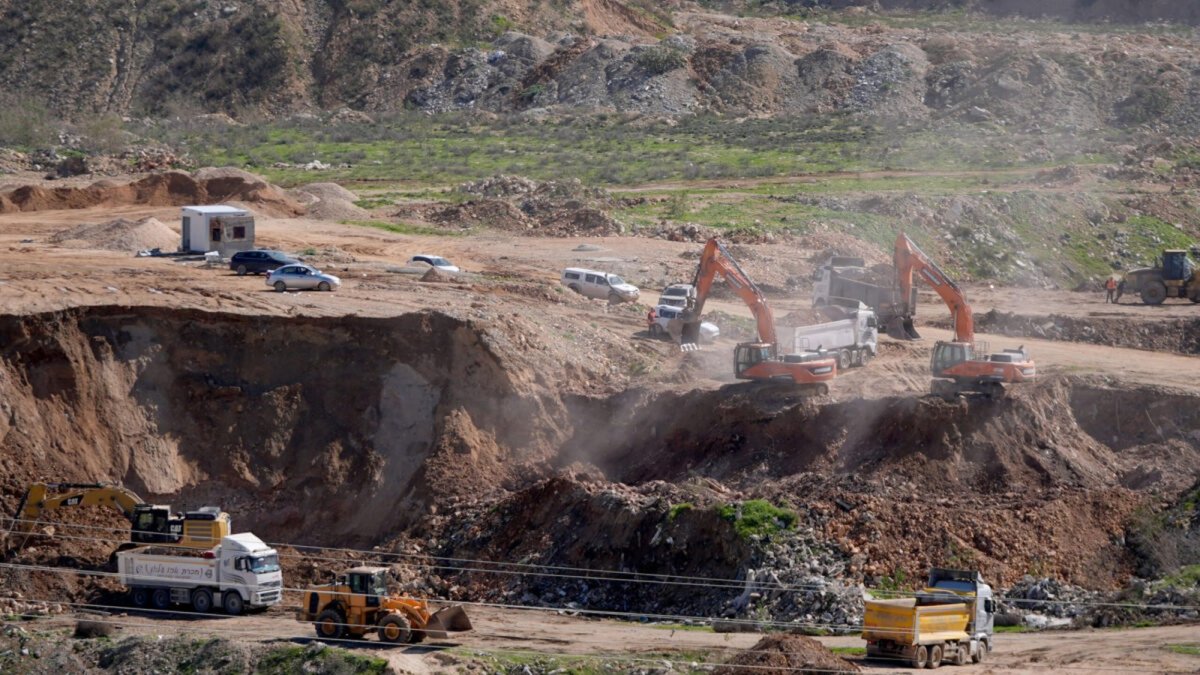
The Jerusalem Municipality's District Planning and Building Committee approved a plan on 28 July 2026 to add 2,300 housing units to the Gilo settlement in occupied East Jerusalem. Israeli non-profit organization Ir Amim reported the decision on 5 August 2026. The project covers roughly 20 hectares and extends Gilo southward toward Route 60, the primary road connecting Jerusalem to Bethlehem. Ir Amim stated that the expansion would further isolate East Jerusalem from the Bethlehem area in the occupied West Bank.
The Plan
The approved plan targets land in southwestern East Jerusalem already designated for settlement use, pushing existing settlement boundaries closer to the main north-south artery used by Palestinians for travel, commerce, and family visits. Ir Amim researcher Aviv Tatarsky described the project as one that cuts off East Jerusalem from the Bethlehem area and strengthens Israeli control over a strategically sensitive zone. The plan remains at the committee stage, with further approvals required before ground preparation can begin.
Land Confiscation and the Absentees' Property Law
At least 28 dunams within the plan area were previously confiscated from Palestinian owners under Israel's Absentees' Property Law and reclassified as state land. Additional dozens of dunams remain listed as unknown ownership, leaving open the possibility that more private Palestinian holdings could be affected. The law permits state registration when owners cannot produce formal title documents. Many Palestinian families hold land through generational inheritance without updated deeds, a situation that dates back to the suspension of land registration procedures after 1967. Hassan Breijieh of the Colonization and Wall Resistance Commission has noted that such measures pave the way for transfer of land to Israeli settlers.
The Absentees' Property Law traces its roots to 1950, when Israeli authorities enacted it to manage properties left behind by Palestinians displaced during the 1948 war. The legislation defined absence broadly, allowing the state to assume control over lands and homes even when owners had fled only temporarily or were prevented from returning. After the 1967 occupation of East Jerusalem and the West Bank, the same framework was extended to newly captured territories, enabling systematic transfers of Palestinian holdings into state or settler hands under the guise of legal administration. This continuity created a durable mechanism that reshaped land ownership patterns across generations.
In East Jerusalem, the law has operated through quiet bureaucratic enforcement, often targeting properties in areas marked for future development. Families who remained in the city after 1967 frequently discovered ancestral plots reclassified without notice, leaving little recourse. Because many Palestinian households lack formal documentation after disruptions under Ottoman, British, and Jordanian rule, entire neighborhoods have seen incremental erosion of communal land bases.
Proving ownership presents formidable obstacles. Claimants without updated deeds must navigate lengthy court proceedings in which oral histories and tax receipts carry limited weight against state assertions. Land experts note that "state land" designations frequently rely on selective surveys conducted without community input, overlooking longstanding cultivation and customary rights.
Olive Groves and the Human Cost
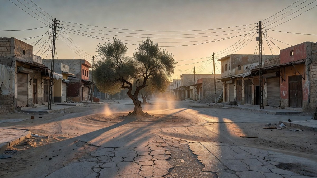
The site contains extensive olive groves with trees decades old, evidence of longstanding private Palestinian cultivation, and implementation of the plan would require their removal. Families in the affected villages of Beit Jala, Beit Safafa, and Sharafat rely on these groves for income and as markers of generational presence. The Jerusalem-Bethlehem corridor supports daily movement for work, medical care, and family connections, and disruption would add restrictions to an already fragmented travel network.
Olive cultivation forms a cornerstone of Palestinian economic and cultural life, providing seasonal income that supports extended families across the West Bank and East Jerusalem periphery. The annual harvest draws communities together in rituals passed down through generations, reinforcing bonds of kinship and collective memory tied to the land. For many households, revenue from olives and olive oil supplements limited formal employment opportunities, serving as a buffer against economic pressures. This heritage extends beyond mere livelihood, embodying resilience and connection to ancestral territories that predate modern political boundaries.
When groves are uprooted, the loss extends far beyond immediate financial impact. Families who have tended specific trees for decades describe the severance of living links to their history, with each tree representing years of labor and inherited knowledge. The destruction disrupts not only income streams but also the transmission of agricultural skills to younger generations, accelerating rural depopulation as younger members seek work elsewhere. Human rights advocates emphasize that such losses compound the psychological strain on communities already navigating movement restrictions and uncertain futures.
Villages and local organizations document individual trees through community mapping, recording age, productivity, and ownership. These records serve as vital evidence in legal challenges and international advocacy, preserving knowledge of heritage even as physical trees are at risk.
The Southern Jerusalem Settlement Wedge
The Gilo expansion forms part of a larger pattern that includes Givat Hamatos and Har Homa. Givat Hamatos, the first new settlement initiated in Jerusalem in over two decades, has its initial phase of 2,610 units already under construction. Ir Amim documented that since the Gaza war began, plans for ten major new settlements totaling more than 20,000 housing units have advanced in East Jerusalem over the past two and a half years. This settlement belt along Jerusalem's southern flank limits Palestinian urban continuity between East Jerusalem and Bethlehem.
Har Homa was established on the forested slopes of Jabal Abu Ghneim beginning in 1997, rapidly growing into a large residential area that altered the southern Jerusalem skyline. Its development marked an early phase in efforts to extend Israeli control along the Jerusalem-Bethlehem axis, creating a physical barrier that reshaped regional geography. Residents there benefit from modern infrastructure while neighboring Palestinian communities face increasing isolation. The settlement's expansion has long been viewed by observers as a pivotal step in fragmenting the landscape between the two cities.
Givat Hamatos has been described by diplomats and analysts as an international red line because its location would complete a chain of settlements that severs Bethlehem's northern access to Jerusalem. Completion of this link would eliminate remaining open corridors essential for any viable Palestinian capital in the eastern part of the city. The project has therefore attracted sustained attention from foreign governments concerned with preserving conditions for negotiated outcomes.
The Lower Aqueduct area figures prominently in the settlement-wedge strategy, serving as a narrow corridor that historically allowed Palestinian movement between Bethlehem and Jerusalem. Control over this passage enables authorities to regulate daily commutes, medical access, and commercial flows. Route 60, running parallel, functions as the primary artery for Palestinian travel in the region, yet faces frequent closures and checkpoints that extend journey times and fragment social networks.
Gilo's History on Palestinian Land
Gilo was established in 1971 on land confiscated from the Palestinian villages of Beit Jala, Beit Safafa, and Sharafat. It now houses approximately 30,000 residents and ranks among the five ring neighborhoods built around Jerusalem. The current plan extends this footprint further onto remaining Palestinian holdings in the same area. Palestinian residents of the original villages continue to live adjacent to the settlement, with their access to surrounding land increasingly constrained by successive planning decisions.
Smotrich's Settlement Acceleration
At the end of June, Israeli Finance Minister Bezalel Smotrich announced an acceleration of settlement construction across the West Bank. He stated that the government had established 160 settlement farms and approved more than 100 new settlements. The Peace Now movement estimates roughly 500,000 settlers in the West Bank and about 250,000 in East Jerusalem settlements. These figures reflect the cumulative outcome of decades of planning decisions that have altered the demographic and territorial landscape around Jerusalem.
Smotrich has publicly advocated maximalist settlement policies aimed at preventing the emergence of a Palestinian state, calling for closer integration of West Bank territory into Israeli administrative structures. The positions reflect long-standing ideological commitments that prioritize territorial retention over negotiated division.
Planning approvals for settlements accelerated after the Gaza war began in 2023, in a political environment with fewer domestic constraints. Organizations tracking these trends describe the current wave as unprecedented in its coordination and speed, with multiple projects advancing simultaneously across different districts.
International Law and the Two-State Solution
The United Nations and most governments regard Israeli settlements in occupied Palestinian territory as illegal under international law. Article 49 of the Fourth Geneva Convention prohibits an occupying power from transferring its civilian population into occupied territory. Article 53 bars destruction of civilian property, and Article 33 prohibits collective punishment. UN Security Council Resolution 2334, adopted in 2016, called on Israel to cease all settlement activity. The current plan, if advanced, would add to the physical barriers that separate East Jerusalem from the southern West Bank and reduce the territorial contiguity required for a viable two-state arrangement.
Palestinian communities in the corridor see these planning moves as direct threats to social and economic ties across the 1967 line, and local organizations continue to document each stage of approval. Figures on the exact number of dunams that may fall under unknown ownership status were not immediately available from the planning documents released so far.
By Fatima Al-Rashid, Staff WriterThis article was produced with AI-assisted research and editorial support. Reporting is based on sources cited in the article.
What's Your Reaction?
 Like
0
Like
0
 Dislike
0
Dislike
0
 Love
0
Love
0
 Funny
0
Funny
0
 Wow
0
Wow
0
 Sad
0
Sad
0
 Angry
0
Angry
0

Gulf/MENA Correspondent at Global1.News. Based in Doha, covering Gulf politics, energy markets, diplomacy, and development across the Middle East and North Africa. Tracks the economic transformation of the Gulf states.














Comments (0)