
Trudy Weakens to Category 1 but Mexico Warns It Could Return as a Category 3
Hurricane Trudy weakened to Category 1 off Mexico's Pacific coast on Saturday, but Mexico's own forecasters warn it could return as a Category 3 by Sunday as the centre passes near Manzanillo, a port city still drying out from Hurricane Simon six days ago.
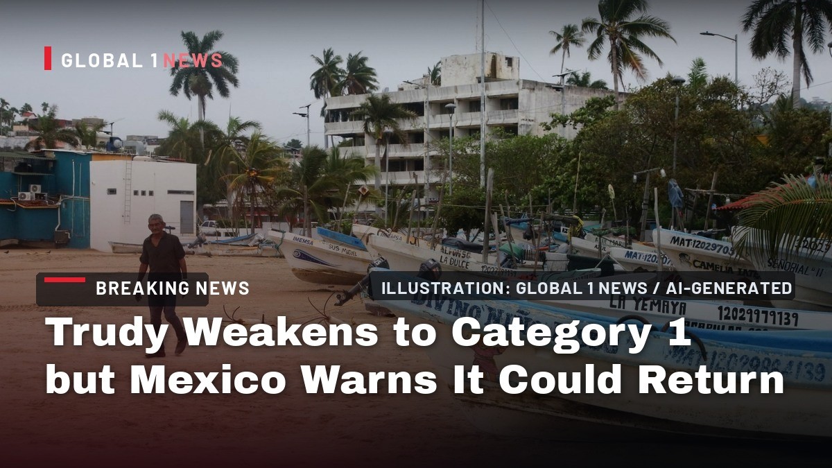
Hurricane Trudy weakened to Category 1 on Saturday morning, but Mexico's own forecasters say the storm could come back as a Category 3 by Sunday. The U.S. National Hurricane Center has the centre passing near the Colima and Jalisco coast tonight and Sunday, and the state of Colima has six days of storm experience behind it and one weekend to prepare.
Trudy Weakens to Category 1 but Mexico Warns It Could Return as a Category 3
Manzanillo, Mexico — Rain was already falling on the port of Manzanillo on Saturday morning, La Jornada reported, as Trudy sat about 170 miles south of the city, according to the U.S. National Hurricane Center. Mexico's Navy puts the centre 150 nautical miles south of Manzanillo with 80-knot winds, 100-knot gusts and 16-to-20-foot seas. Colima's early-warning towers were switched on at 08:30, Meganoticias Colima reported, and the forecast that matters most here says the worst arrives Sunday.
Manzanillo Has Six Days
Six days ago, Hurricane Simon flooded this city. La Jornada reported flooding, damage to businesses, hundreds evacuated and roads blocked by fallen trees across Colima on Sunday 11 October. Colima's state civil protection directorate said protocols began on Friday 9 October with access to the beaches of Manzanillo, Tecoman and Armeria closed, plus the port and the airport. Evacuations followed in the Manzanillo neighbourhoods of Alameda and Santiago and the community of El Chavarin. Refuse collection was suspended in Manzanillo and public transport across the state, and Governor Indira Vizcaino instructed non-essential activities be suspended in Tecoman, Manzanillo, Armeria, Cuauhtemoc and Comala. The port of Manzanillo reopened at 09:00 on Monday 12 October, the regional port captaincy said, with winds down to 2 to 4 knots and two-metre swell. El Pais reported 263 people moved to six shelters in Colima and 739 to 24 shelters in Jalisco, with 28 municipalities at maximum alert. Six days later, a hurricane warning runs from that same port northward.
The 9 A.M. Advisory
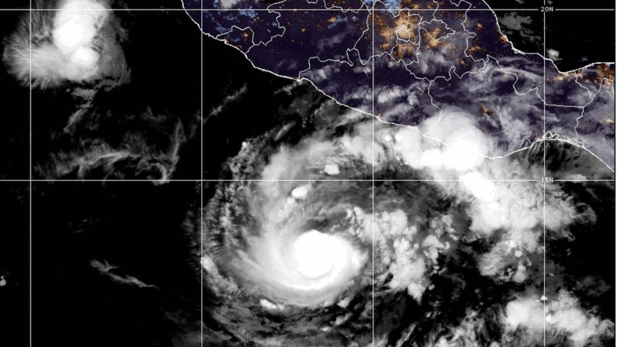
The National Hurricane Center's advisory 17, issued at 900 AM CST Saturday by forecaster Beven, puts the centre near latitude 16.6 North, longitude 103.9 West. That is about 265 miles west of Acapulco, Guerrero, and about 170 miles south of Manzanillo, Colima. Maximum sustained winds are near 90 mph with higher gusts. The storm is moving northwest at 10 mph, and the general motion is forecast to continue through Sunday. Minimum central pressure is 979 mb. Hurricane-force winds extend outward up to 35 miles from the centre; tropical-storm-force winds up to 140 miles. The advisory states: "Some strengthening is possible today, followed by weakening beginning on Sunday." The centre will approach the coast of southwestern and west-central Mexico today and pass near the coast tonight into Sunday. No landfall is forecast in this advisory.
Where the Wind Arrives First
The hurricane warning runs from Manzanillo northward to Cabo Corrientes. A hurricane watch covers the coast from south of Manzanillo to Punta San Telmo. A tropical storm warning is in effect south of Manzanillo to Zihuatanejo, and north of Cabo Corrientes to San Blas. A tropical storm watch covers north of Punta Mita to San Blas, and Las Islas Marias. With this advisory, the Government of Mexico issued a tropical storm warning for the coast north of Punta Mita to San Blas. Hurricane conditions are expected in the hurricane warning area by tonight, and tropical storm conditions are spreading across the area today. Hurricane conditions are possible in the hurricane watch area by late today. The Navy's 10:00 hrs local advisory describes conditions already affecting the coasts of Jalisco, Colima, Michoacan and Guerrero: heavy convective activity, overcast skies, rain, electrical storms, strong wind gusts and high waves.
Mexico's Own Forecast Is the Blunter One
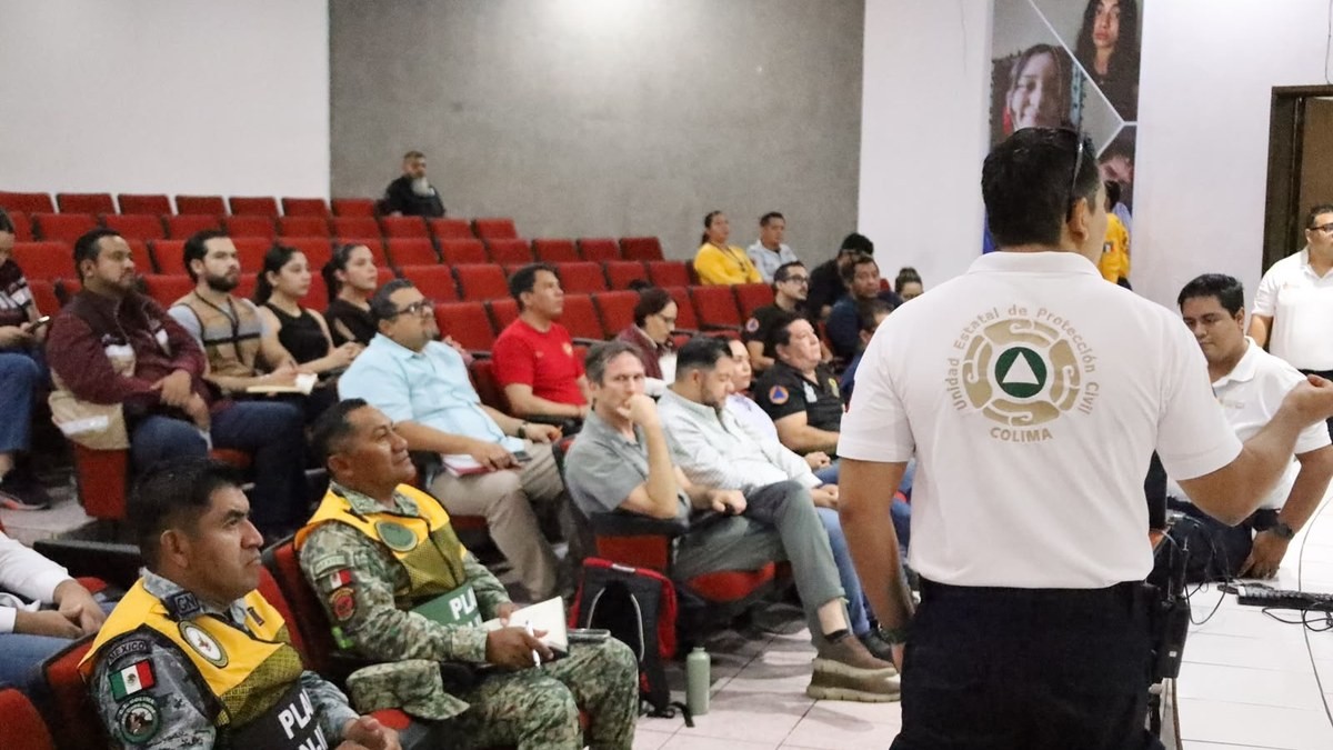
At the President's morning press conference, SMN coordinator general Fabian Vazquez Romana said "critical days" are coming and that Trudy could interact with Cold Front Number 2. He said Trudy will approach the coasts of Colima and Jalisco in the early hours of Sunday as a Category 3, and that Sunday will be the closest pass, "only 65 km" away. "The population has to be alert because on Sunday they can have a major hurricane off the coast," he said. He also said the storm had undergone rapid intensification and would "even reach category 4 on the Saffir-Simpson scale", a call the U.S. centre does not make in its Saturday advisory. He said the most critical period begins Saturday because of wind and swell: "The strongest will be in the region of Jalisco and Manzanillo; the winds will begin to be felt from Saturday." President Claudia Sheinbaum urged citizens to go to the shelters and said work is under way to alert the population to take precautions from today and through the weekend.
The Bulletins Do Not Agree
The forecasts diverge, and each carries its own source and time. The National Hurricane Center says some strengthening is possible today, followed by weakening beginning on Sunday. The Navy's 10:00 hrs advisory forecasts a Category 2 hurricane within the next 6 to 12 hours, with a 12-hour position 87 nautical miles south-southwest of Manzanillo carrying 90-knot winds and 110-knot gusts, and a 24-hour position 80 nautical miles west of Manzanillo. Conagua, as reported by Colima state civil protection, said that if the forecast track holds the centre could come to about 120 km from Manzanillo during Saturday, and that the hurricane could re-intensify and reach Category 3 again during Sunday. Vazquez Romana puts the closest pass at 65 km early Sunday at Category 3. These are not the same forecast. Residents should track the advisory issued closest to them, not the headline that reads best.
The Alerts, and What They Mean
Colima's state civil protection service reported a yellow alert on Friday, the "moderate danger" level, and said the level could change during Saturday if the track held. Meganoticias Colima reported an orange alert on Saturday morning as authorities activated the towers of the early warning system from 08:30. The state's scientific and technical advisory committee met on Friday, led by UEPCyB director general Erick Gonzalez Sanchez, with Semar, SEDENA, Guardia Nacional, Conagua and the state's health, education and emergency agencies, together with the town halls of the coastal municipalities. A command centre will be set up at the Sixth Naval Region in Manzanillo, and protocols to prepare and open temporary shelters in Tecoman, Armeria and Manzanillo were activated in case they are needed.
The Navy Is Already on This Coast
Semar, through the Mexican Navy, keeps the Plan Marina active with preventive actions in Colima, Guerrero, Michoacan and Oaxaca. The Sixth Naval Region, headquartered in Manzanillo, has 5,210 naval elements, seven brigades of 700 members, six vessels, 13 boats, three water-purification plants, two mobile kitchens, 105 vehicles and 11 pieces of heavy machinery. The Sixteenth Naval Zone at Lazaro Cardenas has 3,133 elements, six drones and one Emergency Response Brigade. The Eighth Naval Region and Eighteenth Naval Zone at Acapulco and Zihuatanejo have 3,017 elements, 16 boats, four drones, four water-purification plants and two command-and-control posts. The Twentieth Naval Zone at Huatulco has 252 elements and one Emergency Response Brigade. As national maritime authority, Semar announced closure to navigation for larger vessels at Puerto Escondido, Oaxaca, and for smaller vessels at Lazaro Cardenas, Acapulco, Puerto Marques, Zihuatanejo, and at Bahias de Huatulco and Puerto Escondido.
The Rain Is the Real Threat
The National Hurricane Center forecasts 4 to 8 inches of rain, with isolated totals around 15 inches, along and near the southwest Mexican coast in Michoacan, Colima and Jalisco. The advisory states: "This rainfall may produce life-threatening flooding and mudslides, especially in areas along steep terrain." Elsewhere, outer bands are expected to bring 2 to 4 inches with isolated 6 inches along the southwest coast in Guerrero and Nayarit, with localized flash flooding. The Navy forecasts maximum accumulations of 150 to 250 mm with electrical storms in Nayarit, Jalisco, Colima, Michoacan and Guerrero. Meganoticias Colima reports 100 to 200 mm accumulated over the weekend for Colima, Michoacan and Jalisco, with isolated records that could reach 380 mm. Vazquez Romana summed rainfall over Friday, Saturday and Sunday at 200 to 300 mm in the Huasteca, and of the same magnitude on the coasts of Michoacan, Colima and Jalisco.
A Season That Will Not Stop
Trudy rapidly strengthened on Thursday 15 October from a 75-mph Category 1 to a 120-mph Category 3 in less than 24 hours, according to AccuWeather, and it lost some wind intensity during the day on Friday. The Associated Press reported that the National Hurricane Center said satellite wind data showed it was weaker than indicated and that reports from an Air Force Reserve Hurricane Hunter aircraft showed Trudy had weakened to a Category 1 hurricane with maximum sustained winds near 85 mph by Friday afternoon. AccuWeather reports Trudy is the tenth major hurricane of the 2026 eastern and central Pacific hurricane season, which has so far included a dozen hurricanes, 22 tropical storms and 23 tropical depressions. Its RealImpact rating for Mexico with Trudy is a 3. Wind gusts of 60-90 mph are forecast along the coast from Manzanillo to Puerto Vallarta, with a Local StormMax gust of 100 mph.
The Next 36 Hours
Colima's civil protection service says the most important effects could arrive from Saturday afternoon and night and during Sunday, mainly in the municipalities of Manzanillo, Armeria and Tecoman, with intense rain, strong winds and heavy swell, and risk of rivers and streams overflowing, particularly the Marabasco River. Authorities recommend finishing outdoor preparations during the morning, moving to a shelter or a safe home during the day rather than waiting for nightfall, and keeping phones charged and staying indoors away from windows. They urge people not to go to the beaches, to avoid navigation and not to cross flooded streets or water currents. Vazquez Romana urged people not to try to cross rivers or streams because they rise, and said that is the number-one cause of deaths worldwide. Informational patrols were being reinforced in communities and vulnerable zones near beaches, rivers and streams, and recreational activity there was discouraged.
By Jessica Ali, Staff Writer
This article was produced with AI-assisted research and editorial support. Sources: National Hurricane Center, Secretaria de Marina (Semar), Servicio Meteorologico Nacional, Colima Noticias, Meganoticias, N+, La Jornada, El Pais, AccuWeather, Associated Press. Photographs: Reuters via Al Jazeera, enredcolima.com.mx, NOAA via AP.
What's Your Reaction?
 Like
0
Like
0
 Dislike
0
Dislike
0
 Love
0
Love
0
 Funny
0
Funny
0
 Wow
0
Wow
0
 Sad
0
Sad
0
 Angry
0
Angry
0

Editor-in-Chief at Global1.News. Atlanta-based journalist who cuts through the BS and tells it like it is. Lead anchor, host, and the voice you hear when the spin stops and the truth starts.












Comments (0)