
How modern tech aids Philippines disaster preparedness
Modern technology is reshaping how our barangays brace for the next typhoon, earthquake or volcanic eruption. This AI‑powered interface simplifies hazard assessment, making complex geophysical data accessible to anyone with an internet connection.
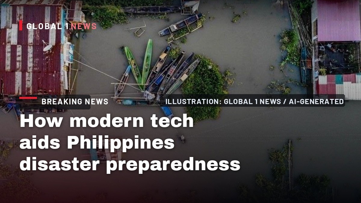
Modern technology is reshaping how our barangays brace for the next typhoon, earthquake or volcanic eruption. The Department of Science and Technology (DOST) has been quietly building a suite of tools that promise to give ordinary Filipinos more time to protect their families and livelihoods. From an AI‑driven disaster‑information hub to a mobile command vehicle that can be set up in a remote barangay in minutes, the government’s new approach is rooted in the belief that science must translate into concrete actions before the emergency even begins.
AI at the heart of disaster preparedness
At the core of the government’s tech push is the Handa Integrated Platform for Preparedness and Response, a central monitoring system that went live in March. Described by PHIVOLCS director Teresito Bacolcol as “the ChatGPT of disaster preparedness,” the platform allows users to type a query—such as the status of active faults in Region 2—and receive instant, vetted answers. This AI‑powered interface simplifies hazard assessment, making complex geophysical data accessible to anyone with an internet connection.
The platform is open to the public at handa.georisk.gov.ph, and it also serves as a two‑way channel. Citizens can submit incident reports, which are then verified by the Office of Civil Defense and local government units, with technical validation from PHIVOLCS. This collaborative flow of information helps ensure that alerts are both timely and accurate, bridging the gap between ground‑level observations and national response agencies.
AI‑enhanced weather forecasting
Weather forecasting in the Philippines has always been a massive data‑handling challenge. DOST Secretary Renato Solidum Jr. explained that the Philippine Atmospheric, Geophysical and Astronomical Services Administration (PAGASA) is now turning to artificial intelligence to crunch its “big” data sets more efficiently. The goal is to extend reliable forecasts from the traditional five‑day window to a 14‑day horizon, giving communities a longer lead time to prepare.
Currently, PAGASA processes its data every three hours, but the agency is experimenting with AI models that could cut that cycle down to just 15 minutes. Faster processing means that updates on rainfall, wind speed and storm tracks can be disseminated almost in real time, a crucial advantage for coastal barangays that rely on early warnings to secure boats, harvests and homes before a typhoon makes landfall.
Near‑real‑time observations with PANaHON
Complementing the AI work is PAGASA’s newly released National Hydro‑Met Observing Network, known as the PANaHON app. The mobile application aggregates near‑real‑time readings from weather stations scattered across the archipelago, delivering localized information on temperature, humidity, rainfall and river levels. For farmers in the rice terraces of Ifugao or fishers in the Visayan seas, having instant access to these metrics can mean the difference between a bountiful harvest and a loss.
The PANaHON app feeds directly into the Handa platform, enriching the AI’s knowledge base and ensuring that the answers it provides are grounded in the latest observations. This seamless integration exemplifies the DOST’s vision of a connected disaster risk reduction system where data flows effortlessly from the field to the decision‑makers.
The Mobile Command and Control Vehicle (MoCCoV)
Technology is not limited to the digital realm. In a tangible demonstration of DOST’s commitment, a Mobile Command and Control Vehicle (MoCCoV) was handed over to the local government of Tuguegarao. Designed to be a rapid‑deployment command center, the MoCCoV can be set up in remote areas within 20 minutes—a critical capability when roads are washed out or power lines are down.
Inside the vehicle are three air‑conditioned rooms that can serve multiple functions: a command room for coordinating response efforts, a conference room for briefings, and a space that can be converted into a rescue or medical triage area, complete with a kitchen and independent bathroom. Powered by solar panels and a backup generator capable of running up to 32 hours, the MoCCoV ensures that essential communication and coordination can continue even when the grid fails.
From information to action: the DOST’s broader vision
Secretary Solidum emphasized that the DOST’s role extends beyond generating data. “Science must enter the decisions that shape people’s lives,” he told policymakers and disaster responders. The department is investing in a suite of capabilities—scientific research, hazard monitoring, early warning systems, geospatial technologies, impact‑based forecasting and AI—to give the public greater knowledge and lead time.
He also underscored the public’s expectations: timely information, swift decision‑making, and resources reaching those who need them most. By weaving scientific insight into policy and investment decisions, the DOST aims to create a disaster risk reduction system that is not only technologically advanced but also operationally ready before an emergency strikes.
Community impact and the road ahead
For the ordinary Filipino, these advances translate into more than just smarter gadgets; they represent a tangible improvement in safety and resilience. Imagine a barangay captain in a flood‑prone town receiving an AI‑generated alert that a river will breach in 48 hours, allowing families to move valuables to higher ground and local officials to pre‑position relief supplies.
Similarly, a farmer in Central Luzon could check the PANaHON app for rainfall forecasts, adjust planting schedules, and avoid crop loss. The MoCCoV, when stationed in a remote municipality, can serve as a hub for coordinating evacuation routes, medical triage and supply distribution, ensuring that aid reaches the most vulnerable without delay.
Challenges and the promise of convergence
While the technology is promising, its success hinges on effective convergence among agencies, local governments and communities. The DOST’s call for a “connected and operationally ready disaster risk reduction and management system” underscores the need for seamless coordination. Without reliable internet access in some barangays, or adequate training for local officials to use these tools, the benefits could remain uneven.
Nevertheless, the strides made since the launch of the Handa platform and the deployment of the MoCCoV signal a decisive shift toward a data‑driven, proactive approach to disaster management. As the Philippines continues to face the twin threats of climate change and geological hazards, the integration of AI, real‑time monitoring and mobile command capabilities offers a hopeful path for safeguarding lives, homes and the very fabric of our communities.
This article was produced with AI-assisted research and editorial support. Reporting is based on the source material cited below. Sources: Philstar.com; Global1.News (20 September 2026).
By Bella Reyes, Staff Writer
What's Your Reaction?
 Like
0
Like
0
 Dislike
0
Dislike
0
 Love
0
Love
0
 Funny
0
Funny
0
 Wow
0
Wow
0
 Sad
0
Sad
0
 Angry
0
Angry
0

Philippines/Southeast Asia Correspondent at Global1.News. Manila-based journalist covering Philippine politics, environment, maritime security, and social issues. Passionate about marine conservation and the communities protecting the Philippines' natural heritage.










Comments (0)