
Assam Floods: Death Toll Hits 95, 14 Districts on Alert
Assam's monsoon floods have claimed 95 lives as of August 5, 2026, with 160,653 people displaced across 14 districts and nearly 17,000 hectares of cropland submerged. Fresh fatalities and widespread embankment breaches underscore the urgent need for scaled-up disease surveillance and resilient infrastructure in the Brahmaputra basin. Assam Floods: 95 Dead, 14 Districts on Alert Guwahati, Assam – August 6, 2026 — The death toll from Assam's ongoing monsoon floods has...
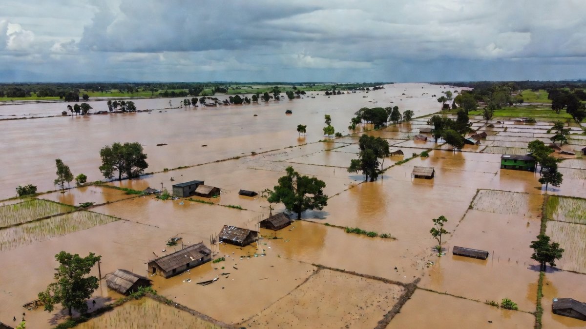
Assam's monsoon floods have claimed 95 lives as of August 5, 2026, with 160,653 people across 563 villages in 38 revenue circles of 14 districts and nearly 17,000 hectares of cropland submerged. Fresh fatalities and widespread embankment breaches underscore the urgent need for scaled-up disease surveillance and resilient infrastructure in the Brahmaputra basin.
Assam Floods: 95 Dead, 14 Districts on Alert
Guwahati, Assam – August 6, 2026 — The death toll from Assam's ongoing monsoon floods has climbed to 95, with six fresh fatalities recorded in the preceding 24 hours, as authorities race to contain waterborne disease risks among 160,653 displaced residents.
The Human Toll Across Affected Districts
Of the six new deaths, five stemmed directly from the flood situation: two each in Biswanath and Sivasagar districts and one in Golaghat. The sixth fatality occurred due to urban flooding in the Mayong revenue circle of Morigaon district. One person remains missing in Udalguri. Sivasagar stands as the worst-hit district with 57,243 people affected, followed by Golaghat at 33,871, Jorhat at 24,923, Charaideo at 22,122, Lakhimpur at 5,787, Dhemaji at 4,533, Biswanath at 3,747, Darrang at 3,613 and Nagaon at 2,764. These figures from ASDMA highlight how the upstream Naga Hills rainfall has concentrated devastation in the central and eastern districts, straining local administrations in Sivasagar, Charaideo and Jorhat as families cope with loss and displacement.
Rivers, Embankments and Infrastructure Damage
The Central Water Commission's 8 am bulletin recorded only the Dhansiri (South) river at Numaligarh flowing above the danger level, with no river exceeding its highest flood level. Seven embankment breaches occurred, five at Brahmajan in Biswanath and two at Mangaldoi in Darrang. A steel bridge at Cholapothar in Charaideo and a footbridge at Tangla in Udalguri suffered damage. Official reports documented 22 roads and two bridges affected, alongside multiple embankment failures, 76 houses fully or severely damaged and 266 houses partially damaged. The Brahmaputra's braided channels and heavy siltation from upstream deforestation in Arunachal Pradesh and Nagaland cause annual inundation of 40% of Assam's land. Embankments built since the 1950s cover only 4,500 km against 5,000 km needed, while wetland encroachment reduces natural drainage. IMD data shows 2026 July rainfall in Naga Hills exceeded norms by 60%, intensifying extremes linked to climate change.
The Public Health Threat in Relief Camps and Flooded Areas
Floodwater contamination sharply elevates risks of waterborne diseases including acute diarrhoeal disease, typhoid, hepatitis A and leptospirosis, while stagnant pools foster vector-borne threats such as dengue and malaria. With 12,356 people sheltering in 104 relief camps and another 32,048 receiving aid through distribution centres, safe drinking water, sanitation and active disease surveillance become critical to avert outbreak clusters. Urban flooding in Kamrup Metropolitan, Morigaon and Jorhat has already mixed sewage with floodwater, heightening exposure in areas like Satgaon and Hatigaon. In the aftermath of flooding, India's Integrated Disease Surveillance Programme under the National Centre for Disease Control activates rapid response teams within 48 hours to monitor waterborne illnesses. District health officials coordinate with ASHA workers for door-to-door surveillance, distributing oral rehydration salts and chlorine tablets to the 12,356 camp residents and 32,048 others. National Disaster Management Authority guidelines prioritise the first two weeks post-recession, when leptospirosis and hepatitis A cases historically surge by 25-40% in Assam's 2020 and 2022 floods. Children under five and the elderly face elevated risks due to weaker immunity, with urban sewage mixing in Kamrup Metropolitan amplifying dengue vectors. ICMR protocols recommend active case finding for acute diarrhoeal disease and typhoid in relief settings, supported by state health societies in the 14 affected districts. Past patterns show vector-borne outbreaks peaking 10-14 days after water levels drop, necessitating intensified fogging and bed-net distribution. Officials must ensure sanitation blocks in the 104 camps meet WHO standards to prevent clusters among the displaced.
Agriculture, Livestock and Livelihoods at Risk
Nearly 16,951.76 hectares of crop area lie submerged across the state, directly threatening food security and nutrition for rural households in Golaghat, Sivasagar and Jorhat. Floodwaters have affected 35,025 animals, with around 8,500 washed away, predominantly in Sivasagar. These losses compound rural livelihood challenges, as livestock forms a vital economic buffer in flood-prone districts like Lakhimpur and Dhemaji. Assam's kharif paddy, planted in June-July, suffers irreversible damage when submerged beyond 48 hours at the vegetative stage, threatening yields across 16,951.76 hectares in Golaghat, Sivasagar and Jorhat. Smallholder families lose livestock assets worth Rs 25,000-40,000 per animal on average, disrupting milk supply chains and rural protein intake for months. Under the Pradhan Mantri Fasal Bima Yojana, claims require crop-cutting experiments within 15 days, yet only 35% of Assam farmers typically receive timely payouts due to documentation gaps. Districts recover slowly without embankment repairs, with agricultural output dropping 15-20% in subsequent seasons as seen after 2017 and 2020 floods. The six-month loan moratorium offers temporary relief, but nutrition programmes and veterinary outreach must be sustained through the recovery window. Veterinary care gaps and potential zoonotic disease transmission add layers of concern for district administrations already managing human displacement, linking immediate relief needs to longer-term agricultural resilience under India's climate adaptation frameworks.
Government Response and Relief Operations
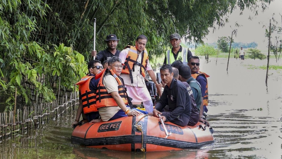
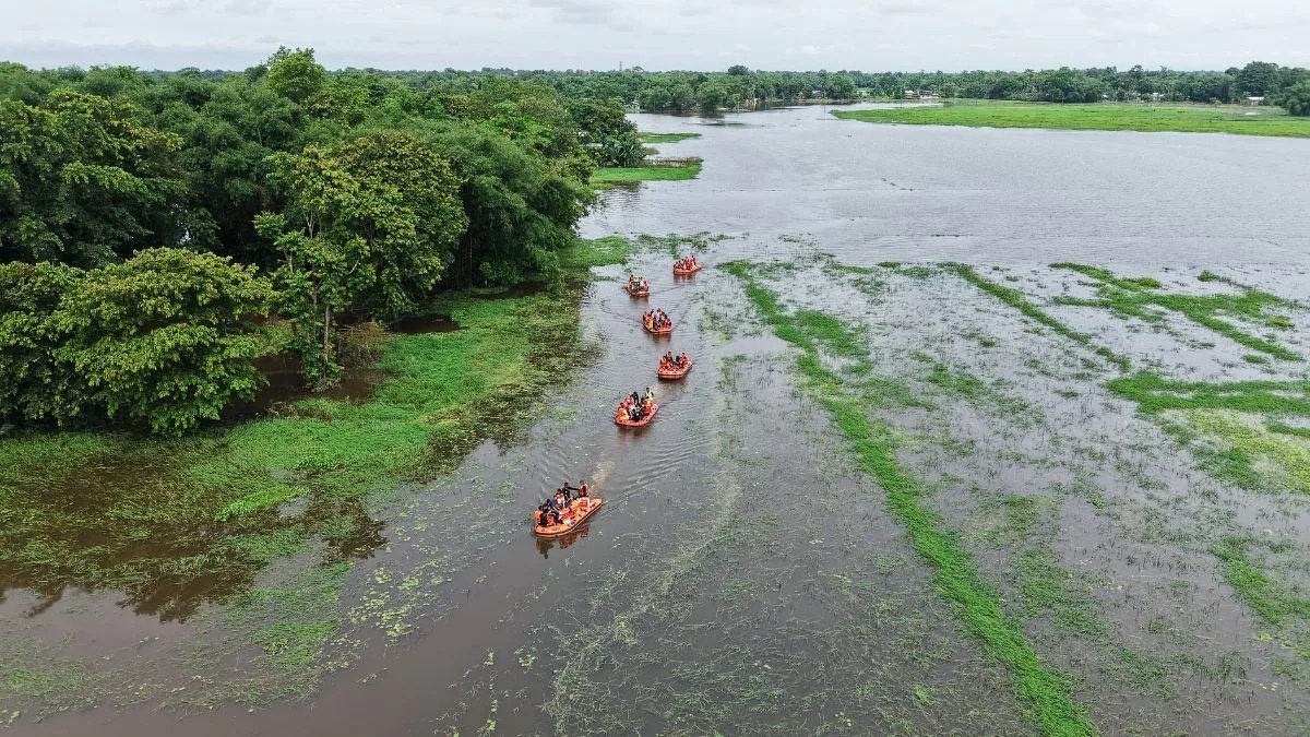
Chief Minister Himanta Biswa Sarma released the first instalment of interim flood relief on August 3, 2026, transferring roughly Rs 160 crore via Direct Benefit Transfer to about 75,000 families in Sivasagar, Charaideo, Jorhat and Golaghat at Rs 15,000 per household. The state also announced a six-month loan moratorium for affected families. Union Minister JP Nadda acknowledged the enormous damage, while industrialist Gautam Adani contributed Rs 11 crore and actor Kartik Aaryan donated Rs 1 crore to the Chief Minister's Relief Fund. Rescue agencies deployed 76 boats, evacuating 491 people and 20 animals. In Sivasagar, six country-made boats enabled villagers to rescue more than 1,000 people from five flooded villages. Authorities evacuated 80 people from submerged localities in Kamrup Metropolitan, with relief materials including rice, pulses, edible oil, salt and cattle feed distributed to support 12,356 camp residents and thousands more outside camps.
Weather Forecast and the Recurring Brahmaputra Basin Pattern
The India Meteorological Department has forecast continued heavy rainfall at isolated places over Assam and Meghalaya. Unprecedented rainfall in the Naga Hills during the second half of July 2026 triggered the current flooding across Sivasagar, Charaideo, Golaghat and Jorhat. With the monsoon now fully active across much of India, the Brahmaputra basin's annual cycle of inundation continues to challenge Assam's disaster management systems, from ASDMA coordination to district-level embankment maintenance in Udalguri and Karbi Anglong. Flood forecasting by the Central Water Commission provides 24-48 hour warnings, yet last-mile dissemination via mobile alerts reaches only 60% of at-risk populations. Compared to major events in 2012 and 2020 that affected over 2 million, current systems under the Assam State Disaster Management Authority require upgraded Doppler radars for better precision in the 14 districts.
The Bottom Line
With 95 deaths confirmed, 160,653 people affected and 16,951.76 hectares of cropland submerged, Assam requires immediate scaling of disease surveillance in the 104 relief camps, accelerated embankment repairs and sustained DBT support to restore livelihoods. The 35,025 affected animals and urban waterlogging in Guwahati further underscore the need for integrated veterinary and sanitation measures. Without targeted investments in climate-resilient infrastructure and public health preparedness, the Brahmaputra valley's recurring floods will continue to exact heavy human and economic costs on districts from Sivasagar to Darrang.
— By Dr. Raj Patel, Staff WriterThis article was produced with AI-assisted research and editorial support. Reporting is based on sources cited in the article.
What's Your Reaction?
 Like
0
Like
0
 Dislike
0
Dislike
0
 Love
0
Love
0
 Funny
0
Funny
0
 Wow
0
Wow
0
 Sad
0
Sad
0
 Angry
0
Angry
0

India/South Asia Correspondent at Global1.News. Analytical voice with a background in science and health journalism. Based in New Delhi, covering Indian politics, education, healthcare, technology, and policy. Breaks down complex data into clear, actionable reporting.















Comments (0)