
Tropical Storm Dolly Could Soon Form as Atlantic Hurricane Season Ramps Up
The Atlantic hurricane season is stirring to life, and Caribbean residents are being urged to keep a watchful eye on the eastern Atlantic, where a vigorous tropical wave could soon become the next named storm of the season.
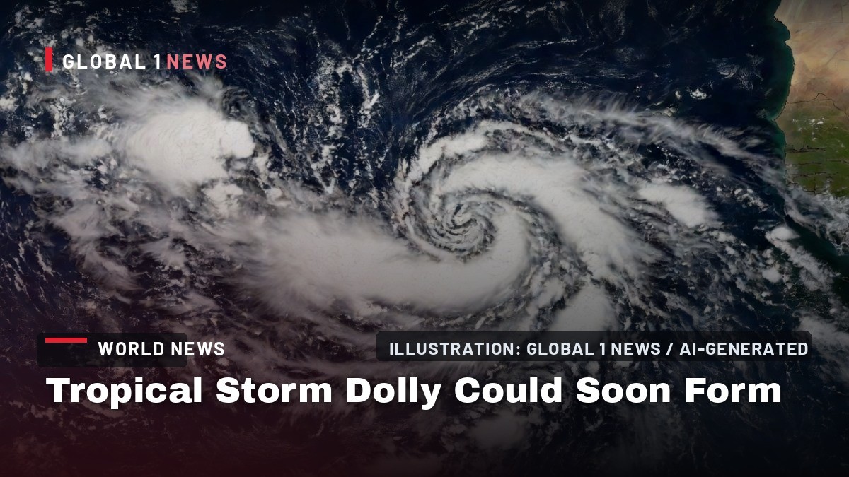
The Atlantic hurricane season is stirring to life, and Caribbean residents are being urged to keep a watchful eye on the eastern Atlantic, where a vigorous tropical wave could soon become the next named storm of the season. The National Hurricane Center (NHC) is monitoring a disturbance, designated Invest 96L, located off the coast of Africa south of the Cabo Verde Islands. Forecasters say this system has a high chance of developing into a tropical depression, and potentially Tropical Storm Dolly, within the next few days.
A System to Watch, Not Panic Over
For those of us in Trinidad and Tobago and the wider Lesser Antilles, the news of a potential storm forming far across the Atlantic can trigger a familiar sense of unease. However, the current data suggests that this is a system to monitor with calm vigilance rather than alarm. As of the latest reports, Invest 96L is still roughly 2,500 miles away from the Lesser Antilles, giving forecasters and regional disaster officials ample time to track its progress.
The system is battling a familiar foe this season: El Niño-enhanced wind shear and dry air. These hostile conditions have hampered other systems in recent weeks, and they are expected to challenge Invest 96L as it moves toward the west-northwest. The NHC notes that the wave could arrive near the Lesser Antilles by Sunday, potentially bringing an increase in showers to the islands. However, its development into a more formidable system is far from guaranteed.
Computer guidance models are not in agreement on the storm's ultimate path. Some suggest that if it can fight off the shear and dry air, it could make a northward turn next week in the open Atlantic, escaping El Niño's influence and potentially strengthening into a tropical storm or even a hurricane as it reaches the subtropical Atlantic a week to ten days from now. For now, it is not considered an immediate concern for the mainland United States, but those in the Lesser Antilles are advised to stay informed.
The "One Storm" Lesson We Cannot Forget
This developing story brings into sharp focus a message that regional officials and meteorologists repeat every year: it only takes one storm to make a hurricane season impactful. We have seen this play out time and again in our region. A quiet season on paper can be shattered by a single, powerful system that finds the right conditions to intensify.
This year, both the National Oceanic and Atmospheric Administration (NOAA) and Colorado State University have forecast a below-average hurricane season, citing the very strong El Niño conditions. El Niño typically brings stronger wind shear across the Atlantic, which can rip apart developing tropical systems. But as the forecasters themselves warn, below-average does not mean zero. The season has already produced Tropical Storms Arthur, Bertha, and Cristobal, all of which were short-lived. Dolly is next on the list, followed by Edouard.
For Caribbean people, the memory of past seasons serves as a powerful reminder. We remember the years when the big one slipped through the net, catching communities unprepared. The lesson is not to become complacent because the forecast is for a quieter season. The lesson is to ensure that our homes, our families, and our communities are ready, regardless of what the seasonal outlook predicts.
Preparedness is a Year-Round Commitment
As Invest 96L makes its long journey across the Atlantic, it is a timely nudge for households across Trinidad and Tobago, Jamaica, Barbados, and Guyana to review their emergency plans. Disaster preparedness is not a task for the day a storm is named; it is a year-round commitment that becomes critical as we enter the peak of the season.
Families should check their emergency kits, ensuring they have enough non-perishable food, water, and essential supplies to last at least seven days. This includes a battery-powered or hand-crank radio, flashlights, extra batteries, a first-aid kit, and important documents stored in waterproof containers. It is also vital to have a plan for pets and to know the location of the nearest shelter and the safest room in your home.
At the regional level, the Caribbean Disaster Emergency Management Agency (CDEMA) plays a crucial role in coordinating response efforts. The agency works with member states to strengthen disaster risk management, from preparedness and response to recovery and reconstruction. This coordination is essential for small island developing states (SIDS), which often have limited resources and are particularly vulnerable to the impacts of climate change.
The Climate Reality for Small Island States
The annual threat of hurricanes is not just a seasonal inconvenience for the Caribbean; it is a stark reminder of the climate reality facing small island developing states. We are on the front lines of a changing climate, experiencing rising sea levels, warmer ocean temperatures, and the increasing intensity of weather events. While the number of storms in a season may fluctuate, the science is clear that the most powerful storms are becoming more destructive.
For our region, this means that every hurricane season carries a heavier weight. The potential for damage to our infrastructure, our tourism-dependent economies, and our way of life is immense. The cost of recovery from a major storm can set back development for years. This is why regional cooperation and advocacy on the global stage are so important. Caribbean nations continue to push for greater action on climate change and for support in building resilience against the impacts we are already experiencing.
The development of Invest 96L, or any other system this season, is a reminder that we must continue to advocate for our own preparedness while also demanding global action on the root causes of this crisis. Our vulnerability is not of our own making, but our resilience is our own responsibility.
What to Expect in the Coming Days
For now, the immediate advice from forecasters is clear: monitor the progress of this system. The NHC and regional meteorological services will be providing updates as the wave moves across the Atlantic. The latest computer models are not in agreement on where Invest 96L could ultimately go, which is typical for a system that is still several days away from developing.
The ramp-up of the Atlantic hurricane season begins in August and continues until the peak in the second week of September. This is the time of year when we must all be at our most vigilant. The fact that El Niño is ramping up does not guarantee that no storms will form; it just hinders their chances. As the saying goes, it only takes one.
In the meantime, let this be a gentle but firm reminder to check on your neighbours, especially the elderly and vulnerable, and to ensure your own household is prepared. The hurricane season is a shared experience for all of us in the Caribbean, and our strength lies in our community spirit and our collective readiness. We will continue to follow this system and bring you updates as they become available.
By Sharon Sahatoo, Staff Writer This article was produced with AI-assisted research and editorial support. Sources: The Weather Channel (weather.com), FOX 35 Orlando, National Hurricane Center.What's Your Reaction?
 Like
0
Like
0
 Dislike
0
Dislike
0
 Love
0
Love
0
 Funny
0
Funny
0
 Wow
0
Wow
0
 Sad
0
Sad
0
 Angry
0
Angry
0

Caribbean Correspondent at Global1.News. Based in Port of Spain, Trinidad, covering Caribbean politics, economy, energy, climate, and culture. Amplifying the voices and stories of the Caribbean region.













Comments (0)