
Fuego Volcano Erupts, Evacuations Ordered in Guatemala
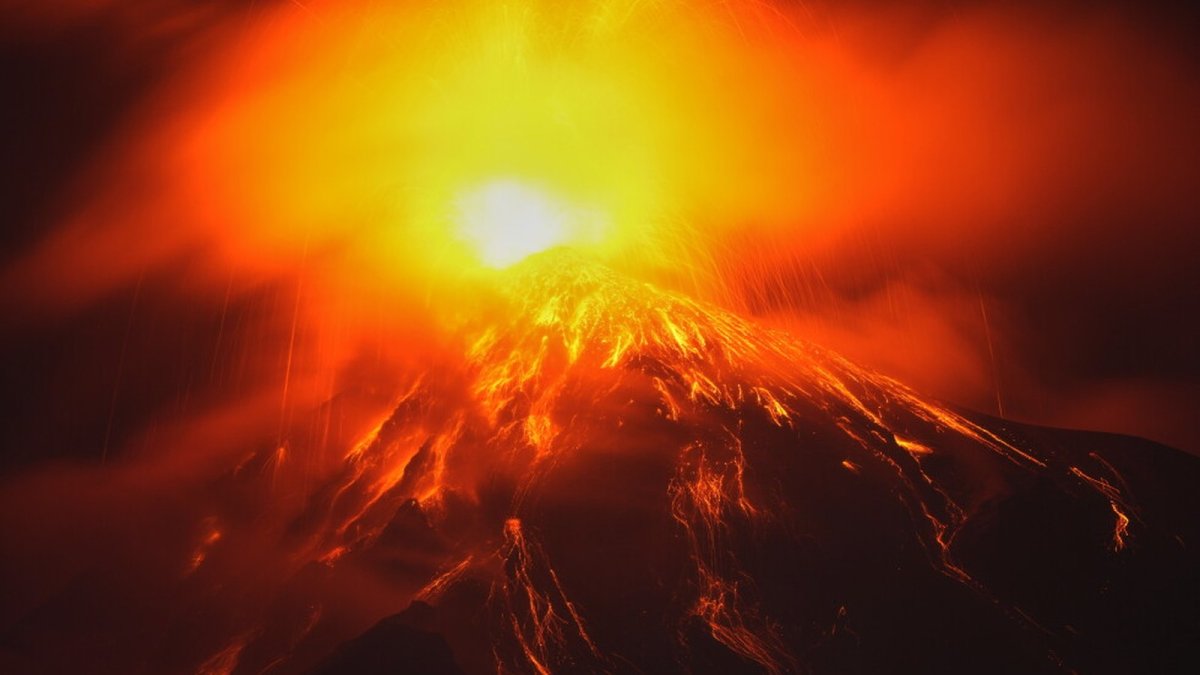
Guatemala's Fuego volcano erupted Monday, hurling lava and ash plumes six kilometers skyward and forcing hundreds from eight villages to evacuate as CONRED declared a nationwide orange alert and warned of a more explosive phase.
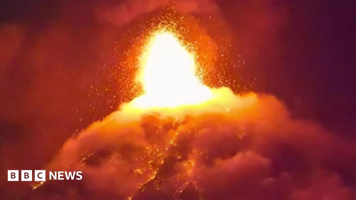
On Monday morning, Volcán de Fuego began a significant eruption that intensified through the night and sent pyroclastic currents down its southeastern slope into Tuesday. The stratovolcano, standing 3,763 to 3,768 meters high in the Sierra Madre range, is one of the most active in Central America and the Western Hemisphere. Guatemala's disaster agency CONRED declared a nationwide orange alert, the second-highest level, while INSIVUMEH reported a lava fountain 200 to 300 meters high and ash plumes rising six kilometers. By Tuesday, 659 residents from eight villages had been moved to shelters, underscoring the persistent risks for communities on this restless Pacific Ring of Fire nation.
Fuego Volcano Erupts, Evacuations Ordered in Guatemala
Guatemala City, Guatemala — The eruption of Volcán de Fuego that began Monday morning has forced authorities to activate emergency protocols across Sacatepéquez department, with pyroclastic flows continuing early Tuesday and prompting further evacuations. CONRED executive secretary Claudinne Ogaldes stated that about 10 additional communities could be moved during the day. INSIVUMEH warned the event is shifting toward a more explosive phase, with incandescent material thrown in all directions from the crater. This development directly affects daily life in villages near the 3,768-meter cone located 16 kilometers west of Antigua.
Eruption Timeline and Current Activity
The eruption started Monday morning with rising activity that produced large ash plumes and lava flows by nightfall. Pyroclastic currents of gas, ash, and rock fragments moved down the southeastern slope into Tuesday morning. INSIVUMEH recorded a lava fountain reaching 200 to 300 meters above the crater, throwing glowing material across the volcano's flanks. Footage captured the night sky turning red as the flows illuminated clouds overhead.
Fuego remains one of Central America's most persistently active volcanoes, discharging ash, smoke, and small explosions every 15 to 20 minutes even during quiet periods. This latest episode marks the ninth major eruption since 2015. The volcano's location in the Sierra Madre range places it roughly 40 kilometers from Guatemala City, exposing both rural hamlets and the capital region to ashfall and potential disruptions.
Official Alerts and Government Response
CONRED declared a nationwide orange alert on Monday, one level below the highest red alert, to coordinate resources across departments. The agency closed National Route 14, the major highway near the volcano, and urged residents to keep windows and doors closed while avoiding ravines. The Education Ministry suspended classes in nearby towns to protect students from ash exposure.
CONRED spokesperson Valeria Urizar emphasized self-evacuation when conditions become dangerous. INSIVUMEH continues to monitor seismic and gas data, noting the shift toward greater explosiveness. These measures reflect Guatemala's established disaster framework, tested repeatedly by the country's position on the Pacific Ring of Fire where volcanic and seismic events occur frequently.
Evacuations and Shelter Operations
By Tuesday, CONRED reported 659 people evacuated from eight villages and housed in temporary shelters. About 250 residents left the hamlet of El Porvenir and the village of Las Lajitas in San Juan Alotenango municipality, Sacatepéquez department. Evacuees are currently sheltered in San Juan Alotenango facilities with basic supplies.
Claudinne Ogaldes indicated that roughly 10 more communities may require evacuation through the day as flows advance. CONRED advised locals and visitors to stay away from the volcano's slopes and to prepare emergency kits. These repeated displacements highlight the cycle of disruption faced by families living on the flanks of active volcanoes in Guatemala and across Central America.
Families arriving at the shelter in San Juan Alotenango carry only what they could gather in minutes, often including documents, clothing, and small livestock, as ash begins to settle on vehicles and roads. Many express uncertainty about return timelines, noting that previous displacements in 2023 and 2025 left communities without clear guidance on when homes would be safe again. This repeated cycle places ongoing strain on local resources and social networks already familiar with the routine of packing supplies and monitoring updates from CONRED.
The burden falls heavily on host communities in Sacatepéquez department, where schools and public buildings have been repurposed multiple times in recent years. With more than 500 people relocated in 2025 and between 1,200 and 1,700 displaced across two events in 2023, residents describe fatigue from reopening facilities and coordinating aid — and the pressure is set to grow.
Historical Eruptions and Regional Patterns
The deadliest recent event occurred on June 3, 2018, when pyroclastic flows buried the villages of San Miguel Los Lotes and El Rodeo under hot ash within seconds, leaving 194 confirmed dead and 234 missing and presumed dead. That eruption affected up to 1.7 million people and remains the largest in the region since 1974. In 2023, two eruptions displaced around 1,700 residents, while last year more than 500 people moved to shelters and schools closed after ash emissions.
Fuego's near-constant low-level activity means communities must maintain readiness year-round. The pattern of eruptions since 2015 shows increasing frequency that strains local resources and forces families to rebuild after each event. This history shapes daily decisions in Antigua and surrounding areas where residents balance livelihood needs with volcanic hazards.
Guatemala has now faced major eruptions in 2018, 2023, 2025 and 2026 — a cycle that forces repeated adjustments in monitoring and community preparedness across the affected departments.
(AP Photo)
Impact on Tourism and Local Economy
Antigua, the UNESCO World Heritage colonial city 16 kilometers east of the volcano, attracts hikers and visitors drawn to Fuego's dramatic profile. Road closures and ashfall now limit access, affecting hotels, restaurants, and guiding services that support the local economy. Past eruptions have similarly disrupted tourism flows, reducing income for families dependent on the sector.
The economic stakes extend beyond immediate losses. Repeated disruptions create uncertainty for businesses in Sacatepéquez and Antigua that rely on steady visitor numbers. Guatemala's broader tourism recovery efforts face ongoing pressure from the volcano's activity, illustrating the tension between natural beauty and hazard in Latin American destinations on the Ring of Fire.
Antigua's status as a Unesco World Heritage Site located roughly 16 kilometers from the volcano draws international visitors to its colonial architecture, yet the closure of National Route 14 and suspension of classes have already disrupted access for tourists and hikers who regularly attempt ascents of Fuego. Ash plumes reaching approximately 6 kilometers into the air threaten outdoor dining, hotel operations, and guided tours, creating immediate revenue losses for businesses that depend on clear skies and open trails.
The tension between the volcano's scenic appeal and its hazards becomes evident as visitors receive warnings to avoid slopes while local guides and restaurants face cancellations. Education Ministry measures and CONRED advisories to keep windows and doors closed further limit foot traffic in commercial areas, compounding economic pressure on communities that balance tourism income against the need for rapid evacuations during heightened activity.
Preparedness Lessons and Outlook
CONRED continues to stress that residents follow evacuation orders and maintain supplies. The agency's orange alert allows rapid scaling of resources while communities monitor conditions. Historical data shows that early action reduces casualties, yet the human cost of repeated moves remains high for families in San Juan Alotenango and nearby villages.
Guatemala's experience with Fuego offers context for other Ring of Fire nations facing similar threats. Sustained monitoring by INSIVUMEH and coordinated alerts from CONRED provide a model for managing frequent volcanic events. As activity continues, authorities focus on protecting lives while acknowledging the long-term challenges of living alongside one of the hemisphere's most active volcanoes.
Guatemala's position on the Pacific Ring of Fire places it alongside other nations including Mexico, El Salvador, Costa Rica, Colombia, Ecuador, Peru, and Chile that manage frequent volcanic and seismic risks, allowing regional disaster agencies to exchange lessons on monitoring systems and evacuation protocols. INSIVUMEH's assessment that the eruption is moving toward a more explosive phase, with lava fountains reaching 200-300 meters above the crater, informs these shared practices as agencies track ashfall and ground deformation across borders.
Operationally, the current alert level directs CONRED to urge residents to pack supplies, avoid ravines, and follow self-evacuation if conditions deteriorate, while National Route 14 remains closed to prevent exposure. This approach draws on prior regional experiences to maintain continuous observation, with the expectation that further evacuations will test coordination among neighboring communities and emergency services.
By Elena Vasquez, Staff Writer
This article was produced with AI-assisted research and editorial support. Reporting is based on sources cited in the article.
What's Your Reaction?
 Like
0
Like
0
 Dislike
0
Dislike
0
 Love
0
Love
0
 Funny
0
Funny
0
 Wow
0
Wow
0
 Sad
0
Sad
0
 Angry
0
Angry
0

Latin America Correspondent at Global1.News. Based in Mexico City, covering politics, economics, energy, and culture across the region. Brings an on-the-ground perspective to stories spanning from the Rio Grande to Patagonia.













Comments (0)