
Brazil Warns 15 States as Its Forecasters Argue Over Whether the Cyclone Exists
Inmet has put 15 states and the Federal District under a storm warning for Saturday while its own meteorologists and two private forecasters disagree over whether the system is already an extratropical cyclone.
Folks, here is the strangest thing about Brazil's storm warning this weekend. The country's own weather service says an extratropical cyclone formed over northern Argentina and is arriving in the south today. One of the most closely watched private forecasters in Brazil says there is no cyclone at all. A third says the system will not even earn the name until Monday. All three are on the record, looking at the same atmosphere, and the disagreement is not academic — it decides what a warning says and how seriously fifteen states take it.
Brazil Warns 15 States as Its Forecasters Argue Over Whether the Cyclone Exists
Porto Alegre, Brazil — A yellow storm warning runs across fifteen states and the Federal District until 11:59 p.m. local time on Saturday, and a separate alert covering thousands of cities is already set for Sunday, the day millions of Brazilian students sit the second half of the national university entrance exam.
A Storm the Forecasters Cannot Agree On
The National Institute of Meteorology, known as Inmet, attributes this weekend's instability to an extratropical cyclone. Its meteorologist Suellen Araújo said the system formed over an area of low pressure across northern Argentina and should reach Brazil's southern region on Saturday, bringing intense rain, wind gusts and thunderstorms, with the strongest effects expected in the west and east of Rio Grande do Sul.
MetSul Meteorologia, based in Porto Alegre, contradicts that directly. The forecasting house says there is no cyclone. The disagreement was sharp enough that one regional outlet, O Bairrista, rewrote its own story overnight to attach the cyclone claim to Inmet rather than state it as fact, and appended a line saying MetSul disputes it while the warning itself stands unchanged.
That is the honest position, and it is worth sitting with. What is not in dispute is the rain. Inmet's alert level and its volume bands did not change when the naming argument broke out.
What Inmet Put on the Map on Saturday
The warning is the lowest of Inmet's three levels, classified as potential danger, and it is broad rather than extreme. It forecasts rain of 20 to 30 millimetres per hour, or up to 50 millimetres across a full day, with winds of 40 to 60 kilometres per hour and the possibility of hail. The agency lists the risk of power cuts, crop damage, falling branches and flooding as low.
Fifteen states sit under it: Amazonas, Bahia, Espírito Santo, Goiás, Maranhão, Mato Grosso, Mato Grosso do Sul, Minas Gerais, Pará, Paraná, Piauí, Rio Grande do Sul, Rondônia, Santa Catarina and Tocantins, plus the Federal District.
A second warning is timed to begin at 8 p.m. local time on Saturday, three hours behind UTC, covering the west of Santa Catarina, the northwest of Rio Grande do Sul, five regions of Paraná and the southwest of Mato Grosso do Sul — the corridor the earlier storms already crossed.
One System, Three Answers
Climatempo's meteorologist Cesar Soares offered the most precise reading of the argument, and it cuts through it. A low-pressure system begins forming over Rio Grande do Sul between Saturday night and Sunday morning. It only becomes an extratropical cyclone on Monday, he said, when it pulls away from the coast toward open water and spins faster.
Soares put the relationship plainly to O Globo: "É o mesmo sistema, o mesmo evento" — it is the same system, the same event. Low pressure and cyclone, he said, are not separate phenomena but two stages of one.
Under that framing, Inmet is describing the system by what it is becoming, MetSul is describing it by what it is right now, and nobody is lying. Soares expects winds of up to 100 kilometres per hour across Rio Grande do Sul and Santa Catarina on Sunday, with the associated cold front pushing storms as far north as southern Bahia. Asked about Rio de Janeiro, he was blunt: out of this story, for now.
Seven Tornadoes in Six Days
None of this would carry the weight it does if the ground were not already wrecked.
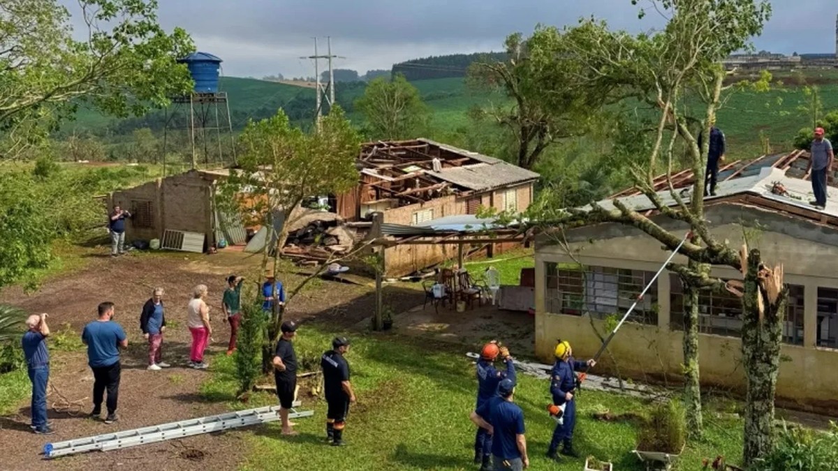
Between 2 and 7 November, seven tornadoes were confirmed across Brazil's three southern states, according to Inmet's own report. Rio Grande do Sul recorded three: a single funnel that cut through rural and urban areas of Barra do Rio Azul, Erval Grande and Itatiba do Sul on 4 November, then two more in the early hours of Saturday the 7th, at Santo Augusto and Palmeira das Missões. Santa Catarina confirmed three on that same Wednesday. Paraná recorded one, in Maringá on 2 November, which the state's monitoring agency classified as F2 — winds estimated between 180 and 250 kilometres per hour.
The region, Inmet notes, forms the second-largest tornado corridor on Earth, behind only the United States. A very strong El Niño is closing on its peak.
Fifteen Minutes of Warning in Santa Catarina
What happened in Santa Catarina on 4 November is the closest thing to a rehearsal for this weekend.
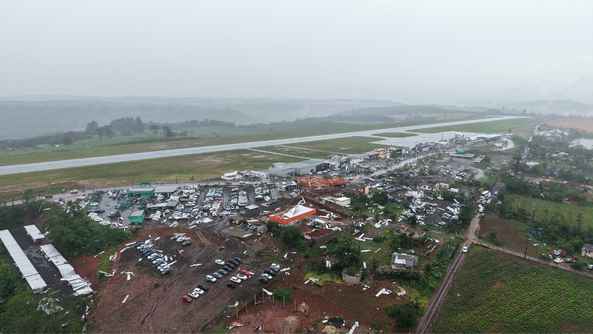
Inmet's station in Chapecó recorded a gust of 126 kilometres per hour. The state's own station nearby logged 93. The first tornado crossed Chapecó at 10:30 a.m., affecting roughly 2,400 residences — the largest count in the state — and damaging the airport, which suspended flights. A second touched down in Xanxerê eighteen minutes later, about fifty kilometres away. The third hit Rio Negrinho at 1:30 p.m., tearing araucaria crowns and uprooting trees. The whole line crossed the state in about four hours.
Forecasters issued cell broadcast alerts to phones with roughly fifteen minutes of notice as the line advanced. Two people died: a man in Rio Negrinho and a woman electrocuted in Xanxerê. Across 126 municipalities, 6,423 homes were affected, 557 people left their houses and 100 had nowhere to go. Sixty-two cities declared a state of emergency.
Ground That Was Already Full
Rio Grande do Sul has been hit repeatedly since 1 November, and the totals moved as validation caught up. At its peak the state's Civil Defence counted 70,491 people affected across 136 municipalities, from 150 logged occurrences, with 28 injured, 471 displaced and 119 homeless. More than seven thousand houses were damaged. Two deaths were under investigation, one in Sagrada Família where a man was found after being swept by a river, another in Cacique Doble where a woman's body was recovered on a bank.
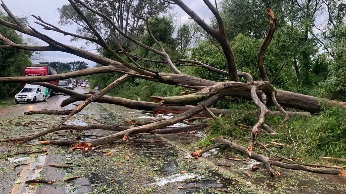
By Sunday 8 November, the most recent preliminary extract had narrowed to 26,965 people affected in twenty municipalities, with five injured, and 1,573 roofs stripped.
The federal civil protection secretariat has since recognised states of emergency in seven southern municipalities for events across September, October and November: Astorga and Querência do Norte in Paraná, São José do Cedro in Santa Catarina, and Caibaté, Eldorado do Sul, Santo Antônio das Missões and Sentinela do Sul in Rio Grande do Sul. Recognition unlocks federal money.
The System the Models Like Better
The forecast that worries meteorologists most is not this weekend's. It is the next one.
Meteored projects a second low-pressure system forming between Monday the 16th and Tuesday the 17th, closer to Argentina and the south of Brazil, with rainfall above 100 millimetres and isolated points approaching 200, and gusts beyond 100 kilometres per hour. Peak risk is Tuesday. The site flags flooding, river overflow, landslides, and does not rule out microbursts or isolated tornadoes.
Inmet's own seven-day outlook is more conservative and should be read next to it rather than instead of it: 30 to 70 millimetres across the south as a whole, 80 to 100 in isolated cores of the centre-south of Rio Grande do Sul, 40 to 60 in Santa Catarina with more in the highlands, and 20 to 50 across most of Paraná.
Both can be true. The extreme figures are projections for small areas, not a promise for every city.
Enem Sits Again on Sunday
Sunday is the second day of Enem, Brazil's national secondary education exam, when candidates sit mathematics and natural sciences. Inmet has issued at least three yellow heavy-rain alerts valid for the whole day, covering more than 2,600 cities across the Southeast and much of the South, including all four southeastern states plus Paraná and Santa Catarina.
The precedent is not theoretical. On the first day of the exam, Sunday 8 November, severe weather stopped the test going ahead at 39 locations, 32 of them in Rio de Janeiro.
Candidates affected by logistical failures can request a reapplication between 16 and 20 November through the exam's participant page. For the students travelling to a test centre tomorrow through a storm band, the timing matters more than the name of the system producing it.
What a Yellow Warning Can and Cannot Do
It is worth being clear about what a yellow alert means, because it is routinely misread in both directions.
It is not an all-clear and it is not a red alert. It means conditions favour storms capable of causing disruption somewhere inside the shaded area. A city inside the box may see a downpour while the next town along gets cloud and nothing else — Inmet's own briefing is explicit that the risk is localised and that the intensity depends on how the fronts move.
It also cannot predict which street floods. In Piauí, 170 municipalities sit under a warning for Sunday with up to 50 millimetres of rain and 60 kilometre-per-hour gusts, and the state's Civil Defence prevention director, Werton Costa, was careful to say the rain there comes from a humidity corridor rather than from the southern cyclone.
Inmet's standing advice: stay out from under trees in a gust, keep cars away from transmission towers and advertising hoardings, unplug electronics during electrical storms. Civil Defence answers on 199. Fire and rescue on 193.
What to Watch Before Tuesday
Three things are worth tracking, and none of them is the argument over the word cyclone.
First, whether the low-pressure system behaves as Climatempo expects and pulls offshore on Monday, in which case the worst of it stays at sea and the coast takes the wind. Second, whether Meteored's second system intensifies on Tuesday into the 200-millimetre scenario, landing on ground that has taken seven tornadoes and thirteen days of storms. Third, whether emergency declarations keep spreading east and north, because that is the clearest signal that damage is outpacing local capacity.
If you are in southern Brazil, charge what needs charging, clear what can block a drain, and know where your nearest shelter is. If you are watching from somewhere dry, understand what you are looking at: a country hit hard for thirteen days, told to brace again, by agencies that cannot agree on what to call the thing coming at them. That is what a forecast looks like when the margin is measured in fifteen minutes.
By Jessica Ali, Staff Writer
This article was produced with AI-assisted research and editorial support. Sources: Inmet (including its alerts portal and public forecast discussion for 14-16 November), Agência Brasil, O Globo/Climatempo, Metrópoles, MetSul Meteorologia, Meteored, G1, CNN Brasil, Brasil de Fato, Correio do Povo, Correio 24 Horas, Santa Catarina State Civil Defence (SDC/SC), O Bairrista, Rádio Itatiaia and Portal 6. Photographs: Prefeitura de Palmeira das Missões; CBMRS/Divulgação; @dechapeco/divulgação, via G1. Cover: Global 1 News editorial image.
What's Your Reaction?
 Like
0
 Dislike
0
 Love
0
 Funny
0
 Wow
0
 Sad
0
 Angry
0

Editor-in-Chief at Global1.News. Atlanta-based journalist who cuts through the BS and tells it like it is. Lead anchor, host, and the voice you hear when the spin stops and the truth starts.




Comments (0)