
5.3 Magnitude Earthquake Rattles Egypt, Tremors Felt Across Cairo
A moderate 5.3-magnitude earthquake struck near Suez early Monday morning, jolting residents from sleep across Greater Cairo and reaching as far as the border with Gaza. USGS data places the epicenter 41.2 kilometers north-northeast of Suez at a shallow 10-kilometer depth, while Egypt's own NRIAG recorded it slightly higher at 5.6.
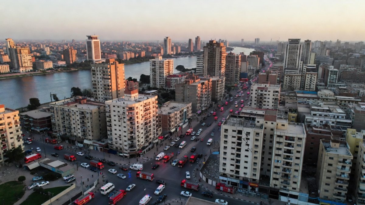
A moderate 5.3-magnitude earthquake struck near Suez early Monday morning, jolting residents from sleep across Greater Cairo and reaching as far as the border with Gaza. USGS data places the epicenter 41.2 kilometers north-northeast of Suez at a shallow 10-kilometer depth, while Egypt's own NRIAG recorded it slightly higher at 5.6. No major damage or casualties have surfaced yet, but the event has put the entire country on edge given its dense population centers and history with seismic surprises.
5.3 Magnitude Earthquake Rattles Egypt, Tremors Felt Across Cairo
Cairo, Egypt — The ground moved just after 3 a.m. local time on August 3, 2026, and people from Suez to the capital felt it. USGS pinpointed the quake at magnitude 5.3 with an epicenter 41.2 kilometers north-northeast of Suez at 10 kilometers depth. NRIAG measured 5.6 and located it roughly 38 kilometers north of Suez. This shallow crustal event sent noticeable shaking through multiple governorates and even parts of the eastern Mediterranean.
What Happened
The quake hit at approximately 3:00 a.m. local time, which is 0000 GMT. USGS instruments fixed the magnitude at 5.3 while Egypt's National Research Institute of Astronomy and Geophysics logged 5.6. Both agencies agree the epicenter sat in the Gulf of Suez rift zone, a known area of tectonic activity. The 10-kilometer depth made the shaking more pronounced on the surface even though the overall energy release stayed moderate.
Egypt sits atop active rift structures that periodically produce these events. Most quakes in the northern Red Sea and Gulf of Suez region remain small and go unnoticed by the public. This one crossed the threshold where people wake up and buildings sway. Authorities immediately began cross-checking reports from the affected zones while NRIAG continued real-time monitoring.
In seismology, magnitude measures total energy released while depth determines how much of that energy reaches the surface. A 10 km focal depth places the event in the upper crust, allowing stronger ground motion compared with deeper quakes of identical magnitude that lose energy over greater distances. The Gulf of Suez forms part of the Red Sea rift system, where extensional stresses slowly pull the African and Arabian plates apart along normal faults. These structures produce moderate events every few years that are widely felt yet rarely destructive. Egypt’s seismic network, operated by the National Research Institute of Astronomy and Geophysics, combines local broadband stations with international data from the USGS global network. Within minutes, automated location algorithms triangulate arrival times from dozens of stations, yielding rapid magnitude and depth estimates that authorities can use to issue initial alerts before aftershock sequences begin.
Tremors Felt Across Cairo and Beyond
AFP journalists in Cairo reported being woken by the shaking, confirming the quake reached the capital roughly 120 kilometers away. Reports also came in from multiple Egyptian governorates and extended to El-Arish near the Gaza Strip border. Some residents in the eastern Mediterranean region described feeling the motion as well, showing how a shallow quake can travel through the crust.
Greater Cairo's sheer size and density amplified the experience for millions. The city houses a large share of Egypt's 107 million people, and even moderate shaking registers widely when the source sits at only 10 kilometers depth. No one needed instruments to know something had moved; the early-hour timing simply made the jolt more startling for those already in bed.
Seismic waves travel efficiently through the thick sedimentary layers and crystalline basement that underlie much of northern Egypt, allowing moderate shaking to propagate tens of kilometers with limited attenuation. Greater Cairo’s metropolitan population exceeds twenty million, so even low-intensity vibrations awaken large numbers of residents simultaneously. High-rise buildings, common in newer districts, sway at periods that match the dominant frequencies of shallow events, producing noticeable rocking that residents interpret as prolonged motion. Because damaging earthquakes remain infrequent, the sudden awakening triggers acute anxiety rather than practiced response. In 2026, smartphones and social platforms accelerate this awareness: geotagged posts and short videos spread within minutes, creating a real-time map of felt reports that both informs emergency services and amplifies public concern through unverified images of minor cracks or displaced objects.
No Immediate Casualties — But Egypt Is on Alert
In the first hours after the event, Egyptian authorities reported no confirmed casualties or major structural collapses. Hospitals and ambulances were placed on alert nationwide, with emergency rooms linked for rapid coordination if needed. The Egyptian Red Crescent issued immediate guidance urging people to avoid old and dilapidated buildings common in some Cairo neighborhoods.
That precautionary stance reflects Egypt's practical approach to seismic risk. While the current quake produced no immediate harm, officials know that even moderate events can expose weaknesses in aging infrastructure. The alert status allows quick response if aftershocks or unreported damage surfaces later in the day.

Why Egypt Felt This One
The Gulf of Suez and northern Red Sea sit along active rift structures where the African and Arabian plates pull apart. These geological features generate periodic moderate quakes, though most stay below the threshold that disturbs daily life. The 10-kilometer depth of Monday's event allowed energy to reach the surface efficiently, which is why residents across such a wide area noticed the motion.
Seismologists note that shallow quakes in rift zones often produce felt reports far from the epicenter when population density is high. Cairo's urban footprint turns even a 5.3 into a regional event. Most smaller quakes in the same area simply pass without public notice because they lack either the magnitude or the shallow focus that amplifies surface effects.
The Red Sea spreading center and its northern continuation into the Gulf of Suez represent a classic divergent boundary where continental crust thins and faults accommodate extension. Most resulting earthquakes are small because strain release occurs gradually along numerous short fault segments rather than on a single locked megathrust. When a shallow event occurs, however, peak ground acceleration can exceed the design thresholds of older masonry and unreinforced concrete structures prevalent in the region. Comparable rift settings such as the East African Rift or the Dead Sea Transform exhibit similar patterns of frequent microseismicity punctuated by occasional moderate shocks. Egypt’s position at the northwestern edge of the Arabian plate places it in a transitional tectonic regime where Red Sea extension interacts with the sinistral shear of the Dead Sea fault system, producing a distinctive distribution of epicenters that cluster along the gulf margins yet can still be felt across the Nile delta.
The 1992 Cairo Earthquake Still Haunts Egypt
Egypt's deadliest modern quake struck in October 1992 at magnitude 5.8, centered near Cairo. That event killed more than 500 people and displaced thousands, many from older or poorly constructed buildings. The memory lingers because the country has not experienced frequent large quakes, making each new tremor a reminder of that vulnerability.
Lessons from 1992 included better hospital coordination and public alerts, yet many working-class neighborhoods still contain structures that predate modern seismic standards. A 5.3-magnitude event today does not match the 1992 toll, but it triggers the same instinctive caution among residents who remember how quickly things can escalate when older buildings are involved.
The October 1992 Dahshur earthquake, magnitude 5.8, exposed long-standing deficiencies in building-code enforcement across Greater Cairo. Thousands of structures collapsed or suffered heavy damage, resulting in more than five hundred fatalities and widespread displacement, particularly in densely packed working-class districts. Subsequent legislative reforms introduced stricter seismic provisions and inspection regimes, yet informal construction and aging masonry buildings continue to dominate many neighborhoods. These structures lack ductile reinforcement and rest on foundations poorly suited to even moderate shaking. Public memory of 1992 remains vivid; any perceptible tremor immediately revives collective anxiety about hidden vulnerabilities. Consequently, emergency hotlines receive surges of calls reporting cosmetic damage that would otherwise go unnoticed, while officials must balance reassurance with reminders that the 1992 lessons have only been partially implemented in the current building stock.
What Happens Next
Authorities continue assessing damage across affected areas while NRIAG monitors for aftershocks. The rift zone setting means additional smaller events remain possible in the coming days, though most will likely stay minor. Residents have been advised to steer clear of visibly weakened structures until inspections finish.
Egypt's emergency systems are now linked and ready, which represents progress since 1992. The focus stays on rapid verification rather than speculation. As more reports filter in from governorates, officials will update the public on any localized issues that surface beyond the initial quiet hours.
After a magnitude 5.3 mainshock in an extensional rift setting, aftershock sequences typically follow an Omori-law decay, with the largest events occurring within the first twenty-four hours and diminishing over subsequent days to weeks. Seismologists monitor the evolving rate and spatial migration of events to assess whether stress has transferred onto adjacent fault segments. Civil-defense teams prioritize rapid visual inspections of schools, hospitals, and high-occupancy public buildings, while the Red Crescent advises residents to avoid structures showing visible cracks until engineers complete assessments. Standard protective actions—drop, cover, and hold on—remain the immediate response during any aftershock. Monitoring agencies will continue to track changes in background seismicity and issue updates if probabilities rise above background levels. Residents are encouraged to secure heavy furniture and identify safe interior spaces, measures that reduce injury risk even when structural damage is limited.
By Jessica Ali, Staff WriterThis article was produced with AI-assisted research and editorial support. Reporting is based on sources cited in the article.
What's Your Reaction?
 Like
0
Like
0
 Dislike
0
Dislike
0
 Love
0
Love
0
 Funny
0
Funny
0
 Wow
0
Wow
0
 Sad
0
Sad
0
 Angry
0
Angry
0

Editor-in-Chief at Global1.News. Atlanta-based journalist who cuts through the BS and tells it like it is. Lead anchor, host, and the voice you hear when the spin stops and the truth starts.















Comments (0)