
Tropical Depression Luis and the Habagat: Heavy Rain Forecast for Metro Manila and Luzon This Week
PAGASA forecasts Tropical Depression Luis and the southwest monsoon will bring heavy rain to Metro Manila and Luzon through Wednesday, with 100-200 mm in Zambales, Bataan and Occidental Mindoro. Signal No. 1 is up in parts of Bicol and Quezon; Luis may strengthen briefly before weakening by Aug. 5.
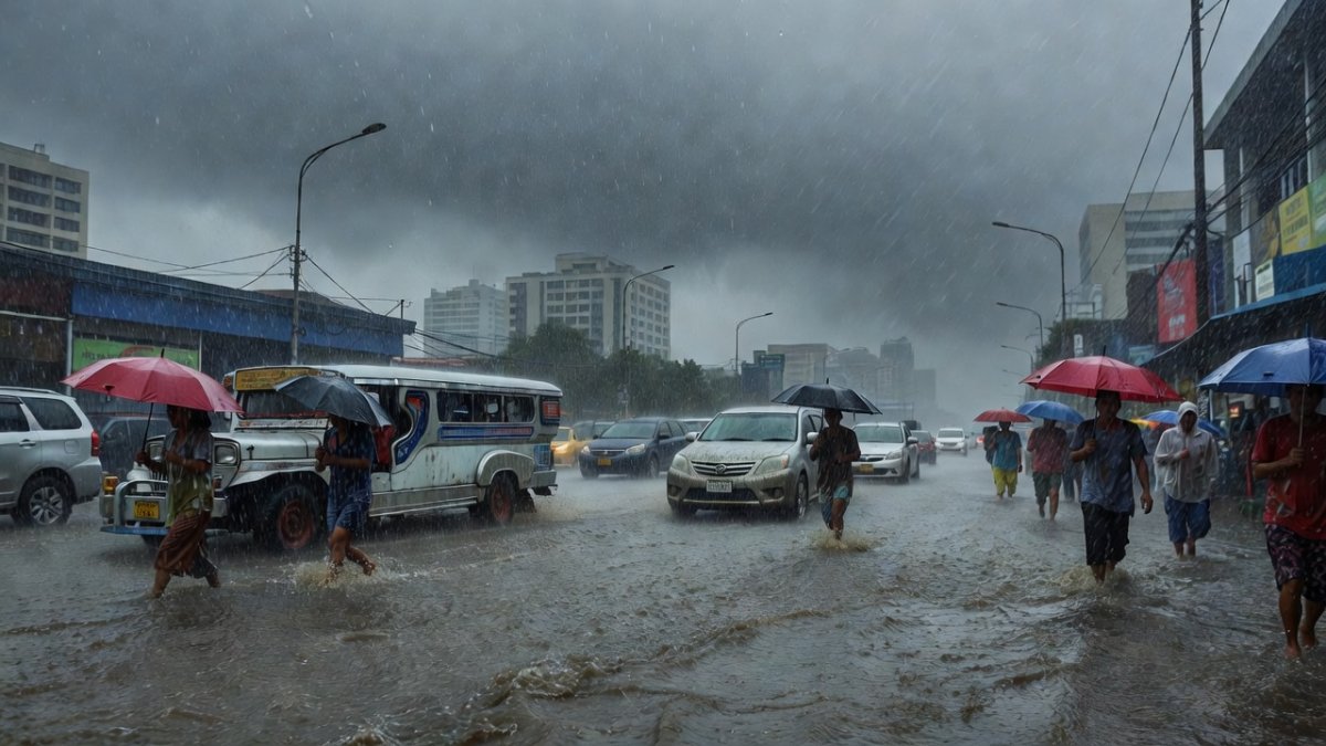
The rainy season is testing Metro Manila and Luzon once again as Tropical Depression Luis and the southwest monsoon, known locally as the habagat, threaten days of heavy rain across the region through the middle of the week.
Tropical Depression Luis and the Habagat: Heavy Rain Forecast for Metro Manila and Luzon This Week
Manila, Philippines – August 2, 2026 — PAGASA issued its Sunday forecast warning that Tropical Depression Luis combined with the southwest monsoon will bring heavy rainfall to Metro Manila and several Luzon provinces through Wednesday, with rainfall amounts of 100 to 200 millimeters projected for Zambales, Bataan, and Occidental Mindoro, raising concerns for flooding in low-lying areas where families already face challenges during the rainy season.
Heavy Rain Expected Through Wednesday
Rainfall amounts of 100 to 200 millimeters are projected for Zambales, Bataan, and Occidental Mindoro, raising concerns for flooding in low-lying areas where families already face challenges during the rainy season.
The southwest monsoon, known locally as the habagat, is a familiar rainy-season pattern for Filipinos that often brings weeks of steady downpours even without a nearby cyclone. An approaching tropical cyclone like Luis enhances the habagat by drawing in more moisture and strengthening winds, which can turn moderate rains into prolonged heavy downpours across wide areas. The agency noted that these rains come as part of the familiar habagat pattern that many Filipinos know well, often turning daily routines into tests of patience and preparedness. Residents in affected areas are urged to monitor updates closely as the system moves.
Signal No. 1 Remains in Place Over Parts of Luzon
As of 4 p.m. Sunday, Tropical Cyclone Wind Signal No. 1 stayed in effect over the Polillo Islands, Camarines Norte, the northern portion of Camarines Sur, and the northern portion of Catanduanes. Specific towns in Camarines Sur include Caramoan, Garchitorena, Lagonoy, Tinambac, and Siruma, while Pandan, Caramoran, Bagamanoc, Panganiban, and Viga in Catanduanes are also covered.
These areas may see winds of 39 to 61 kph, with minimal to minor impacts possible to life and property. PAGASA indicated that Signal No. 2 could still be raised depending on the storm's development, keeping local government units and barangay captains on alert for any sudden changes. Barangay captains and LGUs typically monitor PAGASA bulletins closely during signal warnings, preparing evacuation centers and issuing preemptive advisories to residents in flood-prone zones. Families often respond by securing roofs, stocking basic supplies from the sari-sari store, and checking on kapitbahay neighbors who may need help moving belongings to higher ground.
Luis Position, Strength, and Movement
At 4 p.m., the center of Luis was located 285 kilometers east of Baler, Aurora, having moved closer from its earlier position 400 kilometers east of Infanta, Quezon. The system maintained maximum sustained winds of 55 kph near the center with gusts up to 70 kph and was moving northwestward at 15 kph, with strong winds extending up to 160 kilometers from its center.
Luis is forecast to continue generally northwestward over the next 12 hours before turning east-northeastward. Its center is expected to remain over the Philippine Sea, though a westward shift could bring it close to or over Northern or Central Luzon. The track may still change within the forecast confidence cone. PAGASA's warning cone illustrates possible paths, and track uncertainty matters because even a modest westward deviation could shift heavy rain bands directly over Northern or Central Luzon, affecting more communities than currently projected.
Rainfall Amounts by Day and Province
From Sunday until Monday afternoon, Luis may bring 50 to 100 mm of rain to Pangasinan, Cagayan, Isabela, Quirino, Zambales, Tarlac, Nueva Ecija, Bulacan, Aurora, and Quezon. From Monday afternoon until Tuesday afternoon, the same range is expected over La Union, Pangasinan, Benguet, Isabela, Quirino, Aurora, Nueva Ecija, Bulacan, Tarlac, Pampanga, Zambales, Bataan, Metro Manila, Cavite, Batangas, and Rizal.
The southwest monsoon may add 50 to 100 mm over Occidental Mindoro during that period. From Tuesday afternoon until Wednesday afternoon, Zambales, Bataan, and Occidental Mindoro could receive 100 to 200 mm, while 50 to 100 mm may fall over La Union, Pangasinan, Benguet, Tarlac, Pampanga, Bulacan, Metro Manila, Cavite, Rizal, Batangas, and Antique. Rainfall may be higher over mountainous and elevated areas, worsening conditions where significant rain has already fallen. Flooding risk rises sharply in places that already received significant rainfall because saturated soil cannot absorb more water, and mountainous areas see faster runoff that can trigger landslides or flash floods in valleys below.
Effects on Families, Commuting, and Livelihoods
For ordinary Filipinos in Metro Manila and Luzon, these rains mean disrupted commutes on flooded streets, school preparations that may shift to online classes, and vendors at sari-sari stores worrying about lost sales. Jeepney drivers and tricycle operators often face tough choices between staying home or risking slippery roads to earn for their families. Days of continuous rain can cut daily earnings by half or more for these workers, who rely on steady passenger traffic and face added costs for vehicle maintenance when roads stay flooded. Market vendors and fisherfolk similarly lose income when customers stay home or boats cannot leave port, stretching household budgets already tight during the habagat months.
Fisherfolk in coastal communities brace for rough waters that keep boats docked, cutting into daily income. The spirit of bayanihan often shines through as neighbors help one another clear drains or share supplies, turning potential hardship into moments of community strength during the habagat season.
Sea Conditions and Advice for Small Vessels
Strong to gale-force gusts may affect exposed coastal and upland areas. On Sunday, gusty conditions could impact Marinduque, Occidental Mindoro, Oriental Mindoro, Romblon, Masbate, Sorsogon, Caluya Islands, Northern Samar, Samar, Biliran, Siquijor, Southern Leyte, Camiguin, and Dinagat Islands.
On Monday and Tuesday, strong to gale-force gusts may reach most of Luzon and the Visayas, plus Lanao del Norte, Misamis Occidental, Camiguin, Surigao del Norte, Dinagat Islands, Sarangani, Davao Occidental, and Davao Oriental. Moderate to rough seas with waves up to 2.5 meters may affect the eastern seaboard of Davao Oriental, while waves up to 2 meters are possible in several other seaboards including those of Isabela, Surigao del Sur, and parts of Aurora and Camarines provinces. The motorbanca advisory highlights risks for island communities that depend on sea transport for food, medicine, and travel to the mainland, where even one canceled trip can isolate families for days. PAGASA advised operators of motorbancas and similarly sized vessels to take precautions and avoid sailing when possible under these conditions.
Storm Outlook and Community Readiness
Luis may strengthen into a tropical storm within 24 hours while moving over waters east of Central Luzon. It is expected to remain a tropical storm only briefly before weakening as it turns east-northeastward, potentially becoming a remnant low by Wednesday, August 5, before being absorbed into the circulation of Typhoon Dolphin.
Local government units and barangay captains typically monitor these updates to guide evacuation preparations if needed. Families can prepare by securing belongings, checking drainage around homes, and staying informed through official channels. This approach helps communities face the combined effects of Luis and the habagat with greater resilience.
What This Means for the Week Ahead
With Luis expected to weaken quickly after possible brief strengthening, the main concern remains the enhanced habagat rains that could linger even as the depression fades. Residents across Luzon should plan for continued wet conditions through at least midweek, especially those in low-lying barangays where water levels rise quickly after repeated downpours. OFWs sending remittances home may hear from families about delayed school openings or flooded workplaces, underscoring how weather systems like this ripple through daily life far beyond the storm track itself.
Communities that practice regular drainage clearing and early warning drills often recover faster, showing the value of bayanihan when signals are raised. Monitoring official PAGASA updates remains the most reliable way to adjust plans as the week unfolds.
By Bella Reyes, Staff Writer
By Bella Reyes, Staff Writer
This article was produced with AI-assisted research and editorial support. Reporting is based on sources cited in the article.
What's Your Reaction?
 Like
0
Like
0
 Dislike
0
Dislike
0
 Love
0
Love
0
 Funny
0
Funny
0
 Wow
0
Wow
0
 Sad
0
Sad
0
 Angry
0
Angry
0

Philippines/Southeast Asia Correspondent at Global1.News. Manila-based journalist covering Philippine politics, environment, maritime security, and social issues. Passionate about marine conservation and the communities protecting the Philippines' natural heritage.















Comments (0)