
Ayutthaya riverside areas warned of 10cm water rise
Residents living along the banks of the Chao Phraya and Noi rivers in Ayutthaya have been asked to prepare for a modest rise in water levels this Sunday.
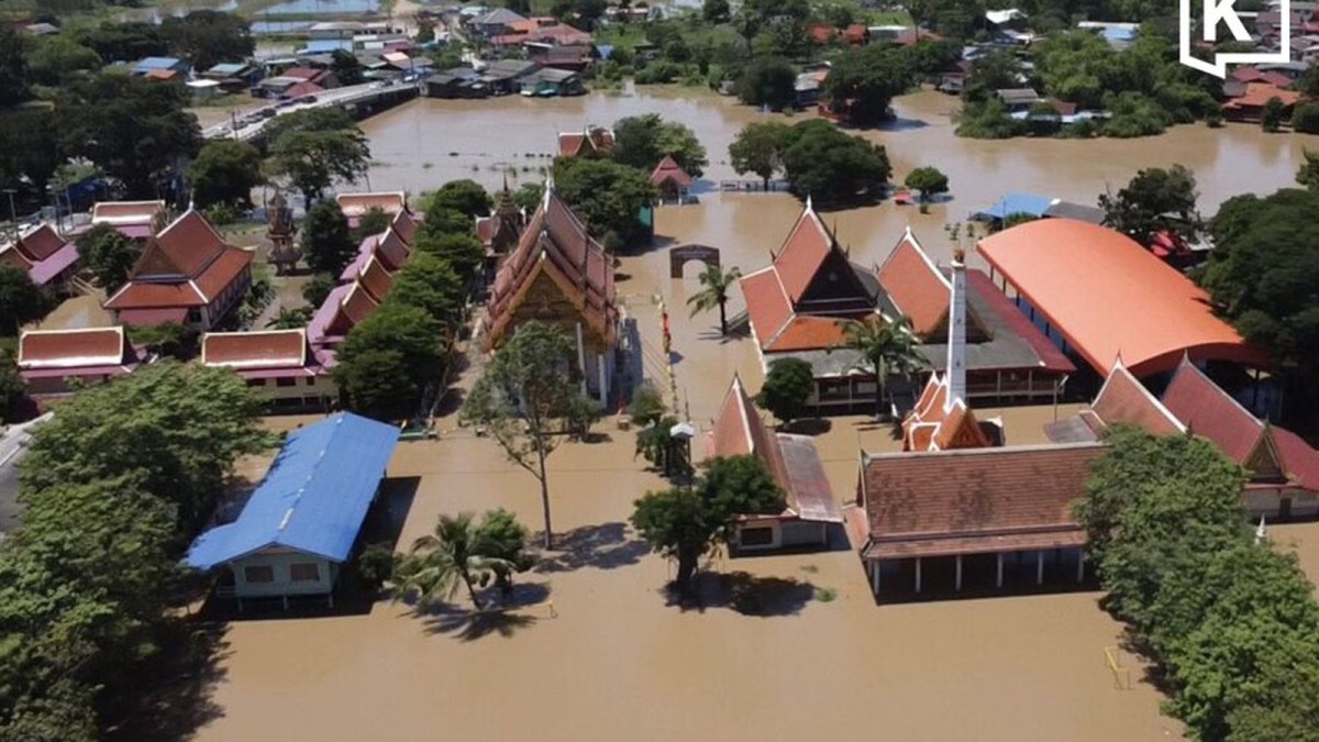
Residents living along the banks of the Chao Phraya and Noi rivers in Ayutthaya have been asked to prepare for a modest rise in water levels this Sunday. The Office of the National Water Resources (ONWR) warned that runoff from the Chao Phraya Dam could lift the river by roughly ten centimetres as it moves downstream. While the increase may seem small, the gentle rise is a reminder of the seasonal rhythms that shape daily life in central Thailand, where riverbanks have long been the cradle of agriculture, community gatherings and Buddhist festivals.
Current river flows and dam operations
At 09:00 on Sunday, the combined flow measured at Nakhon Sawan was about 2,119 cubic metres per second. Meanwhile, the Chao Phraya Dam continued to discharge water at 2,500 cubic metres per second, a level maintained because the Sakae Krang River was still contributing a substantial volume. Deputy Secretary‑General Paitoon Kengkanchang explained that flows from the Ping and Nan rivers into the Chao Phraya basin were on a downward trend, suggesting that the river system is gradually easing after the monsoon peak.
Further upstream, the Pa Sak Jolasid Dam reported an almost balanced inflow and outflow, with discharge hovering around 450 cubic metres per second. This balance translated into a flow of 655 cubic metres per second at the Rama VI Dam in Tha Ruea district, Ayutthaya. The figures illustrate how Thailand’s network of dams works in concert, modulating water release to protect low‑lying communities while ensuring enough water for irrigation and hydro‑electric generation.
What the ten‑centimetre rise means for locals
The anticipated ten‑centimetre rise along the Chao Phraya and Noi rivers is expected to be felt most strongly in riverside neighbourhoods that sit just outside the protective flood embankments. In Ayutthaya, many households have built their homes on stilts, a tradition that reflects centuries of living with the river’s ebb and flow. For those whose homes are set lower, even a modest lift can bring water onto walkways and small gardens, prompting residents to move valuables to higher ground and to check that boat pumps are ready.
Beyond Ayutthaya, the water will continue downstream toward Pathum Thani, Nonthaburi, Bangkok and Samut Prakan. Officials noted that the main protected areas in those provinces are largely shielded by embankments that are high enough to handle the expected increase. Nevertheless, the warning highlighted that some low‑lying districts and communities outside these barriers could still experience minor flooding, underscoring the importance of local vigilance during seasonal water movements.
Reservoir capacity and future releases
Western reservoirs still have room to accommodate additional water. The Vajiralongkorn Dam, for instance, can hold about another 83 million cubic metres. At the time of the report, it was releasing roughly 40 million cubic metres per day while receiving around 45 million cubic metres daily, indicating a near‑balance that keeps the reservoir level stable. This equilibrium is crucial for maintaining water supplies for agriculture in the lower central plains during the dry season.
Further north, the Srinagarind Dam was reported at 95.55 % of its capacity but still able to receive more than 700 million cubic metres. Such remaining capacity provides a safety valve for the system, allowing excess runoff from heavy rains to be stored rather than spilling over into flood‑prone areas downstream.
Mae Klong basin and tidal influences
Downstream of the Mae Klong Dam, flows were measured at above 1,100 cubic metres per second, and water levels along the Mae Klong River have largely returned within their banks. This improvement is expected to aid the gradual drainage of floodwater from Ratchaburi and Samut Songkhram, including the historic Bang Khonthi and Amphawa districts, which are known for their floating markets and riverside temples.
However, officials cautioned that the drainage process could be slowed by sea tides that affect the lower reaches of the Mae Klong. The tidal influence is a reminder of how the Gulf of Thailand’s rhythms intersect with inland river systems, a dynamic that has shaped local livelihoods for generations. Communities along the tidal stretch often rely on the timing of high and low tides for fishing and transport, and any delay in river drainage can affect these activities.
Rainfall forecasts and dam releases
The Meteorological Department forecast heavy rain in Kaeng Krachan district of Phetchaburi, a region that feeds water into the Kaeng Krachan Dam. Anticipated rainfall could prompt increased releases from that dam, adding to downstream flows. In response, the provincial governor and the Royal Irrigation Department have set up a situation management centre to keep residents informed and coordinate any necessary emergency measures.
In the eastern region, water levels are rising in parts of Chachoengsao, and drainage operations continue in Ongkharak district. The Lower Rangsit irrigation project, working together with the Bangkok Metropolitan Administration, is actively moving water out of the area. These coordinated efforts illustrate how multiple agencies collaborate to manage water resources, balancing the needs of agriculture, urban water supply and flood protection.
Looking ahead: rain, rivers and community resilience
From 5 to 8 October, the Meteorological Department expects increased rainfall across several provinces. Despite the forecast, Deputy Secretary‑General Paitoon said the additional rain is not likely to cause a significant rise in water volumes at the Chao Phraya Dam or in Mae Klong basin reservoirs. He emphasized that the overall situation remains manageable, reflecting the effectiveness of current water‑management strategies.
For the people of Ayutthaya and the surrounding provinces, the modest ten‑centimetre rise is a familiar reminder of living in harmony with the river. Communities have long drawn on Buddhist teachings of impermanence and interdependence, preparing for seasonal changes with calm and collective action. As water moves downstream, the shared vigilance of residents, local officials and water‑resource managers continues to safeguard homes, fields and cultural heritage, ensuring that the river remains a source of life rather than a cause of distress.
Connecting the river’s flow to Thailand’s broader water strategy
The current water‑level warning fits within Thailand’s larger effort to balance flood mitigation with water security. By monitoring flow rates at key points such as Nakhon Sawan, Pa Sak Jolasid and Rama VI dams, the ONWR can adjust releases to protect vulnerable low‑lying districts while preserving enough water for irrigation during the dry months. This delicate calibration reflects a national policy that seeks to honor the river’s cultural significance while addressing modern challenges of climate variability.
As the water from the Chao Phraya Dam makes its way downstream this weekend, the modest rise in river height will be a test of both infrastructure and community preparedness. The coordinated response—ranging from dam operators to local situation centres—demonstrates a collective commitment to living with the river’s rhythm, a principle that has guided Thai society for centuries and will continue to shape the country’s water future.
This article was produced with AI-assisted research and editorial support. Reporting is based on the source material cited below. Sources: Khaosod English; khaosodenglish.com; Global1.News (04 October 2026).
By Ann Srisawat, Staff Writer
What's Your Reaction?
 Like
0
Like
0
 Dislike
0
Dislike
0
 Love
0
Love
0
 Funny
0
Funny
0
 Wow
0
Wow
0
 Sad
0
Sad
0
 Angry
0
Angry
0

Southeast Asia Correspondent at Global1.News. Based in Bangkok, covering Thai and Southeast Asian politics, economy, technology, and culture. Deep regional perspective on one of the world's most dynamic regions.















Comments (0)