
Five ways El Niño is affecting the weather around the world
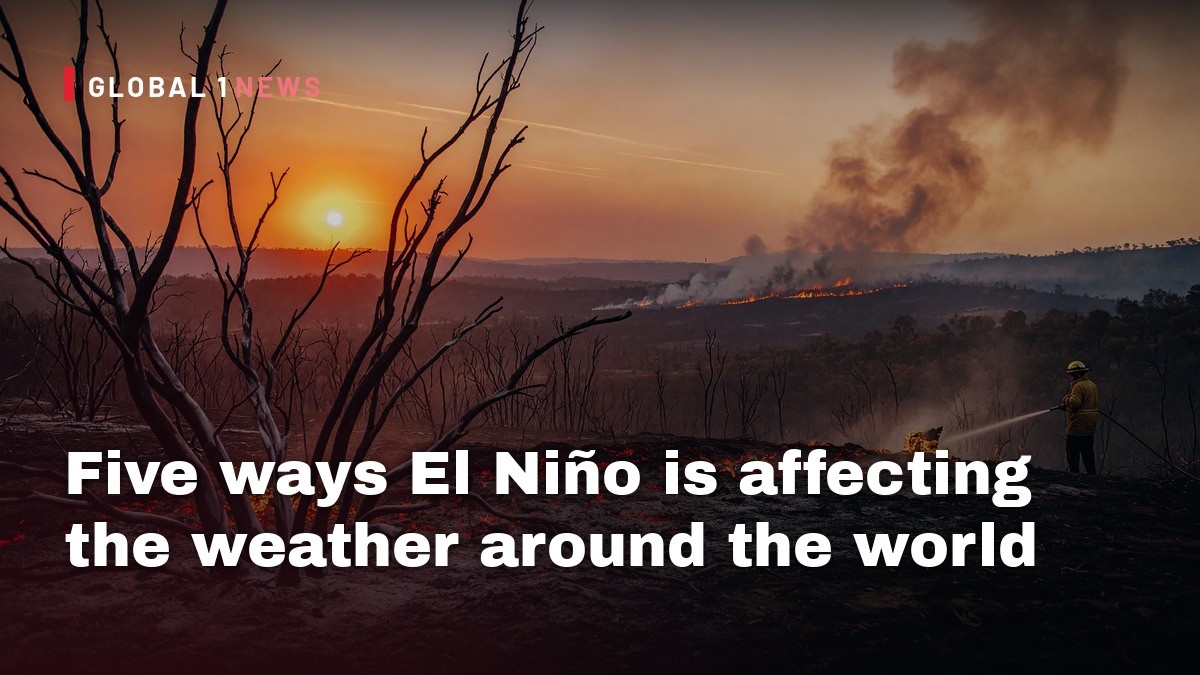
As the strongest El Niño on record continues to intensify, the ripple effects are already reshaping weather across the globe. Since January, more than 895,000 hectares—an area roughly six times the size of Greater London—have been scorched.
As the strongest El Niño on record continues to intensify, the ripple effects are already reshaping weather across the globe. From the choking haze over Indonesia’s rain‑soaked islands to an unprecedented trio of Pacific hurricanes, the phenomenon is turning climate projections into lived reality. While scientists warn that the El Niño will likely persist into 2027, the impacts we are seeing now are already testing the resilience of communities from South Asia to the Caribbean. Below, I unpack the five most striking ways the current El Niño is rewriting weather patterns, and what those changes mean for the people whose daily lives depend on the climate.
Indonesia’s record‑breaking wildfire season
Indonesia, a nation that already grapples with deforestation and peatland fires, is now confronting its worst wildfire season since 2015. Since January, more than 895,000 hectares—an area roughly six times the size of Greater London—have been scorched. The scale of the blaze is more than double the area burned the previous year, underscoring how the hotter, drier conditions associated with El Niño are amplifying a long‑standing problem.
The smoke has forced schools to close and driven a surge in hospital admissions. Millions of residents in Sumatra and Kalimantan are breathing toxic haze, and health officials estimate that around 175,000 people have suffered respiratory illness. Children are disproportionately affected; more than 40,000 cases involve toddlers, ranging from simple coughs to severe conditions such as pneumonia. The human toll of the fires is a stark reminder that climate anomalies translate directly into public‑health crises.
Pacific hurricanes: a season of unprecedented intensity
In the eastern Pacific, El Niño is feeding a hyper‑active hurricane season. To date, 22 named storms have formed, including 12 hurricanes and ten that have reached major status. This output already exceeds the total typically observed over an entire average season, and the season still has two months remaining. Warmer ocean temperatures and weaker upper‑level winds—both hallmarks of El Niño—are providing the perfect ingredients for storms to intensify rapidly.
One storm, for example, produced wind gusts of 180 mph (285 km/h) as it rode the unusually warm waters. The phenomenon has also enabled three hurricanes to exist simultaneously in the central and eastern Pacific—a rarity not seen since 2015. Earlier this September, the trio of Lowell, Karina and Marie churned together, while more recent storms such as Polo, Odalys and Nolo have followed the same pattern. The clustering of powerful cyclones underscores how El Niño is reshaping storm dynamics, creating conditions that allow multiple systems to draw energy from the same swath of heated sea.
The Atlantic’s unusual quietude
While the Pacific roars, the Atlantic has been eerily silent. El Niño typically strengthens wind shear over the north Atlantic, a factor that tears apart developing storms and suppresses formation. This year, only a single hurricane—Isaias—has made landfall, striking the Florida Panhandle and Alabama. Isaias also set a satellite‑era record for the latest formation date, emerging in early September, a milestone previously held by storms in 2002 and 2013.
In an average Atlantic season, we would expect ten named storms, five hurricanes and two major hurricanes by this point. Instead, the basin has produced just eight tropical storms—Arthur, Bertha, Cristobal, Dolly, Edouard, Fay, Gonzalo and Hanna. The contrast between the hyper‑active Pacific and the subdued Atlantic illustrates how El Niño can create a stark regional imbalance in storm activity, with profound implications for disaster preparedness across the Americas.
India’s uneven monsoon under El Niño stress
El Niño’s fingerprint is also evident in South Asia, where the Indian monsoon has arrived 13 % below average rainfall. While the Indian Meteorological Department classifies the overall deficit as still within a “normal” range, the distribution of rain tells a different story. Central India has received near‑normal precipitation, but the east and north‑east are experiencing a 26 % shortfall, prompting authorities to label the region as facing an “exceptional” drought. Southern states are also 24 % drier than average.
The uneven rainfall pattern is compounding agricultural vulnerability. Even where totals are near average, the monsoon has become erratic—long dry spells punctuated by intense downpours. This volatility strains water storage, disrupts planting cycles and threatens crop yields. Scientists caution that while El Niño is a major driver, India’s monsoon is also influenced by a suite of other weather patterns, meaning the drought risk cannot be attributed to a single cause. Nonetheless, the current shortfall is a clear illustration of how global climate anomalies can exacerbate existing regional stresses.
East Asian floods and the shifting typhoon track
Further east, the warmer Pacific waters are also reshaping storm behavior in Japan and eastern China. Ten tropical cyclones have formed in the western Pacific this season—the highest count since 1966, according to the Japanese Meteorological Agency. Storms such as Maysak and Dujuan have already unleashed widespread floods and landslides across the region.
El Niño’s influence on wind patterns pushes cyclones farther east, away from the Japanese archipelago and eastern Chinese coast. This displacement gives storms a longer runway over warm waters, allowing them to intensify into more powerful typhoons before making landfall. Scientists anticipate additional typhoons developing later this year, raising the specter of further flooding and landslides. The shift in storm tracks underscores how a single oceanic anomaly can ripple across the entire Pacific basin, altering risk profiles for nations that have historically relied on predictable seasonal patterns.
Broader implications for climate resilience in Latin America
Although the source material focuses on Asia and the Pacific, the patterns emerging from this El Niño have clear relevance for Latin America. The same atmospheric dynamics that suppress Atlantic hurricanes could, under different phases, amplify storm activity in the Caribbean and Central America. Conversely, the heightened Pacific activity may influence the Inter‑tropical Convergence Zone, altering rainfall patterns across the northern Andes and the Amazon basin.
For countries already wrestling with deforestation, illegal mining and social inequality, any shift in precipitation or temperature can exacerbate existing vulnerabilities. The experience of Indonesia’s wildfire crisis offers a cautionary tale: when climate stress meets land‑use pressures, the result can be a public‑health emergency that overwhelms already stretched health systems. Latin American policymakers must therefore monitor El Niño’s evolution closely, integrating climate forecasts into disaster‑risk planning, agricultural support programs and health‑system preparedness.
Looking ahead: what 2026 and beyond may hold
The World Meteorological Agency warns that this record‑breaking El Niño will likely strengthen further and persist at least until 2027. If the current trajectory holds, we can expect wetter, warmer-than‑normal autumns in many regions, continued strain on water resources, and a higher likelihood of extreme events. The pattern of intensified Pacific storms, a subdued Atlantic season, and erratic monsoon behavior suggests that the coming months will test the adaptive capacity of societies across the globe.
For Latin America, the lesson is clear: climate anomalies are no longer distant scientific forecasts but immediate, lived realities. By learning from the unfolding crises in Indonesia, the Pacific, and India, regional leaders can craft more resilient responses—strengthening early‑warning systems, protecting vulnerable communities, and confronting the underlying land‑use practices that turn climate stress into humanitarian disaster. The El Niño of 2026 is a stark reminder that the climate’s pulse beats in sync with human lives, and that our collective response must be as swift and coordinated as the storms it spawns.
This article was produced with AI-assisted research and editorial support. Reporting is based on the source material cited below. Sources: BBC News Latin America; bbc.co.uk; Global1.News (21 October 2026).
By Elena Vasquez, Staff Writer
What's Your Reaction?
 Like
0
 Dislike
0
 Love
0
 Funny
0
 Wow
0
 Sad
0
 Angry
0

Latin America Correspondent at Global1.News. Based in Mexico City, covering politics, economics, energy, and culture across the region. Brings an on-the-ground perspective to stories spanning from the Rio Grande to Patagonia.














Comments (0)