
A Magnitude 7 Earthquake Kills 16 in Northern Tibet, and the Numbers Are Still Moving
A magnitude 7.0 earthquake struck Baqen County in Nagqu, northern Tibet, at 22:33 on Thursday, killing 16 people and injuring 46. Hundreds of homes are damaged, rescuers are working at 4,864 metres, and the toll is provisional.
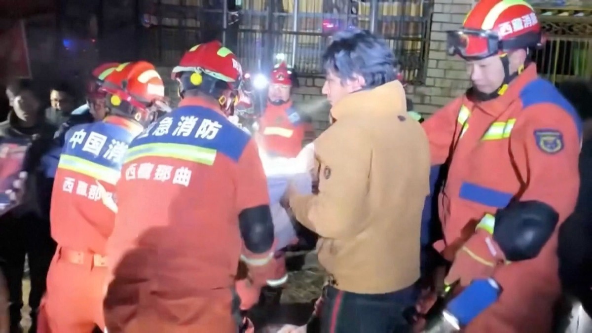
A Magnitude 7 Earthquake Kills 16 in Northern Tibet, and the Numbers Are Still Moving
LHASA, Tibet — A magnitude 7.0 earthquake struck Baqen County in the northern Tibet city of Nagqu at 10:33 p.m. local time on Thursday, October 22, 2026, and the figures coming out of the disaster zone have not stopped shifting since.
By 2:25 a.m. Friday, the city's emergency management bureau reported 16 people killed and 32 injured, with 11 of the injured in serious condition. By 5:20 a.m., after further house-to-house checking, the same bureau reported 16 killed and 46 injured — 11 seriously, 35 with minor injuries. The dead had not been revised upward. The injured had jumped by fourteen in three hours.
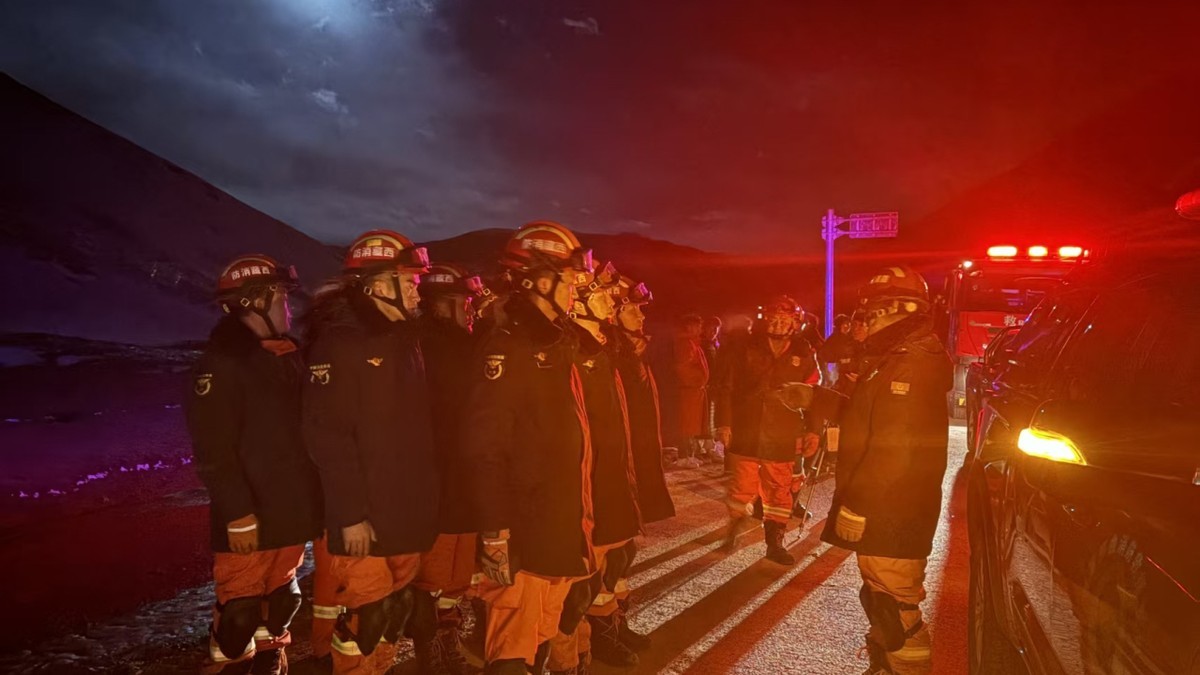
Where It Struck: Maru Township, Baqen County
The epicentre was in Maru township, in Baqen county, at 32.40 degrees north and 93.79 degrees east, according to the China Earthquake Networks Center. That is roughly 191 kilometres east-northeast of Nagqu and 390 kilometres northeast of Lhasa, the regional capital, by the US Geological Survey's calculation.
It is a hard place to reach and a hard place to survive a collapse. CENC data puts the average elevation within five kilometres of the epicentre at about 4,864 metres. The county seat of Baqen sits some 70 kilometres from Maru township, and it lost power and telecommunications when the quake hit.
Maru's deputy township head, Lhawang Dagpo, told Xinhua the shaking was clearly felt at the township office, which took cracks in its walls. Further out, rockfall forced roads to close, slowing the crews trying to get in. Tremors were felt in other parts of the region, including Qamdo and Nyingchi.
The Toll Moved Before Dawn
Disaster tolls in high mountain valleys behave in a particular way. First comes the announcement that casualties have been reported, with no number attached — which is what Xinhua carried late on Thursday night. Then comes the first count. Then come the corrections as teams reach villages the first sweep missed.
That sequence played out in under seven hours. The 5:20 a.m. statement from the Nagqu City earthquake relief command, carried by CCTV and China News Service, put the damage at 339 households with collapsed or damaged houses, and 20 livestock sheds damaged. Earlier Xinhua copy had said more than 300 houses collapsed.
In a county where families keep animals and live in adobe and unreinforced brick, a stock shed and a home are often the same compound, and both are counted in the same sentence. The 16 dead is the figure every major agency is carrying. It is also, at the time of writing, an interim figure.
Two Agencies, Two Depths
The two seismic agencies that matter here do not agree on how deep the rupture was, and neither has reconciled the other.
The China Earthquake Networks Center puts the depth at 10 kilometres. The US Geological Survey puts it at 18 kilometres, or 11 miles. Both put the magnitude at 7.0, which is the number that governs the emergency response.
The USGS assessment is blunt about what that energy did: "Approximately 111,000 people experienced Moderate (MMI V) to Severe (MMI VIII) shaking," it stated, and warned that "aftershocks, some potentially with strong shaking, may follow this earthquake." It also flagged the thing that turns a strong quake into a deadly one in this terrain — many residents live in adobe or unreinforced brick buildings made with mud.
CENC recorded a string of smaller tremors in the magnitude 3 to 4 range afterwards. A separate 4.3-magnitude quake struck Zadoi County in neighbouring Qinghai province about 40 minutes after the main shock, with no collapses or casualties immediately reported there.
Four Response Levels, One Mountain
China's emergency machinery responds on several parallel tracks, and the paperwork on Friday morning shows at least three of them running at once — which is worth reading carefully, because the numbers are not a ranking of the same thing.
The Tibet Autonomous Region activated a Level-II earthquake disaster emergency response, according to the regional emergency command centre. The office of the State Council earthquake relief headquarters and the Ministry of Emergency Management activated a Level-IV response. The China Earthquake Administration announced a Level-II response shortly after the quake, and CGTN's Friday morning live coverage reported it at Level-III.
Separately, the region's Disaster Prevention, Reduction and Relief Committee Office invoked its natural disaster relief plan and activated a Level-III natural disaster relief response on Friday morning, citing documented losses of life and property.
Read plainly: the earthquake response and the relief response are different instruments with different scales, and a Level-IV at the ministry is not a downgrade of a Level-II in Lhasa. The mountain is getting everything.
Troops on the Road at Three in the Morning
The Western Theater Command's joint command centre activated its emergency mechanism immediately after the quake, verified the damage, assessed the terrain and weather, and directed air power to begin reconnaissance, according to the command's own account published by China News Service.
A Western Theater Command Air Force unit launched an unmanned aircraft at about midnight to survey the quake zone and send back live imagery. The Tibet Military District and the Armed Police Tibet Corps activated relief plans and moved more than 300 officers and soldiers with over 20 vehicles overnight by road.
By about 3 a.m., troops from the Nagqu Military Sub-district had reached Zharuogai village in Maru township, surveyed the collapsed houses, set up tents on the spot and opened a temporary meal point. The Armed Police Nagqu Detachment arrived carrying breaking, search-and-rescue, medical and cold-weather equipment, and began clearing access routes.
The Supply List Is a Map of the Cold
Nothing about this disaster is abstract at 4,864 metres in late October. The relief manifest released by Nagqu's publicity department on Friday morning reads less like logistics than a description of the weather.
As of 4:30 a.m., supplies allocated at national, regional, city and county level had arrived in the disaster area: 1,000 prefabricated housing units, 3,239 tents, 2,821 folding beds, 4,280 quilts, 200 stoves, 100 mattresses, 2,000 sets of cotton clothing, 1,760 military overcoats, four generators, 1,000 hand-crank and solar-powered flashlights and 1,000 head-mounted outdoor lights.
Also deployed: more than 300 police officers to the epicentre area, and 347 personnel from the regional fire and rescue corps. An advance team of seven firefighters from the Nagqu battalion of the Lhasa fire and rescue mobile detachment went ahead with life-detection equipment. Local county authorities put more than 1,600 people into the effort.
Why the Tibetan Plateau Breaks This Way
The Tibetan Plateau is the highest plateau on Earth, and it is still spreading. The Indian plate drives beneath Eurasia, lifting the Himalayas and the plateau, and the plateau itself extends east and west under its own weight.
The USGS describes the mechanism of Thursday's event as normal faulting on a northeast- or north-northwest-trending fault, with an estimated rupture surface of roughly 50 by 20 kilometres. That is consistent with the east-west extension the plateau has been undergoing, which the agency likened to the way a pile of honey spreads flat after being poured from a bottle.
The consequence is a landscape criss-crossed with faults that occasionally release in populated valleys. Since 1900, the plateau and its margins have produced 29 earthquakes of magnitude 7.0 or greater, according to the USGS, including the magnitude 8.6 Assam-Tibet earthquake of August 1950, which killed more than 4,000 people.
The Precedent: Tingri, January 2025
Northern and central Tibet have done this before, recently enough that the comparisons are unavoidable. In January 2025, at least 126 people were killed when an earthquake struck rural Tingri county, north of Mount Everest near the Nepali border, injuring 188 and collapsing thousands of homes in freezing conditions.
The USGS reached further back on Thursday: a magnitude 6.9 earthquake in April 2010, about 270 kilometres east-northeast of this week's epicentre, killed more than 2,500 people. Other tallies of that Qinghai event, at Yushu, run higher still — a reminder that casualty counts from remote high-altitude quakes are revised for years, not hours.
And the region has not recovered from its last catastrophe. Less than two months ago, a glacier collapse sent floods and landslides through Tibet and Nepal, killing at least 1,400 people, with hundreds still reported missing. The same valleys are now being asked to absorb an earthquake.
What Is Not Known Yet
Several things that will matter are not in the record as of Friday morning, and it is worth naming them rather than filling the gaps.
No casualties have been identified publicly. No final toll has been issued, and the 16 figure has not been revised upward — but nor has the search been declared complete. There is no assessment yet of how many people have been left without a habitable home, beyond the 339 households counted with collapsed or damaged houses.
There is no public finding on building performance, no statement from Chinese leaders specific to this earthquake, and no confirmed report of foreign offers of assistance. Radio and mobile service in the Baqen county seat was reported cut; there is no independent accounting of how much of it has been restored.
What is established is narrow and solid. A magnitude 7.0 rupture at shallow depth, in a sparsely populated county at high altitude, at night, in a cold season that has already started. Sixteen dead, 46 hurt, and a rescue operation that will be judged on the next 48 hours.
The Number to Watch Now
Tents and stoves and quilts arriving before 4:30 a.m. is the difference between a bad night and a fatal one. The injured who were counted as serious — eleven of them — are the number to watch now. Not the headline number. The eleven.
The count will keep moving. It always does in the high country. What should not move is the pressure to keep counting honestly, in public, and to say out loud when a figure is provisional. When governments get that wrong in remote places, families wait years for the truth about someone they already know is gone.
By Jessica Ali, Staff Writer
This article was produced with AI-assisted research and editorial support. Sources: Xinhua, CCTV, CGTN, China News Service, the Associated Press, Agence France-Presse, Reuters, BBC News, Euronews, RTHK and the US Geological Survey. Photographs: main image CCTV via Reuters; inline image Xinhua.
What's Your Reaction?
 Like
0
 Dislike
0
 Love
0
 Funny
0
 Wow
0
 Sad
0
 Angry
0

Editor-in-Chief at Global1.News. Atlanta-based journalist who cuts through the BS and tells it like it is. Lead anchor, host, and the voice you hear when the spin stops and the truth starts.














Comments (0)